When it comes to wildfire smoke and air quality indices – did you know you can click to find…. • 72 hr projections of Ground Level Wildfire Smoke Fine Particulate Matter (PM 2.5) for the Canadian prairies using this link • Tabular summaries of Air Quality Heatlh Index values and forecast maximums for the provinces of Manitoba, Saskatchewan, Alberta, or British Columbia.
Last week (July 8-14, 2024), average cumulative 7 day rainfall was 5 mm (Figure 1) and was well below the previous week (July 1-7) that experienced an average cumulative rainfall value of 16.7 mm. The average 30 day (June 14 – July 14) temperature was 0.5° C warmer than long term average values. Most of the prairies reported 30 day rainfall amounts ranging from normal to above normal. A region from Saskatoon to Oyen has had uncharacteristically high rainfall; Kindersley and Oyen had greater than 250 % of normal precipitation (Figure 2). Driest conditions were observed near Edmonton and the western areas of the Peace River region. Since April 1, the 2024 growing season average temperatures have been 0.5° C greater than climate normal values. Most of the prairies have had above normal to above normal (157 %) rainfall (Figure 3).
Figure 1. 7 day cumulative rainfall (mm) observed across the Canadian prairies for the period of July 8-14, 2024.Figure 2. 30 day percent of normal rain (%) observed across the Canadian prairies for the period of June 14-July 14, 2024. Figure 3. Growing season percent of normal rain %) observed across the Canadian prairies for the period of April 1 – July 14, 2024.
Soil moisture conditions (top 5 cm) continue to be driest for the eastern and Peace River regions of Alberta and southern regions of Saskatchewan (Figure 4). Soil moisture values were greatest for Manitoba and the Parkland region of Saskatchewan.
Figure 4. 7 day average saturated soil moisture (% soil moisture for the surface layer, <5 cm depth) for the period of July 8-14, 2024.
Relative to climate normal values, average temperatures have increased over the past four weeks. The 7 day average temperature for July 14-20, 2024 was 20.5 °C and was 3.3 °C warmer than normal. Warmest temperatures were observed for northern regions of the Alberta Peace River region, eastern regions of Alberta, and southern regions of Saskatchewan (Figure 1).
Figure 1. Seven day average temperature (°C) observed across the Canadian prairies for the period of July 14-20, 2024.
The 30 day (June 21-July 20) average temperature (18.4 °C) was 2 °C warmer than average (Figure 2). Growing season (April 1 – July 20) average temperatures were 0.7 °C warmer than average (Figures 3 and 4, respectively).
Figure 2. 30-day average temperature (°C) observed across the Canadian prairies for the period of June 21 – July 20, 2024.Figure 3. Growing season average temperature (°C) observed across the Canadian prairies for the period of April 1 – July 20, 2024.Figure 4. Growing season average temperature anomalies (°C) observed across the Canadian prairies for the period of April 1 – July 20, 2024.
Last week (July 14-20, 2024) average cumulative 7 day rainfall was 4.4 mm (Figure 5). Most of the prairies reported 30 day rainfall amounts that were normal to above normal (Figure 6). Rainfall amounts have been above normal for the majority of Manitoba and normal to below normal for most of Alberta. Driest conditions were observed near Edmonton and the western areas of the Peace River region. Rainfall values (June 21-July 20) have been highly variable across Saskatchewan. Growing season (April 1 – July 20) precipitation has been above normal to above normal (147 %) rain (Figure 7).
Figure 5. 7 day cumulative rainfall (mm) observed across the Canadian prairies for the period of July 14-20, 2024.Figure 6. 30 day percent of normal rain (%) observed across the Canadian prairies for the period of June 21 – July 20, 2024.Figure 7. Growing season percent of normal rain (%) observed across the Canadian prairies for the period of April 1 – July 20, 2024.
Soil moisture conditions (top 5 cm) continue to be driest for eastern and Peace River regions of Alberta and southern regions of Saskatchewan (Figure 8). Soil moisture values were greatest for Manitoba and the Parkland region of Saskatchewan.
Figure 8. 7 day average saturated soil moisture (%) for the surface layer (<5cm)) for the period of July 14-20, 2024.
Last week (Jun 24-30, 2024), a number of locations had 7 day rainfall amounts that exceeded 50 mm. Most of the rain was observed across the central prairies extending from Oyen to Brandon. Beaverlodge and Grande Prairie had rain amounts that exceeded 45 mm. Growing season temperatures have been similar to climate normal values while rainfall amounts continue to be well above average. Manitoba continues to have warm temperatures and above normal precipitation.
The average 30 day temperature (June 1 – 30, 2024) was 13.9 °C and was almost 1 °C cooler than long term average temperatures. Warmest temperatures were observed across Manitoba and the southern prairies (Figure 1). Most of the prairies have reported 30 day rainfall amounts were normal to above normal. Average cumulative rainfall (mm) over the past 30 days was 86 mm (71 mm last week) and was 150 % of climate normal values. Rainfall amounts have been greatest for Manitoba as well as central and Parkland regions of Saskatchewan (Figure 2). Rain amounts for the area extending from Saskatoon to Kindersley has been 250 % of normal for the past 30 days while cumulative 30 day rain totals for southwestern Saskatchewan and southern Alberta have been less than 65 % of normal.
Figure 1. 30 day average temperature (°C) observed across the Canadian prairies for the period of June 1-30, 2024.Figure 2. 30 day cumulative rainfall (mm) observed across the Canadian prairies for the period of June 1-30, 2024.
Since April 1, the 2024 growing season average temperature (10 °C) has been marginally greater than climate normal values. Warmest average temperatures were observed across a region extending from Winnipeg to Saskatoon and southwest to Lethbridge (Figure 3). Growing season rainfall (prairie wide average) was 194 mm and has been above normal across most of the prairies (Figure 4). Regions around Brandon and Saskatoon have been particularly wet. Near normal precipitation amounts occurred across southern Saskatchewan, western Alberta and western areas of the Peace River region. Current rain amounts have been 175 % of climate normals. Cumulative rainfall has been lowest for a large region than is west of a line that extends from Regina to Grande Prairie (Figure 5).
Figure 3. Growing season average temperature difference from climate normal (°C) observed across the Canadian prairies for the period of April 1 – June 30, 2024.Figure 4. Growing season percent of normal rain (%) observed across the Canadian prairies from April 1 to June 30, 2024.Figure 5. Growing season cumulative rainfall (mm) observed across the Canadian prairies for the period of April 1 – June 30, 2024.
Soil moisture conditions (top 5 cm) continue to be driest for western regions of Saskatchewan and eastern regions of Alberta (Figure 6) and is similar to the 30 day cumulative rainfall map (Figure 4). Soil moisture values were greatest for Manitoba and the Parkland region of Saskatchewan. Lowest values occurred across southern and central regions of Alberta as well as southwestern Alberta.
Figure 6. 7 day average saturated soil moisture (% soil moisture for the surface layer, <5 cm depth) for the period of June 24-30, 2024.
Growing season temperatures have been marginally warmer than average while rainfall amounts continue to be well above average. Manitoba continues to have warm temperatures and above normal precipitation. The average 30 day temperature (May 25 – June 23, 2024) was 13.2 °C and was 0.8 °C cooler than the long term average temperature. Warmest temperatures were observed across Manitoba and the southern prairies (Figure 1). Most of the prairies have reported 30 day rainfall amounts were normal to above normal. Rainfall amounts have been greatest in eastern regions and continue to be driest across most of Alberta (Figure 2). Average cumulative rainfall (mm) over the past 30 days was 71 mm and was 138 % of climate normal values (164 % last week). Provincial 30 day values were 54 mm, 73 mm and 97 mm for Alberta, Saskatchewan, and Manitoba, respectively. What a difference a year makes; In 2023 the average temperature for May 27 to June 25 was 17.6 °C (4.4 °C warmer than 2024) and the prairie-wide average cumulative rainfall was 56 mm (104 % of climate normals).
Figure 1. 30 day average temperature (°C) observed across the Canadian prairies for the period of May 25-June 23, 2024.Figure 2. 30 day cumulative rainfall (mm) observed across the Canadian prairies for the period of May 25-June 23, 2024.
Since April 1, the 2024 growing season average temperature has been similar to climate normal values. Warmest average temperatures were observed across a region extending from Winnipeg to Saskatoon and southwest to Lethbridge (Figure 3). Growing season rainfall has been above normal across most of the prairies (Figure 4). Near normal precipitation amounts occurred across western Alberta and western areas of the Peace River region. During May rain amounts were well above average. Over the past few weeks, rainfall amounts have been moving closer to long term normal values. Although rainfall amounts continue to be above average, precipitation amounts (relative to climate normal) are lower in late June than mid-May. For example, as of May 12, rain amounts were 221 % of long term average values. Current rain amounts have been 168 % (191 % last week) of climate normals. Cumulative rainfall has been lowest for a large region than is west of a line that extends from Regina to Grande Prairie (Figure 5).
Figure 3. Growing season average temperature difference from climate normal (°C) observed across the Canadian prairies for the period of April 1 – June 23, 2024.Figure 4. Growing season percent of normal rain (%) observed across the Canadian prairies from April 1 to June 23, 2024.Figure 5. Growing season cumulative rainfall (mm) observed across the Canadian prairies for the period of April 1 – June 23, 2024.
Soil moisture values, particularly near the soil surface, can impact the development of soil-borne insect stages (e.g., overwintered or spring stages of eggs, larvae or pupae). Figure 6 presents data to show soil moisture levels (averaged for June 17-23, 2024) in the top five centimeters of soil in western Canada. Driest soil moisture conditions were observed for western regions of Saskatchewan and eastern regions of Alberta. Soil moisture values were greatest for Manitoba and the Parkland region of Saskatchewan. The data is produced from passive microwave satellite data collected by the Soil Moisture and Ocean Salinity (SMOS) satellite and converted to soil moisture using the SMOS soil moisture processor. The data are produced by the European Space Agency. Satellites are used to sense the strength of radiation emitted from the surface of the earth. There is a strong difference in the signals emitted by dry soil and wet soil. This relationship is used to calculate surface soil moisture using a model that incorporates land cover, vegetation content, surface roughness, soil texture and other factors that influence the satellite sensor. The satellite collects data every one to three days over Canada (Satellite Soil Moisture – agriculture.canada.ca).
Figure 6. 7 day average saturated soil moisture (% soil moisture for the surface layer, <5 cm depth) for the period of June 17-23, 2024.
Growing season temperatures have been marginally warmer than average while rainfall amounts continue to be above average. This past week (June 10-16, 2024) temperatures were very similar to climate normal values. The average temperature across the prairies was 14.4 °C (Figure 1). Warmest temperatures were observed across most of Manitoba. Average cumulative seven day rainfall was 29.4 mm. Lowest rainfall values were observed across most of Alberta as well as southern regions of Manitoba and Saskatchewan (Figure 2).
Figure 1. Seven day average temperature (°C) observed across the Canadian prairies for the period of June 10-16, 2024.Figure 2. Seven day cumulative rainfall (mm) observed across the Canadian prairies for the period of June 10-16, 2024.
Relative to climate normals, average temperatures have been cooler than normal over the past few weeks. The average 30 day temperature (May 18 – June 16, 2024) was 12 °C and was 1°C cooler than the long term average temperature. The warmest temperatures were continue to be south of an area extending from Winnipeg to Saskatoon and southwest to Lethbridge (Figure 3). Most of the prairies have reported 30 day rainfall amounts were normal to above normal. Average cumulative rainfall (mm) over the past 30 days was 78 mm and is 164% of climate normal values. Rainfall amounts were lowest across Alberta (Figure 4). Provincial 30 day values were 60 mm, 77 mm and 120 mm for Alberta, Saskatchewan and Manitoba.
Figure 3. 30 day average temperature (°C) observed across the Canadian prairies for the period of May 18 – June 16, 2024.Figure 4. 30 day cumulative rainfall (mm) observed across the Canadian prairies for the period of May 18– June 16, 2024.
Since April 1, the 2024 growing season has been 0.5 °C warmer than average. Warmest average temperatures were observed across a region extending from Winnipeg to Saskatoon and southwest to Lethbridge (Figure 5). Growing season rainfall has been above normal across most of the prairies (Figure 6). Only a few, limited, regions have had normal or below normal growing season rainfall (Figure 6 – areas highlighted yellow, orange). Rain amounts have been 191% of climate normals. Cumulative rainfall has been greatest for most of Manitoba and the Parkland region of Saskatchewan (Figure 7).
Figure 5. Growing season average temperature difference from climate normal (°C) observed across the Canadian prairies for the period of April 1 – June 16, 2024.Figure 6. Growing season percent of normal rain (%) observed across the Canadian prairies from April 1 to June 16, 2024.Figure 7. Growing season cumulative rainfall (mm) observed across the Canadian prairies for the period of April 1 – June 16, 2024.
This past week, cooler temperatures were observed across most of the prairies. Growing season temperatures have been lower than average while rainfall amounts continue to be above average. This past week (June 3-9, 2024) temperatures were 1.2 °C below climate normal values. The average temperature across the prairies was 12.5 °C (Figure 1). Warmest temperatures were observed across a large area that extended west of Winnipeg to Saskatoon and Lethbridge. Seven day cumulative rainfalls were highly variable (Figure 2). Average cumulative seven day rainfall was 16.3 mm. Lowest rainfall values were observed across southern and western regions of the prairies, while the Parkland region had higher rainfall amounts.
Figure 1. Seven day average temperature (°C) observed across the Canadian prairies for the period of June 3-9, 2024.Figure 2. Seven day cumulative rainfall (mm) observed across the Canadian prairies for the period of June 3-9, 2024.
The average 30 day temperature (May 11 – June 9, 2024) was 11.4 °C and was 0.5 °C cooler than the long term average temperature. Warmest temperatures were observed south of an area extending from Winnipeg to Saskatoon and southwest to Lethbridge (Figure 3). Most of the prairies have reported 30 day rainfall amounts were normal to above normal. Average cumulative rainfall (mm) over the past 30 days was 65 mm and was 152% of climate normal values. The Peace River region continues to report lowest rainfall totals (Figure 4). Cumulative rainfall continues to be greatest across most of Manitoba.
Figure 3. 30 day average temperature (°C) observed across the Canadian prairies for the period of May 11 – June 9, 2024.Figure 4. 30 day cumulative rainfall (mm) observed across the Canadian prairies for the period of May 11– June 9, 2024.
Since April 1, the 2024 growing season has been 0.6 °C warmer than average. Warmest average temperatures were observed across the southern prairies (Figure 5). Growing season rainfall has been above normal across most of the prairies. Rain amounts have been 184% of climate normals (Figure 6). Highest cumulative rainfall has been greatest for most of Manitoba and southern Alberta (Figure 7).
Figure 5. Growing season average temperature difference from climate normal (°C) observed across the Canadian prairies for the period of April 1 – June 9, 2024.Figure 6. Growing season percent of normal rain (%) observed across the Canadian prairies from April 1 to June 9, 2024.Figure 7. Growing season cumulative rainfall (mm) observed across the Canadian prairies for the period of April 1 – June 9, 2024.
Prairie temperatures and rainfall amounts continue to be above average for the 2024 growing season. This past week (May 27 – June 2, 2024) temperatures were similar to climate normal values. The average temperature across the prairies was 13.1 °C (Figure 1). Warmest temperatures were observed across the Peace River region and a large area that extended west of Winnipeg to Saskatoon and Swift Current. Seven day cumulative rainfalls were highly variable (Figure 2). Average cumulative seven day rainfall was 10.6 mm. Lowest rainfall values were observed across western regions of the prairies, while eastern areas received higher rainfall amounts.
Figure 1. Seven day average temperature (°C) observed across the Canadian prairies for the period of May 27 – June 2, 2024.Figure 2. Seven day cumulative rainfall (mm) observed across the Canadian prairies for the period of May 27 – June 2, 2024.
The average 30 day temperature (May 4 – June 2, 2024) was 11.1 °C and was 0.5 °C warmer than the long term average temperature. Warmest temperatures were observed south of an area extending from Winnipeg to Saskatoon and southwest to Lethbridge (Figure 3). Most of the prairies have reported 30 day rainfall amounts were normal to above normal. Average cumulative rainfall (mm) over the past 30 days was 70 mm and was 186% of climate normal values. The Peace River region continues to report lowest rainfall totals (Figure 4). Cumulative rainfall continues to be greatest across southern Alberta and most of Manitoba.
Figure 3. 30 day average temperature (°C) observed across the Canadian prairies for the period of May – June 2, 2024.Figure 4. 30 day cumulative rainfall (mm) observed across the Canadian prairies for the period of May 4 – June 2, 2024.
Since April 1, the 2024 growing season has been 1 °C warmer than average. Compared to climate normals, average growing season temperatures were cooler than normal across most of Alberta and warmer than normal for Manitoba and Saskatchewan (Figure 5). Warmest average temperatures were observed across Saskatchewan and Manitoba (Figure 6).
Figure 5. Growing season average temperature difference from climate normal (°C) observed across the Canadian prairies for the period of April 1 – June 2, 2024.Figure 6. Growing season average temperature (°C) observed across the Canadian prairies for the period of April 1 – June 2, 2024.
Growing season rainfall has been above normal across most of the prairies. Rain amounts have been 197 % of climate normals (Figure 7). Highest cumulative rainfall has been greatest for most of Manitoba and southern Alberta (Figure 8).
Figure 7. Growing season percent of normal rain (%) observed across the Canadian prairies for the period of April 1 – June 2, 2024.Figure 8. Growing season cumulative rainfall (mm) observed across the Canadian prairies for the period of April 1 – June 2, 2024.
Due to technical difficulties (typical as the season begins), a full weather summary is unavailable this week.
The 2023 growing season was warmer than normal across the southern prairie region in 2023 (Fig. 1), with the observed prairie average growing season temperature coming in at 16.5°C. This was 2.6°C warmer than the 30-year average of 13.9°C.
Figure 1. Growing season average temperature (°C) observed across the Canadian prairies for the period of May 1 to August 31, 2023.
The 2023 growing season was also characterized by wet conditions in northern Alberta and parts of northern and eastern Saskatchewan but very dry conditions in the southern prairie region, especially in southern Alberta (Fig. 2). Conditions remained fairly dry through September, October, November and December of 2023 with below average snowfall accumulation across most of the prairies. The first significant snowfall of the winter season in Saskatoon, for example, did not occur until early January. Despite some significant snowfall events between January 01 and March 31, 2024, the Canadian Drought Monitor indicated that the majority of the prairie region was abnormally dry or experiencing moderate to exceptional drought conditions (https://agriculture.canada.ca/en/agricultural-production/weather/canadian-drought-monitor#drou).
Large swaths of the prairies received significant rain over the last week and temperatures have been cool/mild since April 1. Spring 2024 conditions, at least so far, have been quite different from spring conditions in 2023.
This past week (August 14-20, 2023) the southern prairies experienced warmer temperatures and minimal rain. In contrast, cooler, wetter conditions continued to persist across most of the Parkland region.
The seven day average daily temperature was 1.5 °C warmer than average in the last week. The coolest temperatures occurred across the central and western areas of the Parkland region (Fig 1).
Figure 1. Seven-day average temperature (°C) observed across the Canadian prairies for the period of August 14-20, 2023.
Growing season (April 1, 2023 to August 20, 2023) average temperatures were warmest across Alberta, southern Saskatchewan and southeastern Manitoba (Fig. 2).
Figure 2. Growing season average temperature (°C) observed across the Canadian prairies for the period of April 1 – August 20, 2023.
In comparing the 2023 growing season temperature to the long-term average temperature for the same period (Fig. 3), growing season temperatures were 2°C warmer than average across Alberta in 2023. In Saskatchewan and Manitoba, the growing season average temperature was 1°C warmer than normal (Fig. 3).
Figure 3. Temperature (°C) anomaly (based on difference of average temperature between observed and climate normals) during the growing season (April 1 – August 20, 2023).
Precipitation for the period of August 14-20, 2023 was greatest across the Parkland regions of Alberta and Saskatchewan (Fig. 4). Rainfall amounts were negligible for the Peace River region as well as south and central regions of the prairies. A more widespread rainfall event on the prairies occurred between August 21 and 24, bringing precipitation to many parts of the prairies.
Figure 4. Seven-day cumulative rainfall (mm) observed across the Canadian prairies for the period of August 14-20, 2023.
Growing season cumulative rainfall amounts were greatest in a region that extended from Red Deer to Grande Prairie (Fig. 5).
Figure 5. Growing season cumulative rainfall (mm) observed across the Canadian prairies for the period of April 1 – August 20, 2023.
Rainfall amounts for central and southern regions of the prairies have been well below average (Fig. 6) in 2023. Areas around and including Lethbridge, Alberta, for example, received 40-70% of the precipitation expected in a ‘normal’ year, based on comparing 2023 to 30-year average weather datasets.
Figure 6. Percent of normal precipitation received during the 2023 growing season (April 1 – August 20, 2023), based on a comparison of cumulative rainfall in 2023 to the climate normal cumulative rainfall (mm).
The Parkland region of Alberta, Manitoba, and Saskatchewan experienced cooler temperatures and rain in the past week, but warm, dry conditions continue to persist across most of the southern prairies.This past week (August 7-13, 2023), the prairie average daily temperature was slightly cooler than the long-term average. The coolest temperatures occurred across the central and eastern areas of the Parkland region (Fig 1). In comparison to the Parkland region, temperatures were much warmer across southern Alberta and southwest Saskatchewan.
Figure 1. Seven-day average temperature (°C) observed across the Canadian prairies for the period of August 7 to 13, 2023.
Precipitation for the period of August 7-13, 2023 was highest for a large region northeast of Edmonton in Alberta, east of Saskatoon and north of Regina in Saskatchewan, and in most of Manitoba (Fig. 2). Southern Alberta has been extremely dry all of summer 2023 and that trend continued in the last week (Fig. 2). Similarly, it has continued to be dry in southwestern Saskatchewan.
Figure 2. Seven-day cumulative rainfall (mm) observed across the Canadian prairies for the period of August 7-13, 2023.
This year, we used scatterplots for growing season average temperature and total rainfall to provide relative comparisons of site specific growing conditions across the prairies. Growing season temperature and precipitation has varied significantly across the prairies in 2023. Lethbridge has had less than 100 mm of rain, for example, while Grande Prairie has reported 250 mm. Growing season average temperatures have ranged from 12.3°C to 15.4°C. Northwestern Alberta locations are categorized as relatively cool and wet in 2023 (Fig. 5). In contrast, most locations in the southern prairies can be characterized as warm and dry.
Figure 3. Site-specific comparison of growing season average temperature (°C) and cumulative rainfall (mm) observed across the Canadian prairies for the period of April 1 – August 13, 2023. The red line indicates the average temperature and the blue line represents the average rainfall.
Warm, dry conditions continue to persist across most of the prairies.This past week (July 31 – August 6, 2023), the prairie average daily temperature was almost 2°C warmer than climate normals. The coolest temperatures occurred across central and northern Alberta (Fig 1). The warmest weekly average temperatures occurred across Saskatchewan and Manitoba (Fig. 1).
Figure 1. Seven-day average temperature (°C) observed across the Canadian prairies for the period of July 31 – August 6, 2023.
Average temperatures over the past 30 days (July 8 – August 6, 2023) have been 1°C above normal; many locations in the Peace River region have reported 30-day average temperatures that were 2°C warmer than average. The warmest temperatures were reported across southern regions of Alberta and Saskatchewan (Fig. 2).
Figure 2. 30-day average temperature (°C) observed across the Canadian prairies for the period of July 8 to August 6, 2023.
Precipitation for the period of July 31 – August 6, 2023 was minimal across most of the prairies (Fig. 3).
Figure 3. Seven-day cumulative rainfall (mm) observed across the Canadian prairies for the period of July 31 – August 6, 2023.
In both the last 7 days and in the last 30 days, northern Alberta has had the most rainfall (Fig. 4). The average cumulative precipitation across the prairies from July 8 to August 6, 2023 was 39 mm, which is about 74% of the cumulative precipitation expected for the same period based on long-term average weather data.
Figure 4. 30-day cumulative rainfall (mm) observed across the Canadian prairies for the period of July 8 -August 6, 2023.
In the 2023 current growing season, the warmest and driest area of the prairies continues to be across southern Alberta and the western half of Saskatchewan.
During the week of July 17-23, 2023, the prairie average daily temperature was 1°C warmer than the climate normal average daily temperature for the same period. The coolest temperatures were observed across eastern Saskatchewan, western Manitoba, and the Peace River region. The warmest weekly average temperatures occurred across southern Alberta and southwestern Saskatchewan (Fig. 1).
Figure 1. Seven-day average temperature (°C) observed across the Canadian prairies for the period of July 17-23, 2023.
Average prairie daily temperatures over the past 30 days (June 24 – July 23, 2023) have been 1°C above normal. Many locations in the Peace River region have reported 30-day average temperatures that were 4°C warmer than average, so it was no surprise that the warmest temperatures in the last 30 days were reported across most of the southern prairies and the Peace River region (Fig. 2).
Figure 2. 30-day average temperature (°C) across the Canadian prairies for the period of June 24 to July 23, 2023.
Growing season (April 1 – July 23, 2023) temperatures continue to be warmer than normal by 1.7°C. For the growing season so far, the warmest temperatures have occurred across the southern regions of all three prairie provinces (Fig. 3).
Figure 3. Growing season average temperature (°C) observed across the Canadian prairies for the period of April 1 to July 23, 2023.
Precipitation for the week of July 17-23, 2023 was minimal across most of the prairies; only the Parkland region had rainfall amounts that were greater than 20mm (Fig. 4).
Figure 4. Seven-day cumulative rainfall (mm) observed across the Canadian prairies for the period of July 17-23, 2023.
In the last 30 days (June 24 to July 23), the average cumulative prairie precipitation was 35 mm, which is only 62% of the precipitation we would normally receive in the same period of the growing season. Cumulative rainfall in the past 30 days was greatest in the Edmonton and Winnipeg regions and the lowest rainfall totals continue to be those recorded across most of Saskatchewan and southern Alberta (Fig. 5).
Figure 5. 30-day cumulative rainfall (mm) observed across the Canadian prairies for the period of June 24 – July 23, 2023.
Since April 1, conditions have generally been dry across the prairies, with some notable exceptions. Most of the prairie region has now received approximately 90% of total rainfall we would expect to receive based on long-term climate normals. Below normal precipitation has occurred across most of Saskatchewan and southern Alberta (Fig. 6). During the current growing season, the warmest and driest area of the prairies continues to be southern Alberta and the western half of Saskatchewan.
Figure 6. Growing season cumulative rainfall (mm) observed across the Canadian prairies for the period of April 1 to July 23, 2023.
The average daily temperature across the prairies was 0.5°C cooler than climate normals during the week of July 10 to July 16, 2023. However, specific locations remained warmer than normal, including Fort St. Jean, British Columbia, where it was 4°C warmer than normal; the warmest weekly average temperatures occurred across most of the Peace River region, southern Alberta, and southwestern Saskatchewan (Fig. 1). The coolest temperatures occurred across eastern Saskatchewan and western Manitoba with many locations having weekly average temperatures that were 2-4°C cooler than average.
Figure 1. Seven-day average temperature (°C) observed across the Canadian prairies for the period of July 10-16, 2023.
Average temperatures over the past 30 days (June 17 – July 16, 2023) have been almost 1°C above normal; many locations in the Peace River region have reported 30 day average temperatures that were 3°C warmer than average. The warmest 30-day temperatures were reported across most of the southern prairies, particularly southern Manitoba (Fig. 2).
Figure 2. 30-day average temperature (°C) across the Canadian prairies for the period of June 17 to July 16, 2023.
Precipitation during the week of July 10 to July 16, 2023 was minimal across most of the prairies (Fig. 3). Precipitation amounts ranged from 0.1mm at Lloydminster, Alberta/Saskatchewan to 34mm at Red Deer, Alberta. Average prairie precipitation (44 mm) for June 17-July 16, 2023) is 71% of normal. Unfortunately, much of the rain since July 10 has been accompanied by hail in some areas.
Figure 3. Seven-day cumulative rainfall (mm) observed across the Canadian prairies for the period of July 10-16, 2023.
Cumulative rainfall for the past 30 days was greatest in the Edmonton region; the lowest rainfall amounts continue to be observed across most of Saskatchewan and southern Alberta (Fig. 4). Rain totals in the last 30 days ranged considerably from location to location. Mayerthorpe, Alberta had 131 mm in the last 30 days (167% of normal). In contrast, Taber, Alberta had only 6mm of rain (16% of normal) in the same period.
Figure 4. 30-day cumulative rainfall (mm) observed across the Canadian prairies for the period of June 17 -July 16, 2023.
Since April 1, conditions across the prairies have generally been quite dry. Precipitation accumulation has been below normal across most of Saskatchewan and southern Alberta (Fig. 5). Most of the prairie region has had less than 88% of normal or expected precipitation so far in 2023. However, some areas have received more rainfall than normal, especially locations around Edmonton, Alberta.
Figure 5. Growing season cumulative rainfall, expressed as the percent of normal/expected rainfall, observed across the Canadian prairies for the period of April 1 to July 16, 2023.
During the week of July 3-9, 2023, the warmest weekly average temperatures occurred across most of the Peace River region, southern Alberta and southwestern Saskatchewan (Fig. 1). The coolest temperatures during the same week occurred across the Parkland region of Manitoba and Saskatchewan. The prairie average daily temperature was similar to that expected based on climate normals. In fact, a number of locations reported temperatures that were cooler than normal; in northeastern Saskatchewan, for example, some locations had weekly average temperatures that were 2°C cooler than normal.
Figure 1. Seven-day average temperature (°C) observed across the Canadian prairies for the period of July 3-9, 2023.
Average temperatures over the past 30 days (June 10 – July 9, 2023) have been almost 2°C above normal; many locations in the Peace River region have reported 30 day average temperatures that were 3°C warmer than average. The warmest 30-day average temperatures were reported across most of the southern prairies, particularly southern Manitoba (Fig. 2).
Figure 2. 30-day average temperature (°C) across the Canadian prairies for the period of June 10 to July 9, 2023.
Precipitation for the period of July 3-10, 2023 was minimal across most of the prairies (Fig. 3).
Figure 3. Seven-day cumulative rainfall (mm) observed across the Canadian prairies for the period of July 3-9, 2023.
Cumulative rainfall for the past 30 days has been greatest in the Edmonton region (Fig. 4). The lowest rainfall amounts continue to be those reported across most of Saskatchewan and southern Alberta. Conditions continue to be dry across most of the prairies.
Figure 4. 30-day cumulative rainfall (mm) observed across the Canadian prairies for the period of June 10 to July 9, 2023.
Prairie rain amounts for June 10-July 9 have been 72% of normal on average across the prairies. Most of Saskatchewan has had less than 40% of normal rainfall (Fig. 5). Southern Alberta and most of Manitoba have had rainfall amounts that are less 60% of normal (Fig. 5).
Figure 5. The percent of normal precipitation (based on cumulative rainfall, in mm) over the last 30 days (June 10 to July 9, 2023) observed across the Canadian prairies.
During the week of June 26 – July 2, 2023, the average daily temperature was 3°C warmer than normal on the prairies. The weekly average temperature in Dawson Creek, British Columbia was 17.8 °C, a whopping 5°C warmer than normal. The warmest temperatures were observed across the southern prairies last week (Fig. 1). The weekly average temperature at Carman, Manitoba was 22°C (4.4°C warmer than normal). The coolest temperatures occurred across northwestern Alberta.
Figure 1. Seven-day average temperature (°C) observed across the Canadian prairies for the period of June 26 to July 2, 2023.
Average temperatures over the past 30 days (June 3 – July 2, 2023) have been 3°C above normal with the warmest values reported across Manitoba and eastern Saskatchewan (Fig. 2). Relative to climate normals, many Manitoba locations have been 4°C warmer than normal over the last 30 days of 2023. Though warmer than normal, temperatures continue to be coolest in the Peace River and Edmonton regions.
Figure 2. 30-day average temperature (°C) across the Canadian prairies for the period of June 3 to July 2, 2023.
Since April 1, warmest temperatures have been reported across the southern prairies (Fig. 3). The coolest temperatures have been observed across eastern Saskatchewan.
Figure 3. Growing season average temperature (°C) observed across the Canadian prairies for the period of April 1 to July 2, 2023.
Between June 26 and July 3, 2023 only small amounts of rainfall were recorded across most of Alberta and Saskatchewan. The exception was the Parkland region of both provinces, where more than 15 mm of rain was recorded (Fig. 4). Seven-day cumulative rainfall was greatest in Manitoba, where many locations reported rain amounts greater than 20 mm.
Figure 4. Seven-day cumulative rainfall (mm) observed across the Canadian prairies for the period of June 26 to July 2, 2023.
The greatest 30 day (June 3 – July 2, 2023) rainfall totals (100-160mm) were reported from a region near Edmonton, Alberta where rainfall totals are 200% of normal (Fig. 5). Rainfall amounts continue to be low across the southern prairies, particularly southern Alberta.
Figure 5. 30-day cumulative rainfall (mm) observed across the Canadian prairies for the period of June 3 to July 2, 2023.
Since April 1, prairie rainfall has generally been below normal (Fig. 6). The driest region is southern Alberta where rainfall received so far in 2023 is only 40% of the average rainfall for the region. A region extending from Oyen to Taber has had less than 60 mm rain in 2023 (Fig. 6). Over the same time period, this region has also been one of the warmest regions of the prairies (Figs. 3).
Figure 6. Growing season cumulative rainfall (mm) observed across the Canadian prairies for the period of April 1 to July 2, 2023.
During the week of June 19-25, the prairie average daily temperature was 1°C warmer than normal (Fig. 1). The warmest temperatures were observed across Manitoba, with Dauphin, Manitoba recording temperatures 4.5°C warmer than normal. The coolest temperatures occurred across eastern Alberta. Calgary, Alberta, for example was 2°C cooler than normal.
Figure 1. Seven-day average temperature (°C) observed across the Canadian prairies for the period of June 19-25, 2023.
Average temperatures over the past 30 days (May 27 to June 25, 2023) have been 3.5°C above normal with the warmest values being reported across Manitoba and Saskatchewan (Fig. 2). Relative to climate normals, Dauphin, Manitoba was 5.5°C warmer than normal. In the last 30 days, temperatures have been coolest in the Peace River region; Grande Prairie, Alberta was only 1°C warmer than normal.
Figure 2. 30-day average temperature (°C) across the Canadian prairies for the period of May 27 to June 25, 2023.
Seven-day cumulative rainfall was greatest in a region around Edmonton, Alberta (Fig. 3). Precipitation amounts were minimal for southern Alberta and a large area of Saskatchewan.
Figure 3. Seven-day cumulative rainfall (mm) observed across the Canadian prairies for the period of June 19 – 25, 2023.
The greatest 30 day rainfall totals (100-160mm) were reported from a region near Edmonton, Alberta (Fig. 4); rainfall totals in some of those areas have been 200% of normal. Rainfall amounts continue to be low across the southern prairies and near Saskatoon, Saskatchewan. For example, at Carman, Manitoba rainfall has been only 26% of normal and Brooks, Alberta has received only 49% of the precipitation expected in an average year.
Figure 4. 30-day cumulative rainfall (mm) observed across the Canadian prairies for the period of May 27 to June 25, 2023.
This past week (June 12-18, 2023), the prairie average daily temperature was 1.8°C warmer than normal (Fig. 1). The warmest temperatures were observed across southern Manitoba and Saskatchewan and the coolest temperatures occurred across the Peace River region of British Columbia and Alberta.
Figure 1. Seven-day average temperature (°C) observed across the Canadian prairies for the period of June 12-18, 2023.
Average temperatures over the past 30 days (May 20 to June 18, 2023) have been 4°C above normal with the warmest temperatures being reported across Manitoba and Saskatchewan (Fig. 2).
Figure 2. 30-day average temperature (°C) across the Canadian prairies for the period of May 20 to June 18, 2023.
Rainfall events were observed across the prairie region in the last week. The 7-day cumulative rainfall was 80-95mm in a region around Edmonton, Alberta (Fig. 3). Areas west of Edmonton that were evacuated due to forest fires are now flooded.
Figure 3. Seven-day cumulative rainfall (mm) observed across the Canadian prairies for the period of June 12 – 18, 2023.
The greatest 30-day rainfall totals (90-140mm) were reported from Red Deer to Grande Prairie, Alberta for the period from May 20 to June 18, 2023 (Fig. 4). Rainfall totals continue to be lowest across the southern prairies.
Figure 4. 30-day cumulative rainfall (mm) observed across the Canadian prairies for the period of May 20 to June 18, 2023.
Over the past 30 days, different parts of the prairies have been characterized by warm/dry, warm/wet, cool/dry, and cool/wet conditions, as represented in the scatter plot (Fig. 5). Grande Prairie and Lacombe, Alberta have generally been cooler and wetter than most other locations across the prairies, while locations in Manitoba have experienced mostly warm and dry weather so far in 2023.
Figure 5. Site-specific comparison of 30-day average temperature (°C) and cumulative rainfall (mm) observed across the Canadian prairies for the period of May 20 to June 18, 2023. The red line indicates the average temperature and the blue line represents the average rainfall for the period of May 20 to June 18, 2023.
The week of June 5-11, 2023 was characterized by average prairie temperatures that continue to be well above average. The prairie average daily temperature was 3.5°C warmer than normal (Fig. 1). Like last week, the warmest temperatures were observed across Manitoba and eastern Saskatchewan. The coolest temperatures occurred across the Peace River region of British Columbia and Alberta.
Figure 1. Seven-day average temperature (°C) observed across the Canadian prairies for the period of June 5 – 11, 2023.
Average temperatures over the past 30 days (May 13 to June 11, 2023) have been 4°C above normal with the warmest values being reported across Manitoba and Saskatchewan (Fig. 2). Average 30-day temperatures ranged from 14.2°C at High Level, Alberta to 20°C at Morden, Manitoba.
Figure 2. 30-day average temperature (°C) across the Canadian prairies for the period of May 13 to June 11, 2023.
Seven-day cumulative rainfall was nominal for most of Alberta and western Saskatchewan while significantly higher rainfall amounts were reported for eastern Saskatchewan and Manitoba (Fig. 3). Southern Alberta, including Lethbridge and Taber reported weekly rainfall totals that were greater than 25mm up to June 11. Winnipeg and Minnedosa, Manitoba reported more than 45mm.
Figure 3. Seven-day cumulative rainfall (mm) observed across the Canadian prairies for the period of June 5-11, 2023.
Eastern Saskatchewan has generally had the highest rainfall totals over the past 30 days. Rainfall amounts continue to be low across Alberta and Manitoba (central and eastern regions) (Fig. 4). In Alberta, a large region that extends from Lethbridge to Edmonton, is extremely dry – this area has received only 40% of the precipitation normally expected for this time of year in the last 30 days. Central and eastern regions of Manitoba have also had less than 40% of normal precipitation. A large region extending north from an area that extends from Brandon, Manitoba to North Battleford, Saskatchewan has had above normal precipitation.
Figure 4. 30-day cumulative rainfall (mm) observed across the Canadian prairies for the period of May 13 to June 11, 2023.
Over the past 30 days, different parts of the prairies have been characterized by warm/dry, warm/wet, cool/dry, and cool/wet conditions, as represented in the scatter plot (Fig. 5). Central and southern regions of Alberta are categorized as relatively cool/dry. The Peace River region has been cool and wet. Eastern Saskatchewan and a number of western Manitoba locations are now categorized as warmer and wetter.
Figure 5. Site-specific comparison of 30-day average temperature (°C) and cumulative rainfall (mm) observed across the Canadian prairies for the period of May 13 to June 11, 2023. The red line indicates average temperature and the blue line represents average rainfall (for the period of May 13 to June 11, 2023).
Average prairie temperatures continued to be well above average from May 29 to June 4. The prairie average daily temperature was 5°C warmer than normal (Fig. 1). The warmest temperatures were observed across southern Manitoba and southeastern Saskatchewan. The coolest temperatures occurred in the Peace River region where temperatures in northwestern Alberta and northeastern British Columbia were similar to climate normal temperatures.
Figure 1. Seven-day average temperature (°C) observed across the Canadian prairies for the period of May 29 to June 4, 2023.
Average temperatures over the past 30 days (May 6 to June 4, 2023) have been 4°C above normal with the warmest values being reported across Manitoba and Saskatchewan (Fig. 2). Average temperatures (30-day) ranged from 13.9°C at Grande Prairie, Alberta to 18.4°C at Morden, Manitoba.
Figure 2. 30-day average temperature (°C) across the Canadian prairies for the period of May 6 to June 4, 2023.
Since April 1, the 2023 growing season has been coolest across eastern Saskatchewan and western Manitoba (Fig. 3). Alberta temperatures continue to be above average. Relative to climate normals, temperatures continue to be above average in the Peace River region.
Figure 3. Growing season average temperature (°C) observed across the Canadian prairies for the period of April 1 to June 4, 2023.
Seven-day cumulative rainfall was nominal for most of Alberta and Manitoba from May 29 to June 4. Eastern Saskatchewan reported greater than 40 mm of rain in the last 7 days (Fig. 4). Coronach, Saskatchewan reported 74 mm and Canora, Saskatchewan had 51 mm in the last 7 days.
Figure 4. Seven-day cumulative rainfall (mm) observed across the Canadian prairies for the period of May 29 to June 4, 2023.
Saskatchewan has generally had more rainfall over the past 30 days than Alberta and Manitoba (Fig. 5). Saskatchewan has had 85-150% of normal rainfall. Central and southern Alberta and most of Manitoba have had 40-60% of normal rainfall in the last 30 days.
Figure 5. 30-day cumulative rainfall (mm) observed across the Canadian prairies for the period of May 6 to June 4, 2023.
Growing season rainfall has been lowest in southern Alberta and highest in Saskatchewan and the Peace River region (Fig. 6). Hanna, Alberta has reported only 21 mm of rain since April 1 and Brooks, Alberta has had only 25 mm. In contrast, Assiniboia, Saskatchewan has had 114 mm of rain since April 1, 2023 and Valley View, Alberta has recorded 110 mm.
Figure 7. Growing season cumulative rainfall (mm) observed across the Canadian prairies for the period of April 1 to June 4, 2023.
Over the past 30 days, different parts of the prairies have been characterized by warm/dry, warm/wet, cool/dry, and cool/wet conditions (Fig. 7). Thus far, locations in southern Manitoba have experienced the warmest and driest growing conditions. The Peace River region has been the coolest and the wettest. Southern Alberta has been the driest and coolest. Many locations in Saskatchewan have had average temperatures and rainfall, although Coronarch is an interesting outlier that has been about average in terms of temperature but also quite wet.
Figure 7. A scatterplot of prairie locations based on 30-day total rain (y-axis) and temperature (x-axis) for site-specific comparison of weather conditions experienced during the last 30 days of the 2023 growing season (May 6 to June 4, 2023). Graph by Ross Weiss.
***Special thanks to Mark Berry, AAFC-Geomatics, for providing up-to-date weather information for the prairies that is summarized here and used to predict insect development***
This past week (May 22-28, 2023), average prairie temperatures continued to be well above average. The prairie average daily temperature was 4°C warmer than normal (Fig. 1). The warmest temperatures were observed across southern regions of Manitoba and Saskatchewan. Even though temperatures have moderated across the Peace River region, temperatures were still 2-3°C warmer than normal for this time of year.
Figure 1. Seven-day average temperature (°C) observed across the Canadian prairies for the period of May 22-28, 2023.
Average temperatures over the past 30 days (April 28 – May 28, 2023) have been 4°C above normal (Fig. 2), with the warmest temperatures reported for Alberta and western Saskatchewan.
Figure 2. 30-day average temperature (°C) across the Canadian prairies for the period of April 29-May 28, 2023.
Since April 1, the 2023 growing season has been coolest across eastern Saskatchewan and western Manitoba (Fig. 3). Temperatures have been below normal for many locations across western Manitoba. For example, the average temperature near Melita has been 1.3°C cooler than average. Alberta temperatures continue to be above average. Relative to climate normals temperatures, the warmest and most above average conditions continue to be those in the Peace River region. For example, the growing season temperature has been 5°C warmer than normal at Fort Vermillion, AB.
Figure 3. Growing season average temperature (°C) observed across the Canadian prairies for the period of April 1 to May 28, 2023.
Seven-day cumulative rainfall was nominal for most of Alberta and Manitoba last week (Fig. 4). Central Alberta and southern locations in the Peace River region received much need rain. Grande Prairie, Alberta reported 65 mm and Peace River, Alberta reported 59 mm. Saskatoon, Saskatchewan reported 41 mm.
Figure 4. Seven-day cumulative rainfall (mm) observed across the Canadian prairies for the period of May 22-28, 2023.
Rainfall over the past 30 days has been highly variable across the prairies (Fig. 5). Recent rainfall in the Peace River region has resulted in many locations in that region having rainfall amounts that are 200% of normal. Conversely eastern Alberta and western Saskatchewan have had rainfall amounts that are well below normal. Over the past 30 days rainfall totals are less than 60% of normal across most of Alberta, northwestern and eastern Saskatchewan and Manitoba.
Figure 5. 30-day average cumulative rainfall (mm) observed across the Canadian prairies for the period of April 29-May 28, 2023.
Growing season rainfall has been greatest across southern Saskatchewan and southern areas of the Peace River region; rainfall amounts have been low for most of the southern and central regions of Alberta, western Saskatchewan, and most of Manitoba (Fig. 6). A large region, extending from Lethbridge, Alberta to Edmonton, Alberta and into western Saskatchewan (to about Saskatoon) continues to have well below normal rainfall accumulations. At Hanna, Alberta for example, the total rainfall this growing season is only 40% of what would normally have accumulated by this time of year.
Figure 6. Growing season cumulative rainfall (mm) observed across the Canadian prairies for the period of April 1 to May 28, 2023.
***Special thanks to Mark Berry, AAFC-Geomatics, for providing up-to-date weather information for the prairies that is summarized here and used to predict insect development. Mark provides this information for every Weekly Update, but I’m new to running the website and have not yet figured out how to add him to the author list for the posts***
During the week of May 15-21 average prairie temperatures continued to be well above average. The average daily temperature was 4°C warmer than normal (Fig. 1). The warmest temperatures were observed across Alberta and western Saskatchewan. Dawson Creek, BC was 8°C warmer than average temperatures for mid-May. The coolest weekly temperatures were observed over eastern Saskatchewan and Manitoba.
Figure 1. Seven-day average temperature (°C) observed across the Canadian prairies for the period of May 15-21, 2023.
Average temperatures over the past 30 days (April 22 – May 21, 2023) have been 3°C above normal with the warmest values being reported for Alberta and western Saskatchewan (Fig. 2).
Figure 2. 30-day average temperature (°C) across the Canadian prairies for the period of April 22-May 21, 2023.
Since April 1, the 2023 growing season has been coolest across eastern Saskatchewan and Manitoba (Fig. 3). Alberta temperatures continue to be above average. Relative to climate normals, growing season temperatures have been well above normal in the Peace River region. Fort Vermillion, AB has been 5°C warmer than normal and Fort St. John, BC has been 4°C above normal. Temperatures have been below normal for many locations in Manitoba. For example, the average temperature near Melita has been 2.25°C cooler than average.
Figure 3. Growing season average temperature (°C) observed across the Canadian prairies for the period of April 1 to May 21, 2023.
Seven-day cumulative rainfall (May 15-21) was very low for Alberta and Saskatchewan (Fig. 4). Over the past 30 days (April 22 – May 21, 2023), rainfall has been minimal for Saskatchewan and Alberta (Fig. 5). For example, Saskatoon has had 12 mm of rain in that time, which is only 9% of what the Saskatoon area normally receives in the same period. On average, the prairie region has received about 40% of the precipitation normally expected for this time of year. For more information, visit the Agriculture and Agri-Food Canada Agroclimate site (https://www.agr.gc.ca/DW-GS/current-actuelles.jspx?lang=eng&jsEnabled=true).
Figure 4. Seven-day cumulative rainfall (mm) observed across the Canadian prairies for the period of May 15-21, 2023. Figure 5. 30-day average cumulative rainfall (mm) observed across the Canadian prairies for the period of April 22-May 21, 2023.
Growing season rainfall has been below normal across most of the prairies so far in 2023 (Fig. 6). A large region, extending from Lethbridge to Saskatoon to the Peace River region continues to have well below normal rainfall accumulations (Fig. 6). Meadow Lake rainfall has been 34% of normal and Kindersley has reported only 15 mm (42% of normal).
Figure 6. Growing season cumulative rainfall (mm) observed across the Canadian prairies for the period of April 1 to May 21, 2023.
Similar to the previous week, this past week (May 8-14, 2023) was warmer and drier than normal. The average temperature across the prairies was 5°C warmer than normal (Fig. 1). This week, the warmest temperatures were observed across southern Manitoba, the northern Peace River region, and across a region that extended between Saskatoon and Edmonton. The coolest weekly temperatures were observed over southern regions of Alberta and Saskatchewan.
Figure 1. Seven-day average temperature (°C) observed across the Canadian prairies for the period of May 8-14, 2023.
Since April 1, the 2023 growing season has been marginally cooler than average across eastern Saskatchewan and Manitoba (Fig. 2). Alberta temperatures continue to be above average. Relative to climate normals, growing season temperatures have been well above normal in the Peace River region. Fort Vermillion has been 4.7°C warmer than normal and Manning has been 3°C warmer than normal.
Figure 2. Growing season average temperature (°C) observed across the Canadian prairies for the period of April 1 to May 14, 2023.
Seven-day cumulative rainfall was greatest across the southern prairies and central regions of Alberta (Fig. 3). Central regions of Saskatchewan received minimal rain over the past seven days. Growing season rainfall (April 1 to May 14) has been below normal across most of the prairies (Fig. 4). A large region, extending from Lethbridge to Saskatoon to the Peace River region has received well below normal rainfall accumulations so far in 2023.
Figure 3. Seven-day cumulative rainfall (mm) observed across the Canadian prairies for the period of May 8-14, 2023.Figure 4. Growing season cumulative rainfall (mm) observed across the Canadian prairies for the period of April 1 to May 14, 2023.
Since April 1, the 2023 growing season has been cooler than average and marginally wetter than normal. It has been coolest across Manitoba and central Saskatchewan (Fig. 1). This past week (May 1-7, 2023), the average temperature across the prairies was 5°C warmer than normal (Fig. 2). Temperatures were warmest across Alberta and western Saskatchewan and cooler over eastern Saskatchewan and Manitoba.
Figure 1. Growing season average temperature (°C) observed across the Canadian prairies for the period of April 1 to May 7, 2023.Figure 2. Seven-day average temperature (°C) observed across the Canadian prairies for the period of May 1-7, 2023.
Growing season rainfall has been near normal across most of the prairies so far in 2023, with the greatest accumulations reported across southern Manitoba and Saskatchewan (Fig. 3). Between May 1 and May 7, 2023, the 7-day cumulative rainfall was marginal across most of the prairies (Fig. 4).
Figure 3. Growing season cumulative rainfall (mm) observed across the Canadian prairies for the period of April 1 to May 7, 2023.Figure 4. Seven-day cumulative rainfall (mm) observed across the Canadian prairies for the period of May 1-7, 2023.
TEMPERATURE: Though average temperatures for the 2022 growing season continue to be similar to long-term average values, August temperatures have been much warmer than normal. This past week (August 15-21, 2022) the average daily temperature for the prairie region was 1.5 °C warmer than the previous week and almost 5 °C warmer than climate normal temperatures for the region. Last week recorded the warmest weekly average temperature of the 2022 growing season so far. The warmest temperatures were observed across southwestern Saskatchewan and southeastern Alberta (Fig. 1).
Figure 1. Seven-day average temperature (°C) across the Canadian prairies for the period of August 15-21, 2022.
The prairie-wide average 30-day temperature (July 23 – August 21, 2022) was 2 °C warmer than the long-term average value for the same period. Average 30-day temperatures continue to be warmest across southern Alberta and southwestern Saskatchewan (Fig. 2). The average growing season (April 1-August 14, 2022) temperature for the prairies has been similar to climate normal values. The growing season has been coolest in a region extending from Edmonton to the Peace River region (Fig. 3).
Figure 2. 30-day average temperature (°C) across the Canadian prairies for the period of July 23 to August 21, 2022.Figure 3. Growing season average temperature (°C) observed across the Canadian prairies for the period of April 1 to August 21, 2022.
PRECIPITATION: This week (August 15-21, 2022), minimal amounts of rain were reported for Alberta and Saskatchewan. The greatest weekly precipitation amounts occurred across southern Manitoba (Fig. 4). The 30-day (July 23-August 21, 2022) rainfall amounts continue to be greatest across eastern Manitoba while dry conditions persist across the southern and central regions of Alberta and Saskatchewan (Fig. 5). Rainfall amounts across southern Alberta and southwestern Saskatchewan have been 40% less than climate normal values.
Figure 4 Seven-day cumulative rainfall (mm) observed across the Canadian prairies for the period of August 15-21, 2022.Figure 5. 30-day cumulative rainfall (mm) observed across the Canadian prairies the past 30 days (July 23 to August 21, 2022).
Growing season rainfall for the prairies (April 1 – August 21, 2022) has been near normal for Alberta and above normal across southeastern Saskatchewan and Manitoba. Total rainfall continues to be greatest across Manitoba and eastern Saskatchewan and least across central and south-central Saskatchewan (Fig. 6).
Figure 6. Growing season cumulative rainfall (mm) observed across the Canadian prairies for the period of April 1 to August 21, 2022.
TEMPERATURE: Average temperatures for the 2022 growing season continue to be similar to long-term average values. This past week (August 8-14, 2022), the average daily temperature for the prairies was 2 °C warmer than the previous week and 2.5 °C warmer than climate normals. The warmest temperatures were observed across southwestern Saskatchewan and the southern and central regions of Alberta (Fig. 1). The prairie-wide average 30-day temperature (July 16 – August 14, 2022) was 1.5 °C warmer than the long-term average 30-day temperature. Average temperatures have been warmest across southern Alberta and southwestern Saskatchewan (Fig. 2).
Figure 1. Seven-day average temperature (°C) across the Canadian prairies for the period of August 8-14, 2022.Figure 2. 30-day average temperature (°C) across the Canadian prairies for the period of July 16 to August 14, 2022.
The average growing season (April 1-August 14, 2022) temperature for the prairies has been similar to observed climate normal values. The growing season has been coolest across the Peace River region (Fig. 3).
Figure 3. Growing season average temperature (°C) observed across the Canadian prairies for the period of April 1 to August 14, 2022.
PRECIPITATION: The greatest weekly precipitation amounts occurred across eastern Saskatchewan last week (August 8-14, 2022) (Fig. 4). 30-day (July 16-August 14, 2022) rainfall amounts continue to be greatest across southeastern Manitoba while dry conditions persist across southern Alberta and southwestern Saskatchewan (Fig. 5).
Figure 4 Seven-day cumulative rainfall (mm) observed across the Canadian prairies for the period of August 8-14, 2022.Figure 5. 30-day cumulative rainfall (mm) observed across the Canadian prairies the past 30 days (July 16 to August 14, 2022).
Growing season rainfall for the prairies (April 1 – August 14, 2022) has been near normal for Alberta and above normal in Manitoba. Total rainfall continues to be greatest across Manitoba and eastern Saskatchewan and least across central and south-central Saskatchewan (Fig. 6).
Figure 6. Growing season cumulative rainfall (mm) observed across the Canadian prairies for the period of April 1 to August 14, 2022.
TEMPERATURE: Average temperatures for the 2022 growing season have been similar to long term average values. This past week (August 1-7, 2022), the average daily temperature across the prairies was 2°C cooler than the previous week and 1°C warmer than the long-term normal (climate normal). The warmest temperatures were observed for the southern prairies (Fig. 1).
Figure 1. Seven-day average temperature (°C) across the Canadian prairies for the period of August 1-7, 2022.
The prairie-wide average 30-day temperature (July 9 – August 7, 2022) was 1.5°C warmer than long-term average values. Average temperatures have been warmest across southeastern Alberta and southwestern Saskatchewan (Fig. 2).
Figure 2. 30-day average temperature (°C) across the Canadian prairies for the period of July 9 to August 7, 2022.
The average growing season (April 1 – August 7, 2022) temperature for the prairies has been similar to that expected based on climate normal values. The growing season has been coolest across the Parkland and Peace River regions (Fig. 3).
Figure 3. Growing season average temperature (°C) observed across the Canadian prairies for the period of April 1 to August 7, 2022.
PRECIPITATION: The lowest weekly (August 1 to 7) precipitation accumulation occurred across southern and central regions of all three prairie provinces (Fig. 4). 30-day (July 9 – August 7, 2022) rainfall amounts have been well below average for northern and western Alberta and near normal across the central and southern regions of Alberta and Saskatchewan (Fig. 5). Precipitation has been above normal in southeastern Saskatchewan and eastern Manitoba.
Figure 4 Seven-day cumulative rainfall (mm) observed across the Canadian prairies for the period of August 1-7, 2022.Figure 5. 30-day cumulative rainfall (mm) observed across the Canadian prairies the past 30 days (July 9 to August 7, 2022).
Average growing season rainfall for the prairies (April 1 – August 7, 2022) has been approximately 160% of normal. Total rainfall continues to be greatest across Manitoba and eastern Saskatchewan. Cumulative rainfall amounts have been near normal for Saskatchewan and Alberta (Fig. 6).
Figure 6. Growing season cumulative rainfall (mm) observed across the Canadian prairies for the period of April 1 to August 7, 2022.
TEMPERATURE: Average temperatures for the 2022 growing season have been similar to long-term average temperature values. This past week (July 25-31, 2022), the average daily temperature on the prairies was 1 °C cooler than the average daily temperature of the previous week and 1.5 °C warmer than the long-term normal temperature. The coolest temperatures were observed across Manitoba and eastern Saskatchewan (Fig. 1).
Figure 1. Seven-day average temperature (°C) across the Canadian prairies for the period of July 25-31, 2022.
The prairie-wide average 30-day temperature (July 2 – July 31, 2022) was 1.5 °C warmer than the long-term average value. Average temperatures have been warmest across a region that extends south from Lethbridge to Saskatoon to Winnipeg (Fig. 2).
Figure 2. 30-day average temperature (°C) across the Canadian prairies for the period of July 02 to July 31, 2022.
The average growing season (April 1-July 31, 2022) temperature for the prairies has been similar to climate normal values. The growing season has been coolest across the Parkland and Peace River regions (Fig. 3).
Figure 3. Growing season average temperature (°C) observed across the Canadian prairies for the period of April 1 to July 31, 2022.
PRECIPITATION: Last week (July 25 to 31), southern Alberta and southwestern Saskatchewan received the lowest amounts of rain of locations across the prairies (Fig. 4). Over the last 30 days (July 2 – July 31, 2022), rainfall amounts have been well below average for northern Alberta and near normal across the central and southern regions of Alberta and Saskatchewan (Fig. 5).
Figure 4 Seven-day cumulative rainfall (mm) observed across the Canadian prairies for the period of July 25-31, 2022.Figure 5. 30-day cumulative rainfall (mm) observed across the Canadian prairies the past 30 days (July 02 – July 31, 2022).
Precipitation has been above normal in Manitoba. The average growing season rainfall for the prairies (April 1 – July 31, 2022) has been approximately 150% of normal. Total rainfall continues to be greatest across Manitoba and eastern Saskatchewan; cumulative rainfall amounts have been much lower for the central and western regions of Saskatchewan and Alberta. Cumulative rainfall amounts have been near normal for the remainder of Saskatchewan and in Alberta (Fig. 6).
Figure 6. Growing season cumulative rainfall (mm) observed across the Canadian prairies for the period of April 1 to July 31, 2022.
TEMPERATURE: Though temperatures over the past 30 days have been warmer than normal, the 2022 growing season across the prairies has been quite similar to that of a ‘normal’ or long-term average season. This past week (July 18-24, 2022), the average daily temperature on the prairies was 2 °C cooler than the average daily temperature of the previous week and 1 °C warmer than the long-term normal temperature. The coolest temperatures were observed across central and northern Alberta (Fig. 1).
Figure 1. Seven-day average temperature (°C) across the Canadian prairies for the period of July 18-24, 2022.
The prairie-wide average 30-day temperature (June 25 – July 24, 2022) was 0.5 °C warmer than the long-term average value. Average temperatures have been warmest across the southern prairies (Fig. 2).
Figure 2. 30-day average temperature (°C) across the Canadian prairies for the period of June 25-July 24, 2022.
The average growing season (April 1-July 24, 2022) temperature for the prairies has been 0.2 °C cooler than the climate normal values. The growing season has been warmest across the southern prairies (Fig. 3).
Figure 3. Growing season average temperature (°C) observed across the Canadian prairies for the period of April 1 to July 24, 2022.
PRECIPITATION: Weekly rainfall accumulation for July 18 to 24 varied across the prairies. Very little precipitation has fallen across the northern prairies (Fig. 4). Observed rainfall amounts across central and northern Alberta were generally less than 5 mm. 30-day (June 25 – July 24, 2022) rainfall amounts have been well below average for the northern prairies and near normal across the southern prairies (Fig. 5).
Figure 4 Seven-day cumulative rainfall (mm) observed across the Canadian prairies for the period of July 18-24, 2022.Figure 5. 30-day cumulative rainfall (mm) observed across the Canadian prairies the past 30 days (June 25-July 24, 2022).
Growing season rainfall for April 1 – July 24, 2022, continues to be greatest across Manitoba and eastern Saskatchewan; cumulative rainfall amounts have been much lower for the central and western regions of Saskatchewan and Alberta (Fig. 6).
Figure 6. Growing season cumulative rainfall (mm) observed across the Canadian prairies for the period of April 1 to July 24, 2022.
TEMPERATURE: Though recent temperatures have been warmer than normal, the 2022 growing season across the prairies continues to be marginally cooler than average. This past week (July 11-17, 2022) the average daily temperature (prairies) was 2.5 °C warmer than last week. Coolest temperatures were observed across Alberta (Fig. 1). The prairie-wide average 30-day temperature (June 18 – July 17, 2022) was 1.5 °C warmer than the long-term average value. Average temperatures have been warmest across the southern prairies, particularly across Saskatchewan and Manitoba (Fig. 2).
Figure 1. Seven-day average temperature (°C) across the Canadian prairies for the period of July 11-17, 2022.Figure 2. 30-day average temperature (°C) across the Canadian prairies for the period of June 18-July 17, 2022.
The average growing season (April 1-July 17, 2022) temperature for the prairies has been 0.3 °C cooler than climate normal values. The growing season has been warmest across the southern prairies (Fig. 3).
Figure 3. Growing season average temperature (°C) observed across the Canadian prairies for the period of April 1 to July 17, 2022.
PRECIPITATION: Weekly (July 11-17, 2022) rainfall varied across the prairies. Highest rainfall amounts were reported across southern Manitoba and southeastern Saskatchewan (Fig. 4). Observed rainfall events across Alberta were generally less than 5 mm. The 30-day (June 18 – July 17, 2022) rainfall amounts have been well below average for the Peace River region, average to above average for Alberta, below normal for Saskatchewan and near normal to above normal across Manitoba (Fig. 5).
Figure 4 Seven-day cumulative rainfall (mm) observed across the Canadian prairies for the period of July 11-17, 2022.Figure 5. 30-day cumulative rainfall (mm) observed across the Canadian prairies the past 30 days (June 18-July 17, 2022).
Growing season rainfall for April 1 – July 17, 2022, continues to be greatest across Manitoba and eastern Saskatchewan; cumulative rainfall amounts have been much lower for central and western regions of Saskatchewan and Alberta (Fig. 6).
Figure 6. Growing season cumulative rainfall (mm) observed across the Canadian prairies for the period of April 1 to July 17, 2022.
TEMPERATURE: Though recent temperatures have been warmer than normal, the 2022 growing season across the prairies continues to be cooler than average. This past week (July 4-10, 2022) the average daily temperature for the prairie region was 2.5 °C warmer than last week. The warmest temperatures were observed across the southern prairies, particularly southeastern Saskatchewan and Manitoba (Fig. 1). The prairie-wide average 30-day temperature (June 11 – July 10, 2022) was 1 °C warmer than the long-term average value. Average temperatures have been warmest across the southern prairies, particularly in Saskatchewan and Manitoba (Fig. 2).
Figure 1. Seven-day average temperature (°C) across the Canadian prairies for the period of July 4-10, 2022.Figure 2. 30-day average temperature (°C) across the Canadian prairies for the period of June 11-July 10, 2022.
The average growing season (April 1-July 10, 2022) temperature for the prairies has been 0.5 °C cooler than climate normal values. The growing season has been warmest across a region than extends from Lethbridge to Regina and Saskatoon as well as southern Manitoba (Fig. 3).
Figure 3. Growing season average temperature (°C) observed across the Canadian prairies for the period of April 1 to July 10, 2022.
PRECIPITATION: Weekly (July 4-10, 2022) rainfall varied across the prairies. The highest rainfall amounts were reported across central Alberta and southern Saskatchewan (Fig. 4). The Peace River region and central Saskatchewan reported rainfall amounts that were generally less than 10 mm. The 30-day (June 11 – July 10, 2022) rainfall accumulation amounts have been well above average for Alberta, near normal to above normal across Manitoba, and well below normal for Saskatchewan (Fig. 5).
Figure 4 Seven-day cumulative rainfall (mm) observed across the Canadian prairies for the period of July 4-10, 2022.Figure 5. 30-day cumulative rainfall (mm) observed across the Canadian prairies the past 30 days (June 11-July 10, 2022).
Growing season rainfall for April 1 – July 10, 2022, continues to be greatest across Manitoba and eastern Saskatchewan; cumulative rainfall amounts have been lower for central and western regions of Saskatchewan and Alberta (Fig. 6).
Figure 6. Growing season cumulative rainfall (mm) observed across the Canadian prairies for the period of April 1 to July 10, 2022.
TEMPERATURE: The 2022 growing season continues to be cooler while rainfall amounts have been highly variable across the prairies. This past week (June 27 – July 3, 2022) the average daily temperature (prairies) was 1 °C cooler than the previous week and 0.5 °C cooler than normal. The warmest temperatures were observed across the southern prairies (Fig. 1). The prairie-wide average 30-day temperature (June 4 – July 3, 2022) was 1 °C cooler than the long-term average value. Average temperatures have been warmest across the southern prairies, particularly for Saskatchewan and Manitoba (Fig. 2).
Figure 1. Seven-day average temperature (°C) across the Canadian prairies for the period of June 27-July 3, 2022.Figure 2. 30-day average temperature (°C) across the Canadian prairies for the period of June 4-July 3, 2022.
The average growing season (April 1-July 3, 2022) temperature for the prairies has been 0.7 °C cooler than climate normal values. The growing season has been warmest across a region than extends from Lethbridge to Regina and Saskatoon (Fig. 3).
Figure 3. Growing season average temperature (°C) observed across the Canadian prairies for the period of April 1 to July 3, 2022.
PRECIPITATION: Weekly (June 27 – July 3) rainfall varied across the prairies. The highest rainfall amounts were reported for central Alberta and the Peace River region. Eastern Saskatchewan and Manitoba reported rainfall amounts that were generally less than 10 mm (Fig. 4). 30-day accumulation amounts have been well above average for Alberta, near normal to above normal across Manitoba, and well below normal for Saskatchewan (Fig. 5).
Figure 4 Seven-day cumulative rainfall (mm) observed across the Canadian prairies for the period of June 27-July 3, 2022.Figure 5. 30-day cumulative rainfall (mm) observed across the Canadian prairies the past 30 days (June 4-July 3, 2022).
Growing season rainfall for April 1 – July 3, 2022, continues to be greatest across Manitoba and eastern Saskatchewan; cumulative rainfall amounts have been lower for central and western regions of Saskatchewan and Alberta (Fig. 6).
Figure 6. Growing season cumulative rainfall (mm) observed across the Canadian prairies for the period of April 1 to July 3, 2022.
TEMPERATURE: This past week (June 20-26, 2022) the average daily temperature on the prairies was 1 °C warmer than the previous week and 1 °C warmer than normal (Fig. 1). Similar to last week, the warmest temperatures were observed across Manitoba and southeastern Saskatchewan. The prairie-wide average 30-day temperature (May 28 – June 26, 2022) was 0.5 °C cooler than the long-term average temperature. Average temperatures have been warmest across the southern prairies (Fig. 2).
Figure 1. Seven-day average temperature (°C) across the Canadian prairies for the period of June 20-26, 2022.Figure 2. 30-day average temperature (°C) across the Canadian prairies for the period of May 28-June 26, 2022.
The growing season (April 1 to June 26, 2022) temperature for the prairies has been 1 °C cooler than climate normal values. A review of specific prairie locations illustrates that Grande Prairie was 1.8 °C cooler than average (Table 1). The growing season has been warmest across western Saskatchewan and southern and central regions of Alberta (Fig. 3).
Figure 3. Growing season average temperature (°C) observed across the Canadian prairies for the period of April 1 to June 26, 2022.
Table 1. Growing season (April 1 – June 26, 2022) temperature and rainfall summary for specific locations across the Canadian prairies.
PRECIPITATION: Weekly (June 20-26) rainfall varied across the prairies. Significant rainfall was reported across southeastern Saskatchewan (Weyburn – 82mm) and from Edmonton (66 mm) to Meadow Lake, Saskatchewan (52 mm). The Peace River region and southwestern Saskatchewan reported rainfall amounts that were generally less than 10 mm (Fig. 4). 30-day rainfall accumulation totals have been well above average across Manitoba and Alberta while rainfall accumulation has been well below normal across Saskatchewan (Fig. 5).
Figure 4 Seven-day cumulative rainfall (mm) observed across the Canadian prairies for the period of June 20-26, 2022.Figure 5. 30-day cumulative rainfall (mm) observed across the Canadian prairies the past 30 days (May 28-June 26, 2022).
Growing season rainfall for April 1 – June 26, 2022 continues to be greatest across Manitoba and eastern Saskatchewan; growing season rainfall remains below normal across central Saskatchewan and near normal for Alberta (Fig. 6; Table 1).
Figure 6. Growing season cumulative rainfall (mm) observed across the Canadian prairies for the period of April 1 to June 26, 2022.
TEMPERATURE: This past week (June 13-19, 2022) the average daily temperature (prairies) was 1 °C warmer than the previous week and 1.5 °C warmer than normal (Fig. 1). Though the prairie-wide average 30-day temperature (May 21 – June 19, 2022) was similar to long-term average values, the average 30-day temperature for May 21 to June 19 was 1.5 °C warmer than the average 30-day temperature for May 14 to June 12 (Fig. 2).
Figure 1. Seven-day average temperature (°C) across the Canadian prairies for the period of June 13-19, 2022.Figure 2. 30-day average temperature (°C) across the Canadian prairies for the period of May 21-June 19, 2022.
The growing season (April 1 – June 19, 2022) temperature for the prairies has been 1 °C cooler than climate normal values. The growing season has been warmest across western Saskatchewan and the southern and central regions of Alberta (Fig. 3; Table 1).
Figure 3. Growing season average temperature (°C) observed across the Canadian prairies for the period of April 1 to June 19, 2022.
Table 1. Growing season (April 1 – June 19, 2022) temperature and rainfall summary for specific locations across the Canadian prairies.
PRECIPITATION: Weekly (June 13-19) rainfall varied across the prairies. Significant rainfall was reported across Alberta (Fig. 4). Rainfall amounts were generally less than 10 mm for most of Saskatchewan. 30-day accumulation amounts have been well above average across large areas of Manitoba and Alberta while rainfall accumulation has been well below normal across Saskatchewan (Fig. 5).
Figure 4 Seven-day cumulative rainfall (mm) observed across the Canadian prairies for the period of June 13-19, 2022.Figure 5. 30-day cumulative rainfall (mm) observed across the Canadian prairies the past 30 days (May 21-June 19, 2022).
Growing season rainfall for April 1 to June 19, 2022, continues to be greatest across Manitoba and southeastern Saskatchewan; rain amounts have been below normal across central Saskatchewan and near normal for Alberta (Fig. 6; Table 1).
Figure 6. Growing season cumulative rainfall (mm) observed across the Canadian prairies for the period of April 1 to June 19, 2022.
TEMPERATURE: The 2022 growing season has been cooler than normal. Rainfall has been below normal for Alberta and western Saskatchewan while rainfall amounts have been well above normal for eastern Saskatchewan and Manitoba. This past week (June 6-12, 2022) average daily temperatures were generally warmer than in the previous week. The warmest conditions occurred across southern Manitoba, a region extending from Regina to Saskatoon and southwest to Lethbridge, and in the northern Peace River region (Fig. 1). The average temperature across the prairies was 2 °C warmer than normal.
Figure 1. Seven-day average temperature (°C) across the Canadian prairies for the period of June 6-12, 2022.
Though the prairie-wide average 30-day temperature (May 14 – June 12, 2022) was similar to the long-term average value, the average was 1.5 °C warmer than the previous week. Average temperatures have increased across most of the prairies (Fig. 2).
Figure 2. 30-day average temperature (°C) across the Canadian prairies for the period of May 14-June 12, 2022.
The prairie-wide average growing season (April 1-June 12, 2022) temperature was 1 °C warmer than last week; the average growing season temperature for the prairies has been 1 °C cooler than climate normal values. The growing season continues to be cooler in Manitoba than Saskatchewan and Alberta (Fig. 3).
The growing season (April 1 – June 5, 2022) has been cooler in Manitoba than in Saskatchewan and Alberta (Fig. 4; Table 1). The average growing season temperature for the prairies has been 1.5 °C cooler than climate normal values.
Figure 3. Growing season average temperature (°C) observed across the Canadian prairies for the period of April 1 to June 12, 2022.
PRECIPITATION: Seven-day cumulative rainfall ranged between 0 and 42 mm across the prairies, with highest rainfall amounts (20-40 mm) occurring in a region extending from Hanna to Calgary and south to Lethbridge (Fig. 4). Rainfall amounts were generally less than 10 mm for most of Saskatchewan.
Figure 4 Seven-day cumulative rainfall (mm) observed across the Canadian prairies for the period of June 6-12, 2022.
30-day accumulation amounts have been well above average across Manitoba but well below normal across southern and western Saskatchewan (Fig. 5). Growing season rainfall for April 1 – June 12, 2022, continues to be greatest across Manitoba and eastern Saskatchewan; rain amounts have been below normal across most of western Saskatchewan and Alberta (Fig. 6).
Figure 5. 30-day cumulative rainfall (mm) observed across the Canadian prairies the past 30 days (May 14-June 12, 2022).Figure 6. Growing season cumulative rainfall (mm) observed across the Canadian prairies for the period of April 1 to June 12, 2022.
TEMPERATURE: The 2022 growing season has been cooler than normal, particularly in Manitoba. This past week (May 30 – June 5, 2022) average daily temperatures were similar to the previous week. The average temperature across the prairies was 1 °C cooler than normal (Fig. 1). Temperatures were warmest in Alberta and coolest in Manitoba.
Figure 1. Seven-day average temperature (°C) across the Canadian prairies for the period of May 30-June 5, 2022.
Average 30-day temperatures (May 7 – June 5, 2022) were warmest in southern Manitoba and southeastern Saskatchewan (Fig. 2). The average temperature across the prairies was similar to long-term average values. Temperature anomalies (difference between observed and climate normals) over the past 30 days indicate that temperatures across southern Saskatchewan and southern Alberta were cooler than average (Fig. 3).
Figure 2. 30-day average temperature (°C) across the Canadian prairies for the period of May 7-June 5, 2022.Figure 3. 30-day average temperature anomaly (°C difference from climate normals) observed across the Canadian prairies for the period of May 7-June 5, 2022.
The growing season (April 1 – June 5, 2022) has been cooler in Manitoba than in Saskatchewan and Alberta (Fig. 4; Table 1). The average growing season temperature for the prairies has been 1.5 °C cooler than climate normal values.
Figure 4. Growing season average temperature (°C) observed across the Canadian prairies for the period of April 1 to June 5, 2022.
PRECIPITATION: Rainfall has been well below normal for Alberta and western Saskatchewan while rainfall amounts have been well above normal for eastern Saskatchewan and Manitoba in 2022. Seven-day cumulative rainfall ranged between 0 and 62 mm with the highest rainfall amounts occurring across Manitoba (Fig. 5). This week southwestern Saskatchewan and southern Alberta received 10-20 mm of rain.
Figure 5. Seven-day cumulative rainfall (mm) observed across the Canadian prairies for the period of May 30-June 5, 2022.
Rain (30-day accumulation) amounts have been well above average across the eastern prairies, particularly southeastern Manitoba; rain amounts have been well below normal in Alberta and western Saskatchewan (Figs. 6 and 7).
Figure 6. 30-day cumulative rainfall (mm) observed across the Canadian prairies the past 30 days (May 29-June 5, 2022).Figure 7. Growing season cumulative rain anomaly (% if climate normals) observed across the Canadian prairies for the period of May 7-June 5, 2022.
Growing season rainfall for April 1 – June 5, 2022, continues to be greatest across Manitoba and eastern Saskatchewan; conditions have been well below normal across most of Saskatchewan and Alberta (Fig. 8; Table 1).
Figure 8. Growing season cumulative rainfall (mm) observed across the Canadian prairies for the period of April 1 to June 5, 2022.
Growing degree day (GDD) maps for Base 5 ºC and Base 10 ºC (April 1-June 6, 2022) can be viewed by clicking the hyperlinks. Over the past 7 days (May 31-June 6, 2022), the lowest temperatures recorded across the Canadian prairies ranged from < -4 to >8 °C while the highest temperatures observed ranged from <6 to >24 °C. Some areas of the prairies hit warmer temperatures with a slight bump in the number of sites experiencing days at or above 25 °C across the prairies – a maximum of 4 days. Access these maps and more using the AAFC Maps of Historic Agroclimate Conditions interface.
TEMPERATURE: Since April 1, the 2022 growing season has been cooler than normal, particularly across Manitoba. Conditions continue to be dry across Alberta and western Saskatchewan while rainfall amounts have been well above normal for eastern Saskatchewan and Manitoba. This past week (May 23-29, 2022) average daily temperatures were significantly warmer than last week. The average temperature across the prairies was 1C warmer than normal (Fig. 1). Temperatures were warmest in an area extending from Saskatoon to Winnipeg.
Figure 1. Seven-day average temperature (°C) across the Canadian prairies for the period of May 23-29, 2022.
Weekly temperatures continue to be cooler in the Peace River region. Average 30-day temperatures (April 30-May 29, 2022) were similar to climate normal values (Figs. 2 and 4). Temperatures were warmer than normal across most of Alberta and western Saskatchewan. The growing season (April 1-May 29, 2022) has been cooler than average (Fig. 3; Table 1).
Figure 2. 30-day average temperature (°C) across the Canadian prairies for the period of April 30 to May 29, 2022.Figure 3. Growing season average temperature (°C) observed across the Canadian prairies for the period of April 1 to May 29, 2022.Figure 4. Growing season average temperature anomaly (°C difference from climate normals) observed across the Canadian prairies for the period of April 1-May 29, 2022.Table 1. Growing season temperature and rainfall summary for specific locations across the Canadian prairies (April 1- May 29, 2022).
PRECIPITATION: Seven-day cumulative rainfall ranged between 0 and 67 mm with the highest rainfall amounts occurring across western Manitoba and eastern Saskatchewan (Fig. 5). Conditions continue to be dry across western Saskatchewan and most of Alberta with rainfall amounts that were generally 5 mm or less for the period of May 23-29.
Figure 5. Seven-day cumulative rainfall (mm) observed across the Canadian prairies for the period of May 23-29, 2022.
Rain (30-day accumulation) amounts have been well above average across the eastern prairies, particularly southeastern Manitoba; rain amounts have been below normal in Alberta and western Saskatchewan (Figs. 6 and 8).
Figure 6. 30-day cumulative rainfall (mm) observed across the Canadian prairies the past 30 days (April 30 to May 29, 2022).
Growing season rainfall for April 1-May 29, 2022 continues to be greatest across Manitoba and eastern Saskatchewan yet conditions have been well below normal across most of western Saskatchewan and Alberta (Fig. 7; Table 1).
Figure 7. Growing season cumulative rainfall (mm) observed across the Canadian prairies for the period of April 1 to May 29, 2022.Figure 8. Growing season cumulative rain anomaly (% if climate normals) observed across the Canadian prairies for the period of April 1-May 29, 2022.
TEMPERATURE: Since April 1, the 2022 growing season has been cooler than normal, particularly across Manitoba. Conditions continue to be dry across Alberta and western Saskatchewan while rainfall amounts have been well above normal for eastern Saskatchewan and Manitoba. This past week (May 16-22, 2022), the average temperature across the prairies was 2 °C cooler than normal (Fig. 1). Temperatures were warmest in an area extending from Regina to Lethbridge and north to Edmonton.
Figure 1. Seven-day average temperature (°C) across the Canadian prairies for the period of May 16-22, 2022.
The average 30-day temperature (April 23-May 22, 2022) was 0.5 °C less than climate normal values (Fig. 2) and the growing season (April 1-May 22, 2022) has been 1.7 °C cooler than average (Fig. 3). Compared with climate normal values or average growing season temperatures, temperatures in 2022 have been 2-4 °C cooler than average across southeastern Saskatchewan and Manitoba (Fig. 4; Table 1).
Figure 2. 30-day average temperature (°C) across the Canadian prairies for the period of April 23 to May 22, 2022.Figure 3. Growing season average temperature (°C) observed across the Canadian prairies for the period of April 1 to May 22, 2022.Figure 4. Growing season average temperature anomaly (°C difference from climate normals) observed across the Canadian prairies for the period of April 1-May 22, 2022.Table 1. Growing season temperature and rainfall summary for specific locations across the Canadian prairies (April 1- May 22, 2022).
PRECIPITATION: Seven-day cumulative rainfall ranged between 0 and 54 mm with highest rainfall amounts occurring across Manitoba and the Parkland region of Saskatchewan (Fig. 5).
Figure 5. Seven-day cumulative rainfall (mm) observed across the Canadian prairies for the period of May 16-22, 2022.
Western Saskatchewan and most of Alberta have received little or no rain over the past seven days. Rain (30-day accumulation) amounts have been well above average across the eastern prairies, particularly southeastern Manitoba; rain amounts have been minimal in Alberta and western Saskatchewan (Fig. 6).
Figure 6. 30-day cumulative rainfall (mm) observed across the Canadian prairies the past 30 days (April 23 to May 22, 2022).
Growing season rainfall for April 1-May 22, 2022 has been greatest across Manitoba and eastern Saskatchewan; precipitation has been well below normal across most of Saskatchewan and Alberta (Figs. 7 and 8; Table 1).
Figure 7. Growing season cumulative rainfall (mm) observed across the Canadian prairies for the period of April 1 to May 22, 2022.Figure 8. Growing season cumulative rain anomaly (% if climate normals) observed across the Canadian prairies for the period of April 1-May 22, 2022.
TEMPERATURE: Since April 1, the 2022 growing season has been marginally cooler than normal. Conditions continue to be dry across Alberta and western Saskatchewan while rainfall amounts have been well above normal for eastern Saskatchewan and Manitoba. This past week (May 9-16, 2022), the average temperature across the prairies was 0.5 °C cooler than normal (Fig. 1). Temperatures were warmest across southern Manitoba. The average 30-day temperature (April 16-May 15, 2022) was 1.5 °C less than climate normal values (click to view Fig. 2) and the growing season (April 1-May15, 2022) has been 1.8 °C cooler than average (click to view Fig. 3). The growing season and 30-day temperatures have been coolest in Manitoba (Fig. 2 and Fig. 3).
Figure 1. Seven-day average temperature (°C) across the Canadian prairies for the period of May 9-15, 2022.
Growing degree day (GDD) maps for Base 5 ºC and Base 10 ºC (April 1-May 15, 2022) can be viewed by clicking the hyperlinks. Over the past 7 days (May 10-16, 2022), the lowest temperatures recorded across the Canadian prairies ranged from < -7 to >2 °C while the highest temperatures observed ranged from <12 to >24 °C. Even at this early point in the growing season, a few areas in Alberta and Saskatchewan have experienced a few days >25 °C (view map). Access these maps and more using the AAFC Maps of Historic Agroclimate Conditions interface.
PRECIPITATION: Average seven-day cumulative rainfall ranged between 0 and 76 mm with the highest rainfall amounts occurring across eastern Saskatchewan and western Manitoba (Fig. 4). Western Saskatchewan and most of Alberta have received little or no rain over the past seven days. Rain accumulation over the past 30 days has been well above average across the eastern prairies, particularly in southeastern Manitoba (click to view Fig. 5). Growing season rainfall for April 1-May 15, 2022, has been greatest across Manitoba and eastern Saskatchewan. Conditions have been drier across most of Saskatchewan and Alberta (click to view Fig. 6).
Figure 4. Seven-day cumulative rainfall (mm) observed across the Canadian prairies for the period of May 9-15, 2022.
TEMPERATURE: Since April 1, the 2022 growing season has been cooler and wetter than normal. This past week (May 2-8, 2022), the average temperature across the prairies was 1.1 °C cooler than normal (Fig. 1). The average 30-day temperature (April 9-May 8, 2022) was 3 °C lower than climate normal values (Fig. 1). Temperatures have been coolest in Manitoba (Figs. 1, 2).
Figure 1. 30-day average temperature (°C) observed across the Canadian prairies for the period of April 9– May 8, 2022.Figure 2. Seven-day average temperature (°C) across the Canadian prairies for the period of May 2-8, 2022.
Growing degree day (GDD) maps for Base 5 ºC and Base 10 ºC (April 1-May 9, 2022) can be viewed by clicking the hyperlinks. Over the past 7 days (May 3-9, 2022), the lowest temperatures recorded across the Canadian prairies ranged from < -12 to >0 °C while the highest temperatures observed ranged from <10 to >25 °C. Even at this early point in the growing season, a few areas in Alberta and Saskatchewan have experienced 1-2 days >25 °C (view map). Access these maps and more using the AAFC Maps of Historic Agroclimate Conditions interface.
PRECIPITATION: Average seven-day cumulative rainfall ranged between 0 and 66 mm with the highest rainfall amounts occurring in the Peace River region of Alberta and British Columbia (Fig. 3). The remainder of the prairies received little or no rain. Rain (30-day accumulation) amounts have been well above average for most of the prairies (255 % of average). Rainfall for April 9-May 8, 2022 was greatest across Manitoba and conditions have been drier across most of Saskatchewan and Alberta (Fig. 4).
Figure 3. Seven-day cumulative rainfall (mm) observed across the Canadian prairies for the period of May 2-8, 2022.Figure 4. 30-day cumulative rainfall (mm) observed across the Canadian prairies for the period of April 9-May 8, 2022.
TEMPERATURE: This past week (August 9 – 15, 2021) the prairies continued to experience above-average temperatures and extremely dry conditions. Across the prairies, the average 30-day (July 17 – August 15, 2021) temperature was 1.5 °C warmer than climate normal values. The warmest temperatures were observed across the southern prairies (Fig. 1). A comparison of temperature anomalies (difference between average and observed temperatures) for this period indicated that southern Alberta and northeast Saskatchewan were approximately 3 °C warmer than normal (Fig. 2). Average temperatures around Peace River, Edmonton, and southern Manitoba were most similar to climate normal values.
Figure 1. 30-day average temperature (°C) observed across the Canadian prairies for the period of July 17– August 15, 2021.Figure 2. Temperature anomalies (difference from climate normal values) for average temperature (°C) observed across the Canadian prairies for the period of July 17 – August 15, 2021.
The 2021 growing season (April 1 – August 15, 2021) has been 1.5 °C warmer than average (Fig. 3). Growing season temperature anomalies indicate that Parkland and Peace River regions have been 1.5-2.5 °C warmer than normal (Fig. 4).
Figure 3. Growing season average temperature (°C) observed across the Canadian prairies for the period of April 1 – August 15, 2021.Figure 4. Temperature anomalies (difference from climate normal values) for average temperature (°C) observed across the Canadian prairies for the period of April 1 – August 15, 2021.
Growing degree day (GDD) maps for Base 5 ºC and Base 10 ºC (April 1-August 9, 2021) can be viewed by clicking the hyperlinks. Over the past 7 days (August 12-18, 2021), the lowest temperatures recorded across the Canadian prairies ranged from < -1 to >11 °C while the highest temperatures observed ranged from <20 to >37 °C. Check the number of days of >25 °C or >30 °C across the Canadian prairies (April 1-August 11, 2021). Access these maps and more using the AAFC Drought Watch webpage interface.
PRECIPITATION: Weekly (August 9-15, 2021) rainfall amounts were generally less than 5 mm. Rainfall amounts for the period of July 17 – August 15 (30-day accumulation) have been well below average with most of the prairies reporting rain amounts that were less than 40 mm (Fig. 5). Growing season precipitation has been below average across most of the prairies with cumulative rain amounts that have been less than 100 mm. A region extending from Lethbridge to northeastern Saskatchewan has had less than 100 mm of rain (Fig. 6).
Figure 5. 30-day cumulative rainfall (mm) observed across the Canadian prairies for the period of July 17 – August 15, 2021Figure 6. Growing season cumulative rainfall (mm) observed across the Canadian prairies for the period of April 1 – August 15, 2021.
TEMPERATURE: This past week (August 2-8, 2021) the prairies continued to experience above-average temperatures and extremely dry conditions. The warmest temperatures were observed across southern and central regions of Alberta, Saskatchewan, and Manitoba (Fig. 1). Across the prairies, the average 30-day (July 10 – August 8, 2021) temperature was 2.5°C warmer than climate normal values (Fig. 2). The 2021 growing season (April 1 – August 8, 2021) has been 1.6 °C warmer than average (Fig. 3).
Figure 1. 7-day average temperature (°C) observed across the Canadian prairies for the period of August 2- 8, 2021.Figure 2. 30-day average temperature (°C) observed across the Canadian prairies for the period of July 10 – August 8, 2021.Figure 3. Growing season average temperature (°C) observed across the Canadian prairies for the period of April 1 – August 8, 2021.
Growing degree day (GDD) maps for Base 5 ºC and Base 10 ºC (April 1-August 9, 2021) can be viewed by clicking the hyperlinks. Over the past 7 days (August 5-11, 2021), the lowest temperatures recorded across the Canadian prairies ranged from < 0 to >12 °C while the highest temperatures observed ranged from <22 to >34 °C. Check the number of days of >25 °C or >30 °C across the Canadian prairies (April 1-August 11, 2021). Access these maps and more using the AAFC Drought Watch webpage interface.
PRECIPITATION: Weekly (August 2-8, 2021) rainfall amounts were generally less than 5 mm (Fig. 4). Rainfall amounts for the period of July 10 – August 8 (30-day accumulation) have been well below average with most of the prairies receiving less than 40% of the average amount for this time period (Fig. 5). Growing season precipitation has been below average across most of the prairies. A region extending from Regina to the USA border is the only region reporting near-normal rainfall for the period of April 1 – August 8, 2021. A region extending from Lethbridge to northeastern Saskatchewan has had less than 100 mm of rain (Fig. 6) in 2021.
Figure 4. 7-day cumulative rainfall (mm) observed across the Canadian prairies for the period of August 2 – 8, 2021.Figure 5. 30-day cumulative rainfall (mm) observed across the Canadian prairies for the period of July 10 – August 8, 2021Figure 6. Growing season cumulative rainfall (mm) observed across the Canadian prairies for the period of April 1 – August 8, 2021.
TEMPERATURE: This past week (July 26 – August 1, 2021) the prairies continued to experience above-average temperatures and extremely dry conditions. The warmest temperatures were observed across the southern and central regions of Alberta and Saskatchewan (Fig. 1).
Figure 1. 7-day average temperature (°C) observed across the Canadian prairies for the period of July 26 – August 1, 2021.
Across the prairies, the average 30-day (July 3 – August 1, 2021) temperature was 2.5 °C warmer than climate-normal values. The warmest temperatures were observed across the southern prairies (Table 1; Fig. 2). Temperature anomalies for July indicated that the entire Canadian prairies were warmer than normal (Fig. 3). The Peace River region, Edmonton area, and southern Manitoba experienced average temperatures most similar to climate-normal values. July average temperatures for southern Alberta and Saskatchewan (southwest and northeast) were 3-4 °C warmer than normal. Lethbridge and Swift Current average temperatures were 3.1 °C warmer than climate-normals.
Figure 2. 30-day average temperature (°C) observed across the Canadian prairies for the period of July 3 – August 1, 2021.Figure 3. Temperature anomalies (difference from climate-normal values) for average temperature (°C) observed across the Canadian prairies for the period of July 3 – August 1, 2021.
The 2021 growing season (April 1 – August 1, 2021) has been 1.5 °C warmer than average (Table 2; Fig. 4). Growing season temperature anomalies indicate that Parkland and Peace River regions have been 2-3 °C warmer than climate-normals (Fig. 5).
Figure 4. Growing season average temperature (°C) observed across the Canadian prairies for the period of April 1 – August 1, 2021.Figure 5. Temperature anomalies (difference from climate-normal values) for average temperature (°C) observed across the Canadian prairies for the period of April 1 – August 1, 2021.
Growing degree day (GDD) maps for Base 5 ºC and Base 10 ºC (April 1-July 26, 2021) can be viewed by clicking the hyperlinks. Over the past 7 days (July 26-August 1, 2021), the lowest temperatures recorded across the Canadian prairies ranged from < 0 to >13 °C while the highest temperatures observed ranged from <25 to >37 °C. With the incredible heat experienced so far, check the number of days of >25 °C or >30 °C across the Canadian prairies (April 1-August 1, 2021). At this point in the growing season, review the astonishing consecutive number of days of >25 °C or >30 °C across the Canadian prairies (April 1-August 1, 2021). Access these maps and more using the AAFC Drought Watch webpage interface.
PRECIPITATION: Weekly (July 26 – August 1, 2021) rainfall amounts were generally less than 5 mm (Fig. 6). Rainfall amounts for the period of July 3 – August 1 (30-day accumulation) have been well below average with most of the prairies receiving less than 40 % of the average amount for this time period (Fig. 7). Accumulated rainfall varied significantly. Grande Prairie and Swift Current reported near-normal rainfall while Saskatoon (13.5 % of normal) and Winnipeg (21.6 % of normal) received minimal rainfall during July (Table 1).
Figure 6. 7-day cumulative rainfall (mm) observed across the Canadian prairies for the period of July 26 – August 1, 2021.Figure 7. 30-day cumulative rainfall (mm) observed across the Canadian prairies for the period of July 3 – August 1, 2021.
Growing season precipitation has been below average across most of the prairies. A region extending from Regina to the USA border is the only region that has reported near-normal rainfall for the period of April 1 – August 1, 2021, whereas a region extending from Lethbridge to northeastern Saskatchewan has received less than 100 mm of rain (Table 2; Fig. 8).
Figure 8. Growing season cumulative rainfall (mm) observed across the Canadian prairies for the period of April 1 – August 1, 2021.
TEMPERATURE: This past week (July 5 – 11, 2021), the prairies continued to experience record-setting temperatures and extremely dry conditions. The warmest temperatures were observed across southern Alberta and Saskatchewan (Fig. 1). Across the prairies, the average 30-day temperature (June 12 – July 11, 2021) was almost 3 °C warmer than climate normal values. The warmest temperatures were observed across southern Alberta and western Saskatchewan (Fig. 2). Southern and western areas of the Peace River region have been 4-5 °C warmer than average.
Figure 1. 7-day average temperature (°C) observed across the Canadian prairies for the period of July 5 – 11, 2021.Figure 2. 30-day average temperature (°C) observed across the Canadian prairies for the period of June 12 – July 11, 2021.
The 2021 growing season (April 1 – July 4, 2021) has been 1.5 °C warmer than average. The warmest temperatures have occurred across southeastern Manitoba, west-central Saskatchewan and southern Alberta (Fig. 3).
Figure 3. Growing season average temperature (°C) observed across the Canadian prairies for the period of April 1 – July 11, 2021.
Growing degree day (GDD) maps for Base 5 ºC and Base 10 ºC (April 1-July 12, 2021) can be viewed by clicking the hyperlinks. Over the past 7 days (July 6-12, 2021), the lowest temperatures recorded across the Canadian prairies ranged from < -1 to >10 °C while the highest temperatures observed ranged from <26 to >36 °C. With the incredible heat experienced so far, check the number of days of >25 °C or >30 °C across the Canadian prairies (April 1-July 12, 2021). Access these maps and more using the AAFC Drought Watch webpage interface.
PRECIPITATION: This past week, significant rainfall was reported across southern and central Saskatchewan and Alberta (Fig. 4). Rainfall amounts for the period of June 12 – July 11 (30-day accumulation) have been well below average with most of the prairies receiving less than 40% average (Fig. 5). Growing season (April 1 – July 11) precipitation has been less than average across most of the prairies. Western Saskatchewan and most of Alberta have received less than 100 mm of rain (Fig. 6).
Figure 4. 7-day cumulative rainfall (mm) observed across the Canadian prairies for the period of July 5 – 11, 2021.Figure 5. 30-day cumulative rainfall (mm) observed across the Canadian prairies for the period of June 12 – July 11, 2021Figure 6. Growing season cumulative rainfall (mm) observed across the Canadian prairies for the period of April 1 – July 11, 2021.
TEMPERATURE: This past week (June 28 – July 4, 2021) an extreme heatwave affected temperatures across most of western North America. The North American heat dome was associated with exceptionally hot weather and resulted in numerous record temperatures across the Canadian prairies. Compared to climate normal temperature values, observed weekly average temperatures were 7.4 °C warmer than average! The warmest temperatures were observed across southern Alberta and western Saskatchewan. Table 1 provides a comparison between observed and average temperatures for the ten warmest locations across the prairies.
Similar to last week, the warmest temperatures were observed across Alberta (Fig. 1). Across the prairies, the average 30-day (June 5 – July 4, 2021) temperature was almost 3 °C warmer than climate normal values. The warmest temperatures were observed across southern Manitoba and southeastern Alberta (Fig. 2).
Figure 1. 7-day average temperature (°C) observed across the Canadian prairies for the period of June 28 – July 4, 2021.Figure 2. 30-day average temperature (°C) observed across the Canadian prairies for the period of June 5 – July 4, 2021.
The 2021 growing season (April 1 – July 4, 2021) has been characterized by temperatures that have been 1.5 °C warmer than average. The warmest temperatures have occurred across southeastern Manitoba, west-central Saskatchewan and southern Alberta (Fig. 3).
Figure 3. Growing season average temperature (°C) observed across the Canadian prairies for the period of April 1 – July 4, 2021.
Growing degree day (GDD) maps for Base 5 ºC and Base 10 ºC (April 1-July 5, 2021) can be viewed by clicking the hyperlinks. Over the past 7 days (July 1-7, 2021), the lowest temperatures recorded across the Canadian prairies ranged from < 0 to >12 °C while the highest temperatures observed ranged from <28 to >39 °C. With the incredible heat experienced so far, check the number of days of >25 °C or >30 °C across the Canadian prairies (April 1-July 7, 2021). Access these maps and more using the AAFC Drought Watch webpage interface.
PRECIPITATION: This past week, minimal rainfall was reported across most of the prairies with most locations reporting weekly amounts of less than 2 mm (Fig. 4). Higher rainfall amounts were reported across central Alberta and northern areas across the Peace River region. Rainfall amounts for the period of June 5 – July 4 (30-day accumulation) have been well below average across most of the prairies. The lowest rainfall amounts have occurred across most of Saskatchewan as well as southern and northern regions of Alberta (Fig. 5).
Figure 4. 7-day cumulative rainfall (mm) observed across the Canadian prairies for the period of June 28 – July 4, 2021.Figure 5. 30-day cumulative rainfall (mm) observed across the Canadian prairies for the period of June 5 – July 4, 2021
The average growing season (April 1 – July 4) precipitation was 90 % of normal with the greatest precipitation occurring across eastern Saskatchewan, including Regina. Below normal rainfall has been reported across western Saskatchewan, southern Alberta and the Peace River region(Fig. 6).
Figure 6. Growing season cumulative rainfall (mm) observed across the Canadian prairies for the period of April 1 – July 4, 2021.
TEMPERATURE: This past week (June 21-27, 2021), weekly temperatures were warmer than normal and rainfall amounts were generally less than 5 mm. The warmest temperatures were observed across Alberta (Fig. 1).
Figure 1. 7-day average temperature (°C) observed across the Canadian prairies for the period of June 21- 27, 2021.
Across the prairies, the average 30-day (May 29 – June 27) temperature was almost 3 °C warmer than climate normal values. The warmest temperatures continue to be observed across southern Manitoba and southeastern Saskatchewan (Fig. 2). The 2021 growing season (April 1 – June 27, 2021) has been characterized by near-normal temperatures. The warmest temperatures have occurred across southern and central regions of the three prairie provinces (Fig. 3).
Figure 2. 30-day average temperature (°C) observed across the Canadian prairies for the period of May 29 – June 27, 2021.Figure 3. Growing season average temperature (°C) observed across the Canadian prairies for the period of April 1 – June 27, 2021.
PRECIPITATION: This week, the highest rainfall amounts were reported across central Alberta, southeastern Saskatchewan and southwestern Manitoba. Minimal rainfall was reported across most of central Alberta and northwestern Saskatchewan (Fig. 4).
Figure 4. 7-day cumulative rainfall (mm) observed across the Canadian prairies for the period of June 21 -27, 2021.
Rainfall amounts for the period of May 29-June 27 (30-day accumulation) were near normal. Rainfall amounts have been below normal across Alberta and large areas of Saskatchewan. Eastern Saskatchewan and western Manitoba have continued to receive the greatest amount of rainfall (Fig. 4).
Figure 5. 30-day cumulative rainfall (mm) observed across the Canadian prairies for the period of May 29 – June 27, 2021
Average growing season (April 1 – June 27) precipitation was 103 % of normal with greatest precipitation occurring across eastern Saskatchewan, including Regina. Below normal rainfall has been reported across western Saskatchewan, southern Alberta and the Peace River region (Fig. 6).
Figure 6. Growing season cumulative rainfall (mm) observed across the Canadian prairies for the period of April 1-June 27, 2021.
TEMPERATURE: This past week (June 14-20, 2021), weekly temperatures were above normal and rainfall amounts for Saskatchewan and Manitoba were less than 5 mm. The warmest temperatures were observed across the southern and central regions of Alberta as well as western Saskatchewan (Fig. 1).
Figure 1. 7-day average temperature (°C) observed across the Canadian prairies for the period of June 14 – 20, 2021.
Across the prairies, the average 30-day (May 22 – June 20) temperature was 1.4 °C warmer than climate normal values. The warmest temperatures were observed across southern Manitoba (Fig. 2). The 2021 growing season (April 1 – June 20, 2021) has been characterized by near normal temperatures. The warmest temperatures have occurred across southern and central regions of the three prairie provinces (Fig. 3).
Figure 2. 30-day average temperature (°C) observed across the Canadian prairies for the period of May 22 – June 20, 2021.Figure 3. Growing season average temperature (°C) observed across the Canadian prairies for the period of April 1 – June 20, 2021.
PRECIPITATION: This week, the highest rainfall amounts were reported across the Peace River region. Minimal rainfall was reported across most of Manitoba (Fig. 4). Rainfall amounts for the period of May 22-June 20 (30-day accumulation) were above normal (150 % of long-term average values). Rainfall amounts have been above normal for northeastern Alberta, most of Saskatchewan, and western and central regions of Manitoba (Fig. 5).
Figure 4. 7-day cumulative rainfall (mm) observed across the Canadian prairies for the period of June 14 -20, 2021.Figure 5. 30-day cumulative rainfall (mm) observed across the Canadian prairies for the period of May 22 – June 20, 2021
The average growing season (April 1 – June 20) precipitation was 116 % of normal with the greatest precipitation occurring across central Alberta, eastern Saskatchewan, including Regina, and an area extending from Brandon to Winnipeg. Below normal rainfall has been reported across western Saskatchewan and southern Alberta (Fig. 6).
Figure 7. Growing season cumulative rainfall (mm) observed across the Canadian prairies for the period of April 1-June 20, 2021.
TEMPERATURE: This past week (June 7-13, 2021), weekly temperatures were above normal and rainfall in eastern Saskatchewan and Manitoba were above normal. The warmest temperatures were observed across Manitoba and Saskatchewan (Fig. 1). Across the prairies, the average 30-day (May 15 – June 13) temperature was 1 °C warmer than climate normal values. Warmest temperatures were observed across southern Manitoba (Fig. 2). The 2021 growing season (April 1 – June 13, 2021) has been characterized by near normal temperatures (Fig. 3).
Figure 1. 7-day average temperature (°C) observed across the Canadian prairies for the period of June 7 -13, 2021.Figure 2. 30-day average temperature (°C) observed across the Canadian prairies for the period of May 15 – June 13, 2021.Figure 3. Growing season average temperature (°C) observed across the Canadian prairies for the period of April 1 – June 13, 2021.
PRECIPITATION: This week, the highest rainfall amounts were reported across eastern Saskatchewan and most of Manitoba. Minimal rainfall was reported across most of Alberta (Fig. 4). Rainfall amounts for the period of May 15-June 13 (30-day accumulation) were above normal (150% of long-term average values). Rainfall amounts have been above normal for northeastern Alberta, northwestern and southeastern Saskatchewan, and western Manitoba. Well above normal rain was reported for Lloydminster, Regina, and Brandon regions. Below normal rainfall amounts were reported for the Peace River region and southern Alberta (Fig. 5). Average growing season (April 1 – June 13) precipitation was 116% of normal with the greatest precipitation occurring across eastern Saskatchewan, including Regina and an area extending from Brandon to Winnipeg. Below normal rainfall has been reported across western Saskatchewan and southern Alberta (Fig. 6).
Figure 4 . 7-day cumulative rainfall (mm) observed across the Canadian prairies for the period of June 7 -13, 2021.Figure 5. 30-day cumulative rainfall (mm) observed across the Canadian prairies for the period of May 15 – June 13, 2021Figure 6. Growing season cumulative rainfall (mm) observed across the Canadian prairies for the period of April 1-June 13, 2021.
TEMPERATURE: This past week (May 31 – June 6, 2021) extremely warm conditions resulted in weekly average temperatures that were well above normal (Fig. 1). The warmest temperatures were observed across Manitoba and eastern Saskatchewan (Fig. 1).
Figure 1. 7-day average temperature (°C) observed across the Canadian prairies for the period of May 31 – June 6, 2021.
Across the prairies, the average 30-day (May 8 – June 6) temperature was almost 2.5 °C warmer than the previous week and 1.3 °C greater than climate normal values. Warmest temperatures were observed across southern Manitoba (Table 1; Fig. 2).
Figure x. 30-day average temperature (°C) observed across the Canadian prairies for the period of May 8 – June 6, 2021.
The 2021 growing season (April 1 – June 6) has been characterized by near-normal temperatures. Temperatures have been warmest for southern Manitoba and southern Alberta (Table 2; Fig. 3).
Figure 3. Growing season average temperature (°C) observed across the Canadian prairies for the period of April 1 – June 6, 2021.
PRECIPITATION: This week, the highest rainfall amounts were reported across northwest Saskatchewan and central Alberta while weekly rainfall amounts less than 2 mm was reported across a large area that extended from western Manitoba, across most of Saskatchewan, to southern Alberta. Extreme dry conditions were reported across the Peace River region (Fig. 4).
Figure 4 . 7 day cumulative rainfall (mm) observed across the Canadian prairies for the period of May 31 – June 6, 2021.
Rainfall amounts for the period of May 8 to June 6 (30-day accumulation) were above normal (110 % of long-term average values). Rainfall amounts have been near normal to above normal for large areas of Alberta as well as northwest and southeast Saskatchewan. Well-above-normal rain was reported for Edmonton and Regina. Below normal rainfall amounts were reported for central and northern areas of the Peace River region and across Manitoba (Table 1; Fig. 5).
Figure 5. 30-day cumulative rainfall (mm) observed across the Canadian prairies for the period of May 8 – June 6, 2021.
Average growing season (April 1 – June 6) precipitation was 94 % of normal with the greatest precipitation occurring near Edmonton and across eastern Saskatchewan, including Regina. Most of Manitoba and the Peace River region have had 60 % or less than normal precipitation during the 2021 growing season (Table 2; Fig. 6).
Figure 6. Growing season cumulative rainfall (mm) observed across the Canadian prairies for the period of April 1 – June 6, 2021.
Access Environment and Climate Change Canada’s weather radar mapping interface. Options to access preceeding precipitation events include clicking off either an 1 or 3 hours time interval, using an 8-colour or 14-colour index. or changing the base map.
TEMPERATURE: This past week (May 24-30, 2021) the average temperature across the prairies was 1 °C cooler than normal (Fig. 1). Temperatures were warmest across most of Alberta and coolest across Saskatchewan and central regions of Manitoba. Across the prairies, the average 30-day (May 1-30) temperature was almost 2 °C warmer than last week and similar to climate normal values. Warmest temperatures were observed across southern Manitoba (Table 1; Fig. 2).
Figure 1. 7-day average temperature (°C) observed across the Canadian prairies for the period of May 24-30, 2021.Figure 2. 30-day average temperature (°C) observed across the Canadian prairies for the period of May 1-30, 2021.
The 2021 growing season (April 1 – May 31) has been characterized by near-normal temperatures. Temperatures have been warmest for southern Manitoba, western Saskatchewan and southern Alberta (Table 2; Fig. 3).
Figure 3. Growing season average temperature (°C) observed across the Canadian prairies for the period of April 1-May 30, 2021.
The growing degree day map (GDD) (Base 5 ºC, April 1-May 31, 2021) is provided below (Fig. 4) while the growing degree day map (GDD) (Base 10 ºC, April 1-May 31, 2021) is shown in Figure 5.
Figure 4. Growing degree day map (Base 5 °C) observed across the Canadian prairies for the growing season (April 1-May 31, 2021). Image has not been reproduced in affiliation with, or with the endorsement of the Government of Canada and was retrieved (03Jun2021). Access the full map at https://www.agr.gc.ca/DW-GS/current-actuelles.jspx?lang=eng&jsEnabled=trueFigure 5. Growing degree day map (Base 10 °C) observed across the Canadian prairies for the growing season (April 1-May 31, 2021). Image has not been reproduced in affiliation with, or with the endorsement of the Government of Canada and was retrieved (03Jun2021). Access the full map at https://www.agr.gc.ca/DW-GS/current-actuelles.jspx?lang=eng&jsEnabled=true
Several areas were on the receiving end of frost and many folks are still watching to see how their crops recover. The lowest temperatures recorded ranged from <-14 to >0 °C (Fig. 6) while the highest temperatures (°C) observed across the Canadian prairies the past seven days ranged from <11 to >25 °C (Fig. 7).
Figure 6. Lowest temperatures (°C) observed across the Canadian prairies the past seven days (May 27-Jun 2, 2021). Image has not been reproduced in affiliation with, or with the endorsement of the Government of Canada and was retrieved (03Jun2021) although PDF file format was not available. Access the full map at https://www.agr.gc.ca/DW-GS/current-actuelles.jspx?lang=eng&jsEnabled=trueFigure 7. Highest temperatures (°C) observed across the Canadian prairies the past seven days (May 27-Jun 2, 2021). Image has not been reproduced in affiliation with, or with the endorsement of the Government of Canada and was retrieved (03Jun2021) although PDF file format was not available. Access the full map at https://www.agr.gc.ca/DW-GS/current-actuelles.jspx?lang=eng&jsEnabled=true
PRECIPITATION: This week, significant precipitation was reported across central regions of Saskatchewan and Alberta while minimal rain was reported across Manitoba and western Alberta (Fig. 8). Rainfall amounts for the period of May 1-30 (30-day accumulation) were 123 % of long-term average values. Rainfall amounts have been near normal to above normal for large areas of Alberta and southern Saskatchewan. Well above normal rain was reported for Edmonton and Regina. Below normal rainfall amounts were reported for central and northern areas of the Peace River region and across Manitoba (Table 1; Fig. 9).
Figure 8. 7-day cumulative rainfall (mm) observed across the Canadian prairies for the period of May 24-30, 2021.Figure 9. 30-day cumulative rainfall (mm) observed across the Canadian prairies for the period of May 1-30, 2021.
Average growing season (April 1 – May 30) precipitation was 105 % of normal with the greatest precipitation occurring near Edmonton and across eastern Saskatchewan. Most of Manitoba and the Peace River region have had 60 % or less of normal precipitation during the 2021 growing season so far (Table 2; Fig. 10).
Figure x. Growing season cumulative rainfall (mm) observed across the Canadian prairies for the period of April 1-May 30, 2021.
Access Environment and Climate Change Canada’s weather radar mapping interface. Options to access preceeding precipitation events include clicking off either an 1 or 3 hours time interval, using an 8-colour or 14-colour index. or changing the base map.
TEMPERATURE: This past week (May 17-23, 2021) began with hot dry conditions followed by cool/wet conditions (mid-week reports of snow and minimum temperatures less than 0 °C). Most of the prairies had significant rainfall over the weekend. The average temperature across the prairies was 1 °C cooler than normal (Fig. 1). For the second week temperatures were warmest across Manitoba. Temperatures were coolest across western Saskatchewan and most of Alberta.
Figure 1. 7-day average temperature (°C) observed across the Canadian prairies for the period of May 17-23, 2021.
The prairie-wide average 30-day temperature (April 24- May 23) was 0.4 °C less than climate normal values. The warmest temperatures were observed across the southern prairies (Table 1; Fig. 2). The 2021 growing season (April 1 – May 16) has been characterized by near-normal temperatures. Temperatures have been similar across the prairies (Table 2; Fig. 3).
Figure 2. 30-day average temperature (°C) observed across the Canadian prairies for the period of April 24-May 23, 2021.Figure 3. Growing season average temperature (°C) observed across the Canadian prairies for the period of April 1-May 23, 2021.
The growing degree day map (GDD) (Base 5 ºC, April 1-May 24, 2021) is provided below (Fig. 4) while the growing degree day map (GDD) (Base 10 ºC, April 1-May 24, 2021) is shown in Figure 5.
Figure 4. Growing degree day map (Base 5 °C) observed across the Canadian prairies for the growing season (April 1-May 24, 2021). Image has not been reproduced in affiliation with, or with the endorsement of the Government of Canada and was retrieved (27May2021). Access the full map at https://www.agr.gc.ca/DW-GS/current-actuelles.jspx?lang=eng&jsEnabled=trueFigure 5. Growing degree day map (Base 10 °C) observed across the Canadian prairies for the growing season (April 1-May 24, 2021). Image has not been reproduced in affiliation with, or with the endorsement of the Government of Canada and was retrieved (27May2021). Access the full map at https://www.agr.gc.ca/DW-GS/current-actuelles.jspx?lang=eng&jsEnabled=true
Many were uttering the f-word this past week… several areas were on the receiving end of frost and many folks are still watching to see how their crops recover. The lowest temperatures recorded ranged from <-14 to >0 °C (Fig. 6) while the highest temperatures (°C) observed across the Canadian prairies the past seven days ranged from <11 to >25 °C (Fig. 7).
Figure 6. Lowest temperatures (°C) observed across the Canadian prairies the past seven days (May 20-26, 2021). Image has not been reproduced in affiliation with, or with the endorsement of the Government of Canada and was retrieved (27May2021). Access the full map at https://www.agr.gc.ca/DW-GS/current-actuelles.jspx?lang=eng&jsEnabled=trueFigure 7. Highest temperatures (°C) observed across the Canadian prairies the past seven days (May 12-18, 2021). Image has not been reproduced in affiliation with, or with the endorsement of the Government of Canada and was retrieved (19May2021). Access the full map at https://www.agr.gc.ca/DW-GS/current-actuelles.jspx?lang=eng&jsEnabled=true
PRECIPITATION: This week average precipitation for the prairies was 17 mm (Fig. 8). Last week the average was less than 2 mm. Conditions continued to be dry in a large region bounded by Swift Current, Saskatoon and Vegreville as well as central and northern areas of the Peace River region. Rainfall amounts for the period of April 24-May 23 (30-day accumulation) were 88 % of long-term average values. Rainfall was greatest for large areas of Alberta, southern Saskatchewan and southern Manitoba (Table 1; Fig. 9). Average growing season (April 1 – May 23) precipitation was 86 % of normal (Table 1; Fig. 10). The map indicates that conditions continue to be very dry across the Peace River region, east-central Alberta, and west-central Saskatchewan.
Figure 8. 7-day cumulative rainfall (mm) observed across the Canadian prairies for the period of May 17-23, 2021.Figure 9. 30-day cumulative rainfall (mm) observed across the Canadian prairies for the period of April 24-May 23, 2021.Figure 10. Growing season cumulative rainfall (mm) observed across the Canadian prairies for the period of April 1-May 23, 2021.
Access Environment and Climate Change Canada’s weather radar mapping interface. Options to access preceeding precipitation events include clicking off either an 1 or 3 hours time interval, using an 8-colour or 14-colour index. or changing the base map.
TEMPERATURE: This past week the average temperature across the prairies was 2.5 °C warmer than normal (Fig. 1). Temperatures were warmest across the Parkland region in Manitoba, Saskatchewan, and Alberta.
Figure 1. 7-day average temperature (°C) observed across the Canadian prairies for the period of May 10-16, 2021.
The prairie-wide average 30-day temperature (April 17- May 16) was 0.9 °C less than climate normal values. A region from Winnipeg to Saskatoon has been 2 to 4 °C cooler than average. Temperatures have been warmest across southern Alberta (Table 1; Fig. 2).
Figure 2. 30-day average temperature (°C) observed across the Canadian prairies for the period of April 17-May 16, 2021.
The 2021 growing season (April 1 – May 16) has been characterized by near normal temperatures. Warmest temperatures were observed in a region between Lethbridge, Saskatoon and Edmonton while coolest temperatures were reported from Manitoba (Table 2; Fig. 3).
Figure 3. Growing season average temperature (°C) observed across the Canadian prairies for the period of April 1-May 16, 2021.
The growing degree day map (GDD) (Base 5 ºC, April 1-May 2, 2021) is provided below (Fig. 4) while the growing degree day map (GDD) (Base 10 ºC, April 1-August 9, 2020) is shown in Figure 5.
Figure 4. Growing degree day map (Base 5 °C) observed across the Canadian prairies for the growing season (April 1-May 17, 2021). Image has not been reproduced in affiliation with, or with the endorsement of the Government of Canada and was retrieved (19May2021). Access the full map at https://www.agr.gc.ca/DW-GS/current-actuelles.jspx?lang=eng&jsEnabled=trueFigure 5. Growing degree day map (Base 10 °C) observed across the Canadian prairies for the growing season (April 1-May 17, 2021). Image has not been reproduced in affiliation with, or with the endorsement of the Government of Canada and was retrieved (19May2021). Access the full map at https://www.agr.gc.ca/DW-GS/current-actuelles.jspx?lang=eng&jsEnabled=true
At this early point in the growing season, cool temperatures pose the risk of frost but the differences between low and high temperatures can exert stress on plants, particularly when field conditions are dry. The lowest temperatures recorded ranged from <-8 to >6 °C (Fig. 6) while the highest temperatures (°C) observed across the Canadian prairies the past seven days ranged from <3 to >28 °C (Fig. 7).
Figure 6. Lowest temperatures (°C) observed across the Canadian prairies the past seven days (May 12-18, 2021). Image has not been reproduced in affiliation with, or with the endorsement of the Government of Canada and was retrieved (19May2021). Access the full map at https://www.agr.gc.ca/DW-GS/current-actuelles.jspx?lang=eng&jsEnabled=trueFigure 7. Highest temperatures (°C) observed across the Canadian prairies the past seven days (May 12-18, 2021). Image has not been reproduced in affiliation with, or with the endorsement of the Government of Canada and was retrieved (19May2021). Access the full map at https://www.agr.gc.ca/DW-GS/current-actuelles.jspx?lang=eng&jsEnabled=true
PRECIPITATION: Seven-day cumulative rainfall amounts indicate that most of the prairies had less than 2 mm of rain in the past week (Fig. 8). Rainfall amounts for the period of April 17-May 16 (30-day accumulation) were 56 % of long-term average values. Rainfall was greatest for southwestern Saskatchewan and across most of Alberta (Table 1; Fig. 9).
Figure 8 . 7-day cumulative rainfall (mm) observed across the Canadian prairies for the period of May 10-16, 2021.Figure 9. 30 day cumulative rainfall (mm) observed across the Canadian prairies for the period of April 17-May 16, 2021.
Average growing season (April 1 – May 16) precipitation has been well below average for most of the prairies (35 % less than normal). Saskatoon has reported 4.3 mm (15 % of normal) and most of Saskatchewan and Manitoba have had less than 15 mm (40 % of normal precipitation) (Table 1; Fig. 10).
Figure 10. Growing season cumulative rainfall (mm) observed across the Canadian prairies for the period of April 1-May 16, 2021.
Access Environment and Climate Change Canada’s weather radar mapping interface. Options to access preceding precipitation events include clicking off either an 1 or 3 hours time interval, using an 8-colour or 14-colour index. or changing the base map.
This past week (May 3-9, 2021), the average temperature across the prairies was 1.3 °C cooler than normal (Fig. 1). Similarly, the average 30-day temperature (April 10-May 9) was 1.7 °C less than climate normal values (Fig. 2). Temperatures have been warmest in southern Alberta (Table 1; Fig. 1-2).
Figure 1. Seven-day average temperature (°C) across the Canadian prairies for the period of May 3-9, 2021.Figure 2. 30-day average temperature (°C) across the Canadian prairies for the period of April 10-May 9, 2021.
The growing degree day map (GDD) (Base 5 ºC, April 1-May 2, 2021) is provided below (Fig. 3) while the growing degree day map (GDD) (Base 10 ºC, April 1-August 9, 2020) is shown in Figure 4.
Figure 3. Growing degree day map (Base 5 °C) observed across the Canadian prairies for the growing season (April 1-May 11, 2021). Image has not been reproduced in affiliation with, or with the endorsement of the Government of Canada and was retrieved (12May2021). Access the full map at https://www.agr.gc.ca/DW-GS/current-actuelles.jspx?lang=eng&jsEnabled=trueFigure 4. Growing degree day map (Base 10 °C) observed across the Canadian prairies for the growing season (April 1-May 11, 2021). Image has not been reproduced in affiliation with, or with the endorsement of the Government of Canada and was retrieved (12May2021). Access the full map at https://www.agr.gc.ca/DW-GS/current-actuelles.jspx?lang=eng&jsEnabled=true
At this early point in the growing season, cool temperatures pose the risk of frost but the differences between low and high temperatures can exert incredible stress on newly germinating plants in field crops. The lowest temperatures recorded ranged from <-59 to >-6 °C (Fig. 5) while the highest temperatures (°C) observed across the Canadian prairies the past seven days ranged from <11 to >26 °C (Fig. 6). Wow, what an amazing range – spring is tough!
Figure 5. Lowest temperatures (°C) observed across the Canadian prairies the past seven days (May 5-11, 2021). Image has not been reproduced in affiliation with, or with the endorsement of the Government of Canada and was retrieved (12May2021). Access the full map at https://www.agr.gc.ca/DW-GS/current-actuelles.jspx?lang=eng&jsEnabled=trueFigure 6. Highest temperatures (°C) observed across the Canadian prairies the past seven days (May 5-11, 2021). Image has not been reproduced in affiliation with, or with the endorsement of the Government of Canada and was retrieved (12May2021). Access the full map at https://www.agr.gc.ca/DW-GS/current-actuelles.jspx?lang=eng&jsEnabled=true
Seven-day cumulative rainfall indicates that below normal rain (86% of average) was reported for the prairies (Fig. 7). Over the past seven-days rain totals across most of Alberta and the extreme southwest region of Saskatchewan was 10-20 mm. The rest of the prairies received little or no rain. Rain (30-day accumulation) amounts have been less than average for most of the prairies (81% of average). Rainfall for April 10-May 9, 2021, has been greatest for southeastern Manitoba, southwestern Saskatchewan and across most of Alberta (Table 1; Fig. 8). Average growing season (April 1 to May 9) precipitation has been well below average for most of the prairies. The two large regions (Swift Current to Prince Albert to Vegreville and the western two-thirds of Manitoba) have had less than 40 % of normal precipitation.
Figure 7. Seven-day cumulative rainfall (mm) observed across the Canadian prairies the past 30 days (May 3-9, 2021).Figure 8. 30-day cumulative rainfall (mm) observed across the Canadian prairies the past 30 days (April 10-May 9, 2021).
Since April 1, the 2021 growing season has been cooler and dryer than normal. This past week (April 26-May 2, 2021), the average temperature across the prairies was approximately 0.5 °C cooler than normal. Similarly, the average 30-day temperature (April 3- May 2) was 0.6 °C less than climate normal values. Temperatures have been warmest in southern Alberta. Seven day cumulative rainfall indicates that below normal rain (79% of average) was reported for the prairies.
Figure 1. 7-day average temperature (°C) across the Canadian prairies for the period of April 26-May 2, 2021.Figure 2. 30-day average temperature (°C) across the Canadian prairies for the period of April 3-May 2, 2021.
The growing degree day map (GDD) (Base 5 ºC, April 1-May 2, 2021) is below (Fig. 3) while the growing degree day map (GDD) (Base 10 ºC, April 1-August 9, 2020) is shown in Figure 4.
Figure 3. Growing degree day map (Base 5 °C) observed across the Canadian prairies for the growing season (April 1-May 3, 2021). Image has not been reproduced in affiliation with, or with the endorsement of the Government of Canada and was retrieved (06May2021). Access the full map at https://www.agr.gc.ca/DW-GS/current-actuelles.jspx?lang=eng&jsEnabled=trueFigure 4. Growing degree day map (Base 10 °C) observed across the Canadian prairies for the growing season (April 1-May 3, 2021). Image has not been reproduced in affiliation with, or with the endorsement of the Government of Canada and was retrieved (06May2021). Access the full map at https://www.agr.gc.ca/DW-GS/current-actuelles.jspx?lang=eng&jsEnabled=true
At this early point in the growing season, cool temperatures pose the risk of frost but the differences between low and high temperatures can exert incredible stress on newly germinating plants in field crops. The lowest temperatures ranged from <-14 to >0 °C (Fig. 5) while the highest temperatures (°C) observed across the Canadian prairies the past seven days ranged from <3 to >24 °C (Fig. 6).
Figure 5. Lowest temperatures (°C) observed across the Canadian prairies the past seven days (April 29-May 5, 2021). Image has not been reproduced in affiliation with, or with the endorsement of the Government of Canada and was retrieved (06May2021). Access the full map at https://www.agr.gc.ca/DW-GS/current-actuelles.jspx?lang=eng&jsEnabled=trueFigure 6. Highest temperatures (°C) observed across the Canadian prairies the past seven days (April 29-May 5, 2021). Image has not been reproduced in affiliation with, or with the endorsement of the Government of Canada and was retrieved (06May2021). Access the full map at https://www.agr.gc.ca/DW-GS/current-actuelles.jspx?lang=eng&jsEnabled=true
Rain (30-day accumulation) amounts have been less than average for most of the prairies (75 % of average; Fig. 7). Rainfall for April 3-May 2, 2021, has been greatest for southeastern Manitoba and the extreme southwest of Alberta (Fig. 8).
Figure 7. 30-day cumulative rainfall (mm) observed across the Canadian prairies the past 30 days (April 1-May 2, 2021).Figure 8. Seven-day cumulative rainfall (mm) observed across the Canadian prairies the past 30 days (April 26-May 2, 2021).
An abbreviated synopsis is provided for the final Weekly Update of the 2020 growing season. It was a warm week for most of the prairies! The highest temperatures the past seven days across the prairies are represented in Figure 1 and ranged from <22 to >35 °C.
All those high temperatures advanced the accumulation of heat units across the prairies. The growing degree day map (GDD) (Base 5 ºC, April 1-August 17, 2020) is below (Fig. 2) while the growing degree day map (GDD) (Base 10 ºC, April 1-August 17, 2020) is shown in Figure 3.
Figure 2. Growing degree day map (Base 5 °C) observed across the Canadian prairies for the growing season (April 1-August 17, 2020). Image has not been reproduced in affiliation with, or with the endorsement of the Government of Canada and was retrieved (20Aug2020). Access the full map at http://www.agr.gc.ca/DW-GS/current-actuelles.jspx?lang=eng&jsEnabled=true&reset=1588297059209Figure 3. Growing degree day map (Base 10 °C) observed across the Canadian prairies for the growing season (April 1-August 17, 2020). Image has not been reproduced in affiliation with, or with the endorsement of the Government of Canada and was retrieved (20Aug2020). Access the full map at http://www.agr.gc.ca/DW-GS/current-actuelles.jspx?lang=eng&jsEnabled=true&reset=1588297059209
So far this growing season, the number of days above 25 °C ranges from 0-10 days in the northwest of the prairies then increases up to 61-70 days in southern Manitoba (Fig. 4). In comparison, the number of days above 30 °C ranges up to 25-27 days in southern Saskatchewan and southern Manitoba (Fig. 5)
Figure 4. Number of days above 25 °C observed across the Canadian prairies this growing season (April 1-August 19, 2020). Image has not been reproduced in affiliation with, or with the endorsement of the Government of Canada and was retrieved (20Aug2020). Access the full map at http://www.agr.gc.ca/DW-GS/current-actuelles.jspx?lang=eng&jsEnabled=true&reset=1588297059209Figure 5. Number of days above 30 °C observed across the Canadian prairies this growing season (April 1-August 19, 2020). Image has not been reproduced in affiliation with, or with the endorsement of the Government of Canada and was retrieved (20Aug2020). Access the full map at http://www.agr.gc.ca/DW-GS/current-actuelles.jspx?lang=eng&jsEnabled=true&reset=1588297059209
As fields continue to mature in late August and in to September, growers will be watching for cool evenings. The lowest temperatures the past seven days across the prairies are represented in Figure 6 and ranged from <1 to >13 °C.
Cumulative rainfall for the past 7 days was lowest across central and southern regions of Alberta and Saskatchewan while western and northern areas of the Peace River region AND eastern Saskatchewan plus much of Manitoba received more moisture (Fig. 7). Cumulative 30-day (Fig. 8) and rainfall for the growing season (April 1-August 19, 2020; Fig. 9) are below.
This past week (Aug 4-10, 2020) conditions were generally warm and dry. Weekly prairie temperatures were warmest across Manitoba and Saskatchewan (Fig. 1). Lower temperatures were observed across western and northwestern Alberta (Fig. 1). Though average 30-day (July 12 – August 10, 2020) temperatures continue to be cooler in Alberta than eastern Saskatchewan and Manitoba (Fig. 2), temperature anomalies (mean temperature difference from average; July 14-August 10, 2020) indicate that conditions have generally been warmer than average across most of Alberta as well as Parkland regions of Saskatchewan and Manitoba (Fig. 3).
Figure 1. Observed average temperatures across the Canadian prairies the past seven days (August 4-10, 2020).Figure 2. Observed average temperatures across the Canadian prairies the past 30 days (July 12-August 10, 2020).Figure 3. Mean temperature difference from Normal the past 30 days (July 14-August 12, 2020). Image has not been reproduced in affiliation with, or with the endorsement of the Government of Canada and was retrieved (12Aug2020). Access the full map at http://www.agr.gc.ca/DW-GS/current-actuelles.jspx?lang=eng&jsEnabled=true&reset=1588297059209
Regions in southeastern central and southern Saskatchewan and across southern Manitoba have reported temperatures that have been up to 2 °C cooler than average. Based on growing season temperatures (April 1-August 10, 2020) temperatures were warmest across the southern prairies (Fig. 4). Based on growing season temperature deviations (observed temperatures compared with climate normal temperatures), below average temperatures have been observed across central and western regions of Saskatchewan and central regions of Alberta (Fig. 5). Across southern Alberta and most of Manitoba, temperatures have generally been above average. (Fig. 5)
Figure 4. Observed average temperatures across the Canadian prairies for the growing season (April 1-August 10, 2020).Figure 5. Observed difference from average temperatures across the Canadian prairies for the growing season (April 1-August 10, 2020).
Most areas reported 7-day cumulative rainfall amounts that were less than 10 mm (Fig. 6). Cumulative 30-day rainfall was lowest across a large area ranging across southern Alberta as well as central and western regions of Saskatchewan (Fig. 7). Growing season rainfall (percent of average) is highly variable across the prairies (Fig. 8). Rainfall has been below normal across most of Saskatchewan as well as southern Alberta, and the Peace River region (Fig. 8).
Figure 6. Observed cumulative precipitation across the Canadian prairies the past seven days (August 4-10, 2020).Figure 7. Observed cumulative precipitation across the Canadian prairies the past 30 days (July 12-August 10, 2020).Figure 8. Percent of average precipitation for the growing season (April 1-August 10, 2020). Image has not been reproduced in affiliation with, or with the endorsement of the Government of Canada and was retrieved (12Aug2020). Access the full map at http://www.agr.gc.ca/DW-GS/current-actuelles.jspx?lang=eng&jsEnabled=true&reset=1588297059209
The growing degree day map (GDD) (Base 5 ºC, April 1-August 9, 2020) is below (Fig. 9) while the growing degree day map (GDD) (Base 10 ºC, April 1-August 9, 2020) is shown in Figure 10.
Figure 9. Growing degree day map (Base 5 °C) observed across the Canadian prairies for the growing season (April 1-August 9, 2020).Figure 10. Growing degree day map (Base 10 °C) observed across the Canadian prairies for the growing season (April 1-August 9, 2020).
The highest temperatures (°C) observed across the Canadian prairies the past seven days ranged from <17 to >34 °C (Fig. 11) while the lowest temperatures ranged from <-1 to >13 °C (Fig. 12). So far this growing season (as of August 12, 2020), the number of days above 25 °C ranges from 0-10 days in the west (to west of Calgary, west and north of central Alberta and extending into the south and west of the Peace River region) but extends up to 51-60 days in southern Manitoba (Fig. 13).
Figure 11. Highest temperatures (°C) observed across the Canadian prairies the past seven days (April 1-August 12, 2020). Image has not been reproduced in affiliation with, or with the endorsement of the Government of Canada and was retrieved (13Aug2020). Access the full map at http://www.agr.gc.ca/DW-GS/current-actuelles.jspx?lang=eng&jsEnabled=true&reset=1588297059209Figure 12. Lowest temperatures (°C) observed across the Canadian prairies the past seven days (April 1-August 12, 2020). Image has not been reproduced in affiliation with, or with the endorsement of the Government of Canada and was retrieved (13Aug2020). Access the full map at http://www.agr.gc.ca/DW-GS/current-actuelles.jspx?lang=eng&jsEnabled=true&reset=1588297059209Figure 13. Number of days above 25 °C observed across the Canadian prairies this growing season (April 1-August 12, 2020). Image has not been reproduced in affiliation with, or with the endorsement of the Government of Canada and was retrieved (13Aug2020). Access the full map at http://www.agr.gc.ca/DW-GS/current-actuelles.jspx?lang=eng&jsEnabled=true&reset=1588297059209
This past week (July 28 to August 3, 2020) prairie temperatures were warmest in southeastern Alberta and southwestern Saskatchewan and coolest in southern Manitoba and the Peace River region of Alberta and British Columbia (Fig. 1). Temperatures in the past week represent a switch from previous weeks, where it was warmer in Manitoba than in Alberta. Average 30-day temperatures (July 5 to August 3, 2020) continue to be cooler across most of Alberta than observed in eastern Saskatchewan and Manitoba (Fig. 2). The average 30-day temperature at Winnipeg and Brandon continued to be greater than locations in Alberta and Saskatchewan (Fig. 2).
Figure 1. Observed average temperatures across the Canadian prairies the past seven days (July 28-August 3, 2020).Figure 2. Observed average temperatures across the Canadian prairies the past 30 days (July 5-August 3, 2020).Figure 3. Mean temperature difference from Normal the past 30 days (July 1-31, 2020). Image has not been reproduced in affiliation with, or with the endorsement of the Government of Canada and was retrieved (13Jul2020). Access the full map at http://www.agr.gc.ca/DW-GS/current-actuelles.jspx?lang=eng&jsEnabled=true&reset=1588297059209
Cumulative rainfall for the past 7 days was lowest across southern regions of Alberta, Saskatchewan and Manitoba (Fig. 4). Cumulative 30-day rainfall was lowest across a large area ranging from southwest Saskatchewan to Saskatoon (Fig. 5). Growing season rainfall (percent of average) is below normal across eastern Saskatchewan and localized areas of Manitoba and above normal across most of Alberta (Fig. 6).
Figure 4. Observed cumulative precipitation across the Canadian prairies the past seven days (July 28-August 5, 2020).Figure 5. Observed cumulative precipitation across the Canadian prairies the past 30 days (July 5-August 3, 2020).Figure 6. Percent of average precipitation for the growing season (April 1-August 3, 2020). Image has not been reproduced in affiliation with, or with the endorsement of the Government of Canada and was retrieved (04Aug2020). Access the full map at http://www.agr.gc.ca/DW-GS/current-actuelles.jspx?lang=eng&jsEnabled=true&reset=1588297059209
The growing degree day map (GDD) (Base 5 ºC, April 1-August 3, 2020) is below (Fig. 7) while the growing degree day map (GDD) (Base 10 ºC, April 1-August 3, 2020) is shown in Figure 8.
Figure 7. Growing degree day map (Base 5 °C) observed across the Canadian prairies for the growing season (April 1-August 3, 2020). Image has not been reproduced in affiliation with, or with the endorsement of the Government of Canada and was retrieved (06Aug2020). Access the full map at http://www.agr.gc.ca/DW-GS/current-actuelles.jspx?lang=eng&jsEnabled=true&reset=1588297059209Figure 8. Growing degree day map (Base 10 °C) observed across the Canadian prairies for the growing season (April 1-August 3, 2020). Image has not been reproduced in affiliation with, or with the endorsement of the Government of Canada and was retrieved (06Aug2020). Access the full map at http://www.agr.gc.ca/DW-GS/current-actuelles.jspx?lang=eng&jsEnabled=true&reset=1588297059209
The highest temperatures (°C) observed across the Canadian prairies the past seven days ranged from <24 to >32 °C (Fig. 9). So far this growing season (as of August 6, 2020), the number of days above 25°C ranges from 0-10 days throughout much of Alberta and into the BC Peace then extends up to 51-60 days in southern Manitoba (Fig. 10).
An abbreviated synopsis of the past week is provided below. Recent warm weather across the Canadian prairies helped crop development this past week
The growing degree day map (GDD) (Base 5 ºC, April 1-July 27, 2020) is below (Fig. 1) while the growing degree day map (GDD) (Base 10 ºC, April 1-July 27, 2020) is shown in Figure 2.
Figure 1. Growing degree day map (Base 5 °C) observed across the Canadian prairies for the growing season (April 1-July 27, 2020). Image has not been reproduced in affiliation with, or with the endorsement of the Government of Canada and was retrieved (30Jul2020). Access the full map at http://www.agr.gc.ca/DW-GS/current-actuelles.jspx?lang=eng&jsEnabled=true&reset=1588297059209Figure 2. Growing degree day map (Base 10 °C) observed across the Canadian prairies for the growing season (April 1-July 27, 2020). Image has not been reproduced in affiliation with, or with the endorsement of the Government of Canada and was retrieved (30Jul2020). Access the full map at http://www.agr.gc.ca/DW-GS/current-actuelles.jspx?lang=eng&jsEnabled=true&reset=1588297059209
The highest temperatures (°C) observed across the Canadian prairies the past seven days ranged from <22 to >34 °C (Fig. 3). So far this growing season (up to July 29, 2020), the number of days above 25 ranges from 0-10 days throughout much of Alberta and into the BC Peace then extends up to 41-50 days in southern Manitoba (Fig. 4).
Cumulative rainfall for the past 7 days was lowest across southern regions of Alberta, Saskatchewan, and Manitoba with the exception of around Regina south to the American border, and southwest Manitoba west into the southeast corner of Saskatchewan (Fig. 5). Cumulative 30-day (Fig. 6) and rainfall for the growing season (April 1-July 29, 2020; Fig. 7) are below.
The maps above are all produced by Agriculture and Agri-Food Canada. Growers can bookmark the AAFC Current Conditions Drought Watch Maps for the growing season. Historical weather data can be access at the AAFC Drought Watch website, Environment Canada’s Historical Data website, or your provincial weather network.
This past week (July 13-19, 2020) prairie temperatures were warmest in Manitoba and eastern Saskatchewan (Table 1; Fig. 1). Average 7-day temperatures continue to be warmest across Manitoba and eastern Saskatchewan and coolest across most of Alberta(Table 1; Fig. 1).
Figure 1. Observed average temperatures across the Canadian prairies the past seven days (July 13-19, 2020).
Average 30-day (June 20-July 19, 2020) temperatures continued to be cooler in Alberta than eastern Saskatchewan and Manitoba (Table 2; Fig. 2). The average 30-day temperature at Winnipeg and Brandon continued to be greater than locations in Alberta and Saskatchewan(Table 2; Fig. 2). Based on growing season temperatures (April 1 – July 19, 2020), conditions continue to be warmest for southern locations (Table 3).
Figure 2. Observed average temperatures across the Canadian prairies the past 30 days (June 20-July 19, 2020).
Cumulative rainfall for the past 7 days was lowest across southern regions of Alberta and Saskatchewan. Cumulative 30-day rainfall was lowest across a large area ranging from southwest Saskatchewan to Saskatoon. Growing season rainfall (percent of average) is below normal across eastern Saskatchewan and localized areas of Manitoba.
Figure 4. Observed cumulative precipitation across the Canadian prairies the past seven days (July 16-19, 2020).Figure 5. Observed cumulative precipitation across the Canadian prairies the past 30 days (June 20-July 19, 2020).Figure 6. Percent of average precipitation for the growing season (April 1-July 19, 2020). Image has not been reproduced in affiliation with, or with the endorsement of the Government of Canada and was retrieved (21Jul2020). Access the full map at http://www.agr.gc.ca/DW-GS/current-actuelles.jspx?lang=eng&jsEnabled=true&reset=1588297059209
The growing degree day map (GDD) (Base 5 ºC, April 1-July 13, 2020) is below (Fig. 7) while the growing degree day map (GDD) (Base 10 ºC, April 1-July 13, 2020) is shown in Figure 8.
Figure 7. Growing degree day map (Base 5 °C) observed across the Canadian prairies for the growing season (April 1-July 22, 2020). Image has not been reproduced in affiliation with, or with the endorsement of the Government of Canada and was retrieved (23Jul2020). Access the full map at http://www.agr.gc.ca/DW-GS/current-actuelles.jspx?lang=eng&jsEnabled=true&reset=1588297059209Figure 8. Growing degree day map (Base 10 °C) observed across the Canadian prairies for the growing season (April 1-July 22, 2020). Image has not been reproduced in affiliation with, or with the endorsement of the Government of Canada and was retrieved (23Jul2020). Access the full map at http://www.agr.gc.ca/DW-GS/current-actuelles.jspx?lang=eng&jsEnabled=true&reset=1588297059209
The highest temperatures (°C) observed across the Canadian prairies the past seven days ranged from <19 to >32 °C (Fig. 9). So far this growing season (up to July 22, 2020), the number of days above 25 ranges from 0-10 days throughout much of Alberta and into the BC Peace then extends up to 41-50 days in southern Manitoba (Fig. 10).
The maps above are all produced by Agriculture and Agri-Food Canada. Growers can bookmark the AAFC Current Conditions Drought Watch Maps for the growing season. Historical weather data can be access at the AAFC Drought Watch website, Environment Canada’s Historical Data website, or your provincial weather network.
The 2020 growing season, April 1 – July 12, 2020, has been cooler and wetter than normal across many locations in Alberta and Saskatchewan. Conditions in Manitoba have been warmer and dryer than normal. This past week (July 6-12, 2020) prairie temperatures were warmest in Manitoba and eastern Saskatchewan (Table 1; Fig. 1). Average 7-day temperatures continue to be warmest across Manitoba and eastern Saskatchewan and coolest across most of Alberta (Table 1; Fig. 1).
Figure 1. Observed average temperatures across the Canadian prairies the past seven days (July 6-12, 2020).
Average 30-day (June 13-July 12, 2020) temperatures continue to be cooler in Alberta than in southern Saskatchewan and Manitoba (Table 2; Fig. 2). The average 30-day temperature at Winnipeg and Brandon continued to be greater than locations in Alberta and Saskatchewan (Fig. 2). Temperature anomalies indicate that temperatures have been below normal across most of Alberta and Saskatchewan and were 0 to 2 °C warmer than average across eastern Saskatchewan and southern Manitoba (Table 2; Fig. 3). Based on growing season temperatures (April 1 – July 12, 2020), conditions have been warmest for southern locations (Table 3).
Figure 2. Observed average temperatures across the Canadian prairies the past 30 days (June 13-July 12, 2020).Figure 3. Mean temperature difference from Normal the past 30 days (June 16-July 13, 2020). Image has not been reproduced in affiliation with, or with the endorsement of the Government of Canada and was retrieved (13Jul2020). Access the full map at http://www.agr.gc.ca/DW-GS/current-actuelles.jspx?lang=eng&jsEnabled=true&reset=1588297059209
Cumulative rainfall for the past 7 days was lowest across southern regions of Alberta and across most of Manitoba (Table 1 Fig. 4). Lethbridge reported 4.2 mm and Winnipeg reported 1.4 mm (Table 1). Cumulative 30 day rainfall continued to be greatest across central regions of Alberta (Table 2; Fig. 5). Rainfall amounts were lowest across southern regions of the prairies (Table 2; Fig. 5).
Figure 4. Observed cumulative precipitation across the Canadian prairies the past seven days (July 6-12, 2020).
Total 30-day rainfall at Brandon, Winnipeg and Swift Current was less than 100 mm (Table 2; Fig. 5). Lethbridge has reported 122.3 mm (261% of normal) in the past 30 days (Table 2). Growing season rainfall (percent of average) is below normal across eastern Saskatchewan and localized areas of Manitoba.
Figure 5. Observed cumulative precipitation across the Canadian prairies the past 30 days (June 13-July 12, 2020).Figure 6. Percent of average precipitation for the growing season (April 1-July 13, 2020). Image has not been reproduced in affiliation with, or with the endorsement of the Government of Canada and was retrieved (14Jul2020). Access the full map at http://www.agr.gc.ca/DW-GS/current-actuelles.jspx?lang=eng&jsEnabled=true&reset=1588297059209
The growing degree day map (GDD) (Base 5 ºC, April 1-July 13, 2020) is below (Fig. 7):
Figure 7. Growing degree day map (Base 5 °C) observed across the Canadian prairies for the growing season (April 1-July 13, 2020). Image has not been reproduced in affiliation with, or with the endorsement of the Government of Canada and was retrieved (16Jul2020). Access the full map at http://www.agr.gc.ca/DW-GS/current-actuelles.jspx?lang=eng&jsEnabled=true&reset=1588297059209
The growing degree day map (GDD) (Base 10 ºC, April 1-July 13, 2020) is below (Fig. 8):
Figure 8. Growing degree day map (Base 10 °C) observed across the Canadian prairies for the growing season (April 1-July 13, 2020). Image has not been reproduced in affiliation with, or with the endorsement of the Government of Canada and was retrieved (16Jul2020). Access the full map at http://www.agr.gc.ca/DW-GS/current-actuelles.jspx?lang=eng&jsEnabled=true&reset=1588297059209
The highest temperatures (°C) observed the past seven days ranged from <15 to >33 °C in the map below (Fig. 9).
The maps above are all produced by Agriculture and Agri-Food Canada. Growers can bookmark the AAFC Current Conditions Drought Watch Maps for the growing season. Historical weather data can be access at the AAFC Drought Watch website, Environment Canada’s Historical Data website, or your provincial weather network.
Weather synopsis – Temperature – Crops continue to mature and some fields have been harvested across the prairies. The map below reflects the number of days above 25°C (Fig. 1) while the next map reflects the number of days above 30°C (Fig. 2).
Figure 1. Number of days above 25°C.
Figure 2. Number of days above 30°C.
The map below reflects the highest temperatures across the prairies the past seven days (Fig. 3) while the lowest temperatures the past seven days reveals some cool nights in some areas (Fig. 4).
Figure 3. Highest temperatures the past seven days (August 15-21, 2017) across
the Canadian prairies.
Figure 4. Lowest temperatures the past seven days (August 15-21, 2017) across the Canadian prairies.
Precipitation – Seven-day rainfall accumulations were greatest in central Alberta into Saskatchewan but also in eastern Saskatchewan and into Manitoba (Fig. 5).
Figure 5. Accumulated precipitation the past seven days (August 15-21, 2017).
The accumulated precipitation for the growing season (Fig. 6) continues to reflect dryer growing conditions and dryer than normal for most of the prairies (Fig. 7).
Figure 6. Accumulated precipitation for the growing season (April 1-21, 2017).
Figure 7. Percent of average precipitation for the growing season (April 1-August 21, 2017).
The growing degree day map (GDD) (Base 10ºC, March 1 – August 20, 2017) is below:
The growing degree day map (GDD) (Base 5ºC, March 1 – August 20, 2017) is below:
The maps above are all produced by Agriculture and Agri-Food Canada. Growers may wish to bookmark the AAFC Drought Watch Maps for the growing season.
Weather synopsis – Temperature – This week’s temperatures were warmest in southern Alberta and Manitoba (Fig. 1). The 30-day average temperatures were warmest along the border with USA (Fig. 2).
Figure 1. Average precipitation across the Canadian prairies the past
seven days (August 7-14, 2017).
Figure 2. Average temperature across the Canadian prairies the
past 30 days (July 14-August 14, 2017).
After a fair bit heat across the prairies (Fig. 3), a few of us woke to cooler temperatures (Fig. 4) this week!
Figure 3. Highest temperatures the past seven days (August 10-16, 2017) across
the Canadian prairies.
Figure 4. Lowest temperatures the past seven days (August 10-16, 2017) across
the Canadian prairies.
Precipitation – Seven-day rainfall accumulations were greatest in regions north of the Yellowhead highway (Fig. 5). Total 30-day rainfall accumulations indicate that conditions dryer than normal for most of the prairies, particularly southern and central regions of Alberta (Fig. 6).
Figure 5. Accumulated precipitation the past seven days (August 7-13, 2017).
Figure 6. Percent of average precipitation across the Canadian prairies the past 30 days (July 15-August 13, 2017).
This growing season (April 1 – August 13, 2017), the percent of average precipitation continues to be below average for most of the prairies (Fig. 7).
Figure 7. Percent of average precipitation across the Canadian prairies for the growing season (April 1-August 13, 2017).
The growing degree day map (GDD) (Base 10ºC, March 1 – August 13, 2017) is below:
The growing degree day map (GDD) (Base 5ºC, March 1 – August 13, 2017) is below:
The maps above are all produced by Agriculture and Agri-Food Canada. Growers may wish to bookmark the AAFC Drought Watch Maps for the growing season.
Weather synopsis – This past week’s temperatures were above normal in many locations on the prairies, especially south and central Alberta and Saskatchewan (Fig. 1).
Figure 1. Highest temperatures across the Canadian prairies the past seven days (July 25-31, 2017).
Seven-day rainfall accumulations were low across the prairies. Total 30-day rainfall accumulations indicate that conditions are normal to dryer-than-normal for most of the prairies (Fig. 2).
Figure 2. Percent of average precipitation across the Canadian prairies the past 30 days (July 2-31, 2017).
Growing season (April 1 – July 31, 2017) percent of average precipitation continues to be average for some areas of Alberta, but below average for most of Saskatchewan and Manitoba.
Figure 3. Percent of average precipitation across the Canadian prairies over the growing season (April 1-July 31, 2017).
The growing degree day map (GDD) (Base 10ºC, March 1 – July 30, 2017) is below:
The growing degree day map (GDD) (Base 5ºC, March 1 – July 30, 2017) is below:
The maps above are all produced by Agriculture and Agri-Food Canada. Growers may wish to bookmark the AAFC Drought Watch Maps for the growing season.
Weather synopsis – This week’s temperatures were similar to last week, both the seven-day (Fig. 1) and 30-day average temperatures (Fig. 2) were similar to long term averages (Fig. 3). Compared to 30-day average temperatures, Alberta was above normal, whereas Saskatchewan and Manitoba were slightly below normal (Fig. 2).
Figure 1. Accumulated precipitation the past 7 days (from July 17-24, 2017) across the Canadian prairies.
Figure 2. Accumulated precipitation the past 30 days (from June 24-July 24, 2017) across the Canadian prairies.
Figure 3. Long Term Normal (LTN) average temperatures over 30 days
(from June 24-July 24) across the Canadian prairies.
Seven-day rainfall accumulations were low across the prairies ( Fig. 4). Total 30-day rainfall accumulations indicate that conditions are normal to dryer than normal for most of the prairies (Fig. 5). Growing season (April 1 – July 23, 2017) percent of average precipitation continues to be average for most of Alberta and below average for most of Saskatchewan and Manitoba.
Figure 4. Accumulated precipitation the past seven days (July 17-24, 2017) across the Canadian prairies.
Figure 5. Accumulated precipitation the past 30 days (June 24-July 24, 2017) across the Canadian prairies.
Figure 6. Percent of average precipitation for the across the Canadian prairies for
the growing season (April 1-July 24, 2017).
The lowest temperatures across the prairies over the past seven days (July 18-24, 2017) are mapped below.
In contrast, the highest temperatures recorded over the past seven days (July 13-19, 2017) are presented below.
The growing degree day map (GDD) (Base 10ºC, March 1 – July 23, 2017) is below:
The growing degree day map (GDD) (Base 5ºC, March 1 – July 23, 2017) is below:
The maps above are all produced by Agriculture and Agri-Food Canada. Growers may wish to bookmark the AAFC Drought Watch Maps for the growing season.
Weather synopsis – Seven-day rainfall accumulations were generally greater than the previous week. Some areas in southern prairies received 10 to 30 mm of rain (Fig. 1). Total 30-day rainfall for June 17 to July 16, 2017, indicates that conditions are somewhat dryer than normal for most of the prairies. Figure 2 indicates that the regions with <40% of average rainfall (30-day) now include much of southern Saskatchewan, as well as large spots of southern Alberta and Manitoba. The percent of average precipitation for this growing season continues to be average for most of Alberta and below average for much of Saskatchewan and Manitoba (Fig. 3).
Figure 1. Accumulated precipitation across the Canadian prairies the past seven days (July 10-16, 2017).
Figure 2. Accumulated precipitation across the Canadian prairies the past 30 days (June 17-July 16, 2017).
Figure 3. Percent of average precipitation across the Canadian prairies from June 17-July 16, 2017.
Over the past week, the warmest temperatures occurred over a large area from Brandon to Edmonton and south to the Canada-USA border. Although temperatures were warmer (1°C) than last week, both the 7- and 30-day average temperatures were similar to long-term normal (LTN). Compared to 30-day average temperatures, Alberta was above normal whereas Saskatchewan and Manitoba were slightly below normal.
The lowest temperatures across the prairies over the past seven days (July 13-19, 2017) are mapped below.
In contrast, the highest temperatures recorded over the past seven days (July 13-19, 2017) are presented below.
The growing degree day map (GDD) (Base 10ºC, March 1 – July 13, 2017) is below:
The maps above are all produced by Agriculture and Agri-Food Canada. Growers may wish to bookmark the AAFC Drought Watch Maps for the growing season.
Weather synopsis – Although temperatures were warmer than last week, both the seven- and 30-day average temperatures were similar to long term averages.
Compared to 30-day average temperatures, Alberta was above normal, whereas Saskatchewan and Manitoba were slightly below normal.
Central and northern regions of all three provinces reported increased rainfall amounts. Total 30-day rainfall accumulations indicate that conditions are normal to dryer than normal for most of the prairies.
Growing season (April 1 – July 10, 2017) percent of average precipitation is average for most of Alberta and below average for most of Saskatchewan and Manitoba.
The lowest temperatures across the prairies over the past seven days (July 5-11, 2017) are mapped below.
In contrast, the highest temperatures recorded over the past seven days (July 5-11, 2017) are presented below.
The updated growing degree day map (GDD) (Base 5ºC, March 1 – July 9, 2017) is below:
While the growing degree day map (GDD) (Base 10ºC, March 1 – July 9, 2017) is below:
The maps above are all produced by Agriculture and Agri-Food Canada. Growers may wish to bookmark the AAFC Drought Watch Maps for the growing season.
Weather synopsis – This past week, average temperatures were slightly below long-term normals for mid-June. Average temperatures for June indicate that Alberta temperatures were average, to above average, while Saskatchewan was slightly below than average temperatures.
Total 30 day rainfall accumulations indicate that conditions are dryer than normal for most of Saskatchewan, the southern Peace River region and large areas of Manitoba. Central and southern Alberta has had normal rainfall for June.
The lowest temperatures across the prairies over the past seven days (June 29-July 5, 2017) are mapped below.
In contrast, the highest temperatures recorded over the past seven days (June 29-July 5, 2017) are presented below.
The updated growing degree day map (GDD) (Base 5ºC, March 1 – July 3, 2017) is below:
While the growing degree day map (GDD) (Base 10ºC, March 1 – July 3, 2017) is below:
The maps above are all produced by Agriculture and Agri-Food Canada. Growers may wish to bookmark the AAFC Drought Watch Maps for the growing season.
Weather synopsis – Our AAFC Staff are busy surveying this week so be sure to check back for updates!
Precipitation for the growing season is presented below (April 1-June 27, 2017) followed by the precipitation expressed as Percent of Normal for the same period.
Over the past seven days, the greatest precipitation fell in northern growing areas along areas typically grouped as Boreal Plains (June 21-27, 2017). Southern Alberta, southeast Saskatchewan and southwest Manitoba received the lowest amounts of precipitation over the same period.
The lowest temperatures across the prairies over the past seven days (June 21-27, 2017) are mapped below. Although there was little chance of frost, much of the prairies recorded lows ranging from 0-4°C.
In contrast, the highest temperatures recorded over the past seven days (June 21-27, 2017) are presented below. The field crops in some of these areas endured daily fluctuations of 20-25°C.
The updated growing degree day map (GDD) (Base 5ºC, March 1 – June 25, 2017) is below:
While the growing degree day map (GDD) (Base 10ºC, March 1 – June 25, 2017) is below:
The maps above are all produced by Agriculture and Agri-Food Canada. Growers may wish to bookmark the AAFC Drought Watch Maps for the growing season.
Weather synopsis – Over this past week, average temperatures were similar to last week and only marginally cooler than long term averages for early June. Average temperatures were warmest in southern Manitoba with cooler conditions occurring across Alberta.
This second map presents the 30 Day Average Temperature. Average temperatures were greatest in southern regions of Manitoba and central Alberta.
The map below indicates that 7 Day Accumulated Precipitation was greatest across Alberta while central and southern Saskatchewan continued to be dry.
The map below indicates that the rainfall amounts for the past month (May 13 – June 11) were average to above-average in Alberta and below-average for Manitoba and Saskatchewan.
The updated growing degree day map (GDD) (Base 5ºC, March 1 – June 11, 2017) is below:
While the growing degree day map (GDD) (Base 10ºC, March 1 – June 11, 2017) is below:
The maps above are all produced by Agriculture and Agri-Food Canada. Growers may wish to bookmark the AAFC Drought Watch Maps for the growing season.
Weather synopsis – Meteorological conditions for the past month of May were generally warmer and dryer than normal. Average May temperatures were in the range of 0 to 2°C warmer than long term averages.
May precipitation was below average across Manitoba and Saskatchewan; rainfall amounts were greatest across Alberta. The overall precipitation this growing season has been below normal to normal in Saskatchewan and Manitoba, but normal to well above normal in Alberta.
Over this past week, average temperatures across the prairies were 2°C warmer than last week, and marginally warmer than long term averages for early June. Weekly average temperatures were greatest in southern regions of Manitoba and Alberta. Precipitation over the past week was greatest in central and northern Alberta. Most of Saskatchewan was dry over the past week.
The map below reflects the Accumulated Precipitation for the Growing Season so far for the prairie provinces (i.e., April 1-June 5, 2017):
The map below shows the Lowest Temperatures the Past 7 Days (May 30-June 5, 2017) across the prairies:
Whereas the map below shows the Highest Temperatures the Past 7 Days (May 30-June 5, 2017):
The updated growing degree day map (GDD) (Base 5ºC, March 1 – June 4, 2017) is below:
While the growing degree day map (GDD) (Base 10ºC, March 1 – June 4, 2017) is below:
The maps above are all produced by Agriculture and Agri-Food Canada. Growers may wish to bookmark the AAFC Drought Watch Maps for the growing season.
Weather synopsis – Across the prairies, this week’s average temperatures were slightly cooler than normal.
After a wetter week in central and northern Alberta, the most current 7-day rainfall was greater in the east of central Alberta into central Saskatchewan down into Manitoba.
The 30-day rainfall amounts were average to below average across the southern prairies.
The map below reflects the Accumulated Precipitation for the Growing Season so far for the prairie provinces (i.e., April 1-May 31, 2017):
The map below shows the Lowest Temperatures the Past 7 Days (May 25-31, 2017) across the prairies:
Whereas the map below shows the Highest Temperatures the Past 7 Days (May 25-31, 2017):
The updated growing degree day map (GDD) (Base 5ºC, March 1 – May 28, 2017) is below:
While the growing degree day map (GDD) (Base 10ºC, March 1 – May 28, 2017) is below:
The maps above are all produced by Agriculture and Agri-Food Canada. Growers may wish to bookmark the AAFC Drought Watch Maps for the growing season.
Weather synopsis – This week’s average temperatures were approximately 3°C cooler than normal (Fig. 1) and seven day precipitation accumulations were above normal. The 30-day rainfall amounts were below average in eastern Saskatchewan and Manitoba (Fig. 2).
The map below reflects the Accumulated Precipitation for the Growing Season so far for the prairie provinces (i.e., April 1-May 24, 2017):
The map below shows the Lowest Temperatures the Past 7 Days (May 18-24, 2017) across the prairies:
Whereas the map below shows the Highest Temperatures the Past 7 Days (May 18-24, 2017):
The updated growing degree day map (GDD) (Base 5ºC, March 1 – May 22, 2017) is below:
While the growing degree day map (GDD) (Base 10ºC, March 1 – May 22, 2017) is below:
The maps above are all produced by Agriculture and Agri-Food Canada. Growers may wish to bookmark the AAFC Drought Watch Maps for the growing season.
Weather synopsis – This week’s average temperatures were approximately 2°C cooler than normal and seven-day precipitation accumulations were above normal.
Over the past month, precipitation was below average in Manitoba, but above average in northwest Alberta.
The map below reflects the Accumulated Precipitation for the Growing Season so far for the prairie provinces (i.e., April 1-May 17, 2017):
The map below shows the Lowest Temperatures the Past 7 Days (May 11-17, 2017) across the prairies:
Whereas the map below shows the Highest Temperatures the Past 7 Days (May 11-17, 2017):
The updated growing degree day map (GDD) (Base 5ºC, March 1 – May 14, 2017) is below:
While the growing degree day map (GDD) (Base 10ºC, March 1 – May 14, 2017) is below:
The maps above are all produced by Agriculture and Agri-Food Canada. Growers may wish to bookmark the AAFC Drought Watch Maps for the growing season.
Weather synopsis – Many locations across southern Saskatchewan and Alberta experienced temperatures above 25°C this week. Average temperatures were warmest across southeastern Saskatchewan from May 1-8, 2017.
The map below reflects the Accumulated Precipitation for the Growing Season so far for the prairie provinces (i.e., April 1-May 10, 2017):
Whereas the seven-day precipitation accumulations were greatest across Saskatchewan:
The map below shows the Lowest Temperatures the Past 7 Days (May 4-10, 2017) across the prairies:
Whereas the map below shows the Highest Temperatures the Past 7 Days (May 4-10, 2017):
The updated growing degree day map (GDD) (Base 5ºC, March 1 – May 7, 2017) is below:
While the growing degree day map (GDD) (Base 10ºC, March 1 – May 7, 2017) is below:
The maps above are all produced by Agriculture and Agri-Food Canada. Growers may wish to bookmark the AAFC Drought Watch Maps for the growing season.
Weather synopsis – We begin with a synopsis of the weather situation starting with the map below which reflects the Accumulated Precipitation received during the winter (Nov 1, 2016 to Mar 31, 2017) across the prairies (Figure 1).
Figure 1. Accumulated precipitation across the Canadian prairies during the winter (November 1, 2016-March 31, 2017).
Average temperatures over the past month have been warmest across the southern prairies. April precipitation was greater across Manitoba and eastern Saskatchewan than western Saskatchewan or Alberta (Figure 2). Compared to last year at this time, April 2017 was approximately 2°C cooler with marginally greater precipitation than last year (prairie-wide average values; Figure 3).
Figure 2. Average temperatures across the Canadian prairies the past 30 days (April 1-30, 2017).
Figure 3. Cumulative precipitation across the Canadian prairies the past 30 days (April 1-30, 2017).
The map below reflects the Highest Temperatures occurring over the past 7 days across the prairies.
The map below reflects the Lowest Temperatures occurring over the past 7 days across the prairies.
The maps above are all produced by Agriculture and Agri-Food Canada. Growers may wish to bookmark the AAFC Drought Watch Maps for the growing season.
Weather synopsis – The average temperature over the past seven days (August 7-14, 2016) was similar to Long Term Normal (LTN) values.
Across central Alberta, Saskatchewan, and Manitoba, average cumulative rainfall was well above LTN values.
The average 30 day temperature for July 8-August 7, 2016, was similar to LTN and rainfall was 50% greater than LTN (average across the prairies). The wettest conditions have been in south and central areas of western Saskatchewan and central Alberta.
The average growing season temperature (April 1- August 7, 2016) was marginally warmer than normal. Growing season rainfall has been approximately 28% above average.
The map below shows the modelled soil moisture across the prairies (August 14, 2016).
The updated growing degree day map (GDD) (Base 5ºC, March 1 – August 14, 2016) is below:
While the growing degree day map (GDD) (Base 10ºC, March 1 – August 14, 2016) is below:
The map below shows the Lowest Temperatures the Past 7 Days (August 10 – August 16, 2016) across the prairies:
The map below shows the Highest Temperatures the Past 7 Days (August 10 – August 16, 2016):
The maps above are all produced by Agriculture and Agri-Food Canada. Growers may wish to bookmark the AAFC Drought Watch Maps for the growing season.
Average temperatures for June 27-July 3 were warmer in Alberta than Manitoba. This week the trend was reversed with the warmest temperatures being reported from Manitoba. Prairie wide, the average temperature was similar to Long Term Normals (LTN).
Seven day (July 4-10, 2016) cumulative rainfall was greater in Manitoba and eastern Saskatchewan and Alberta and western Saskatchewan. Average cumulative rainfall was marginally greater than LTN values.
The average 30 day temperature (June 10-July 10) was 0.5 °C warmer than LTN values.
The average 30 day rainfall was 20% greater than LTN values.
The average growing season temperature (April 1 – July 10) has been approximately 1 °C warmer than normal. Growing season rainfall has been approximately 10% above average.
The map below shows the Lowest Temperatures the Past 7 Days (July 5-11, 2016) across the prairies:
The map below shows the Highest Temperatures the Past 7 Days (July 5-11, 2016):
The updated growing degree day map (GDD) (Base 5ºC, March 1 – July 10, 2016) is below:
While the growing degree day map (GDD) (Base 10ºC, March 1 – July 10, 2015) is below:
The maps above are all produced by Agriculture and Agri-Food Canada. Growers may wish to bookmark the AAFC Drought Watch Maps for the growing season.
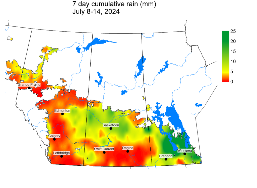
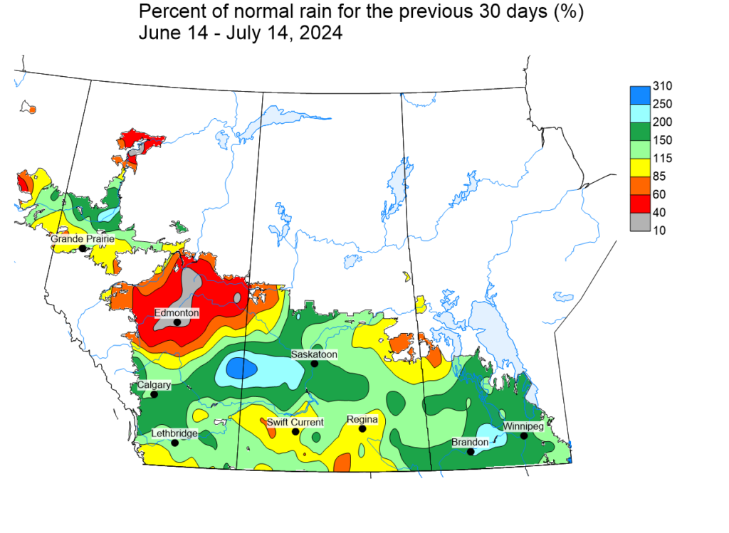
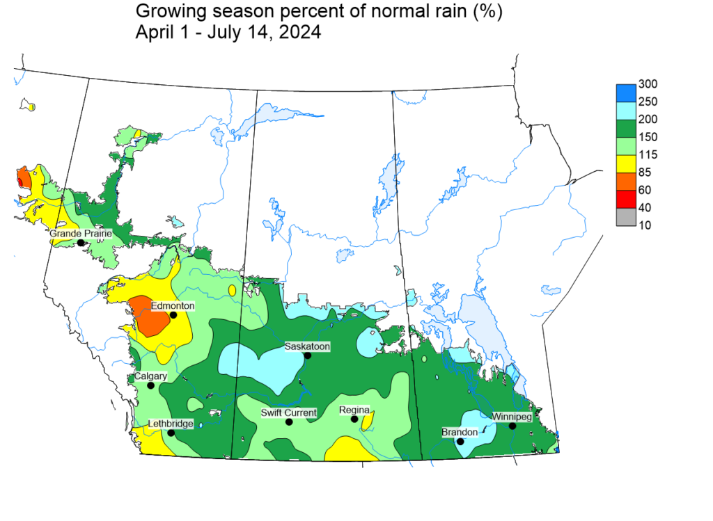
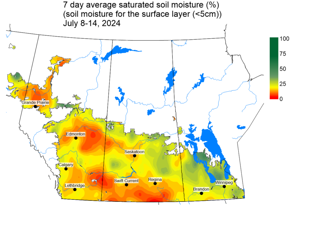
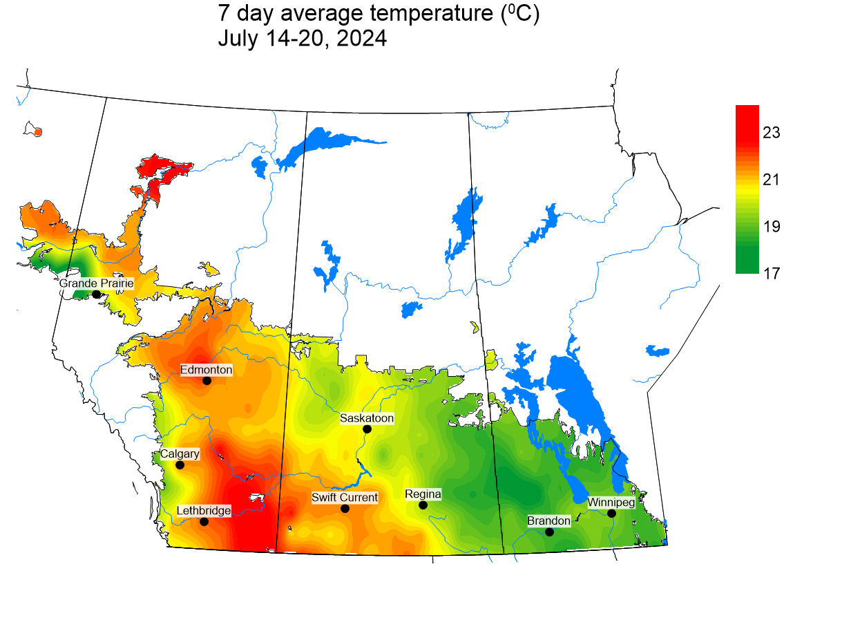
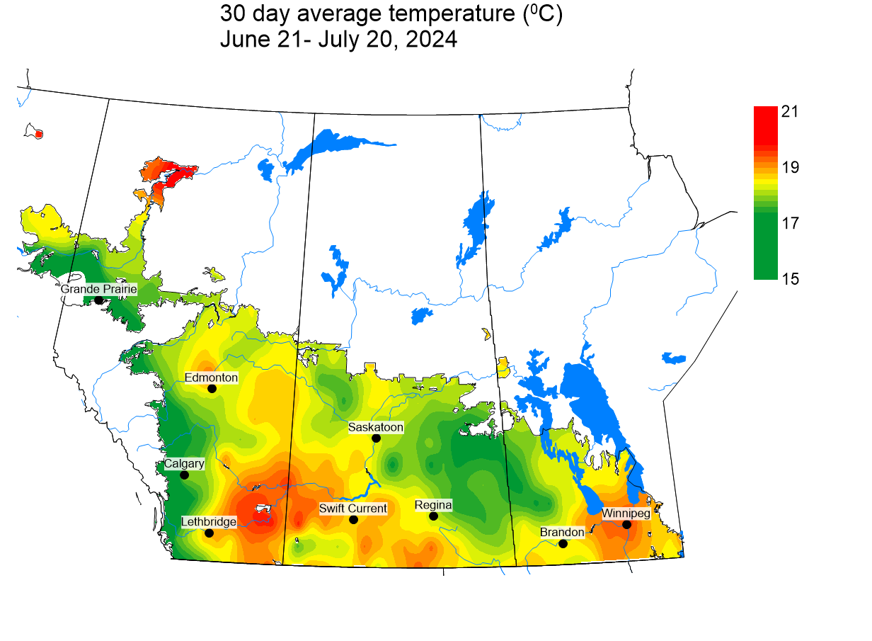
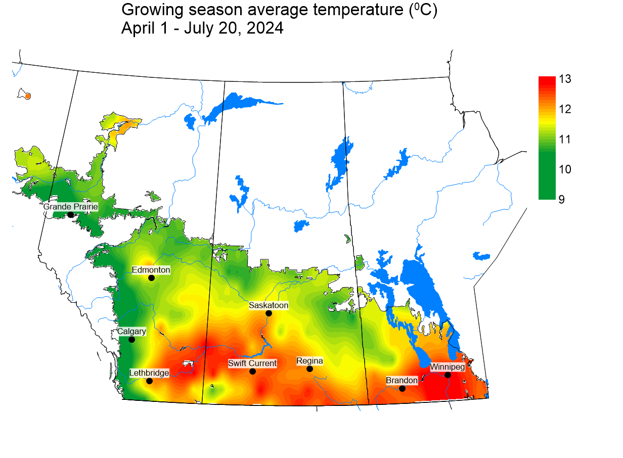
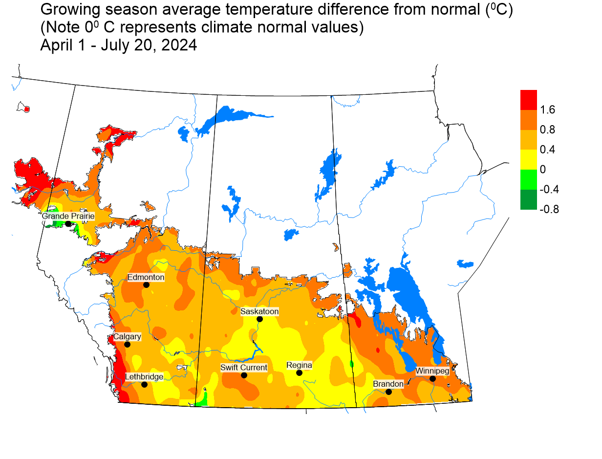
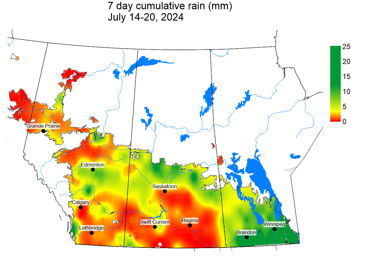
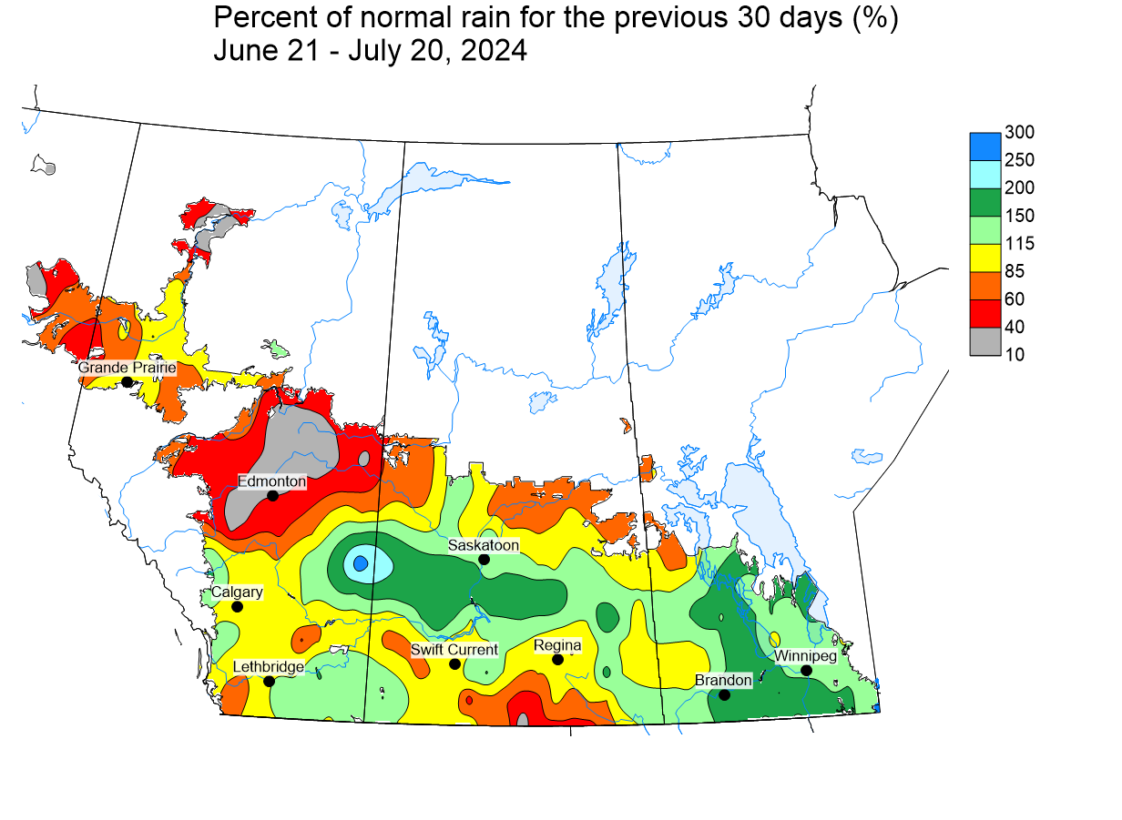
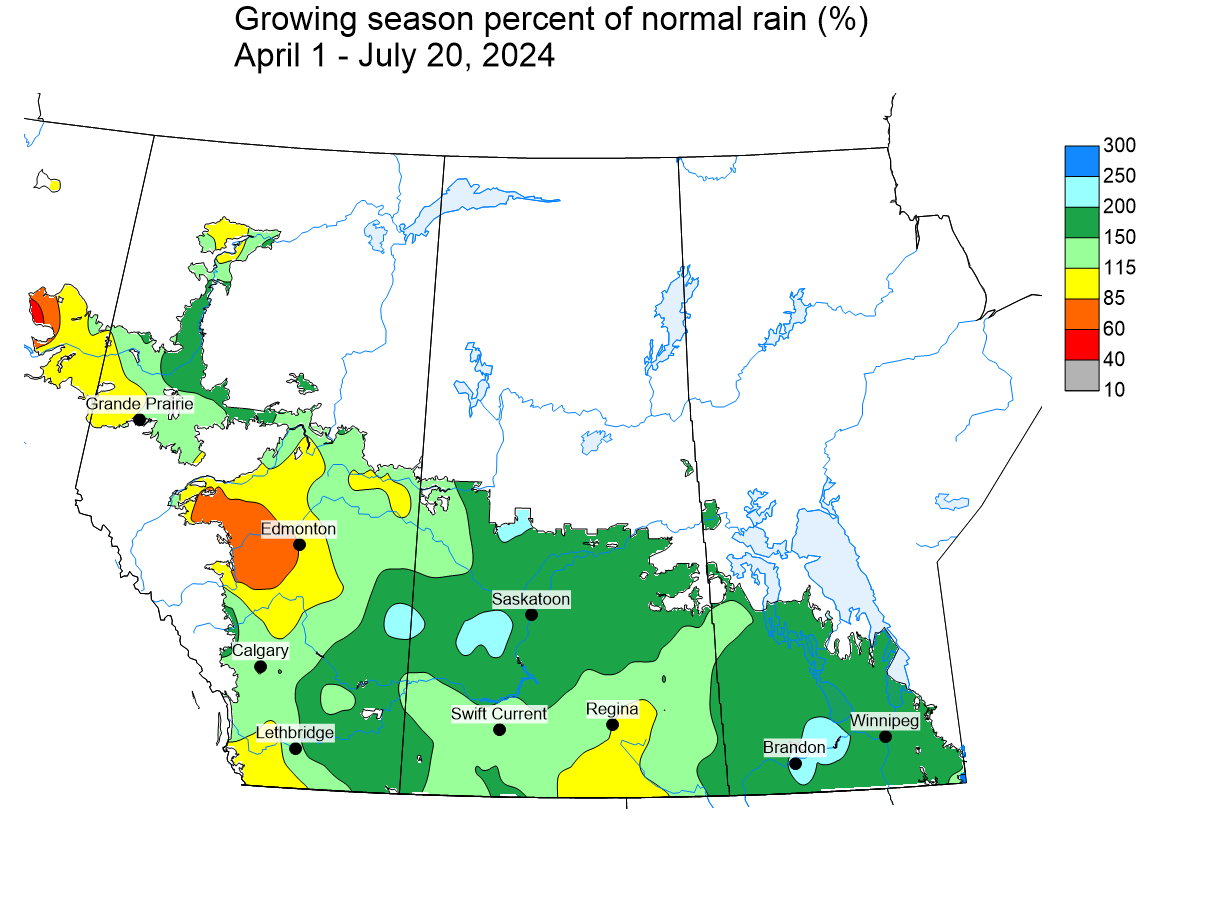
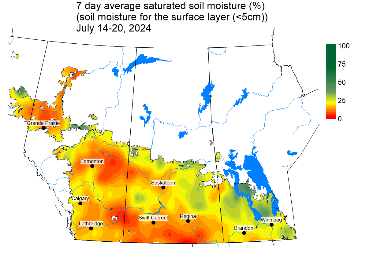
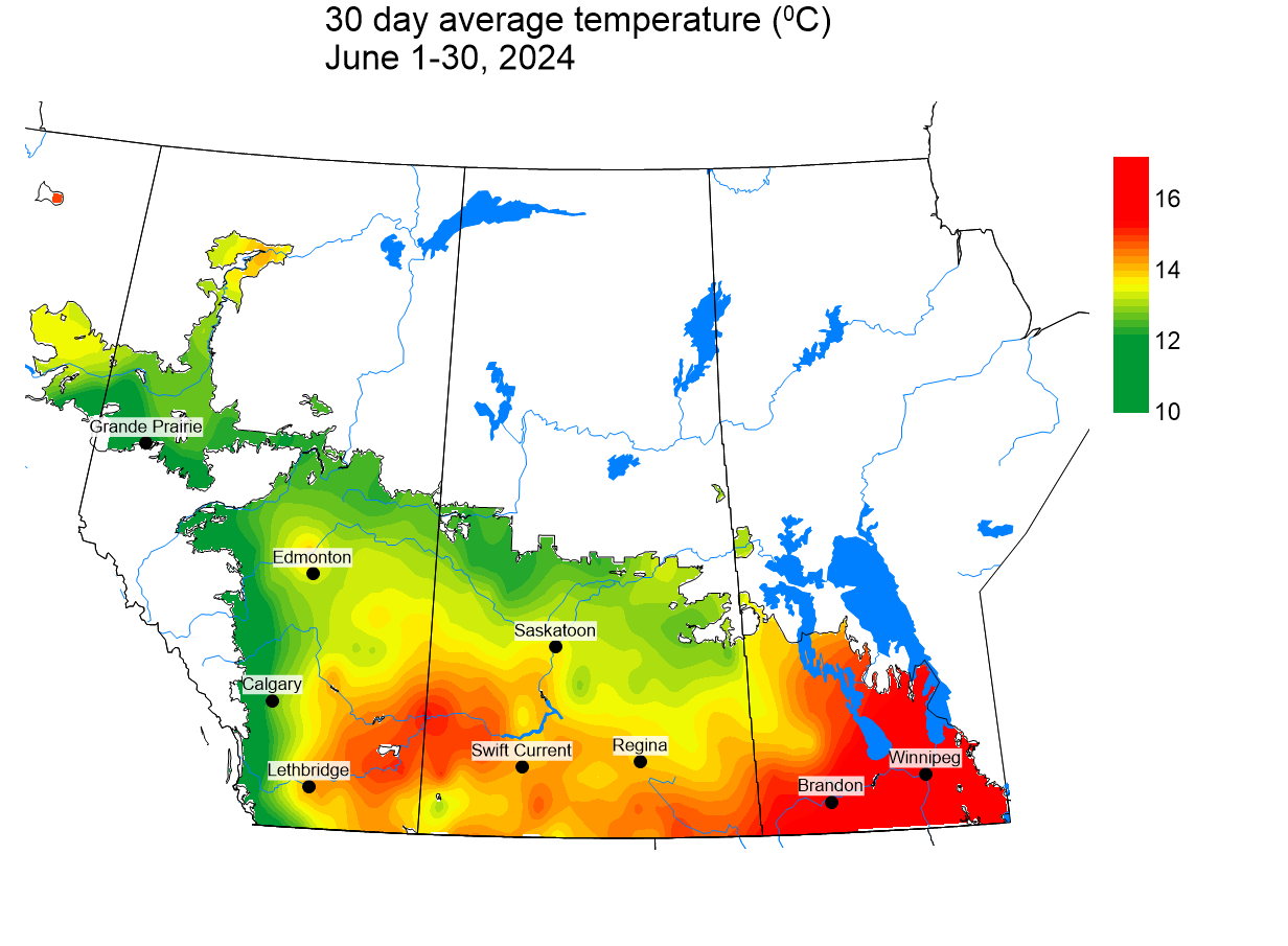
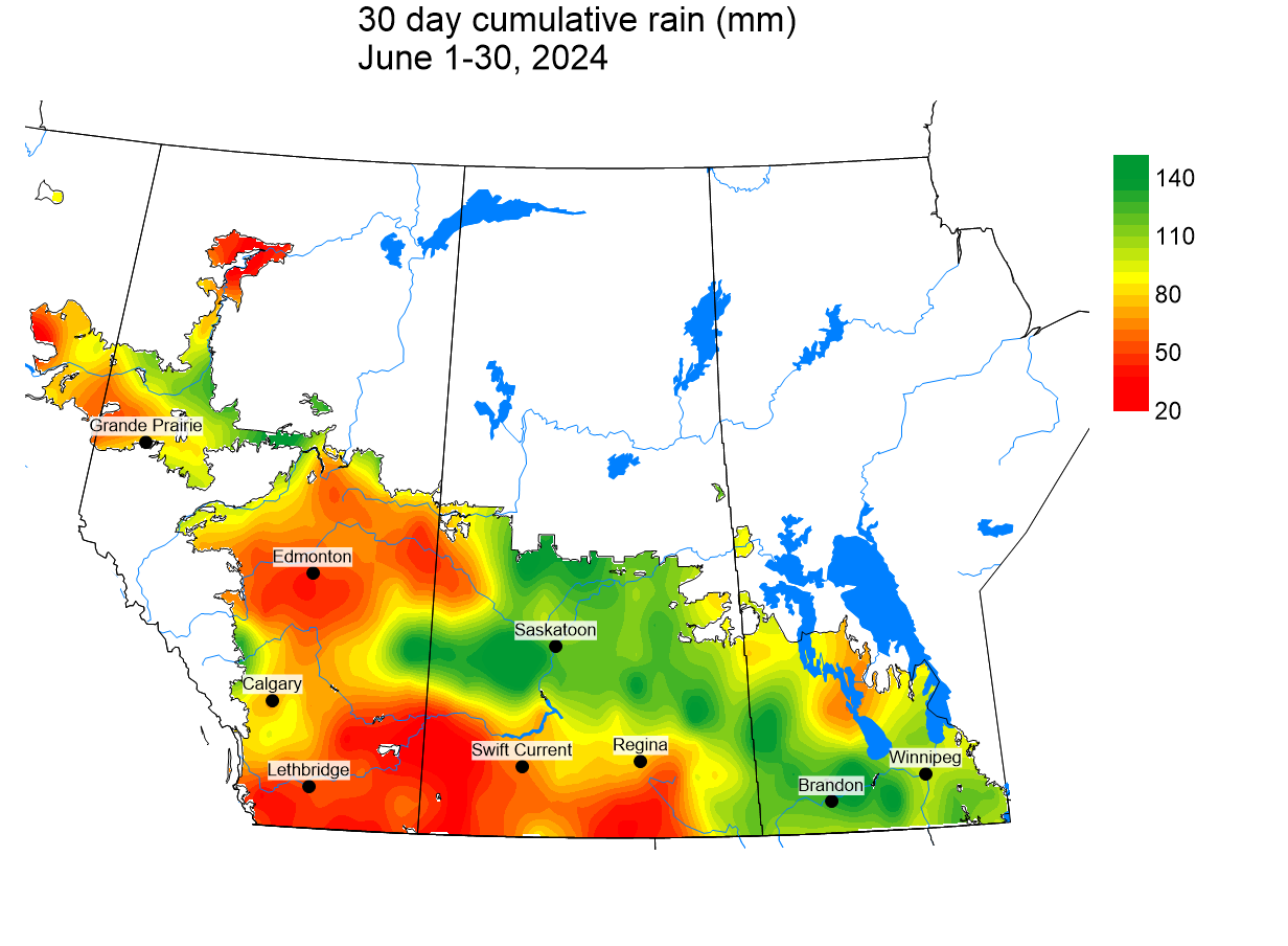
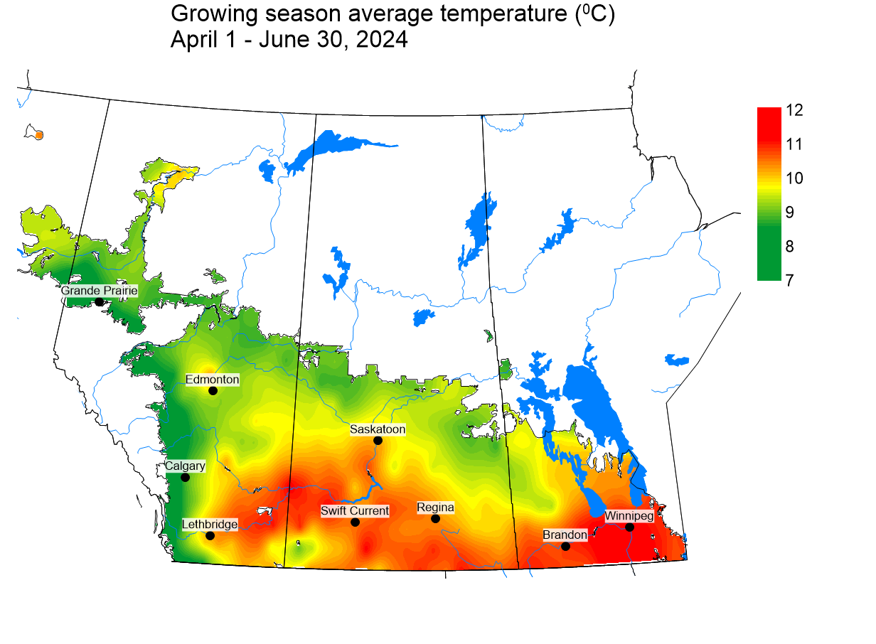
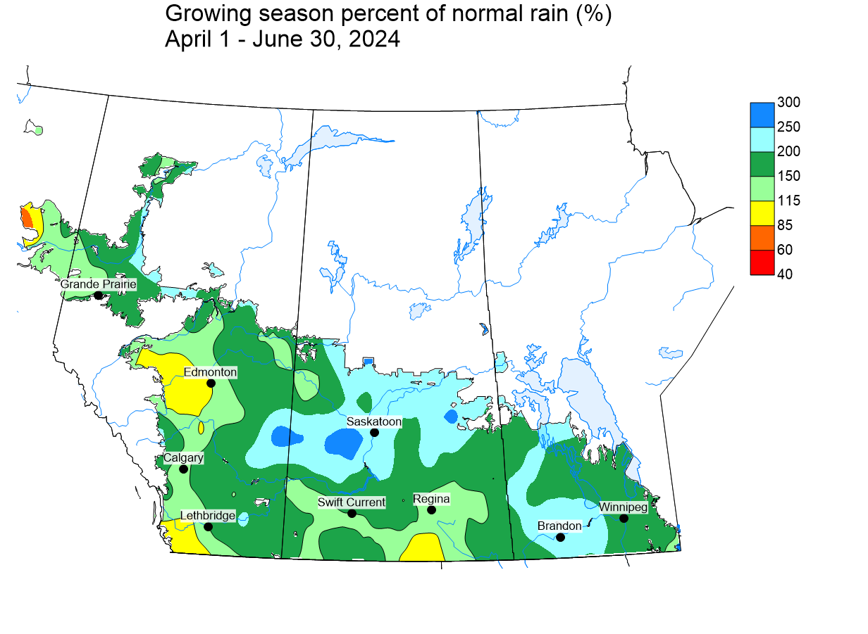
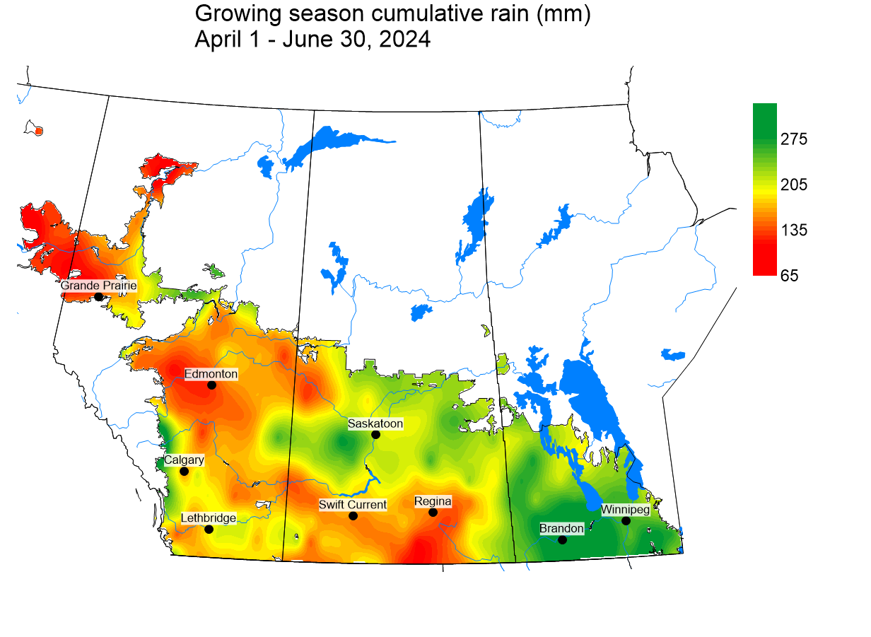
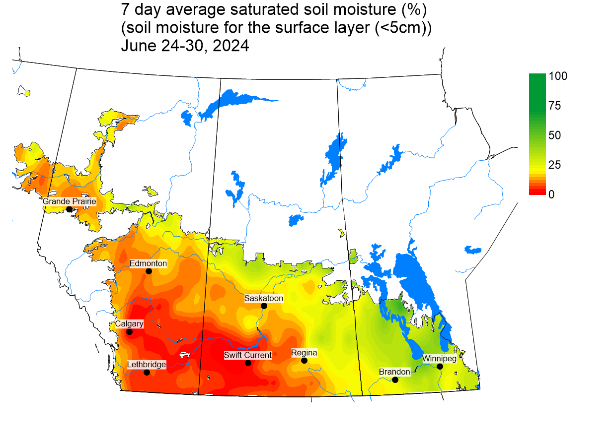
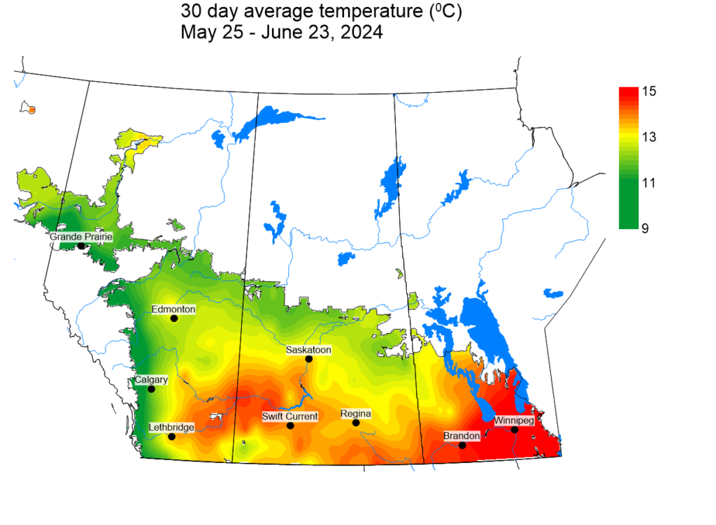
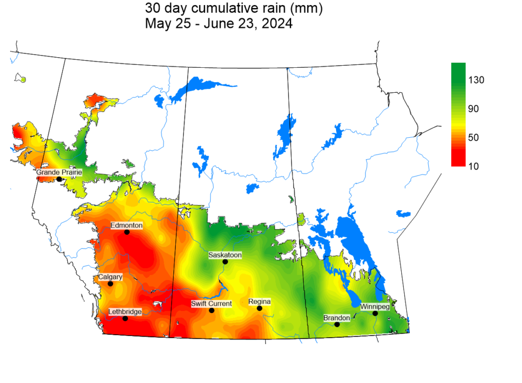
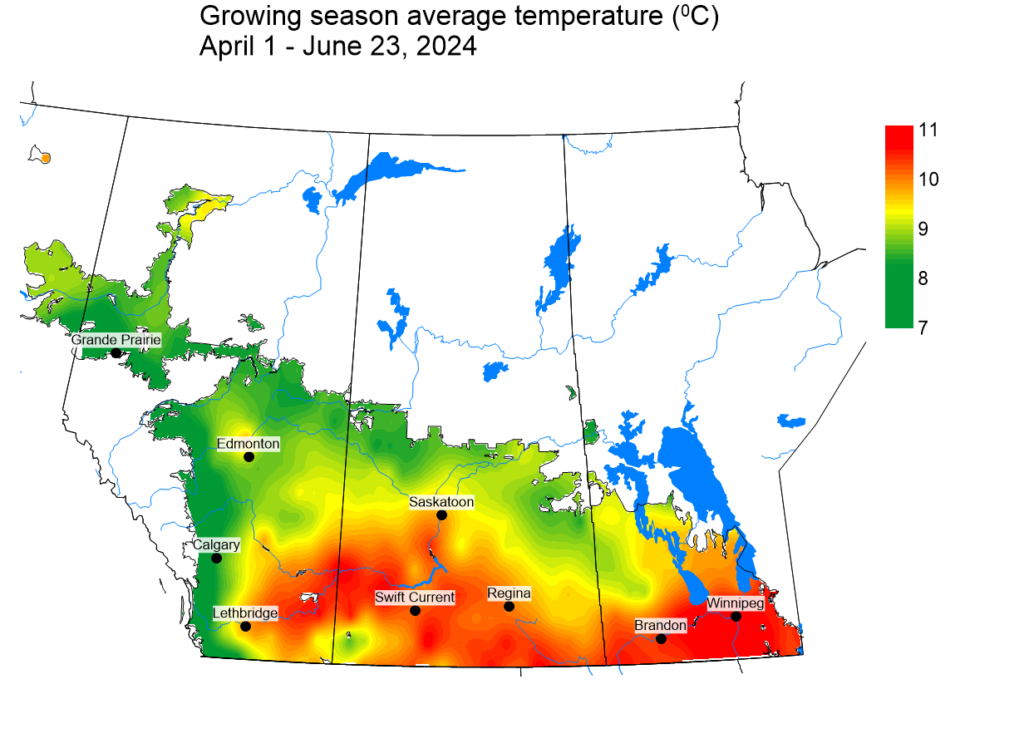
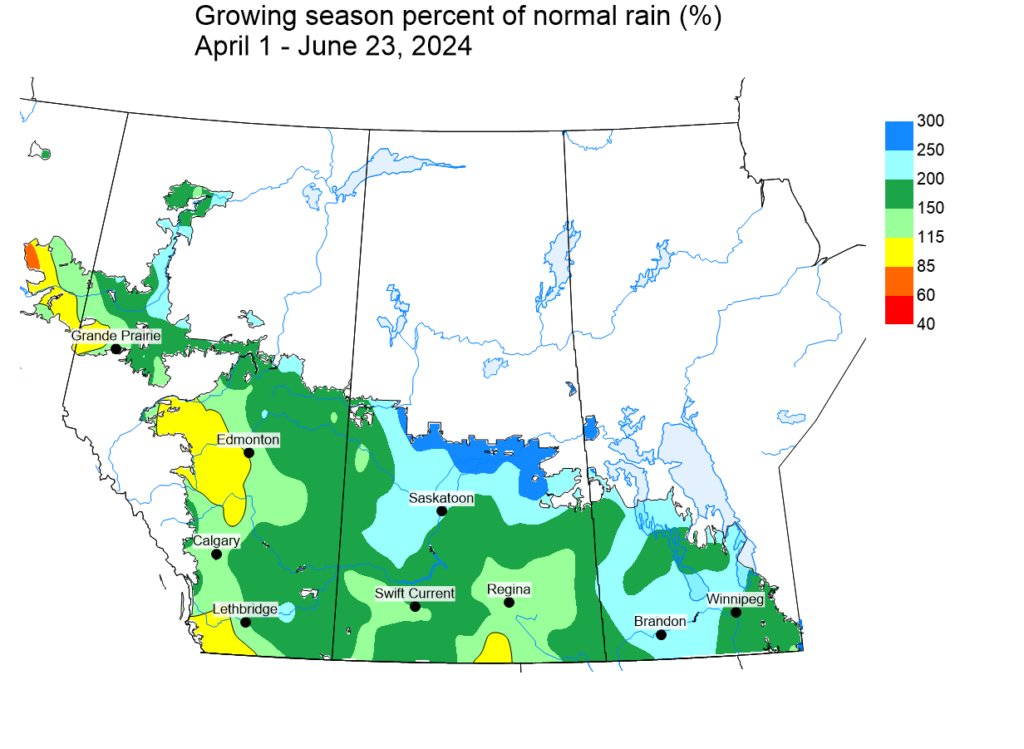
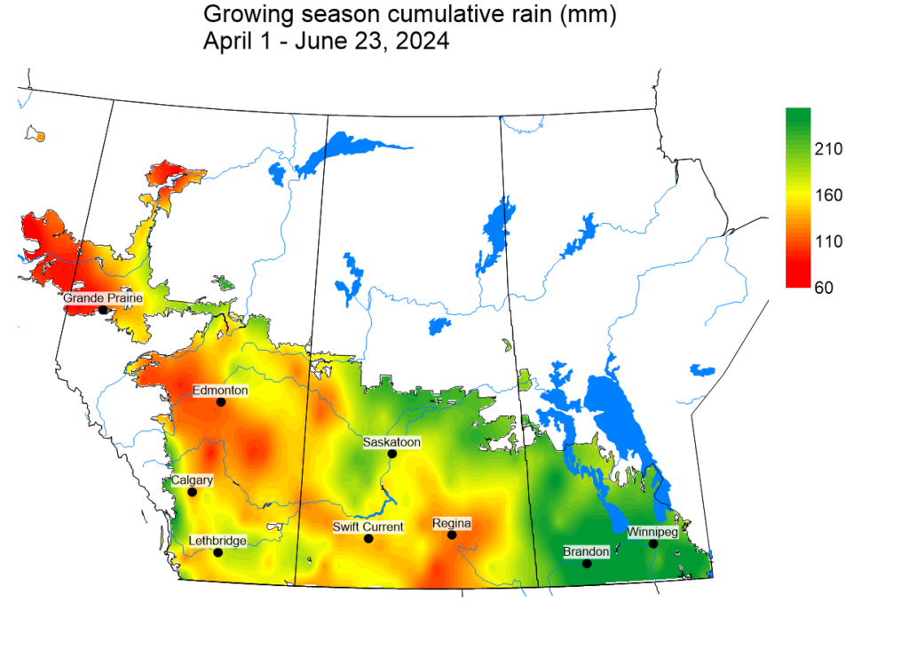
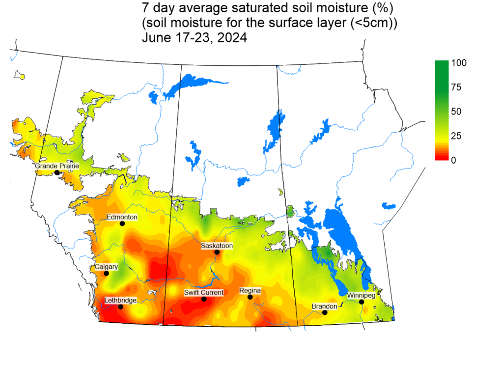
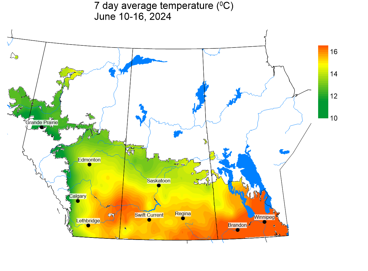
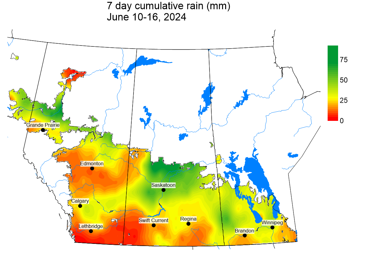
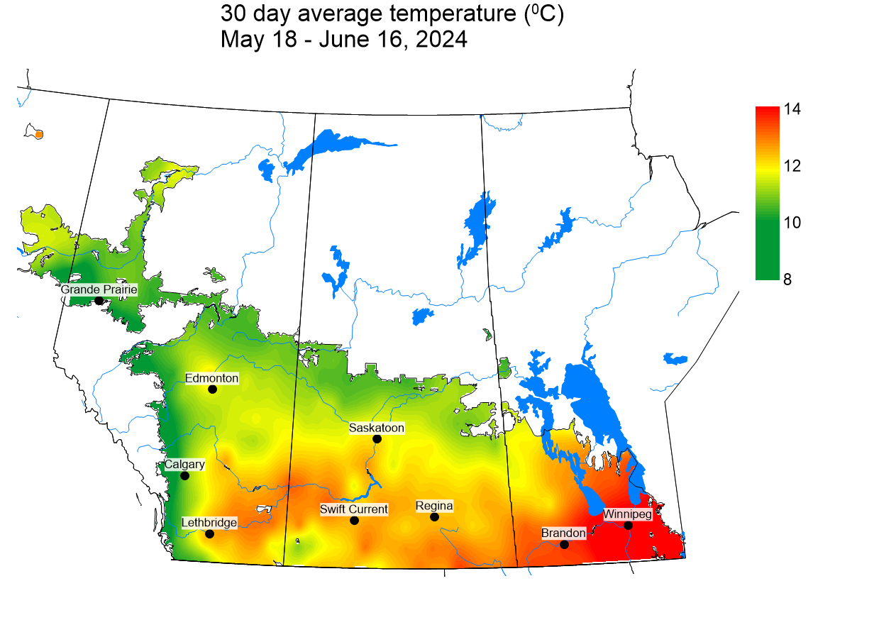
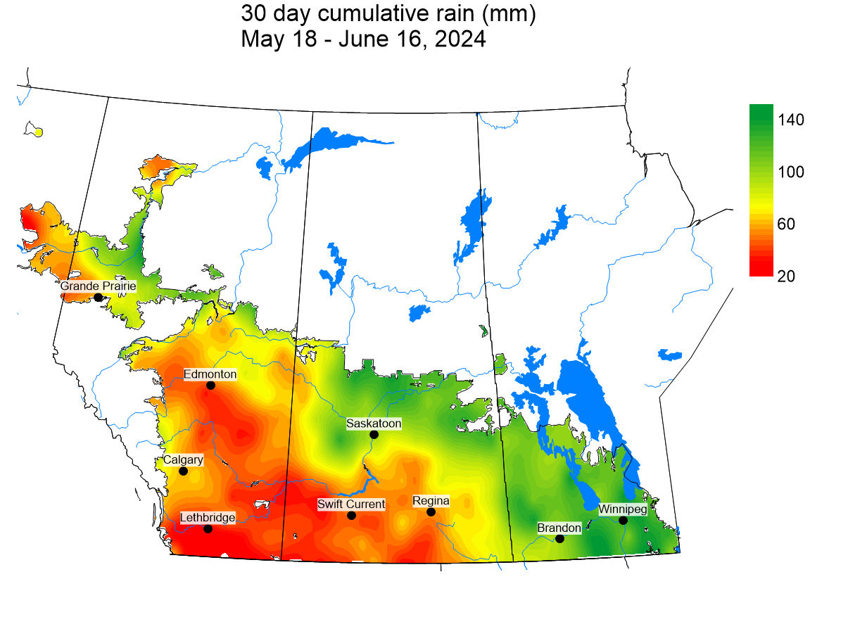
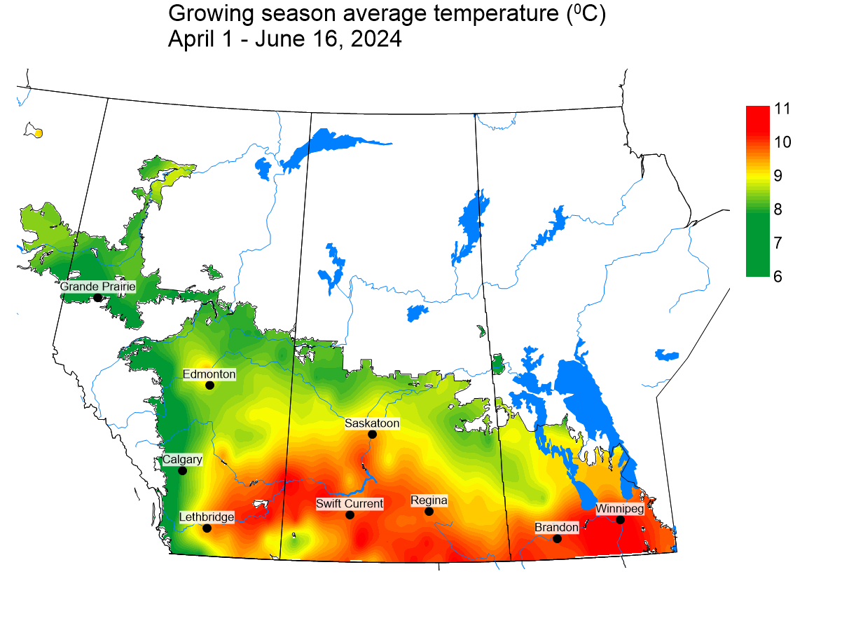
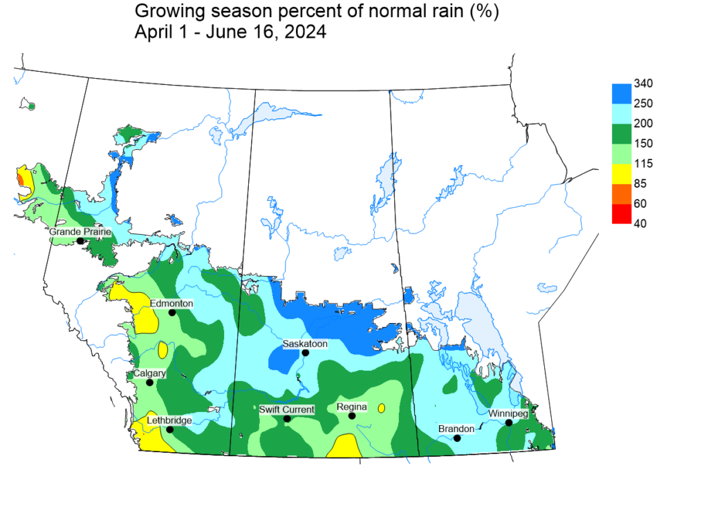
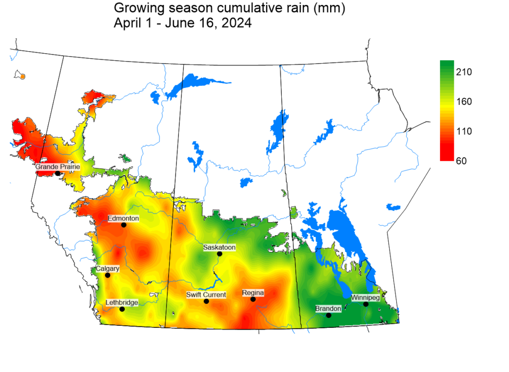
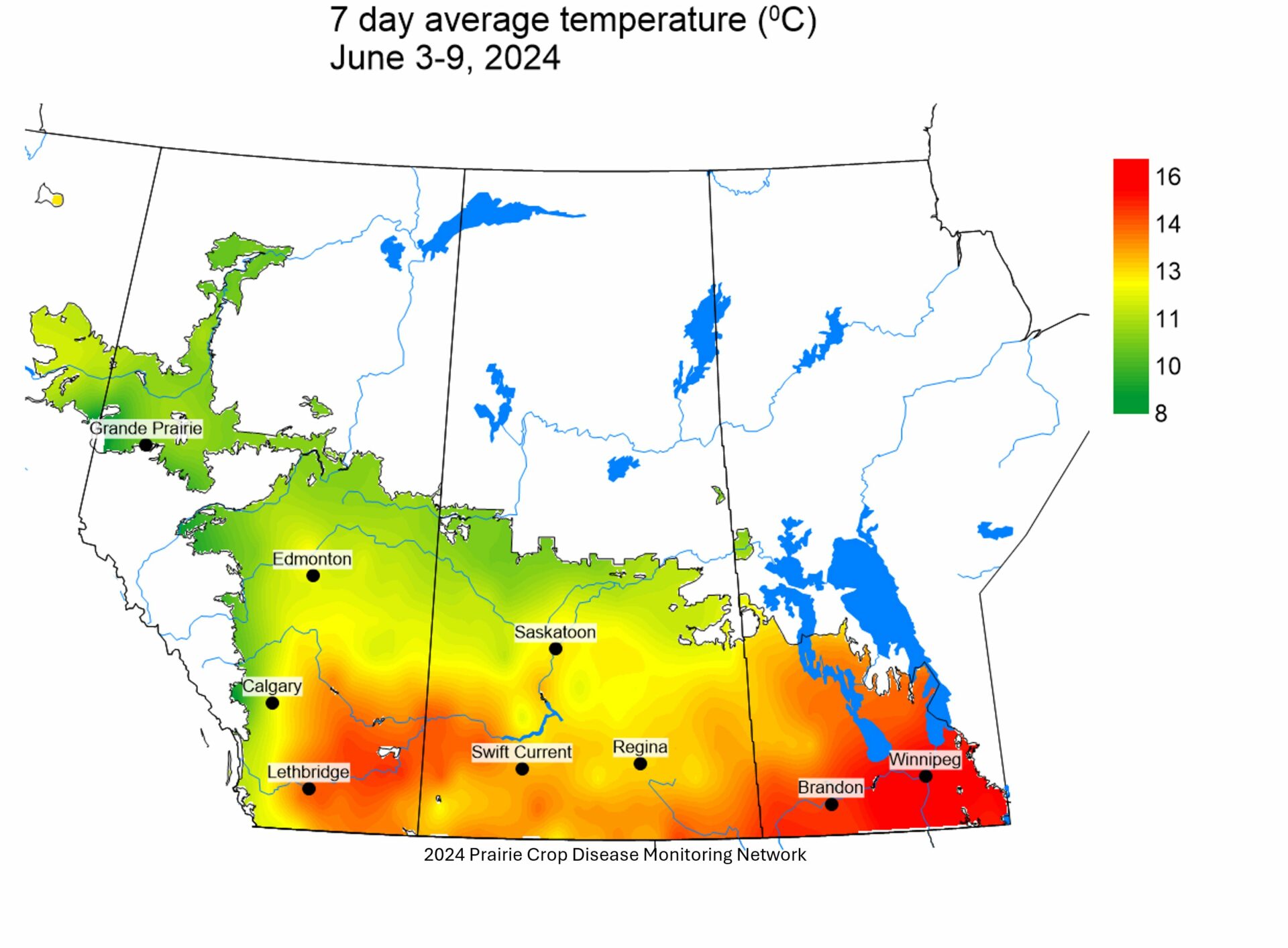

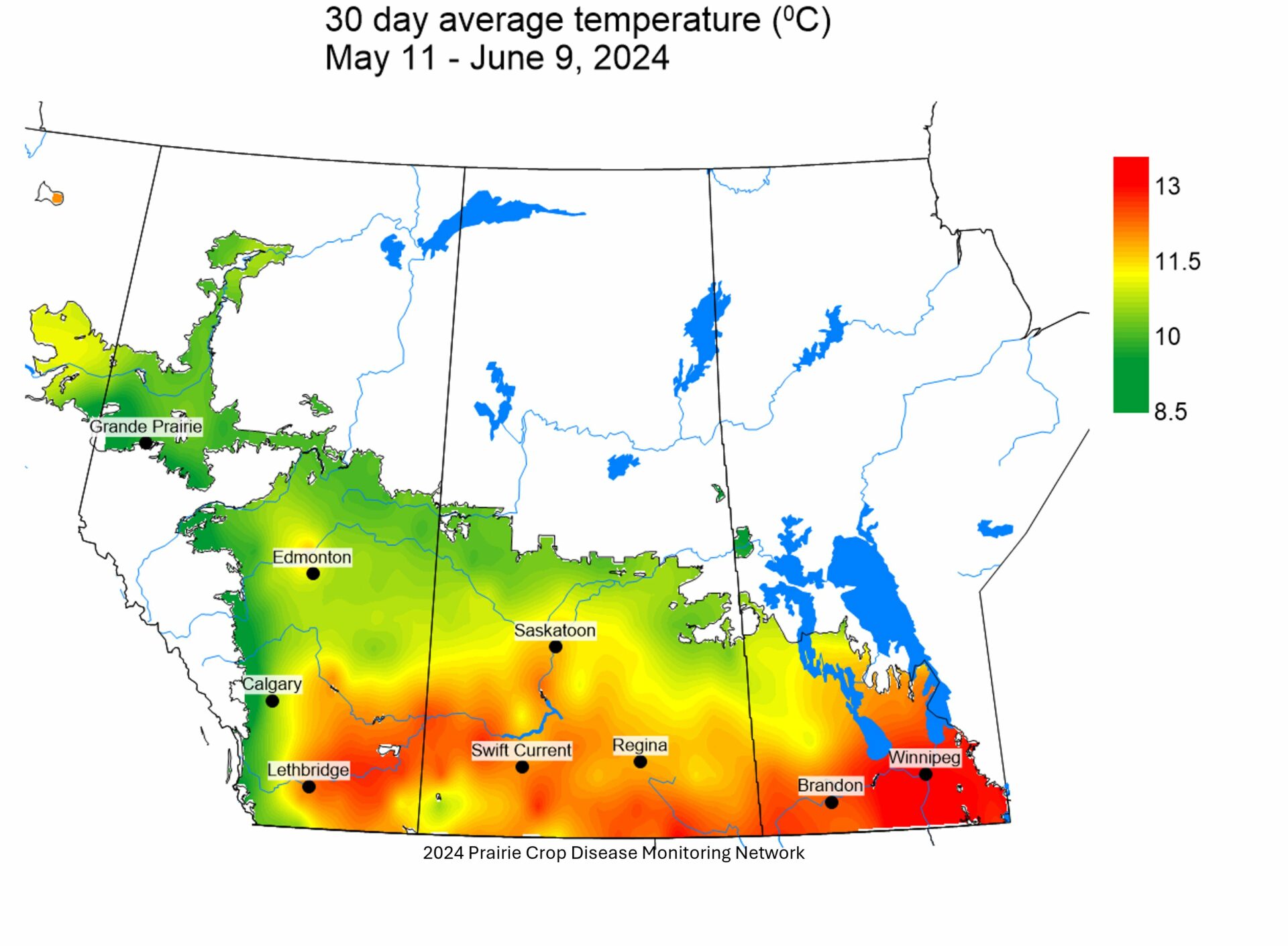
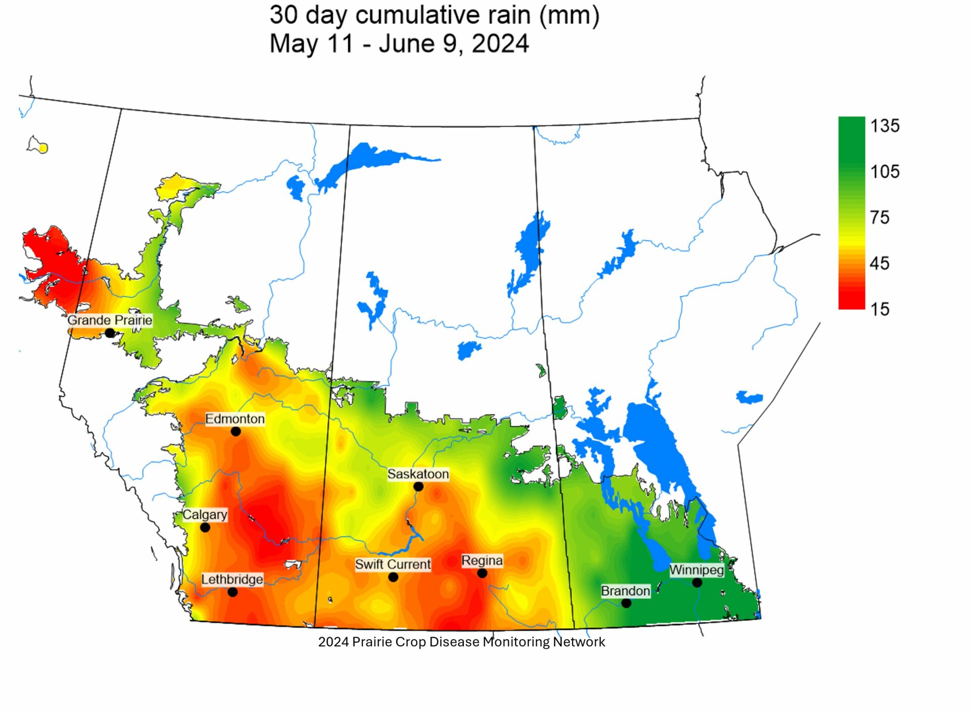

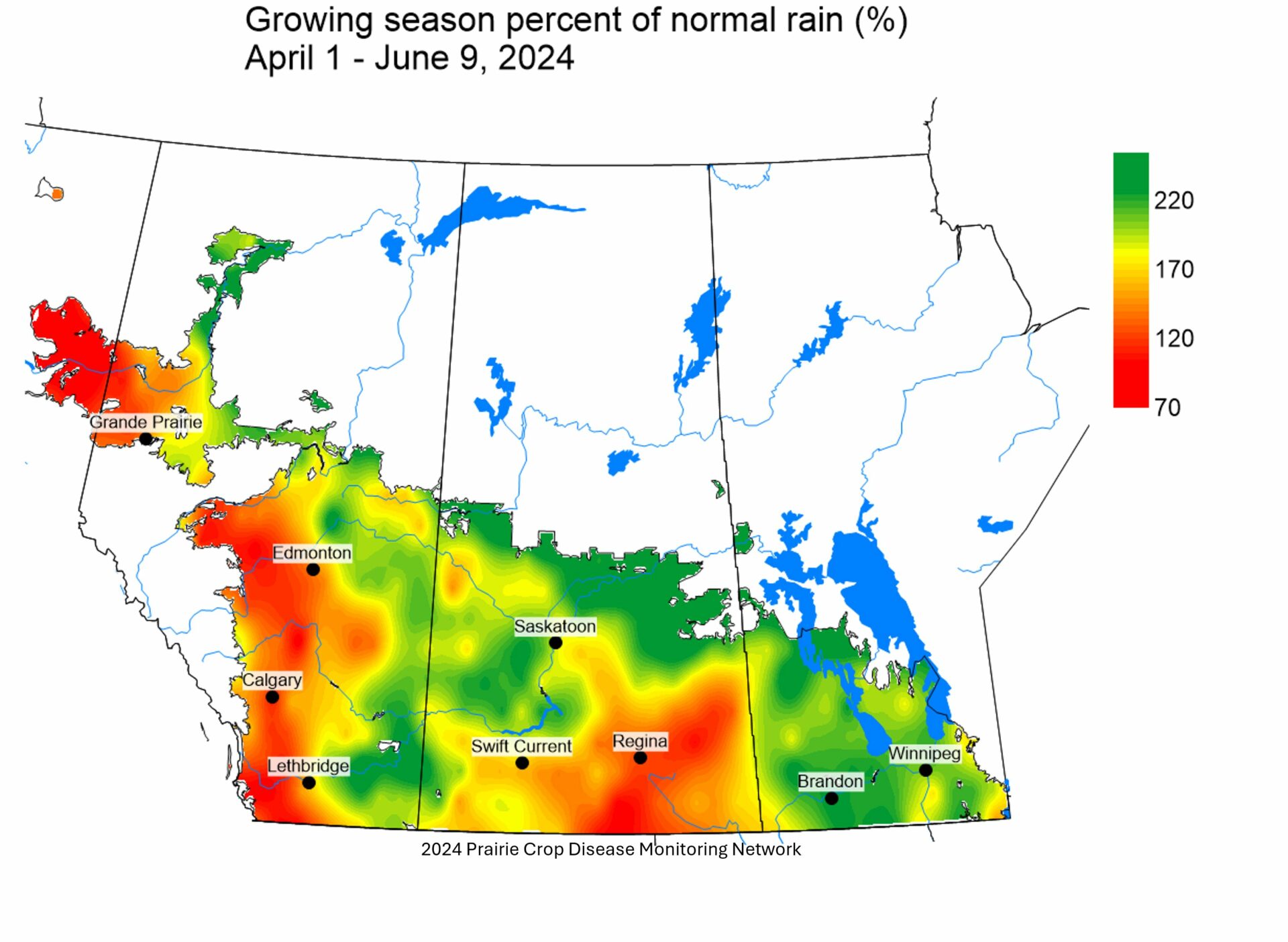
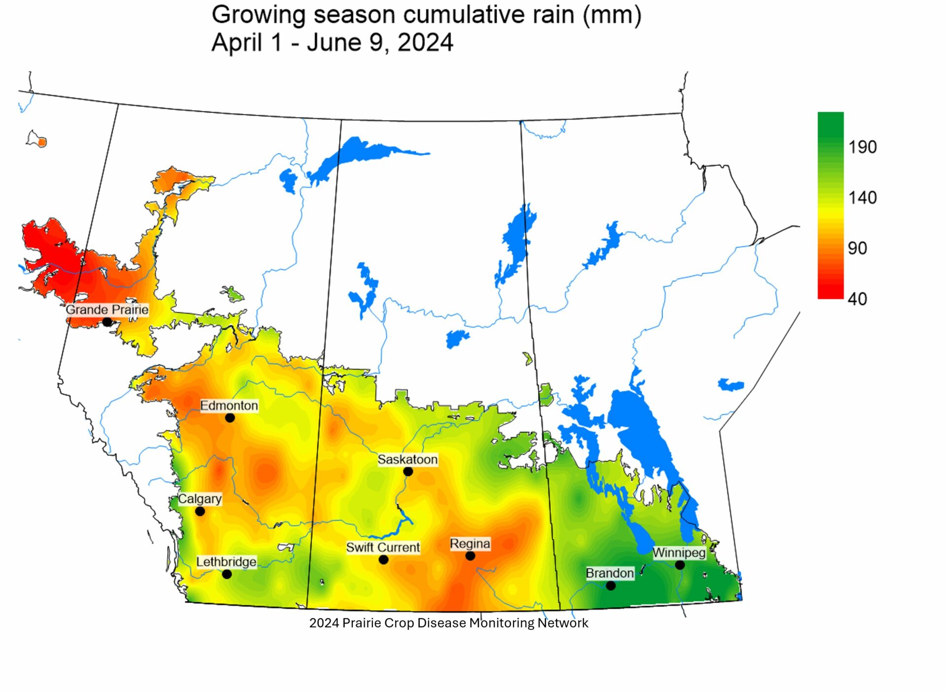
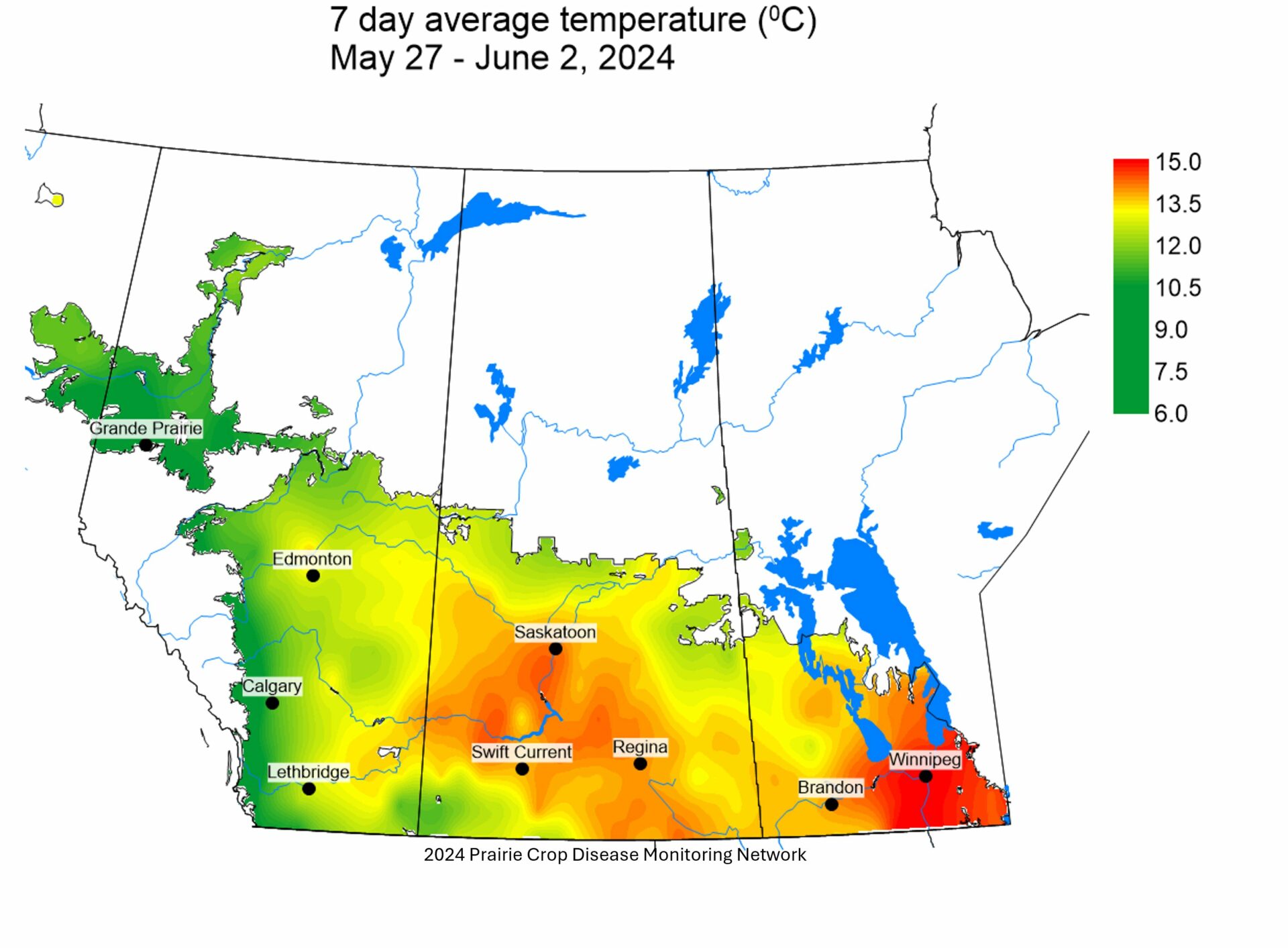
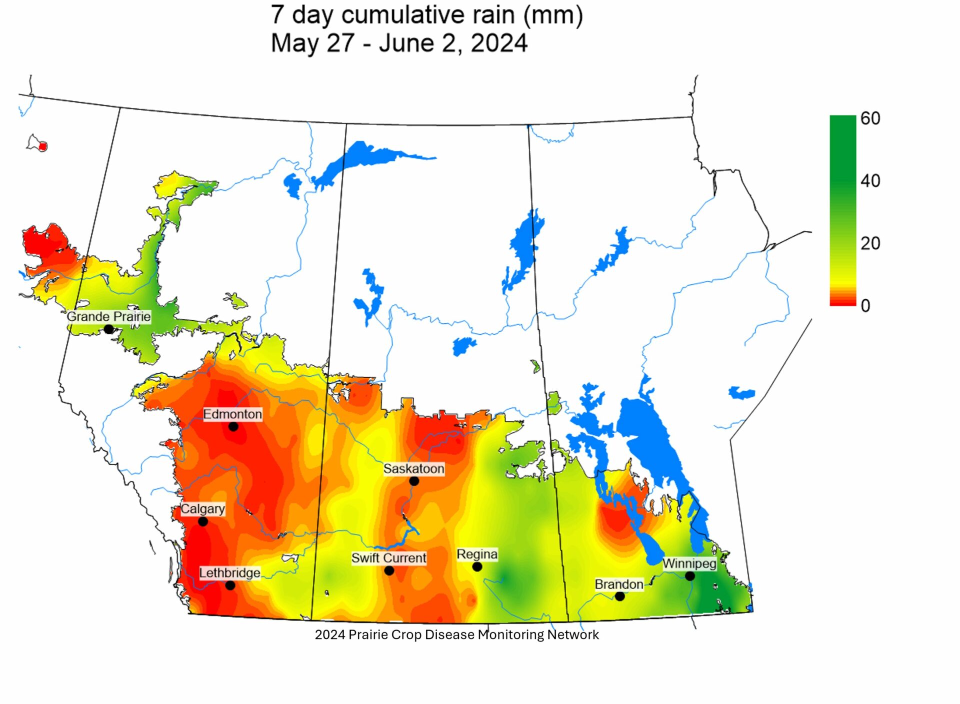
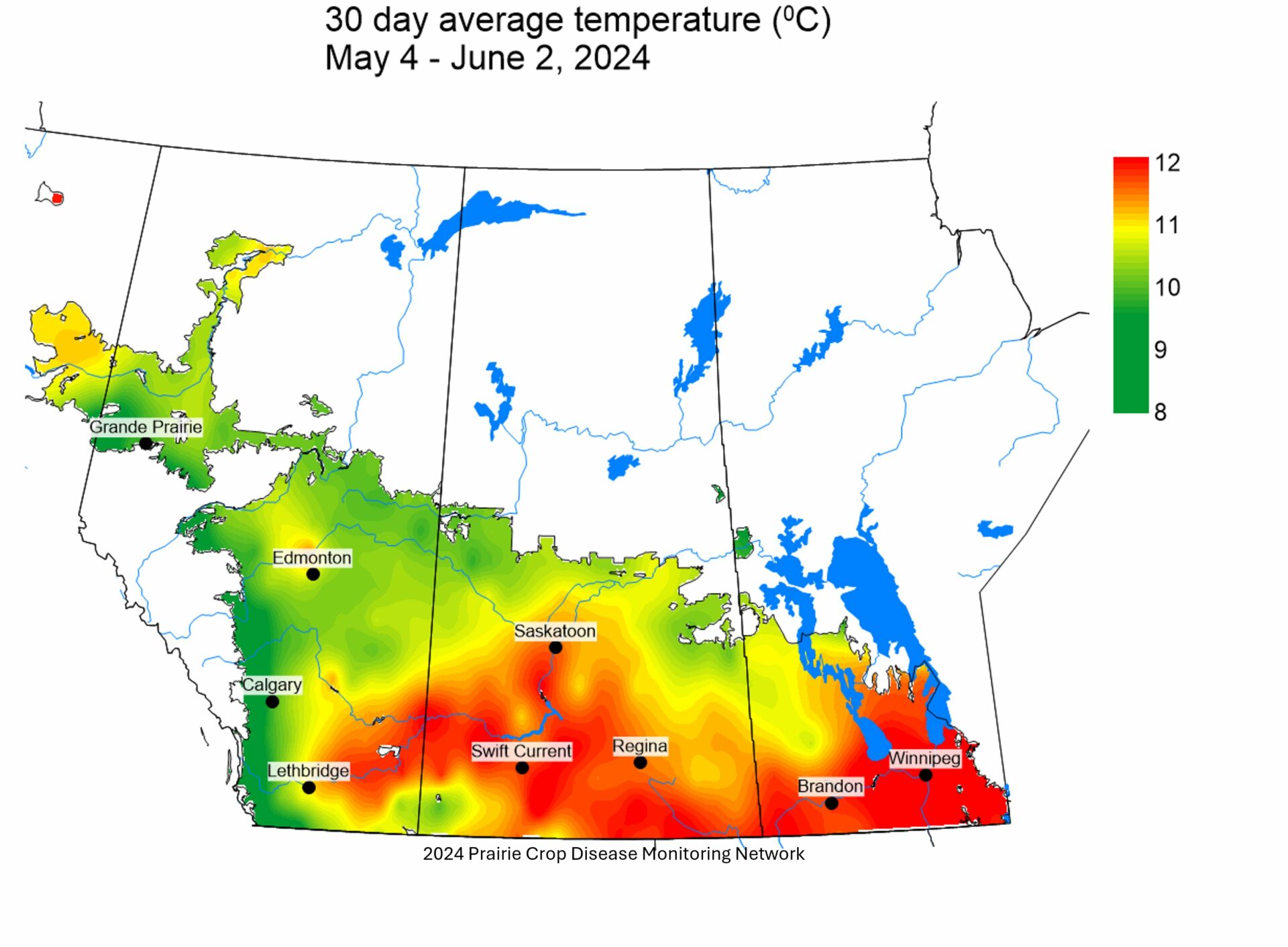
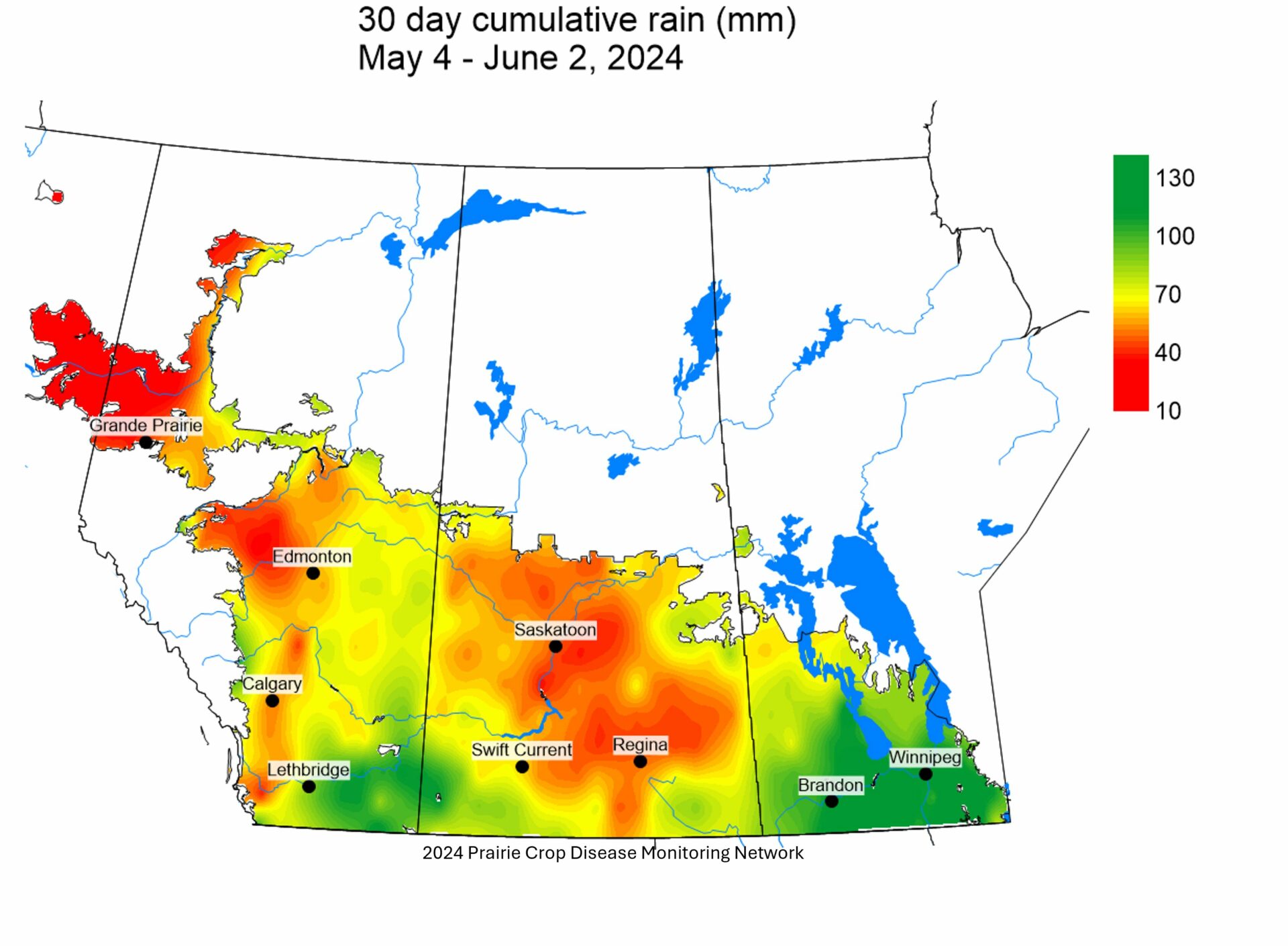
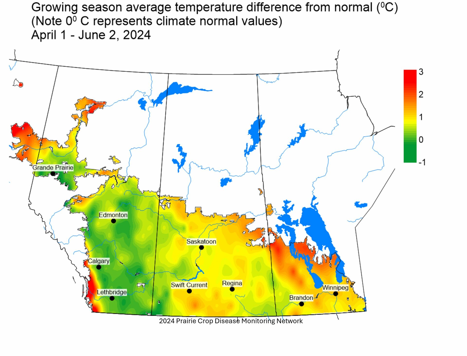
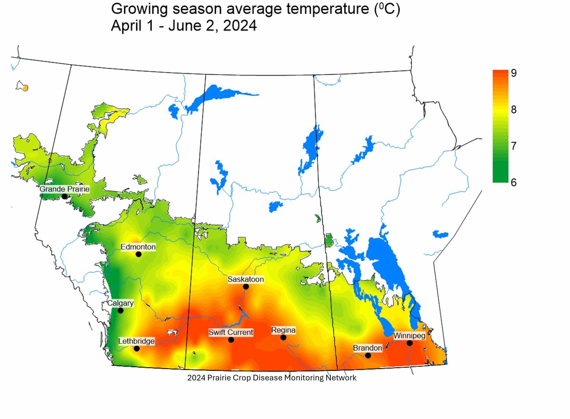
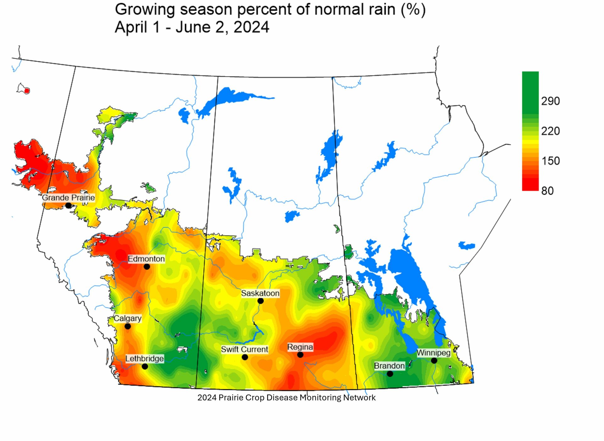
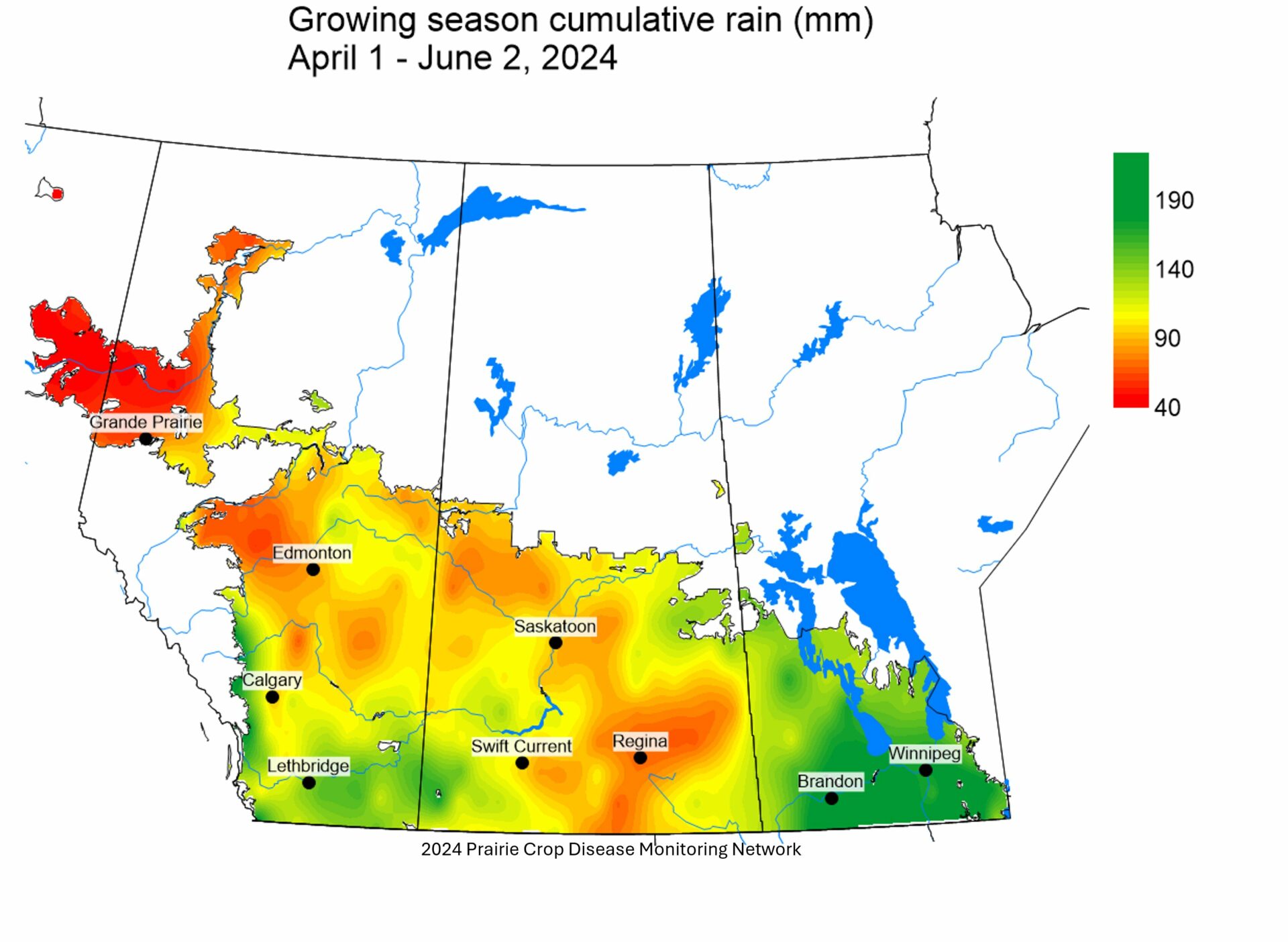

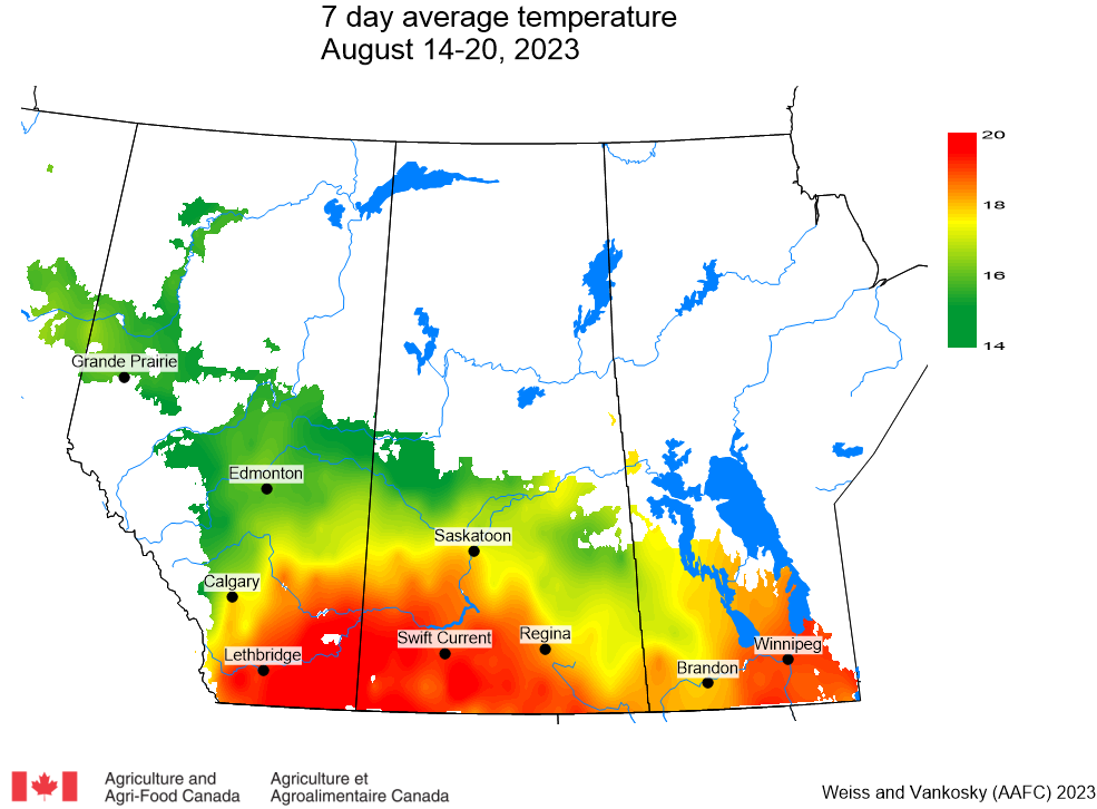
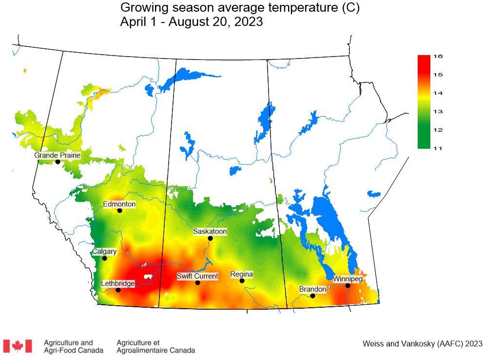
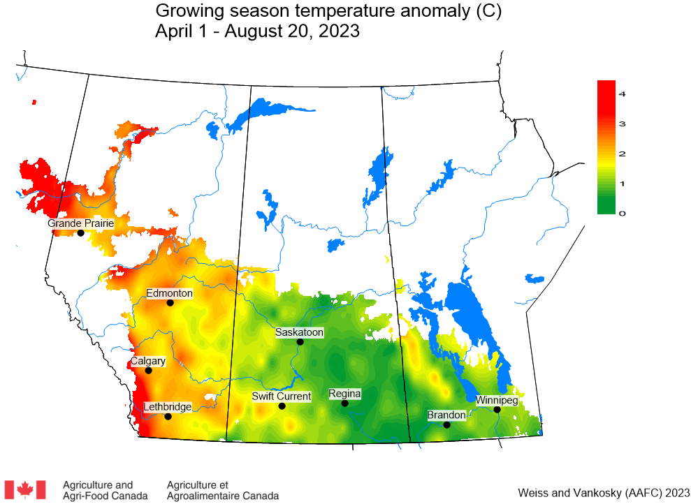
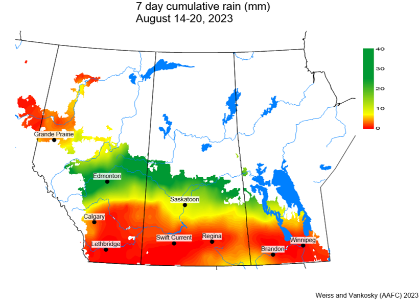
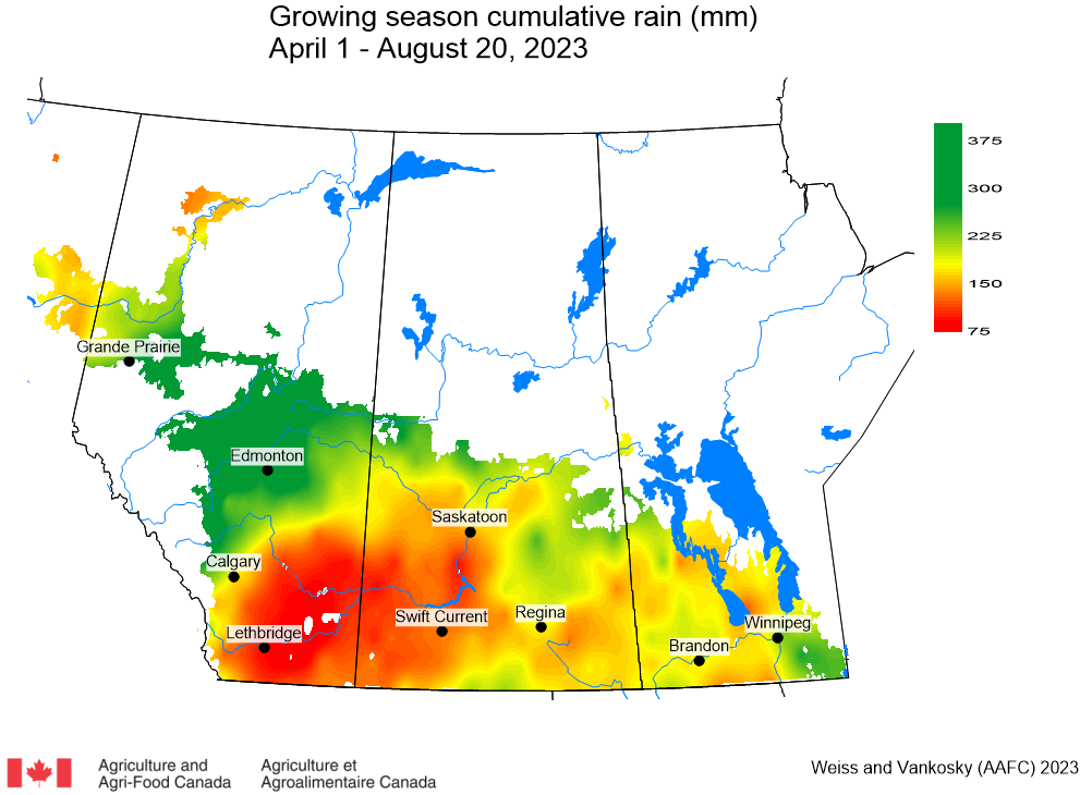
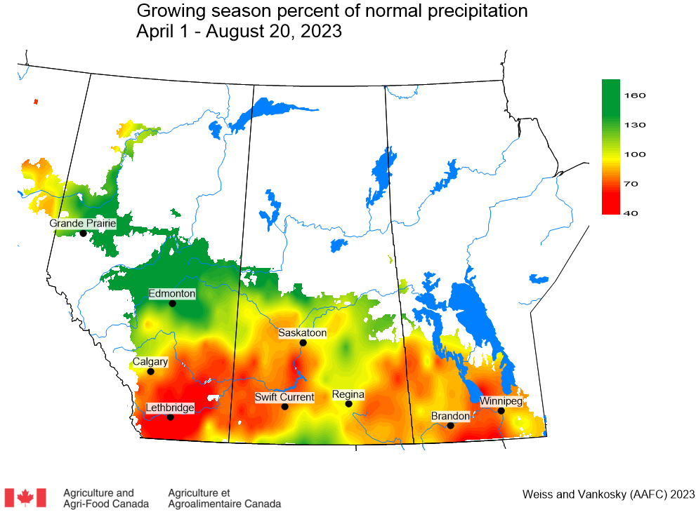
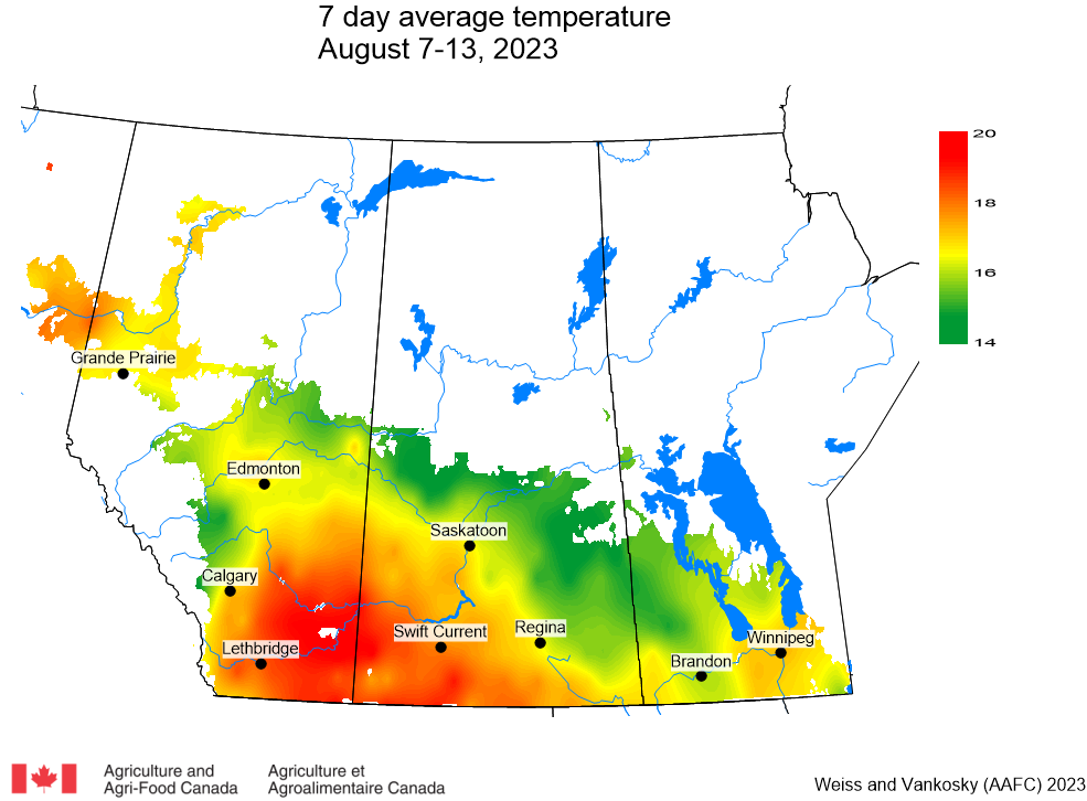
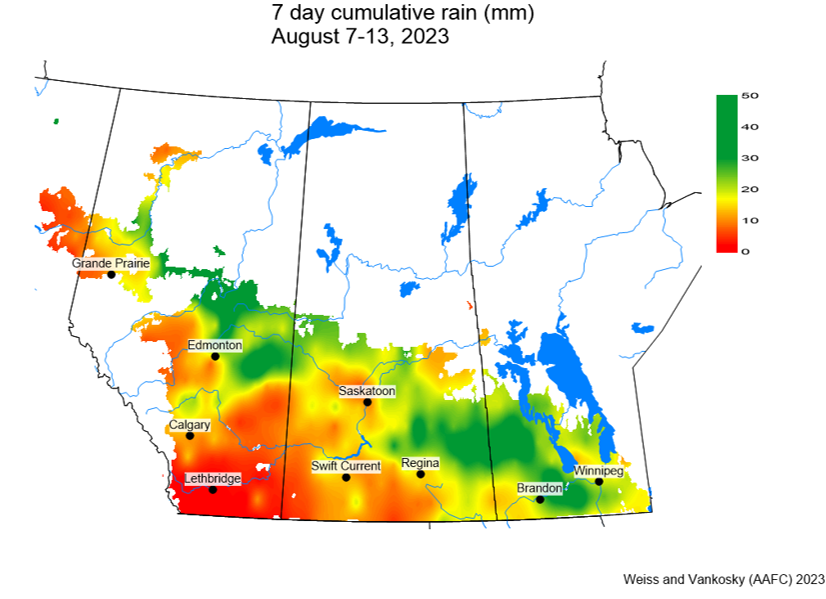
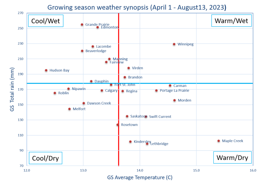
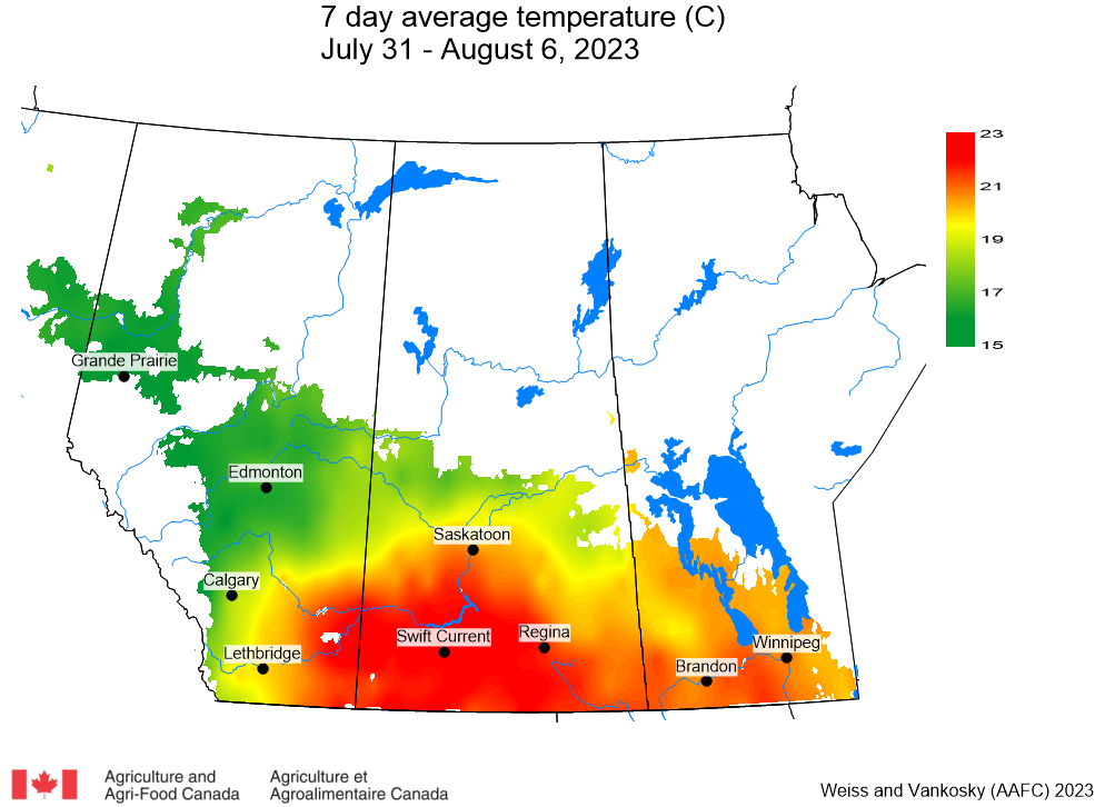
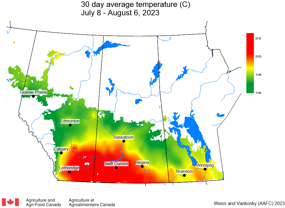
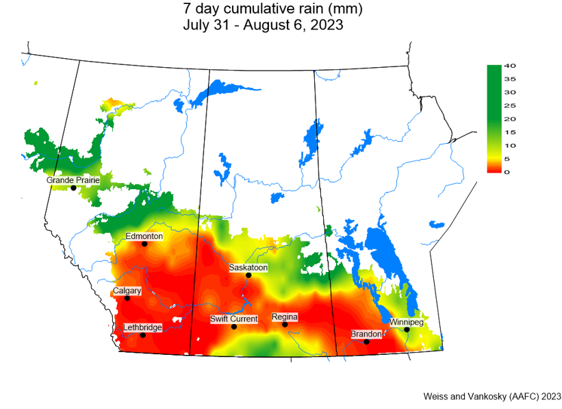
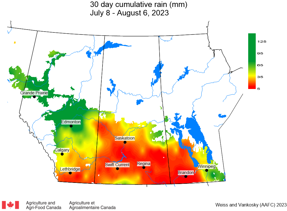
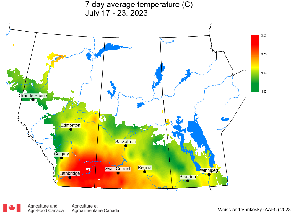
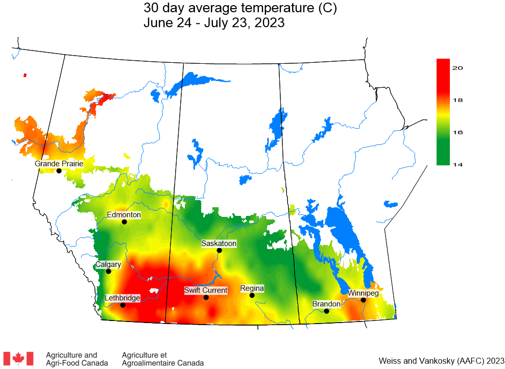
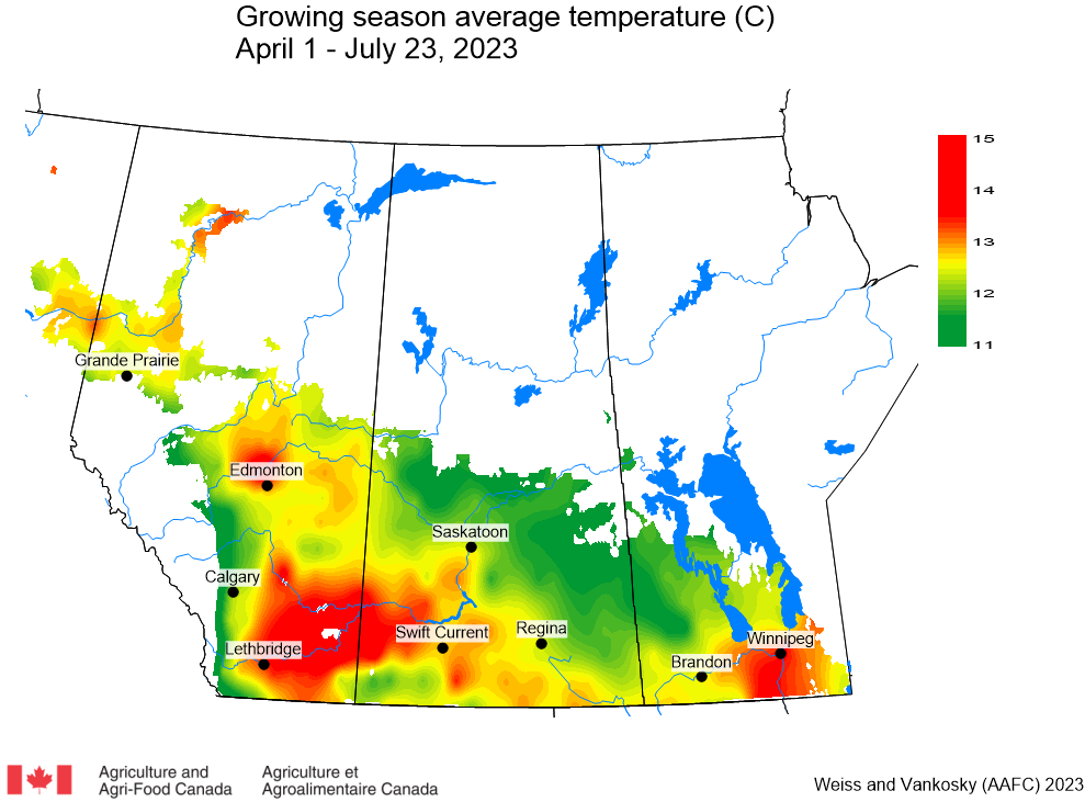
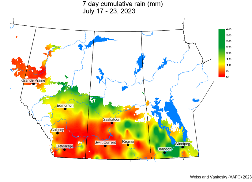
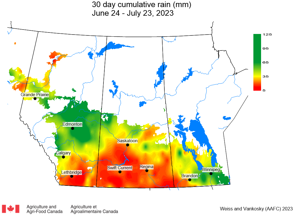
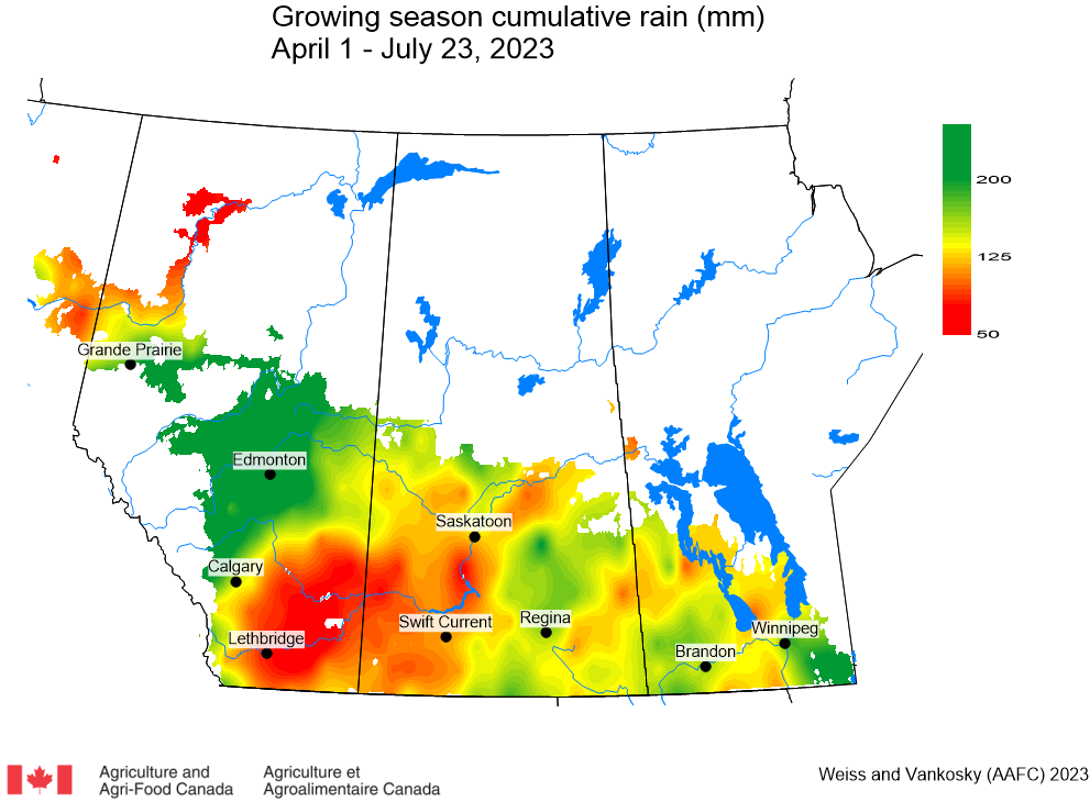
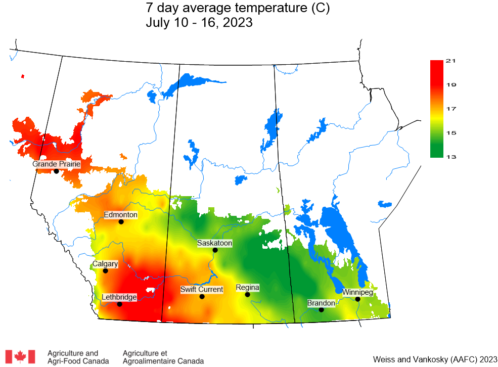
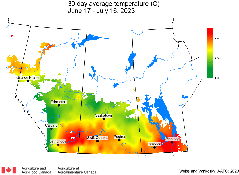
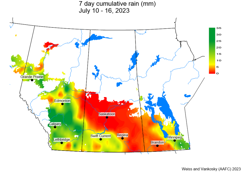
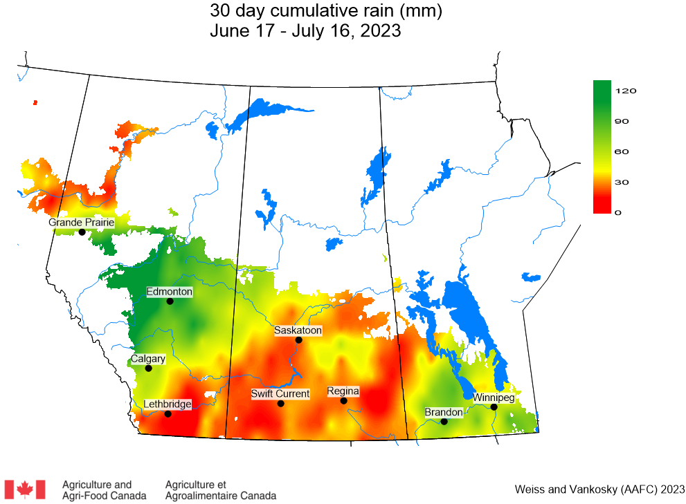
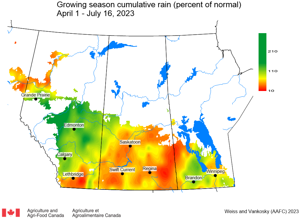
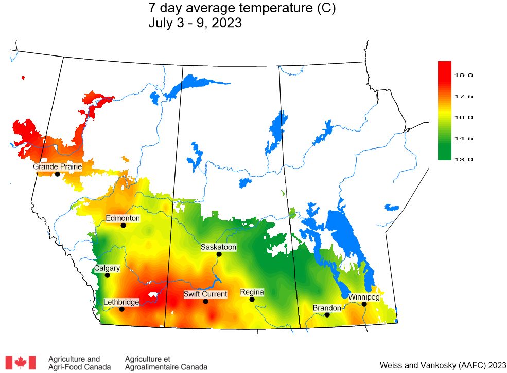
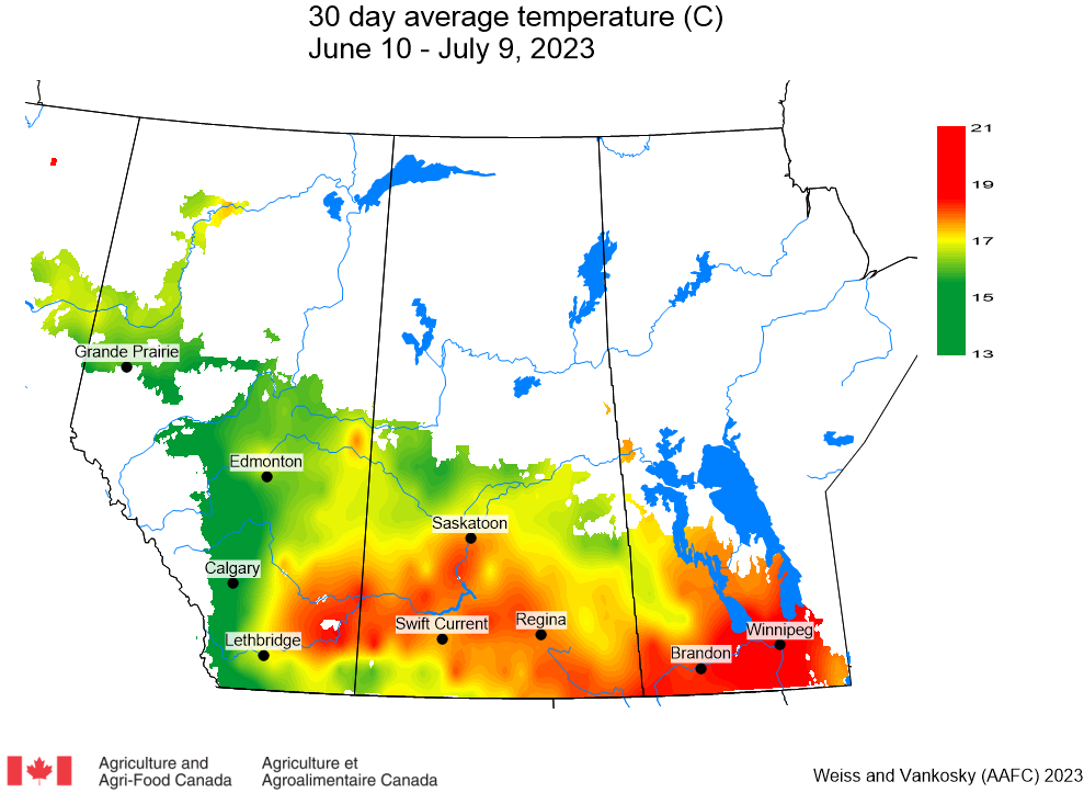
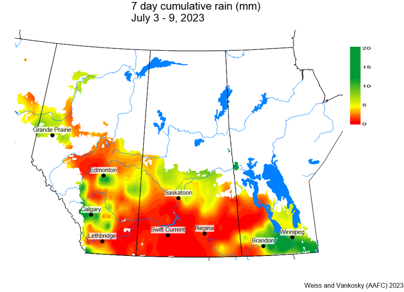
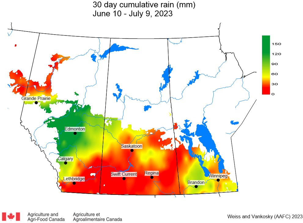
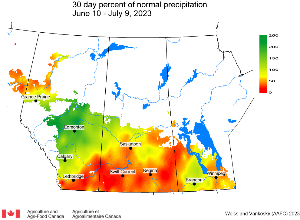
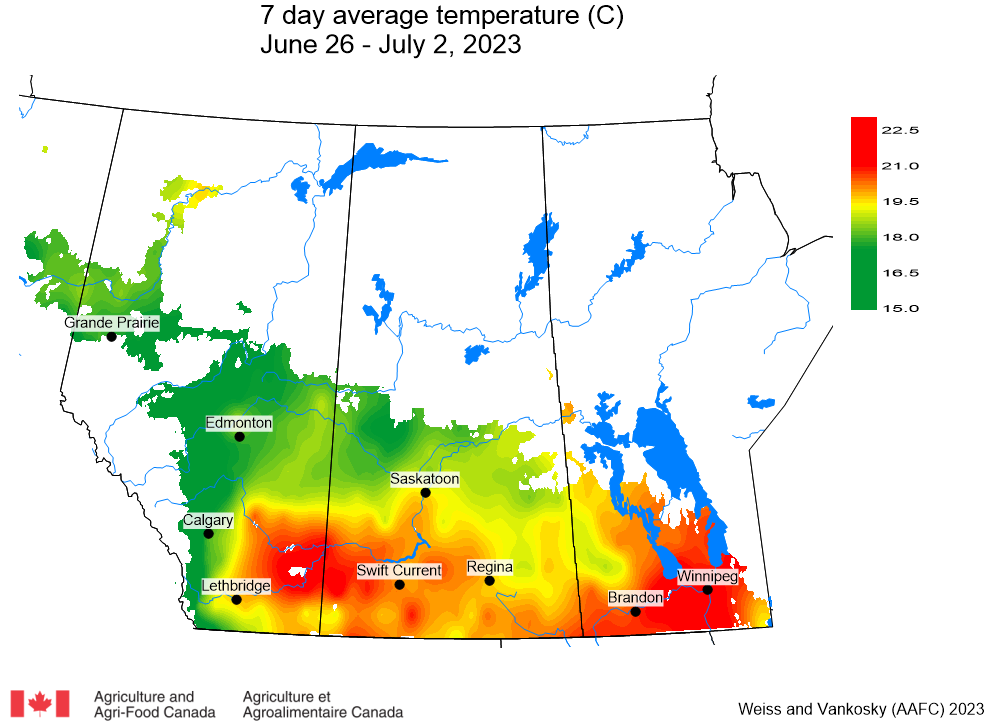
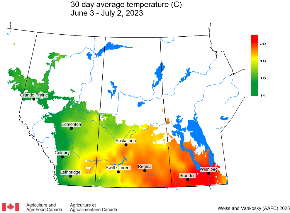
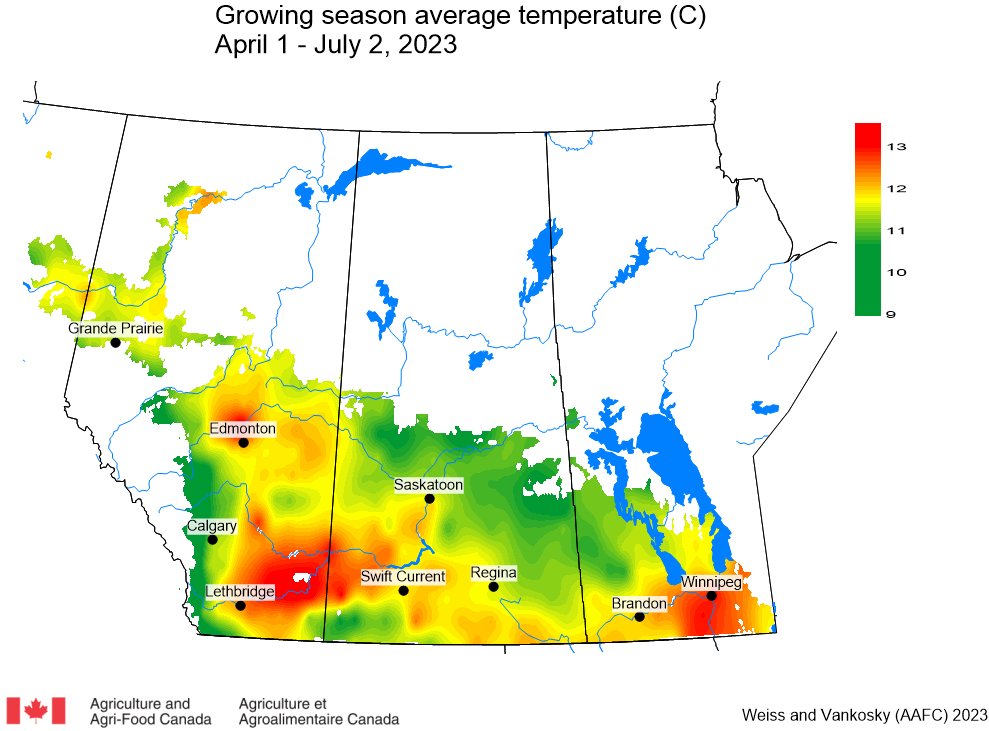
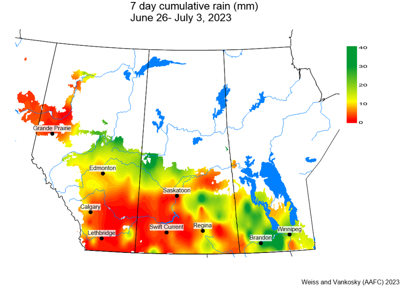
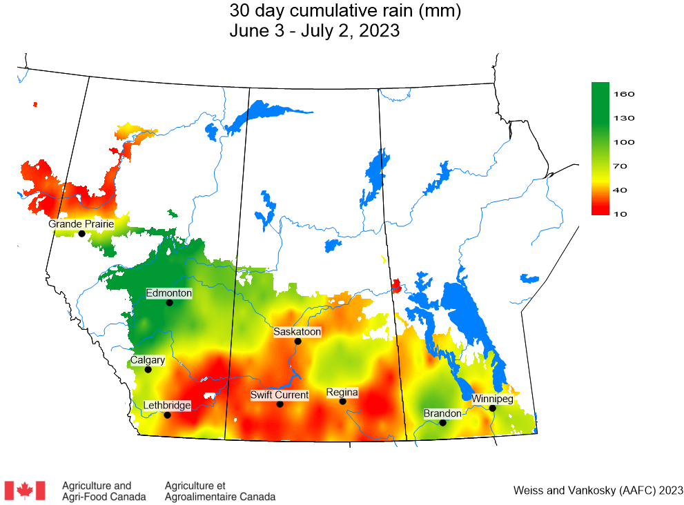
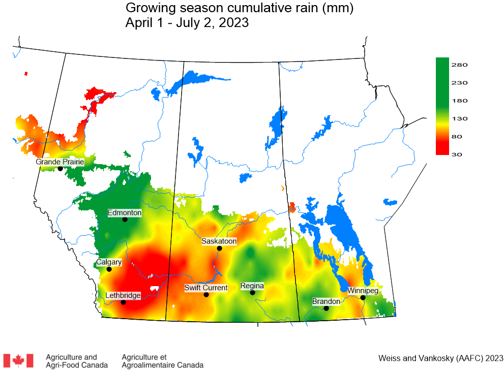
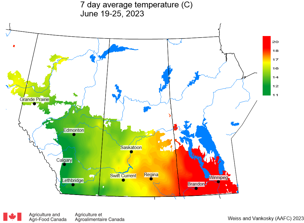
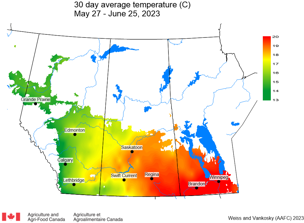
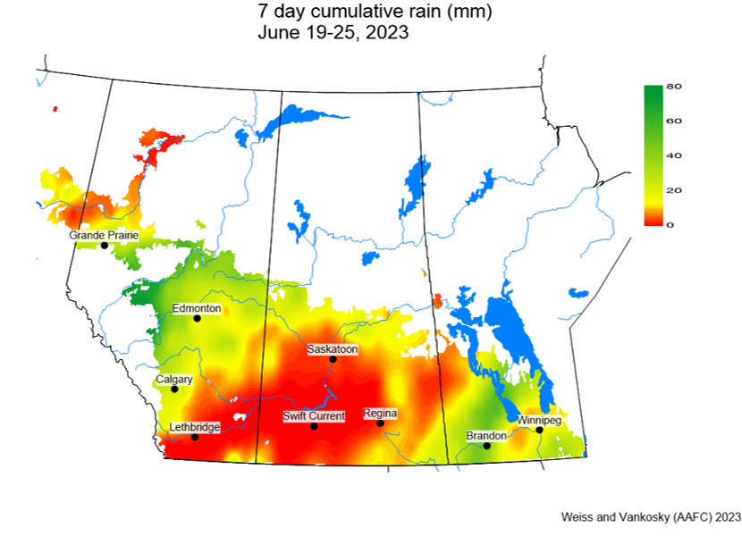
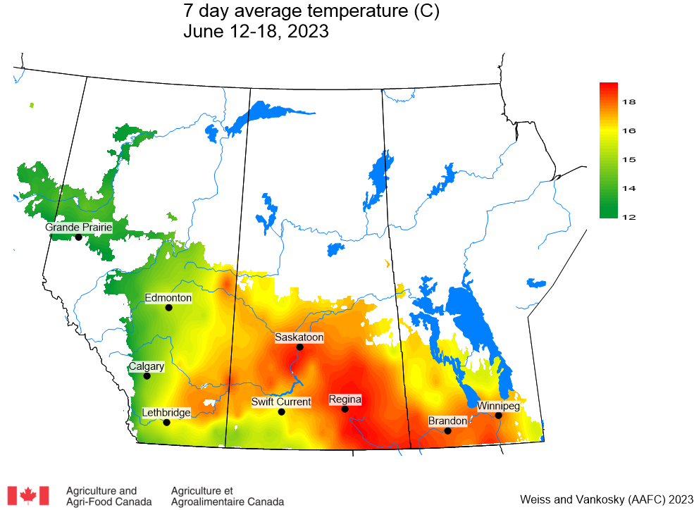
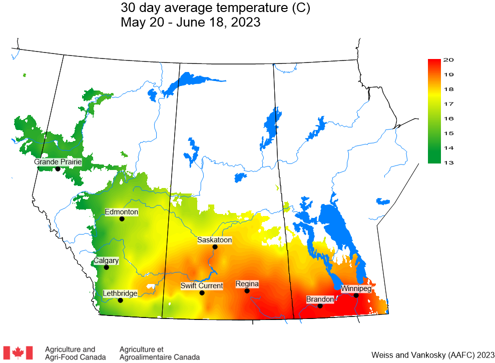
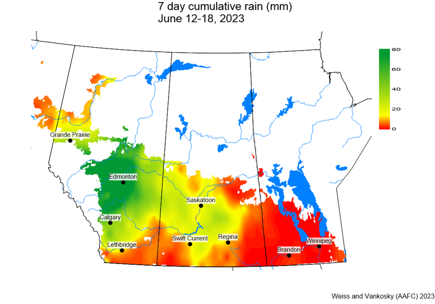

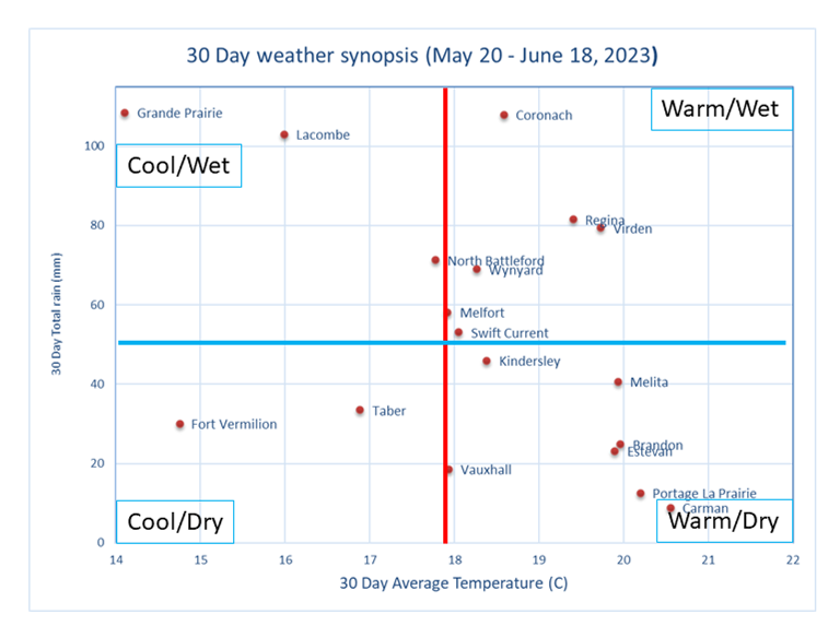
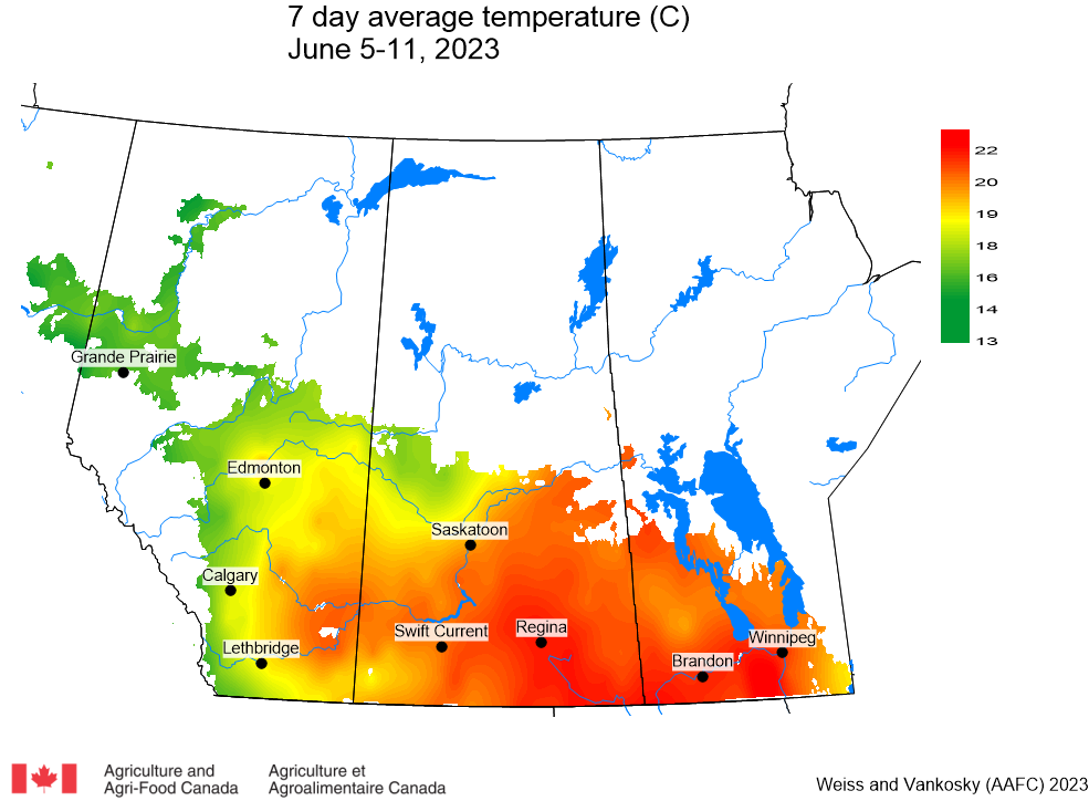
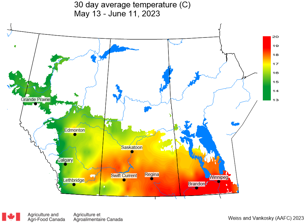
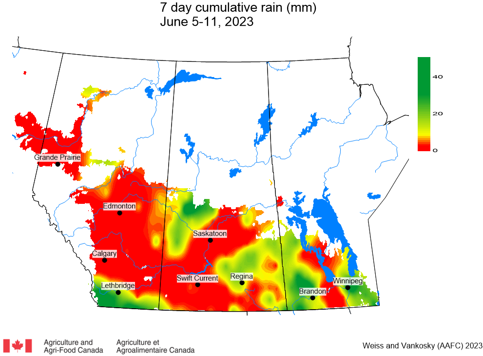
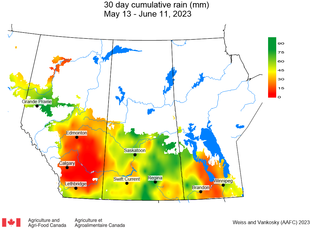
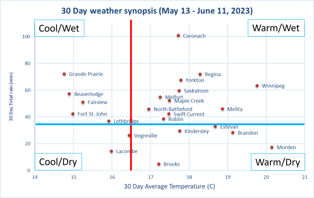
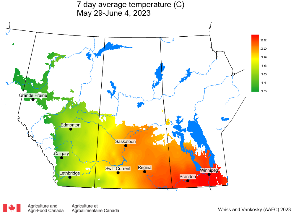

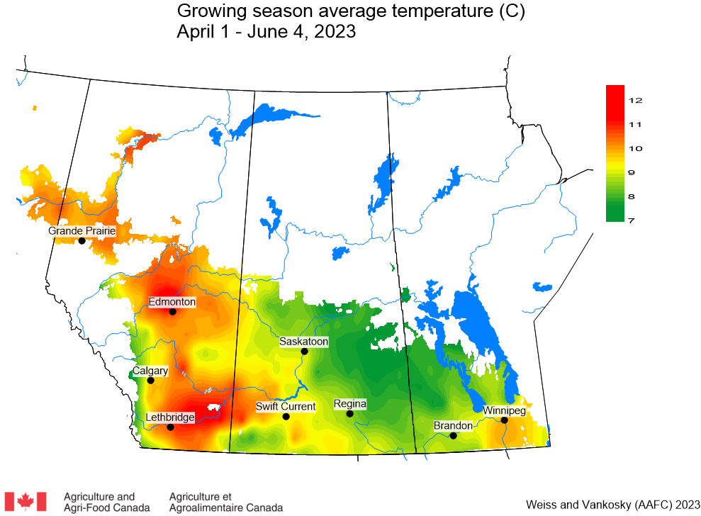
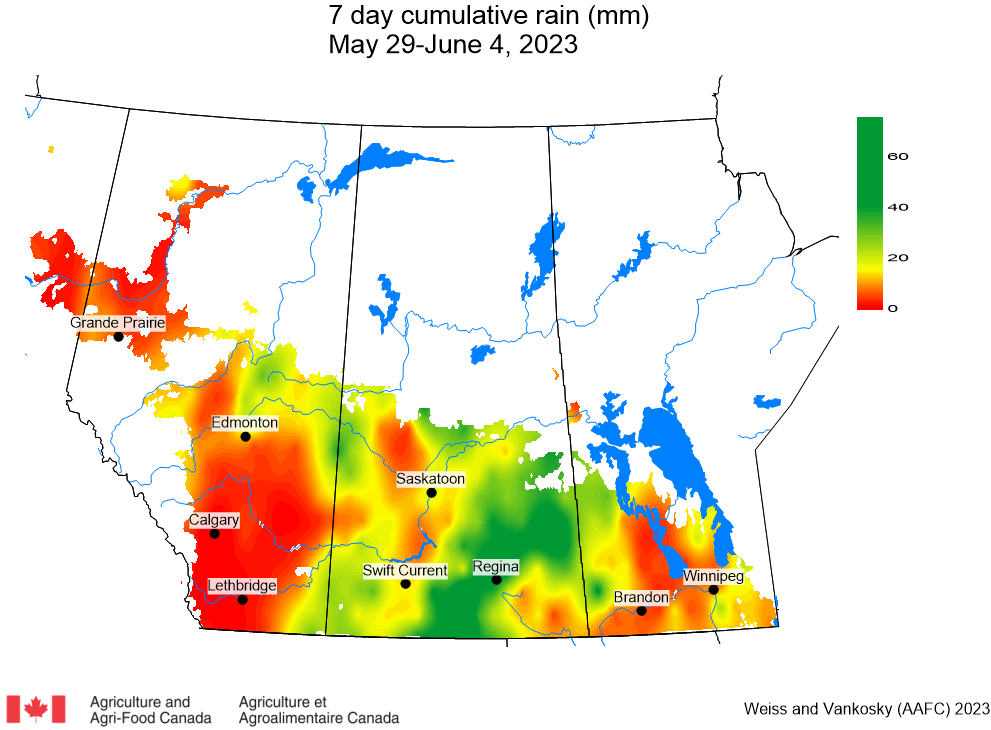
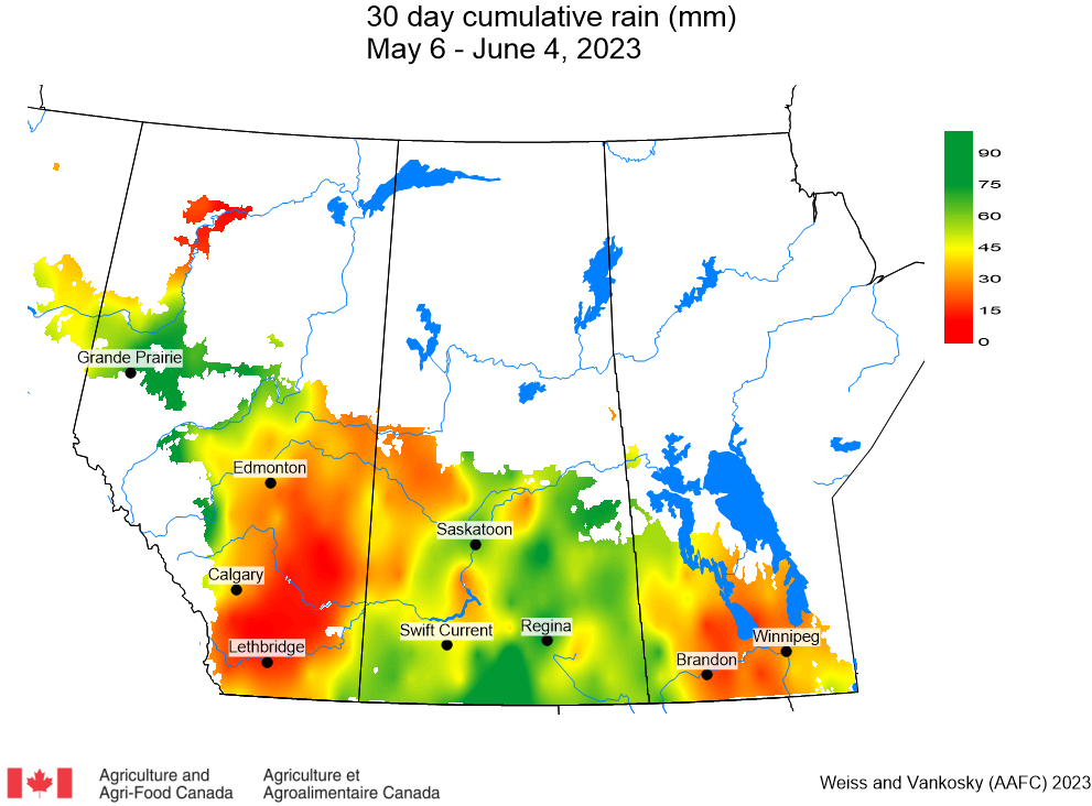
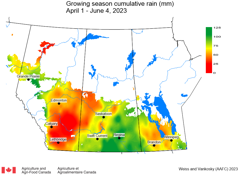
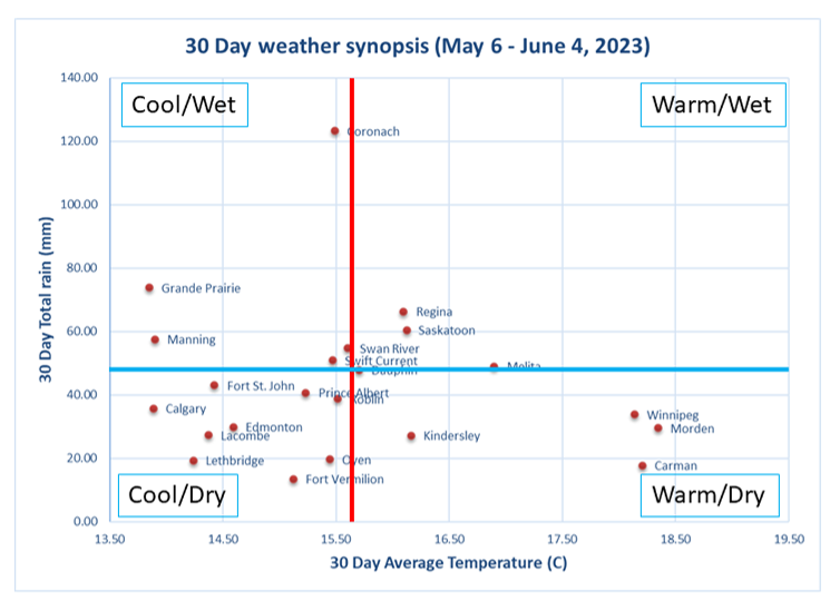
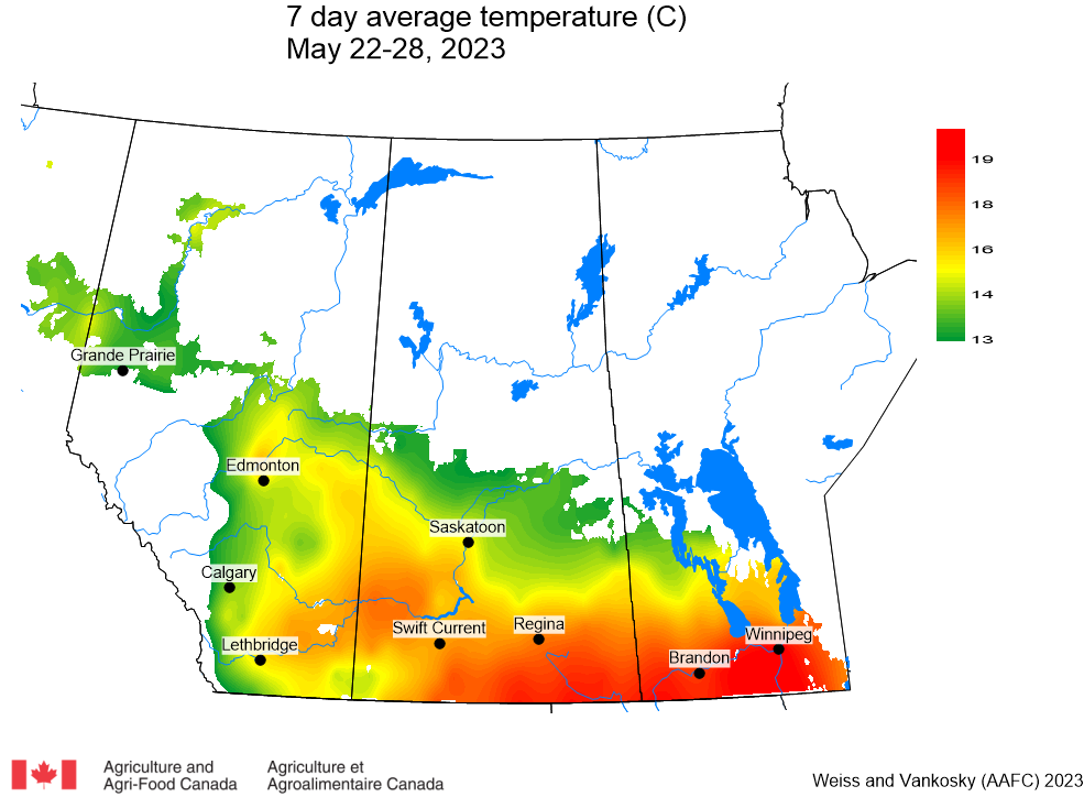
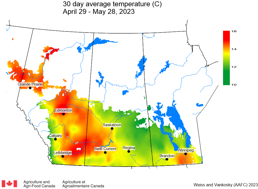

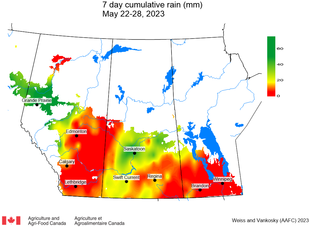
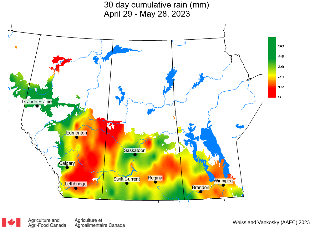
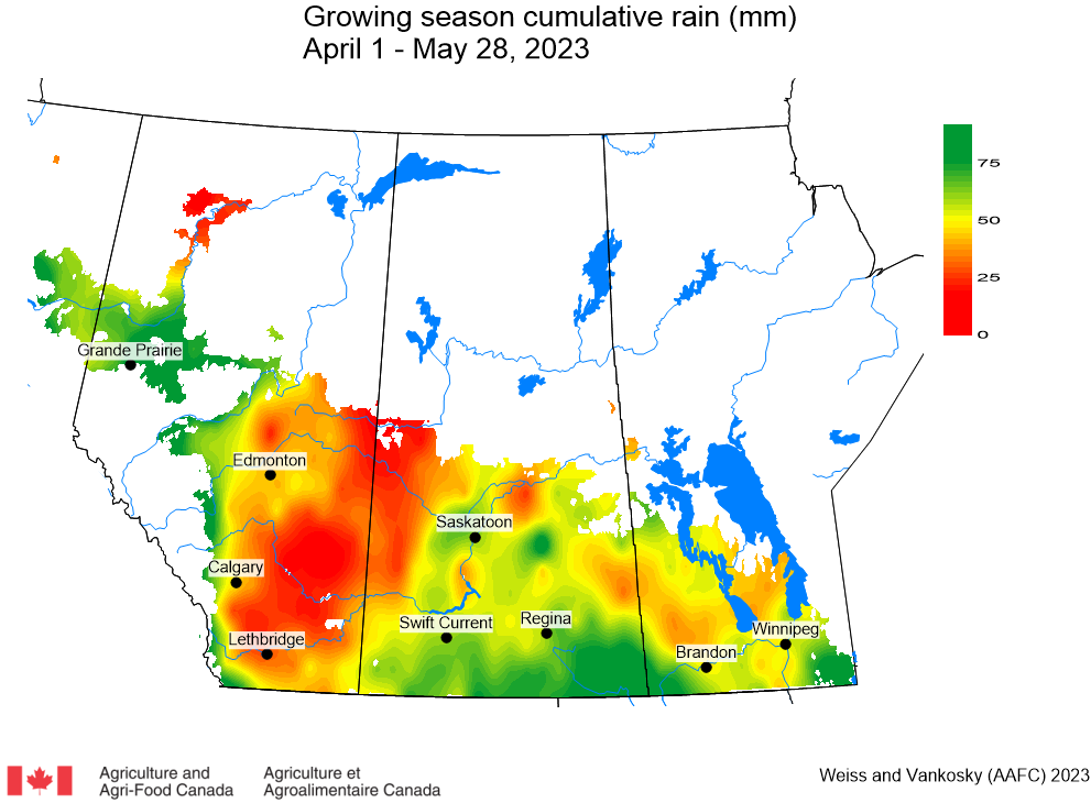
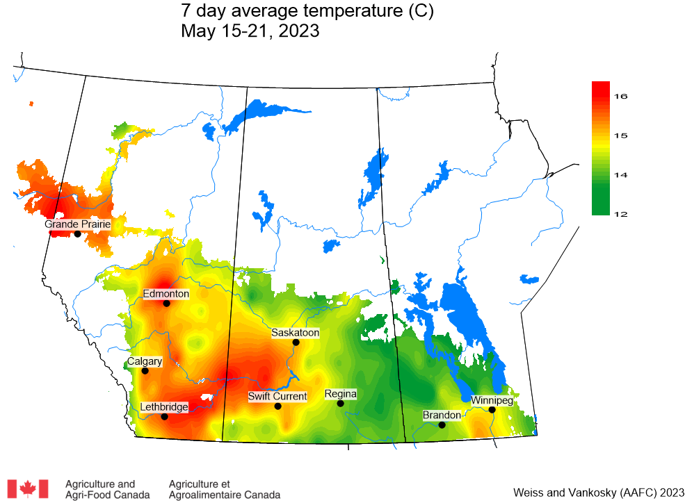
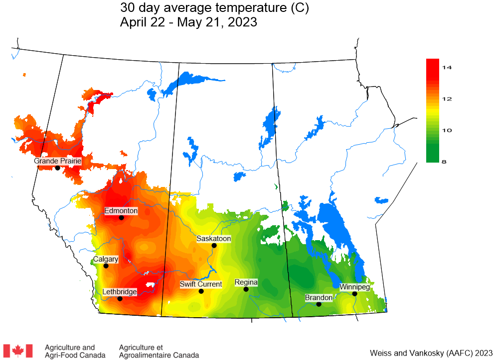
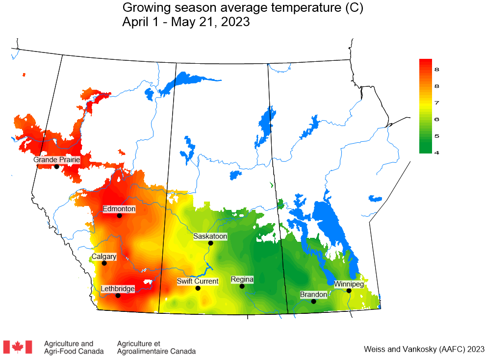
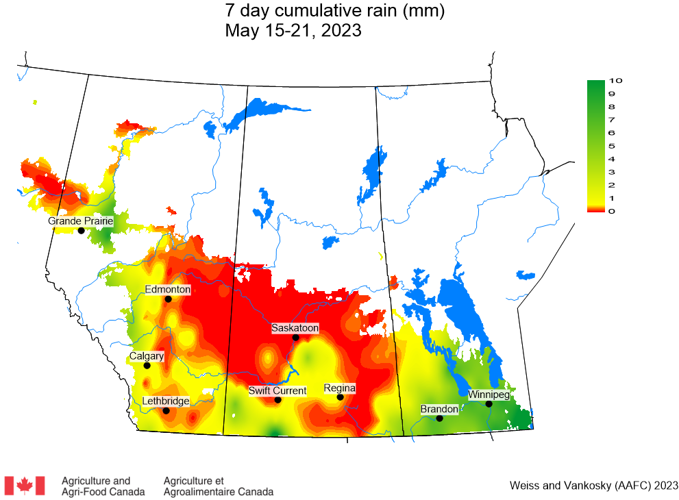
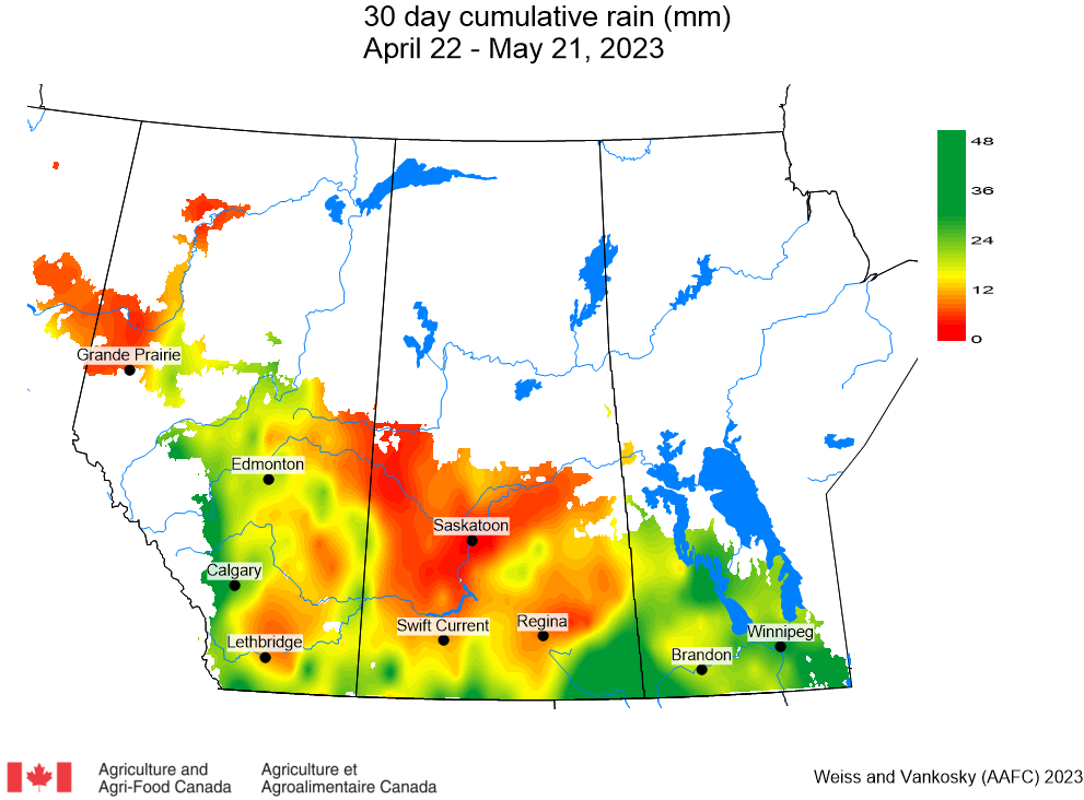
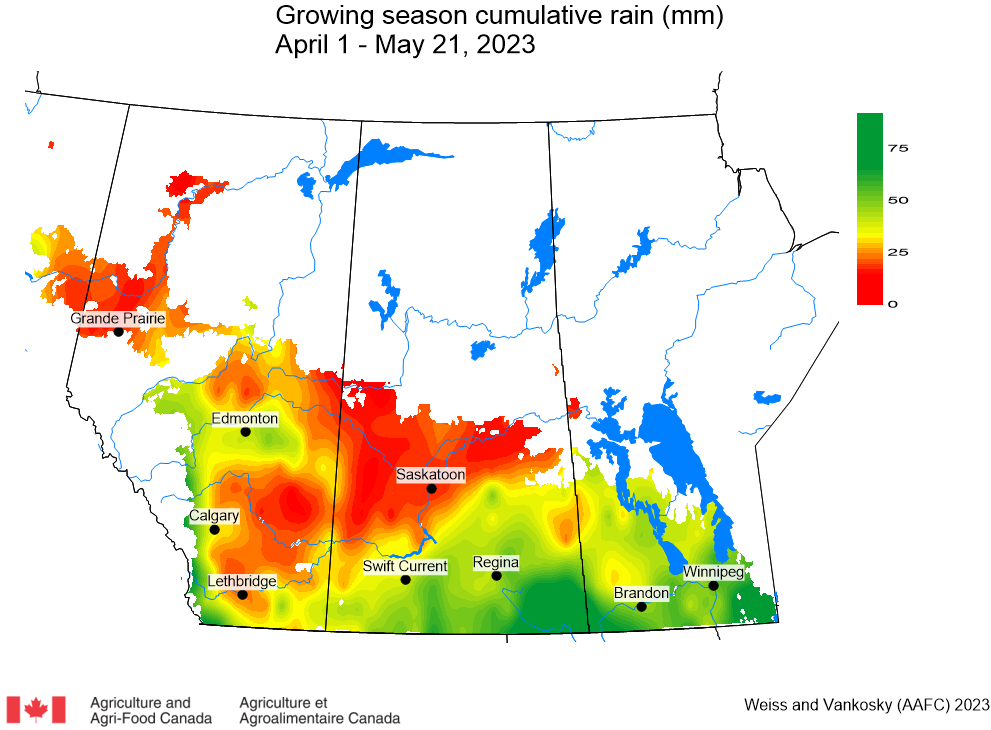
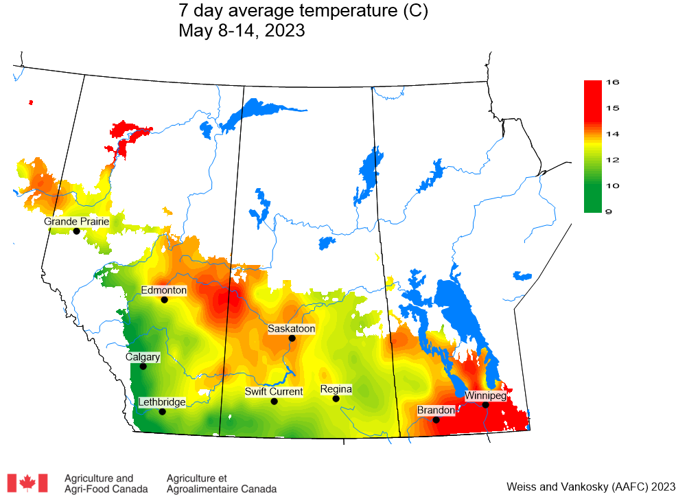
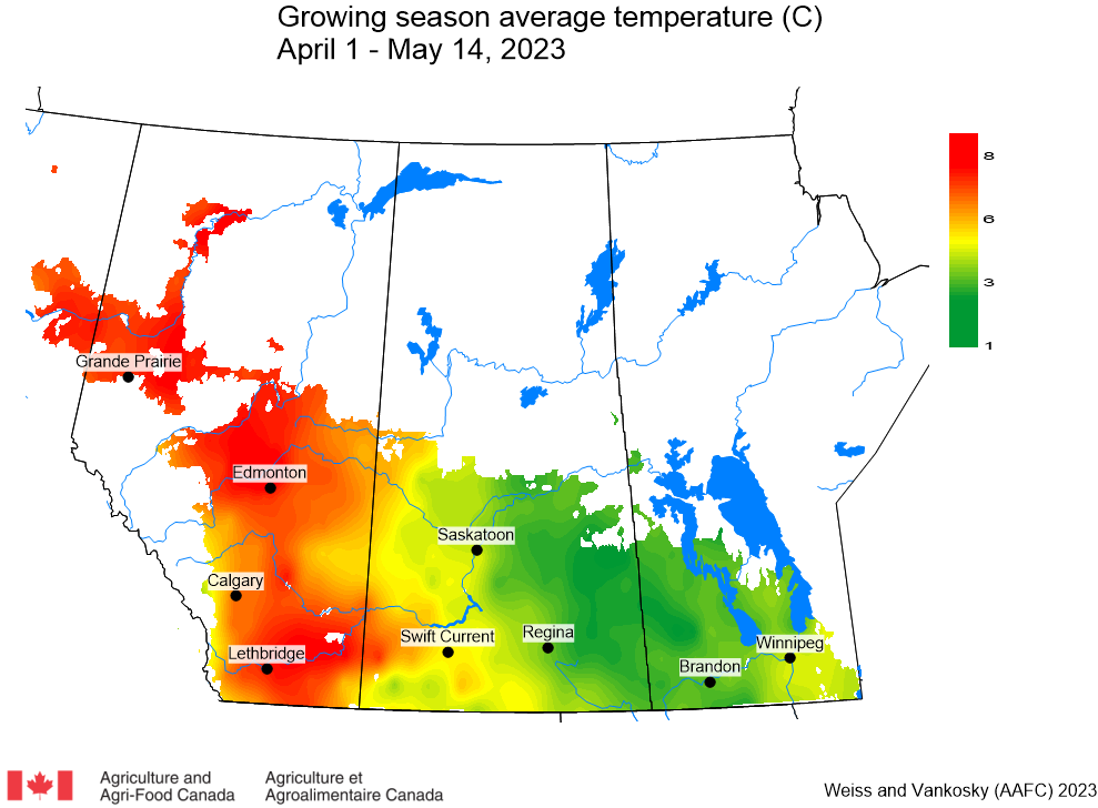
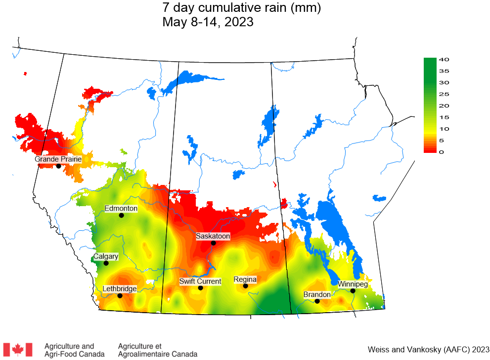
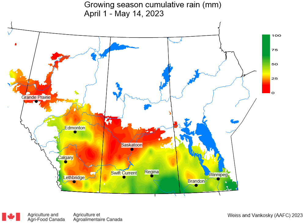
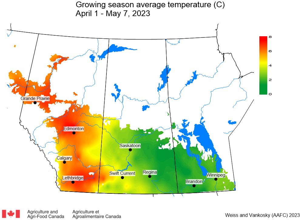
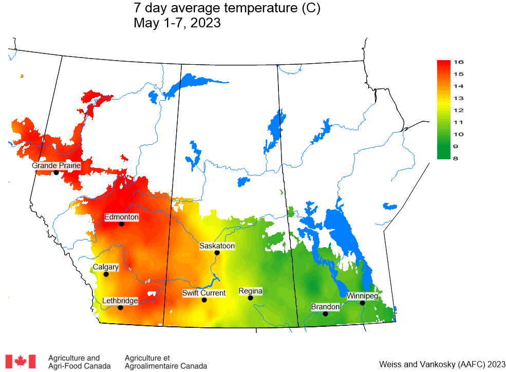
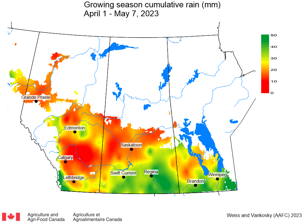
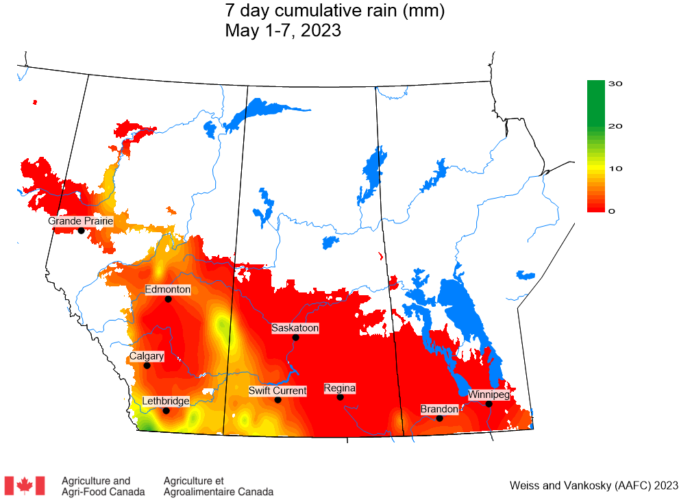
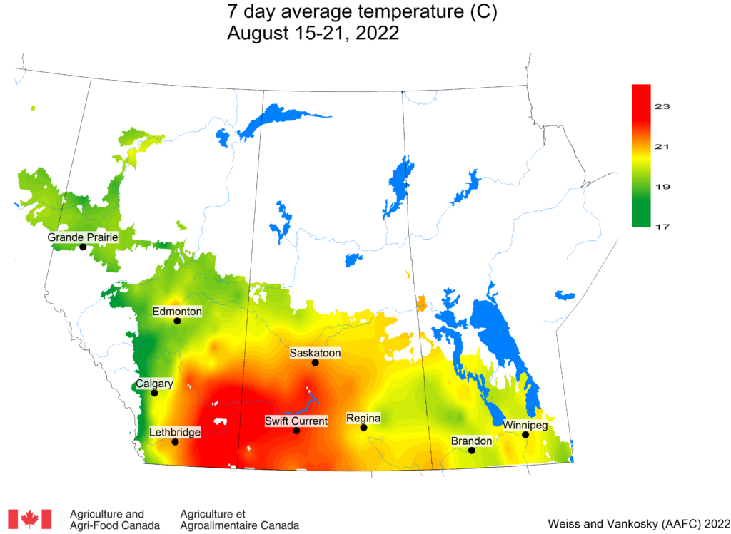
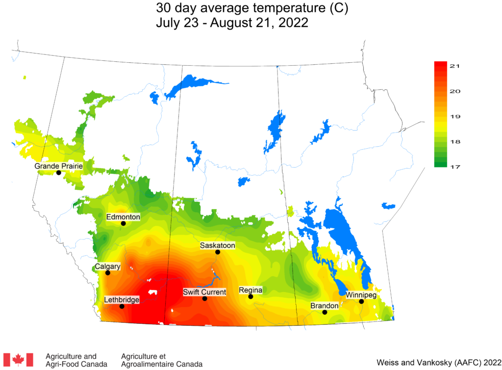
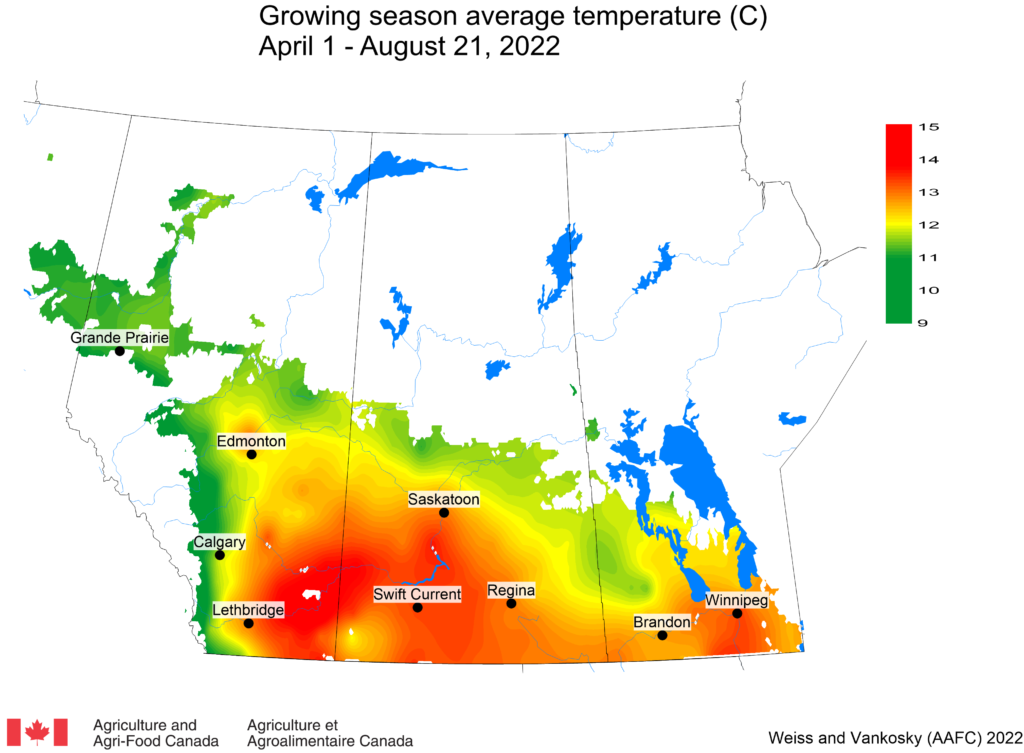
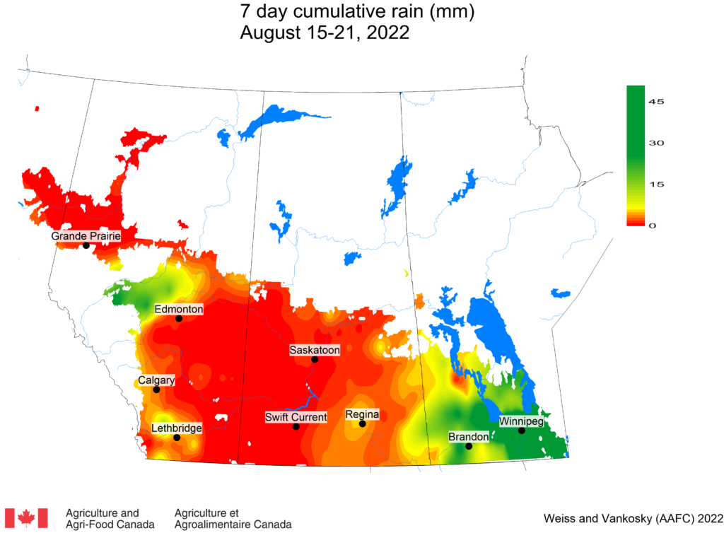
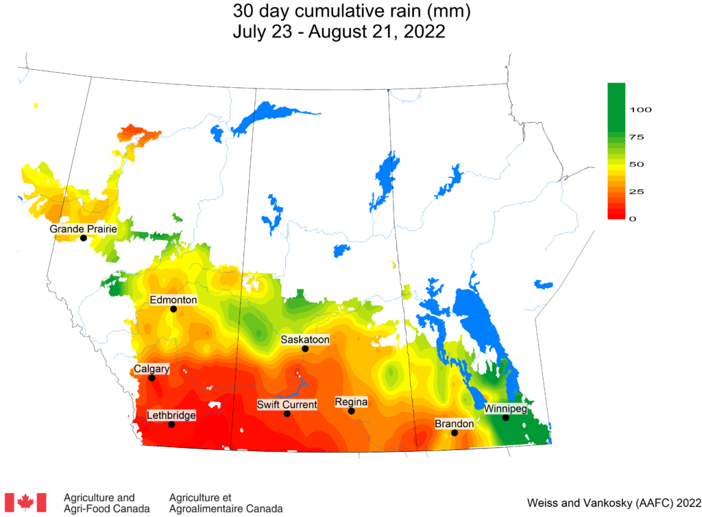
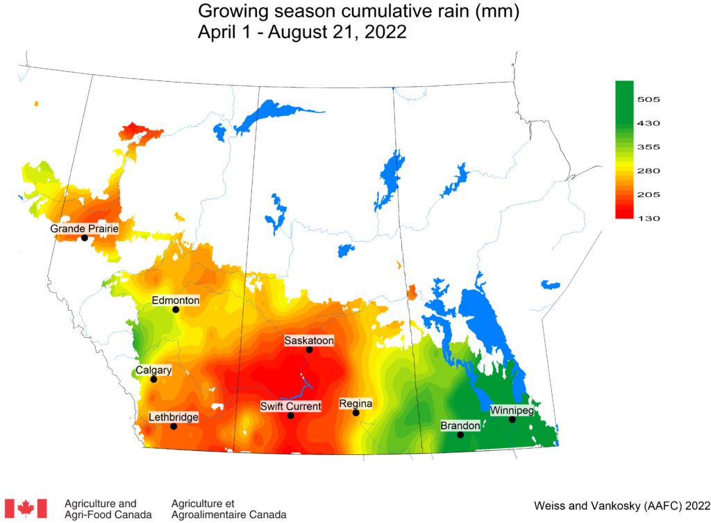
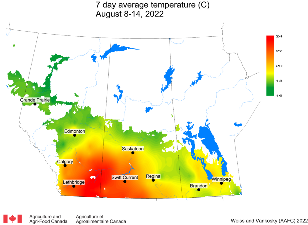
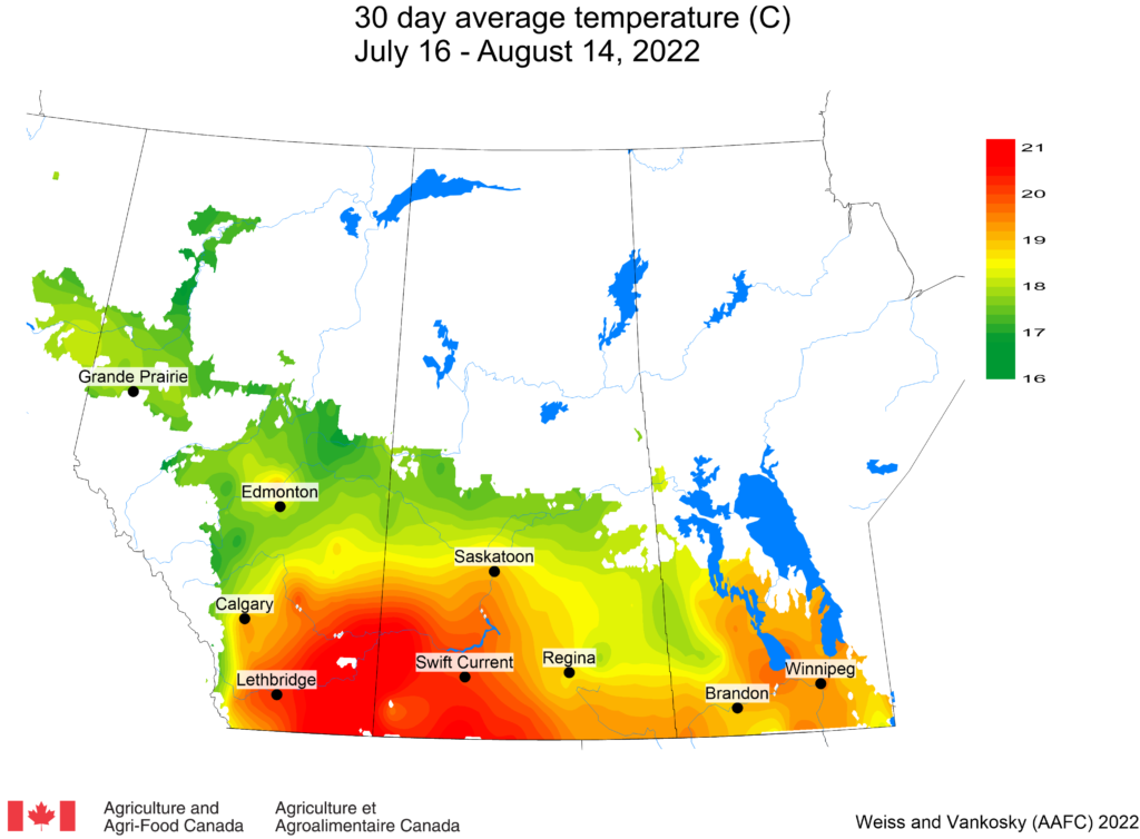
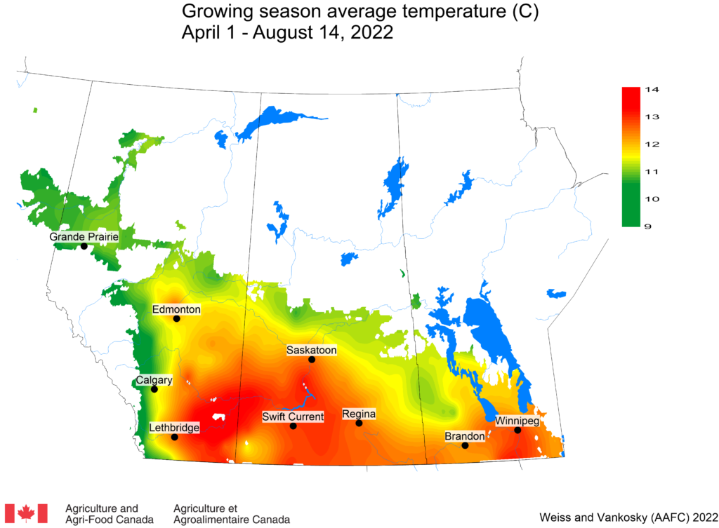
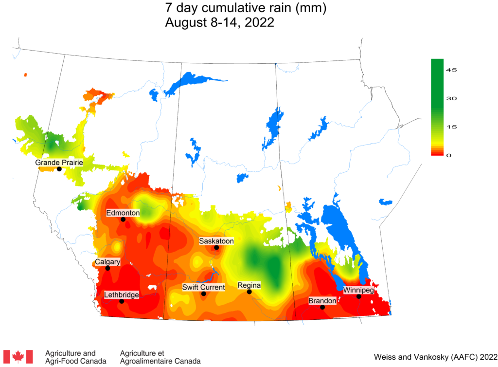
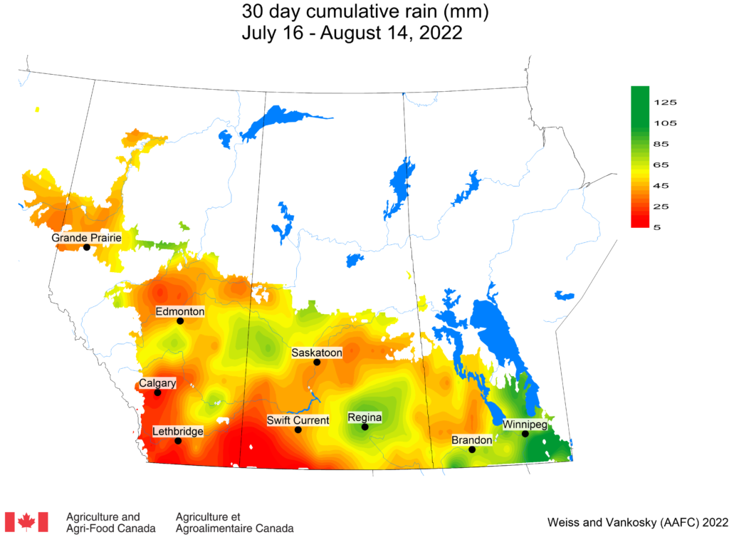

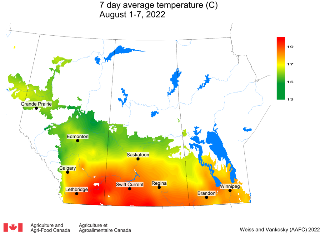
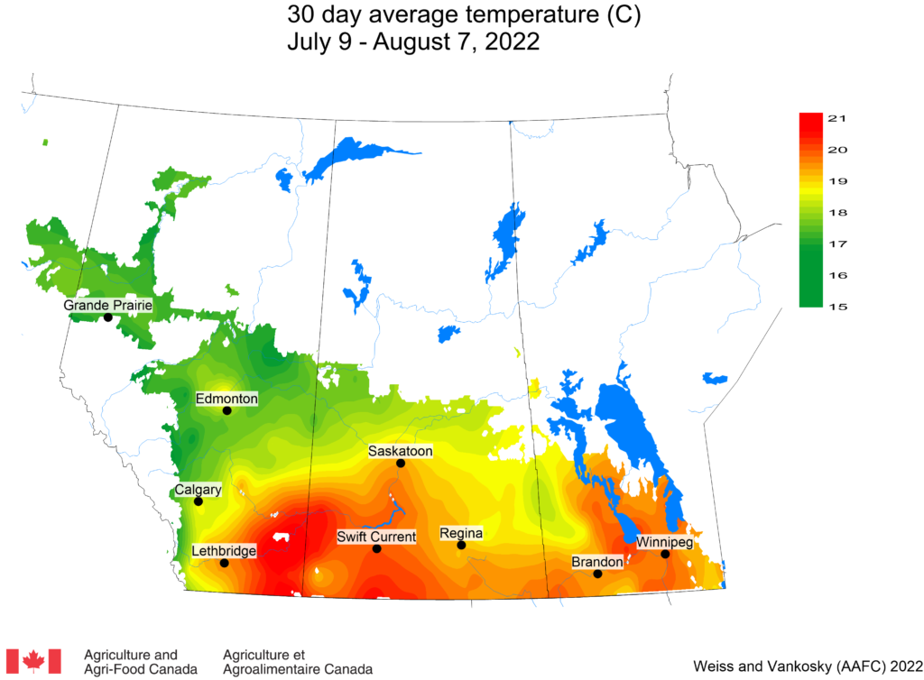
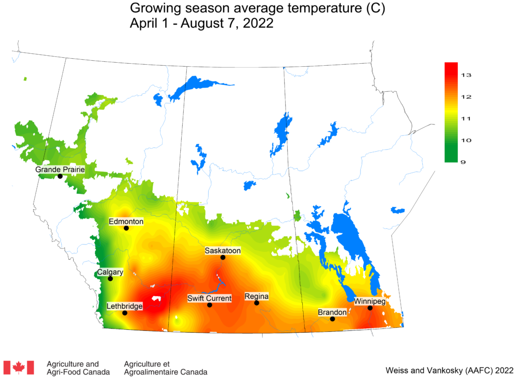
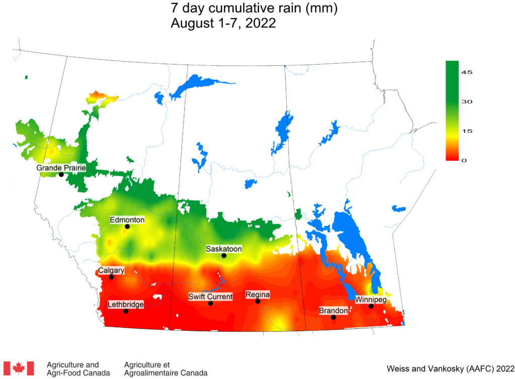
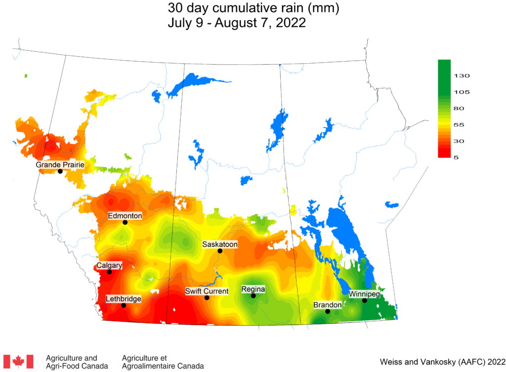
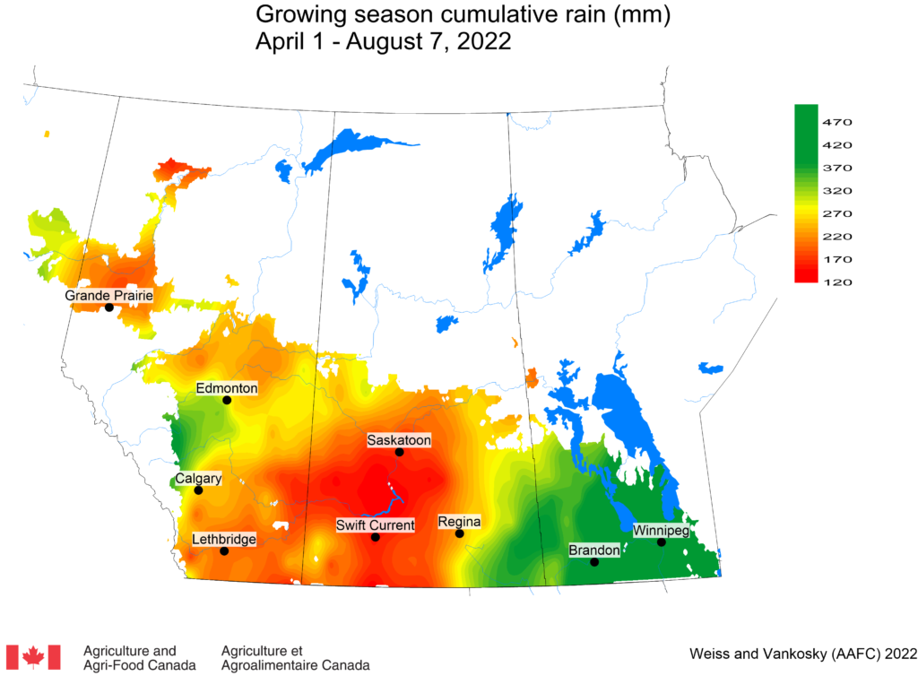
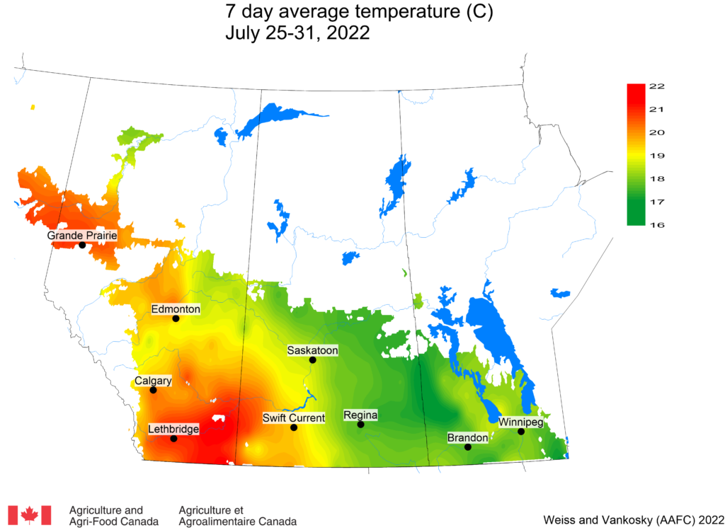
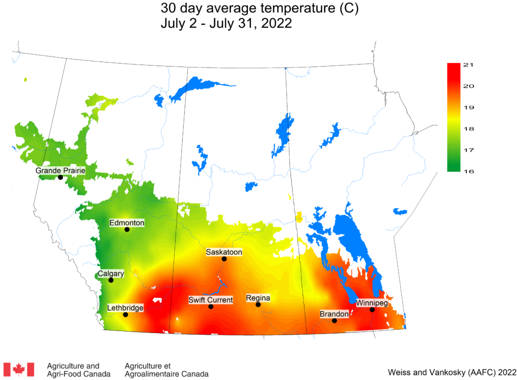
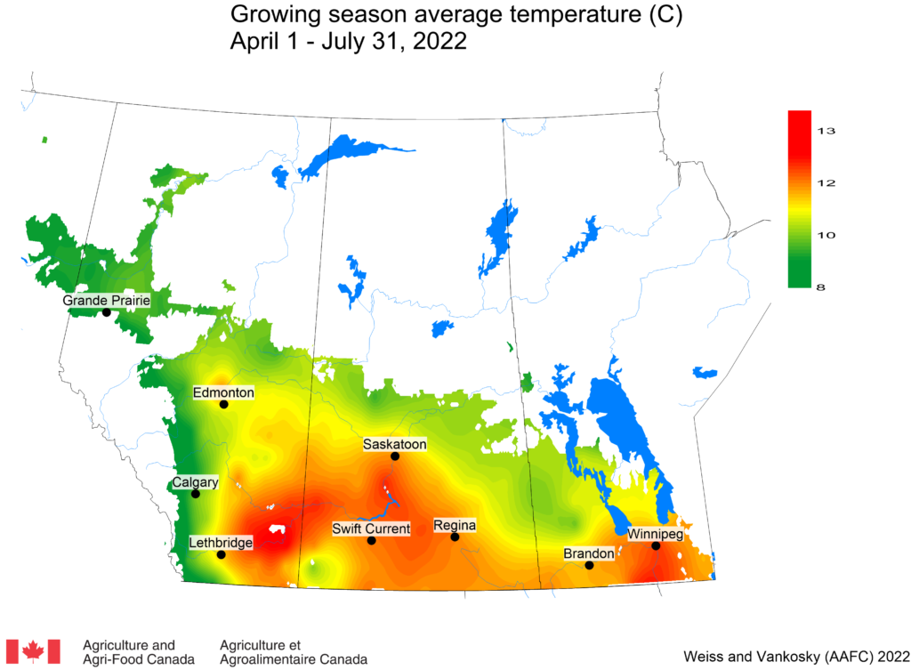
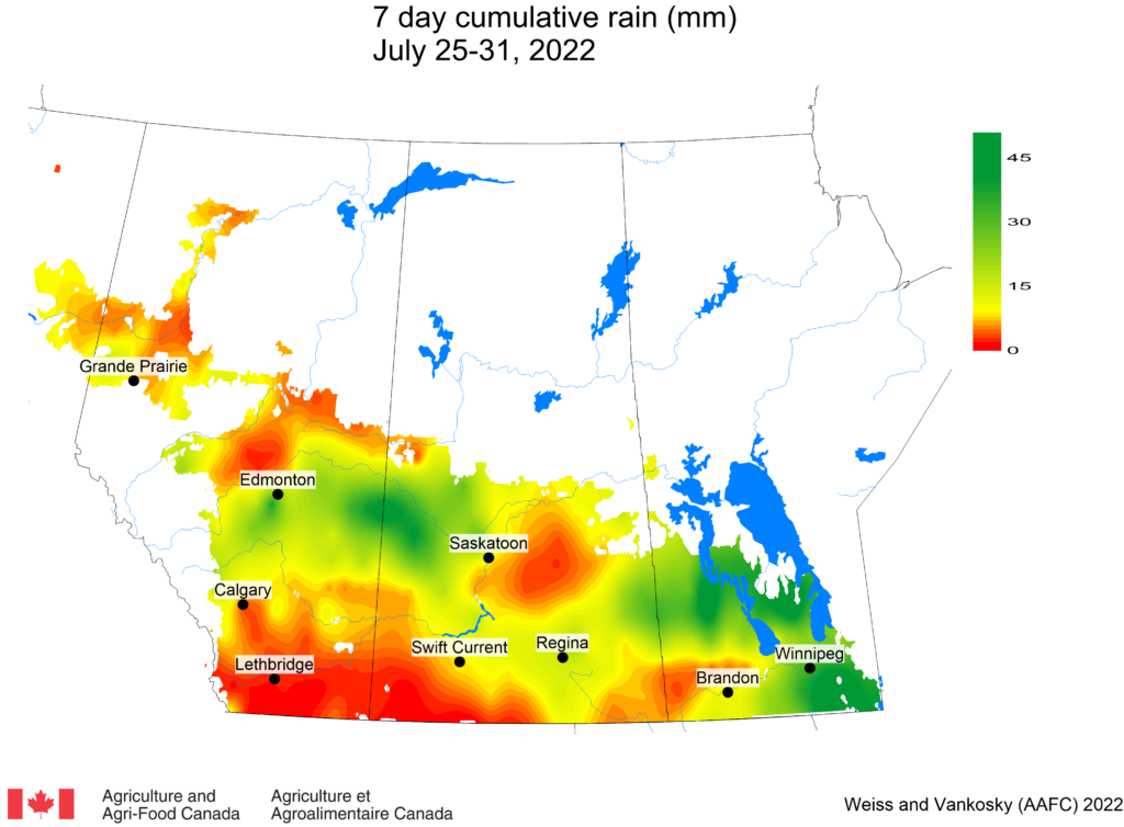
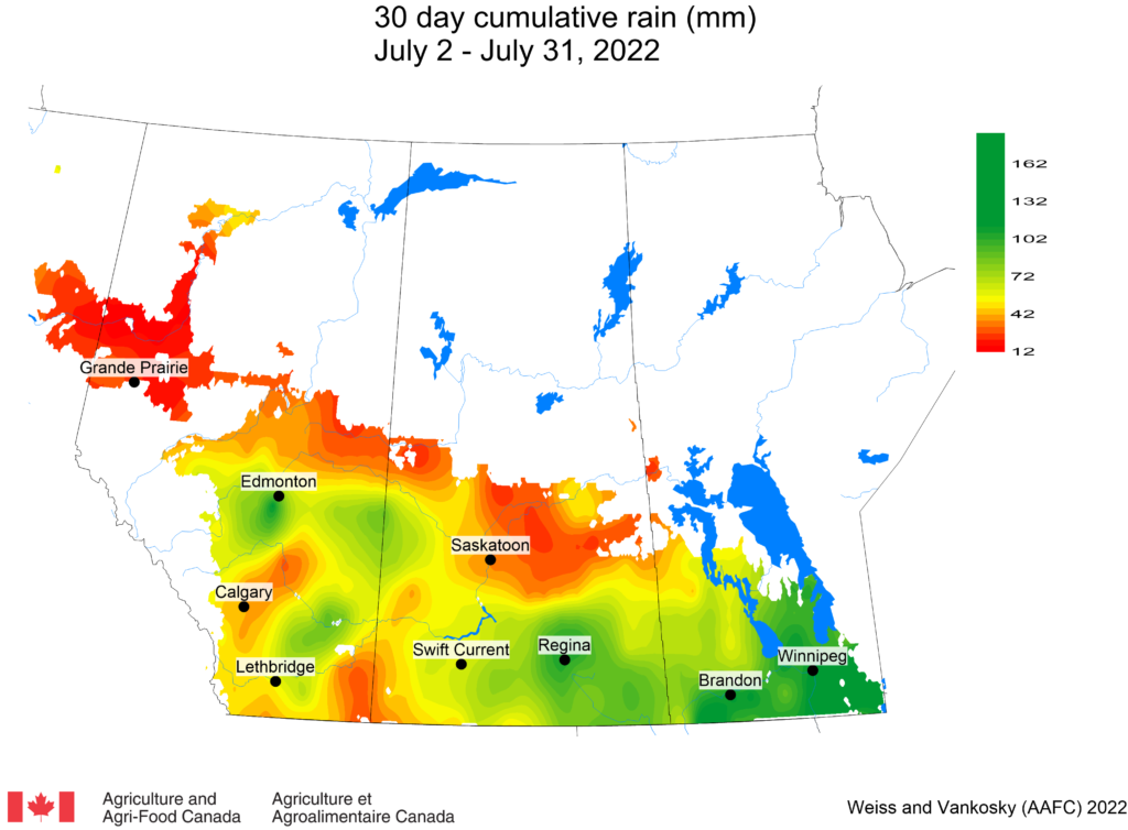
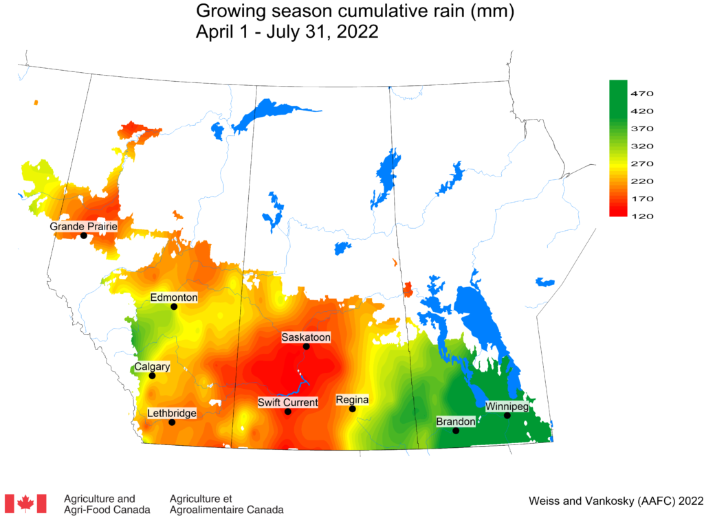
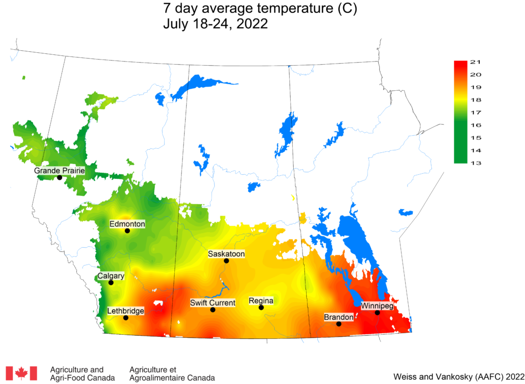
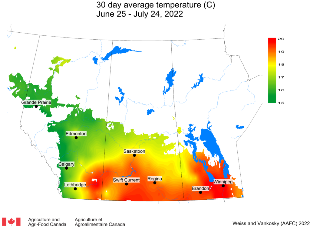

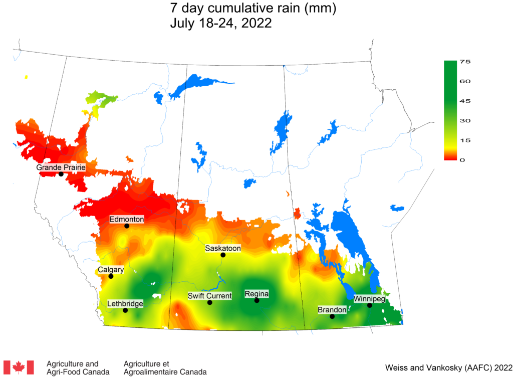
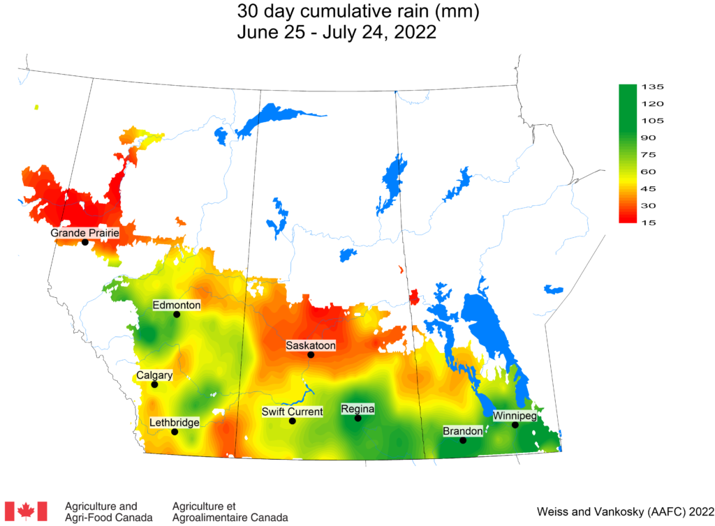
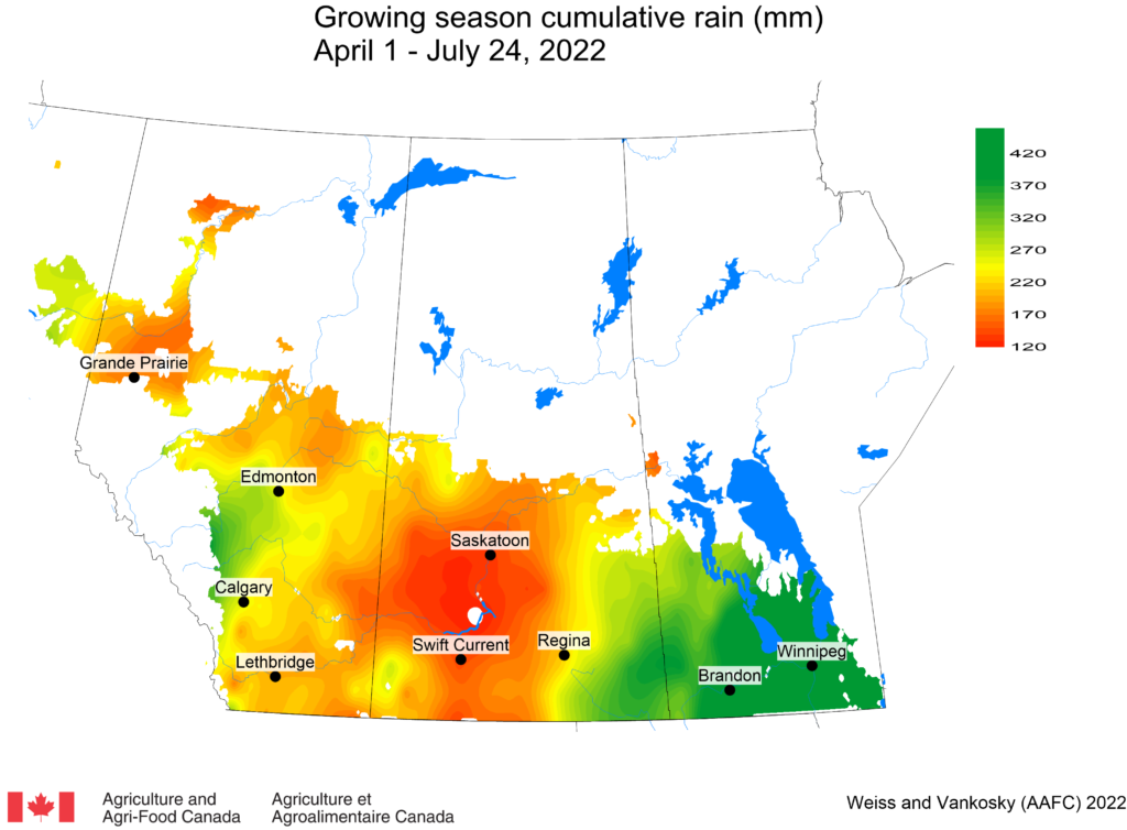
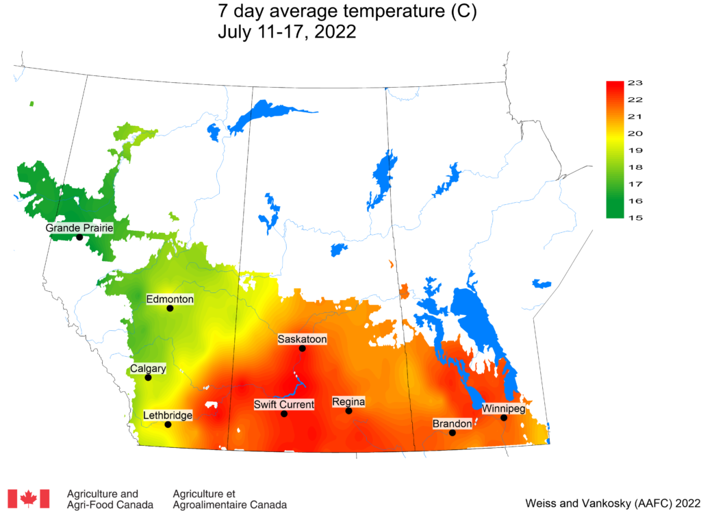
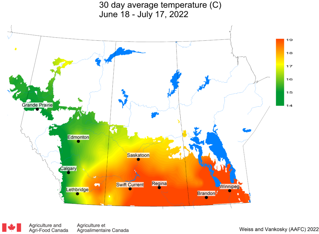
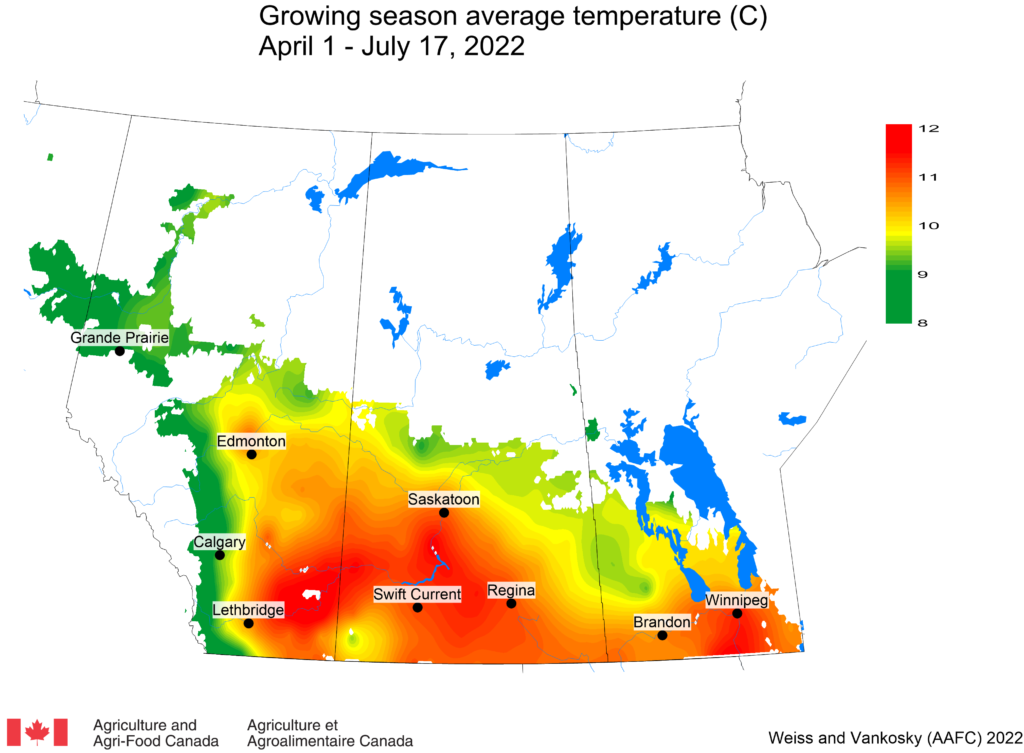
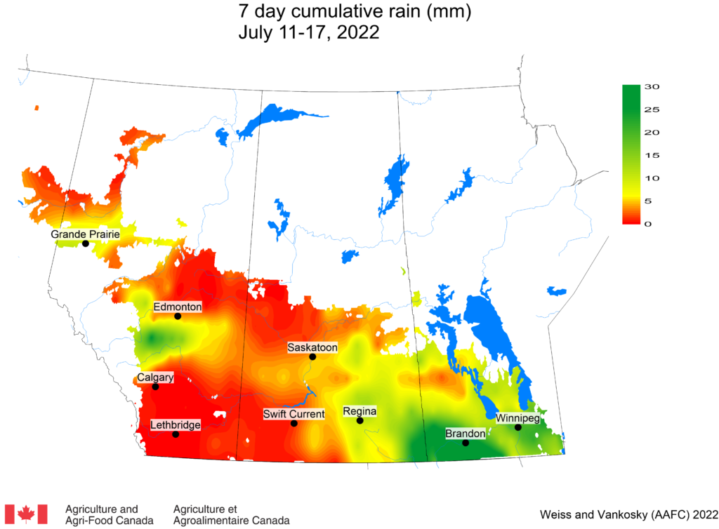
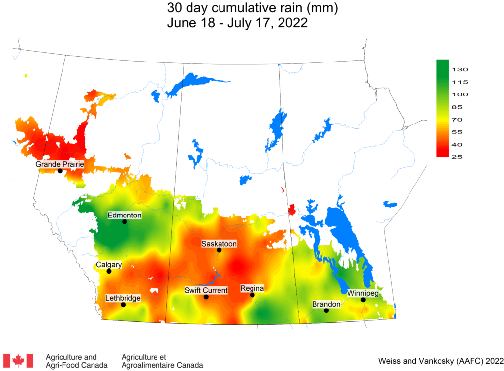

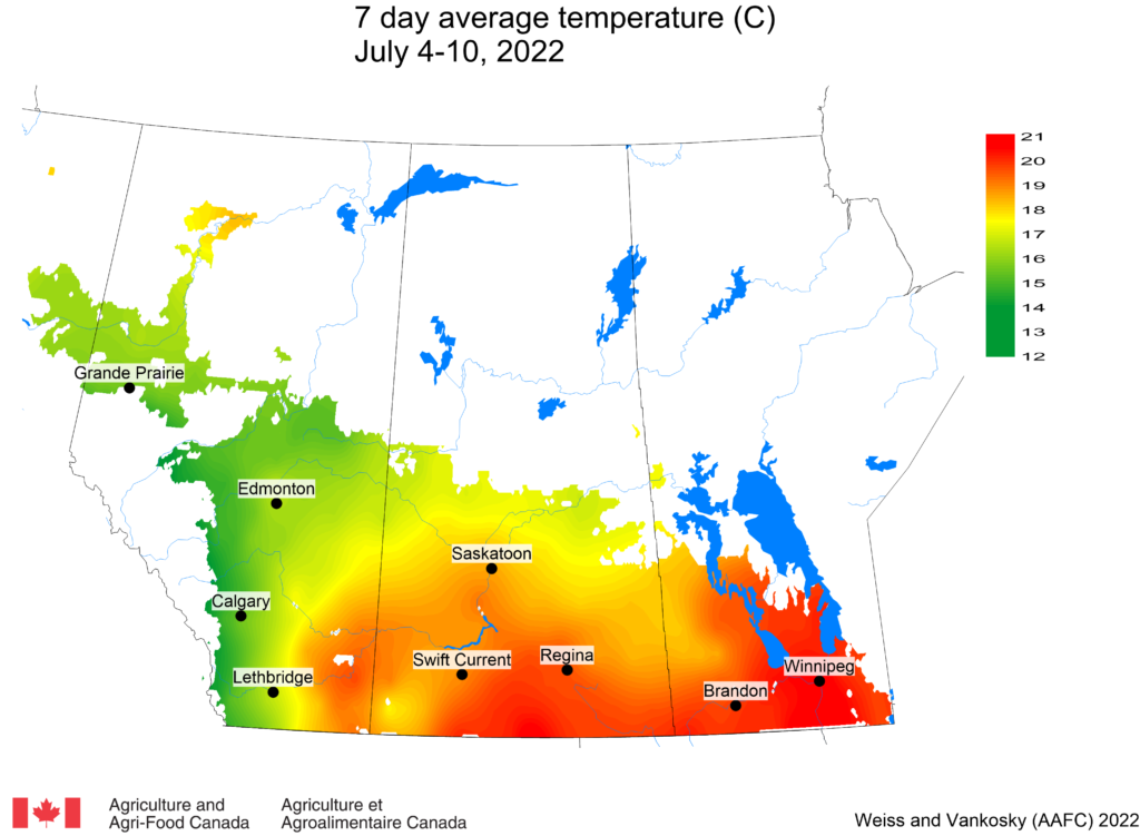
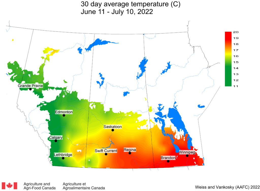
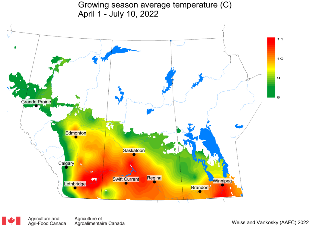
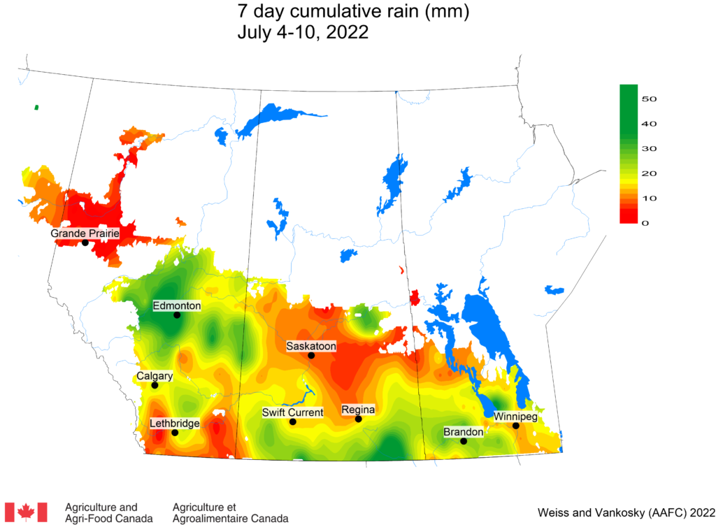
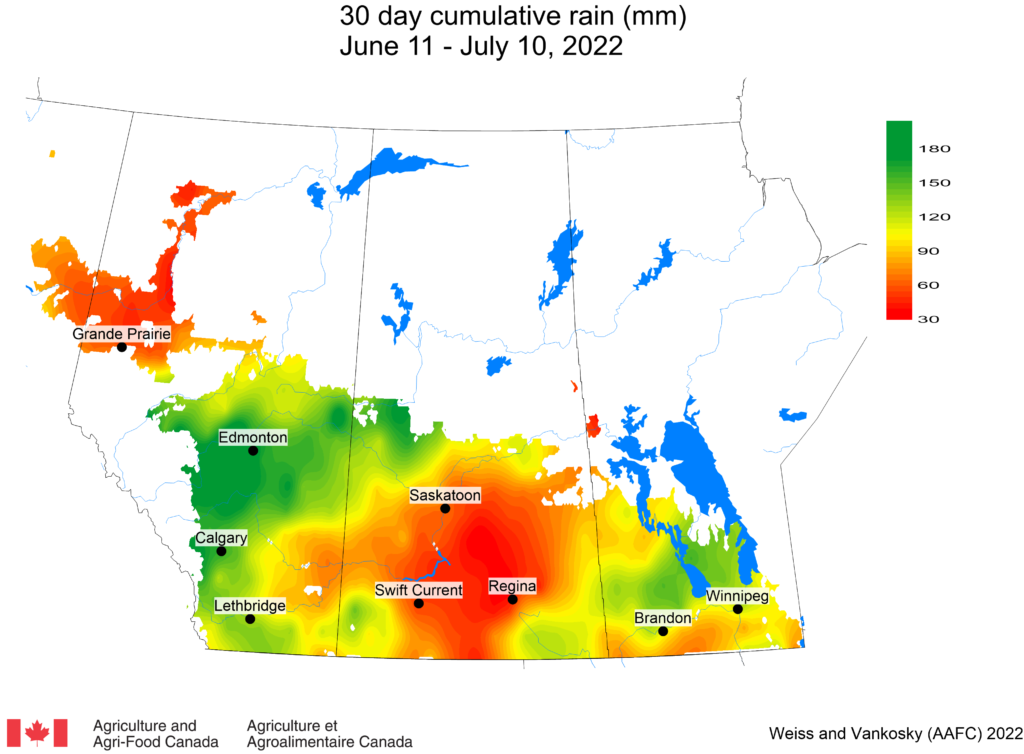
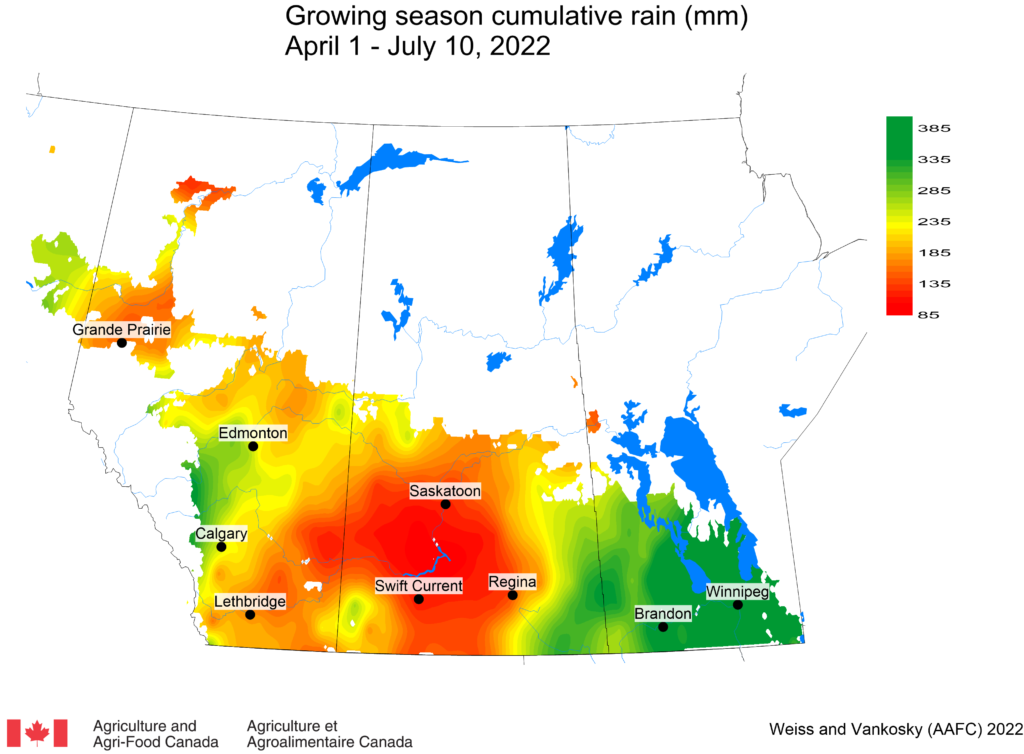
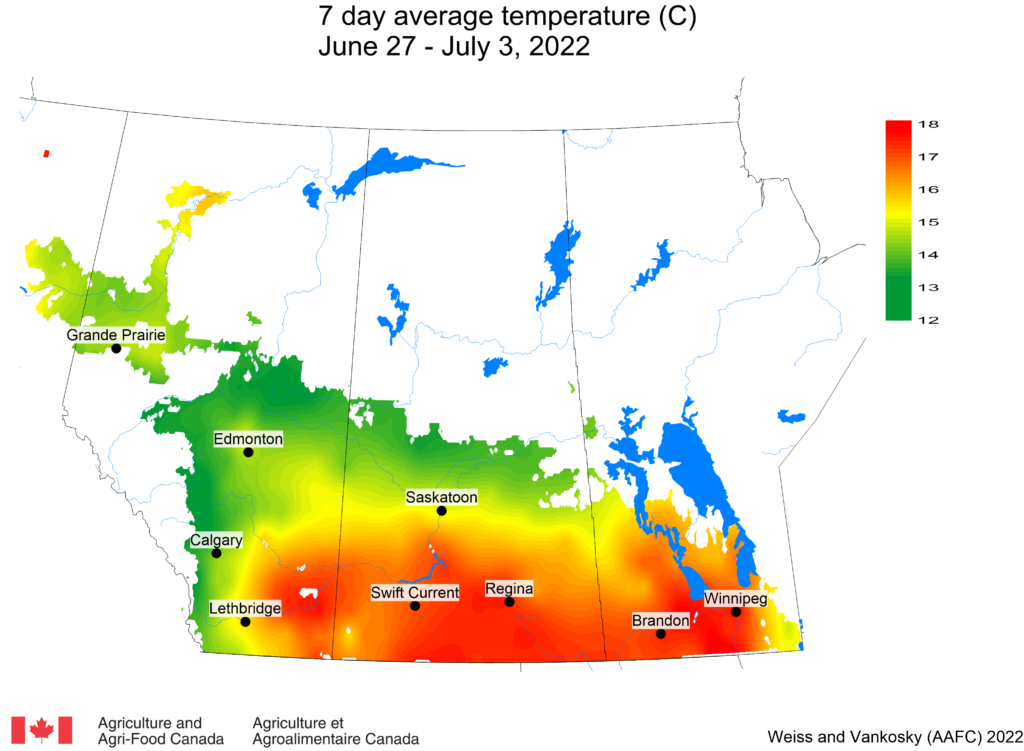
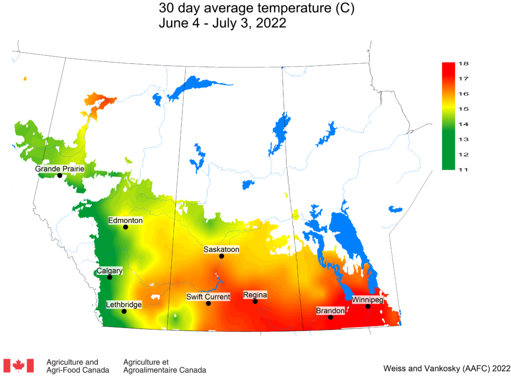
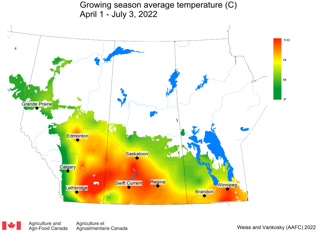
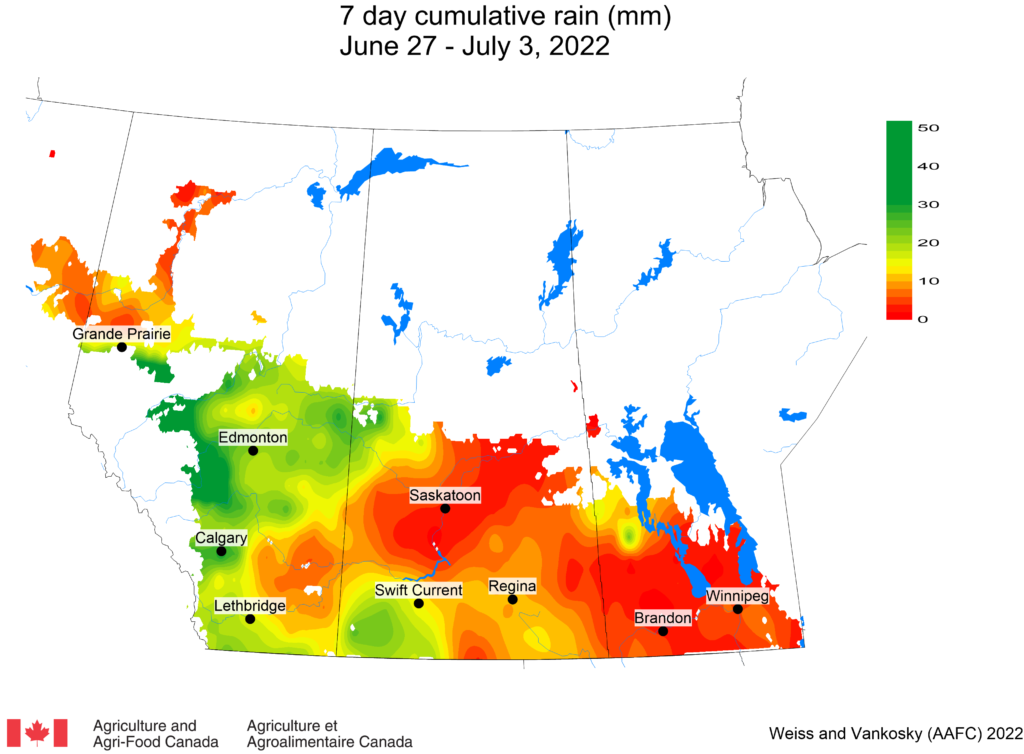
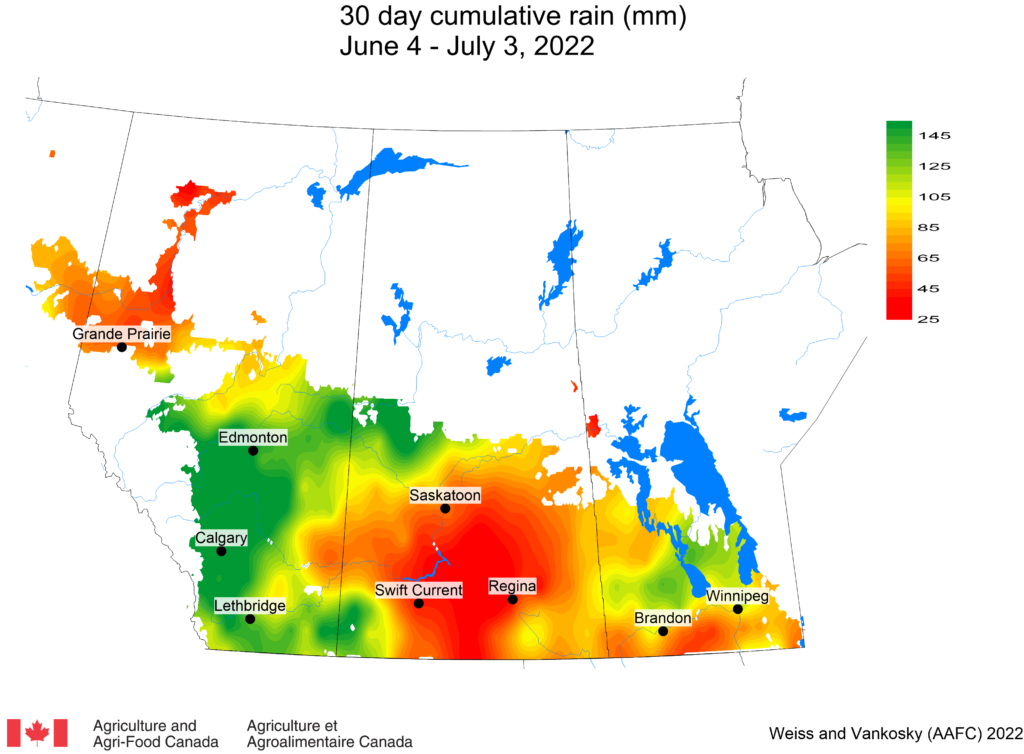
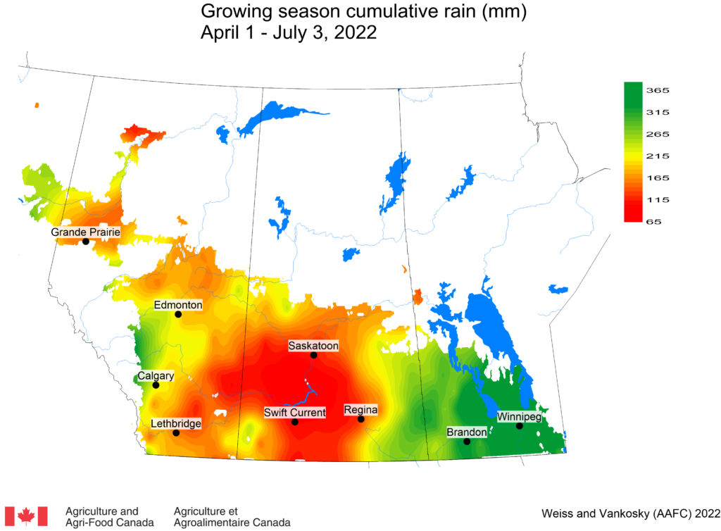
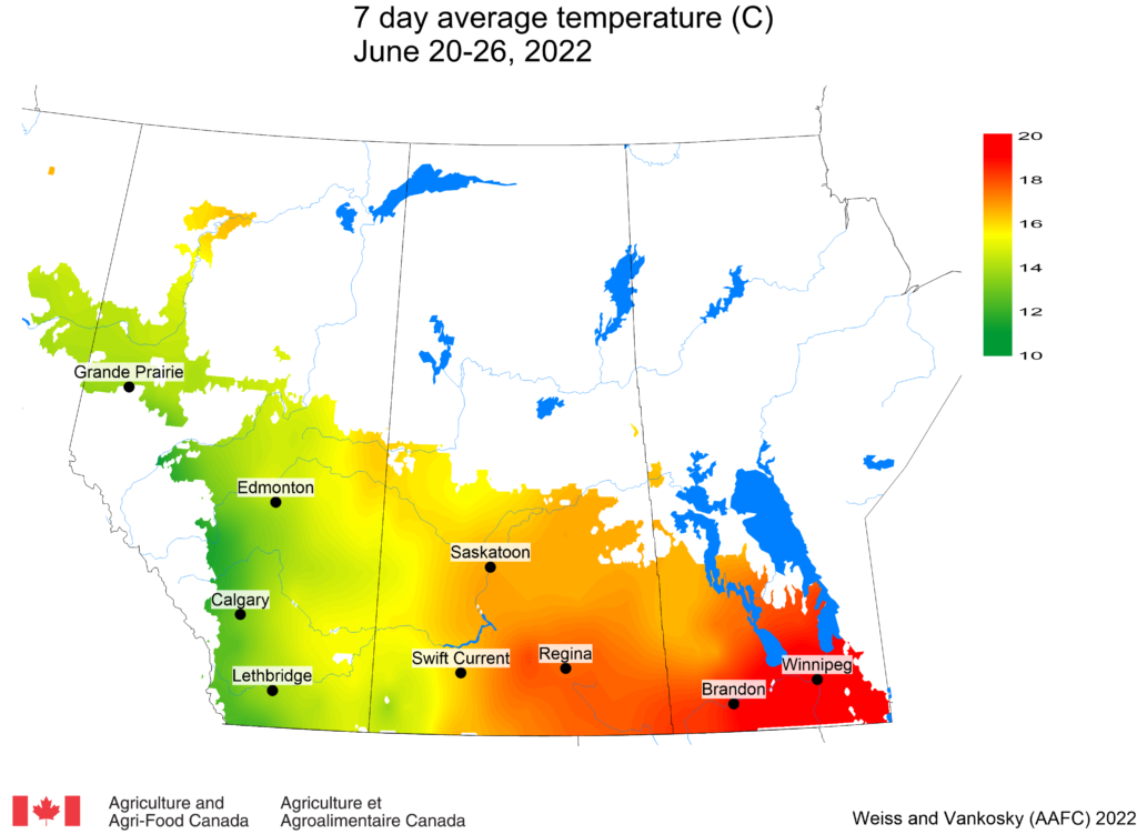
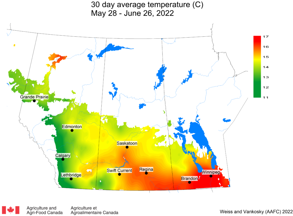
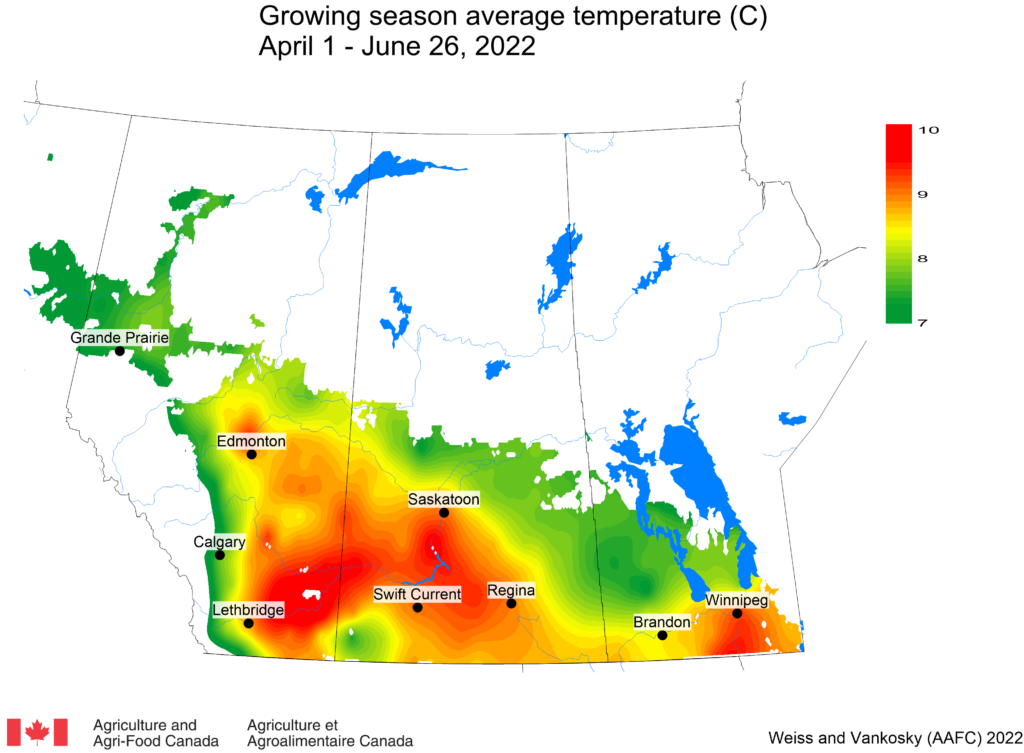
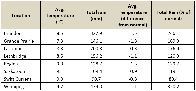
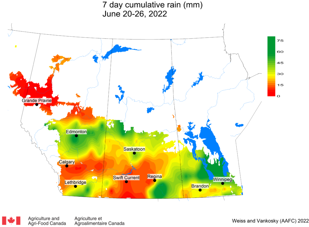
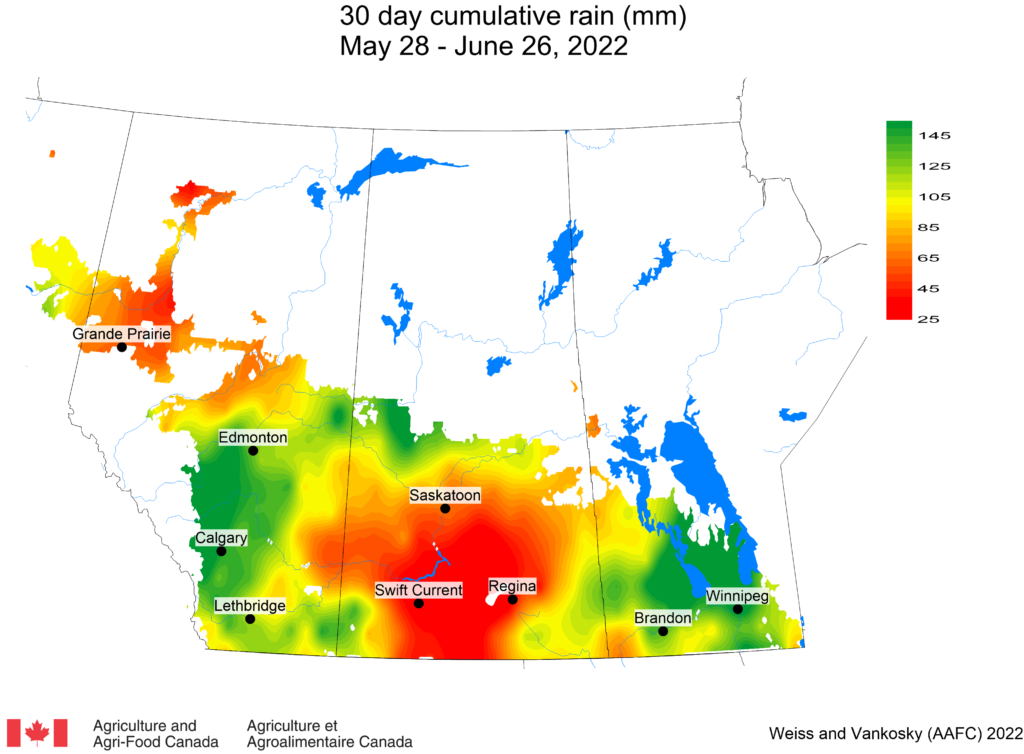
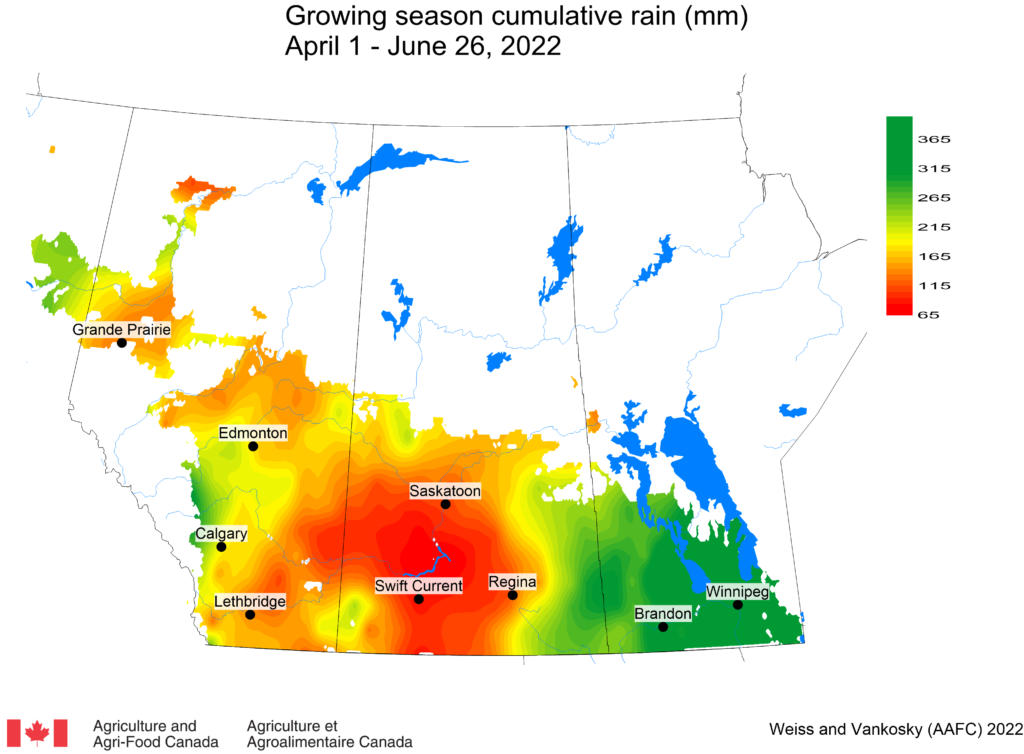
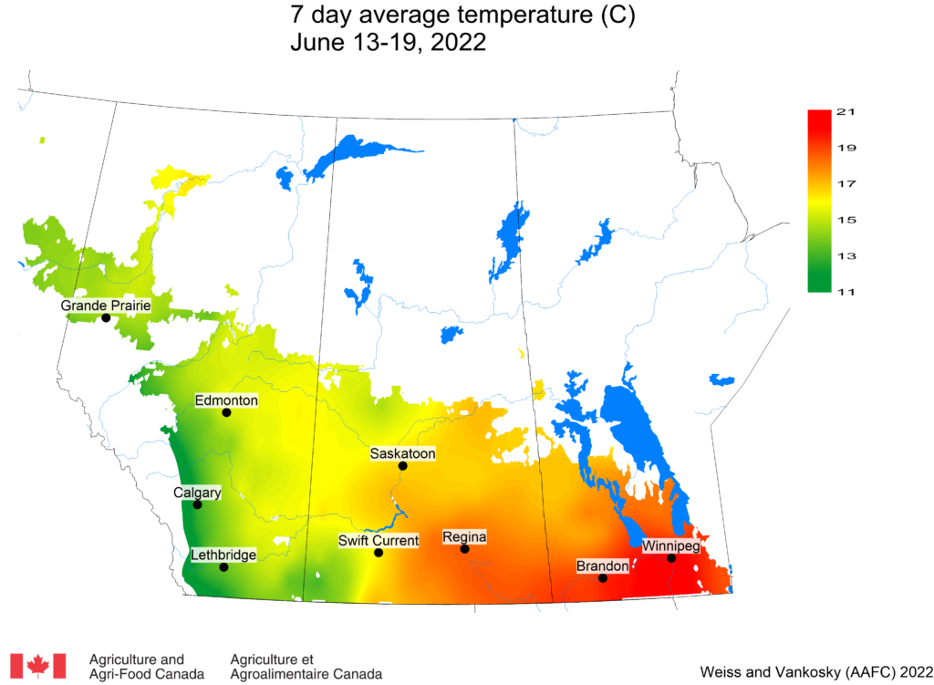
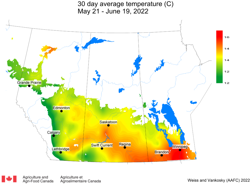

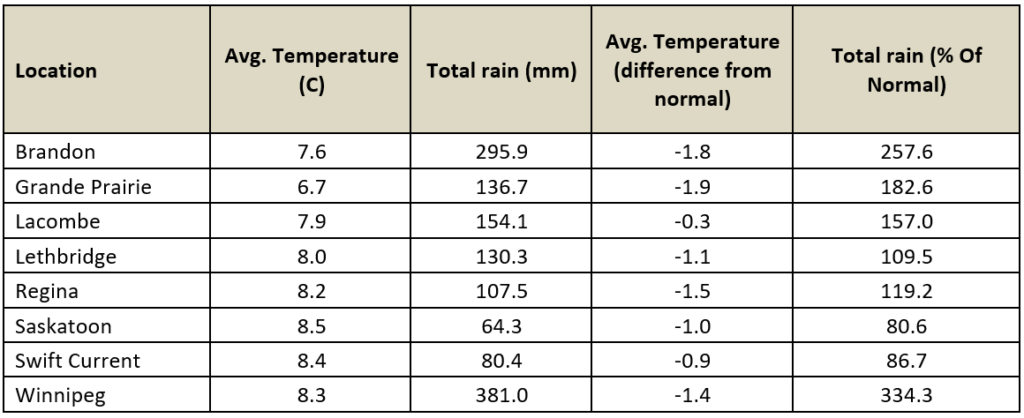
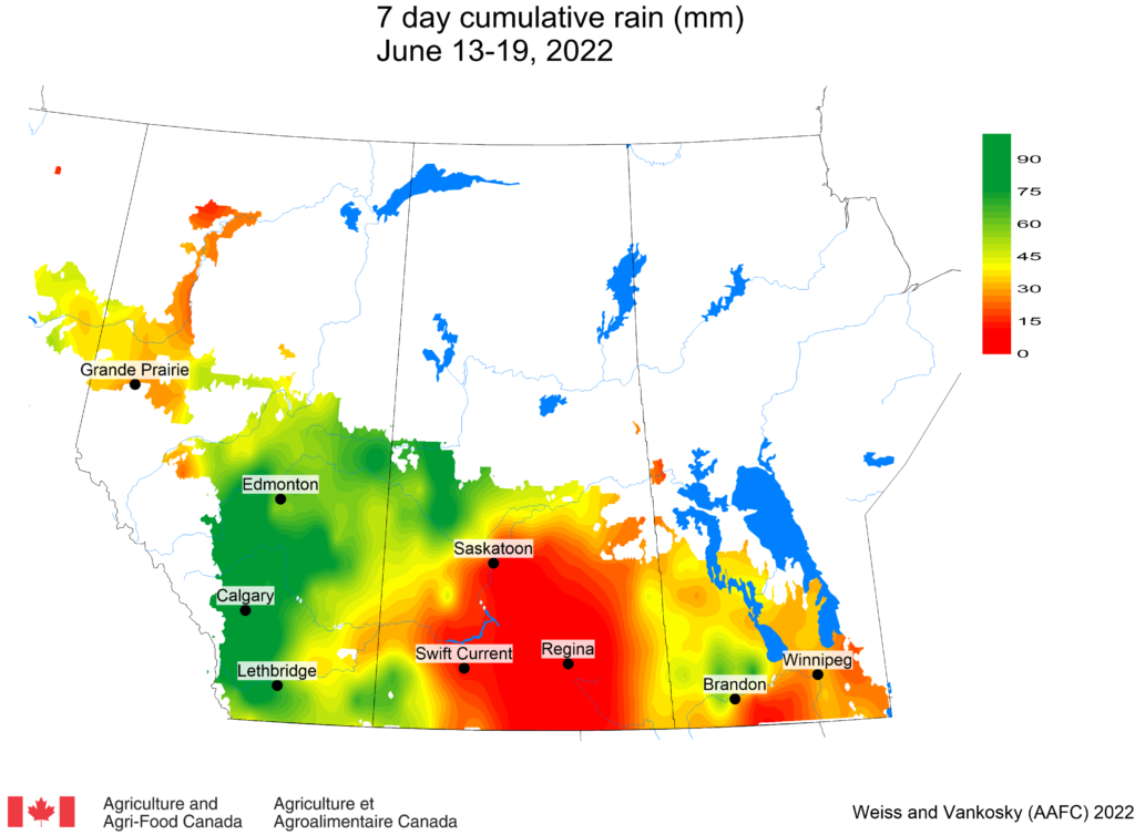
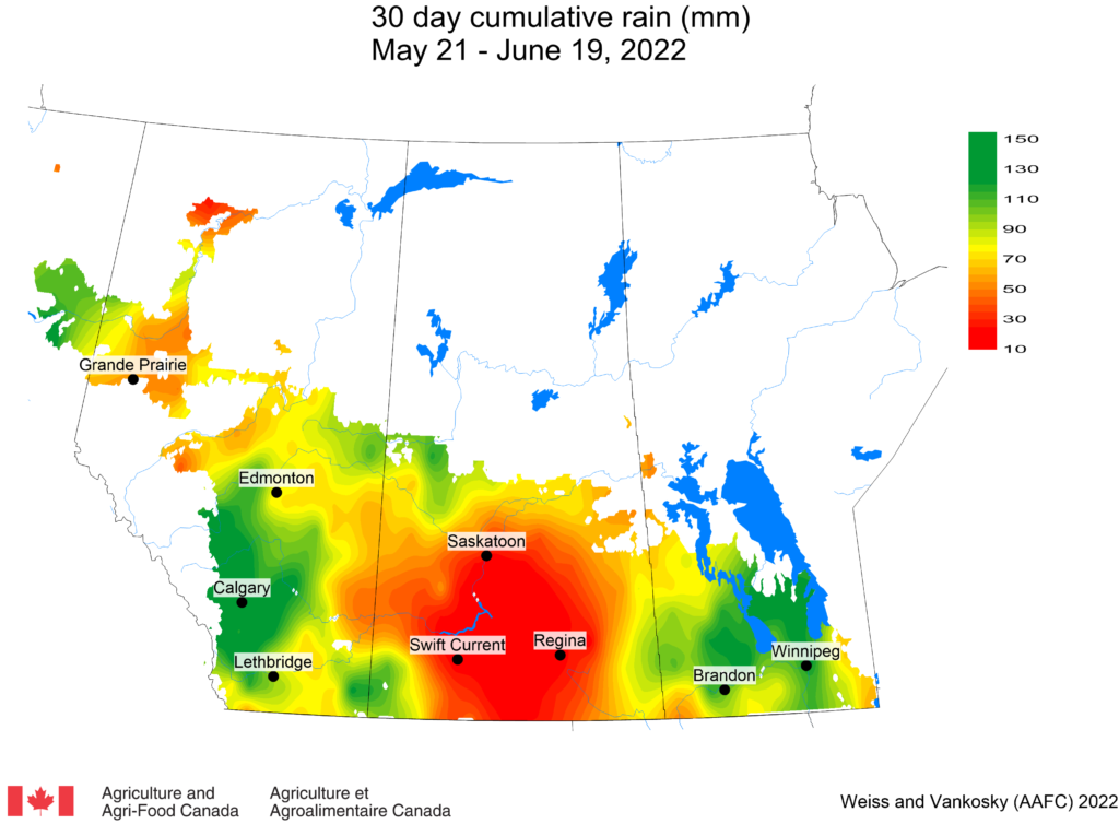
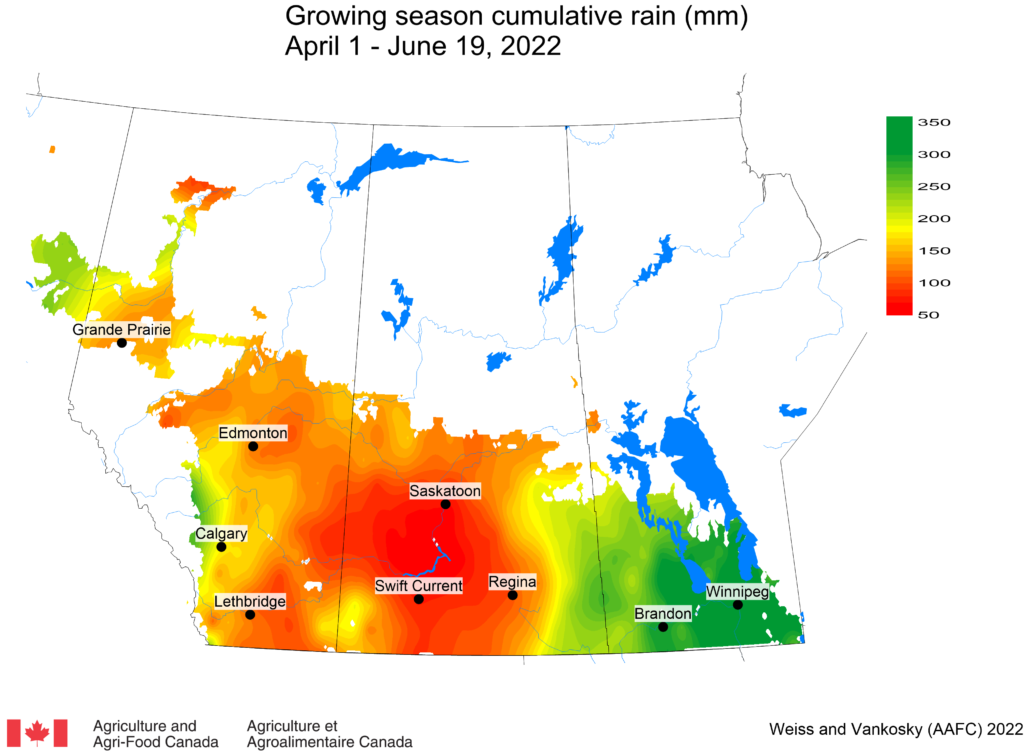
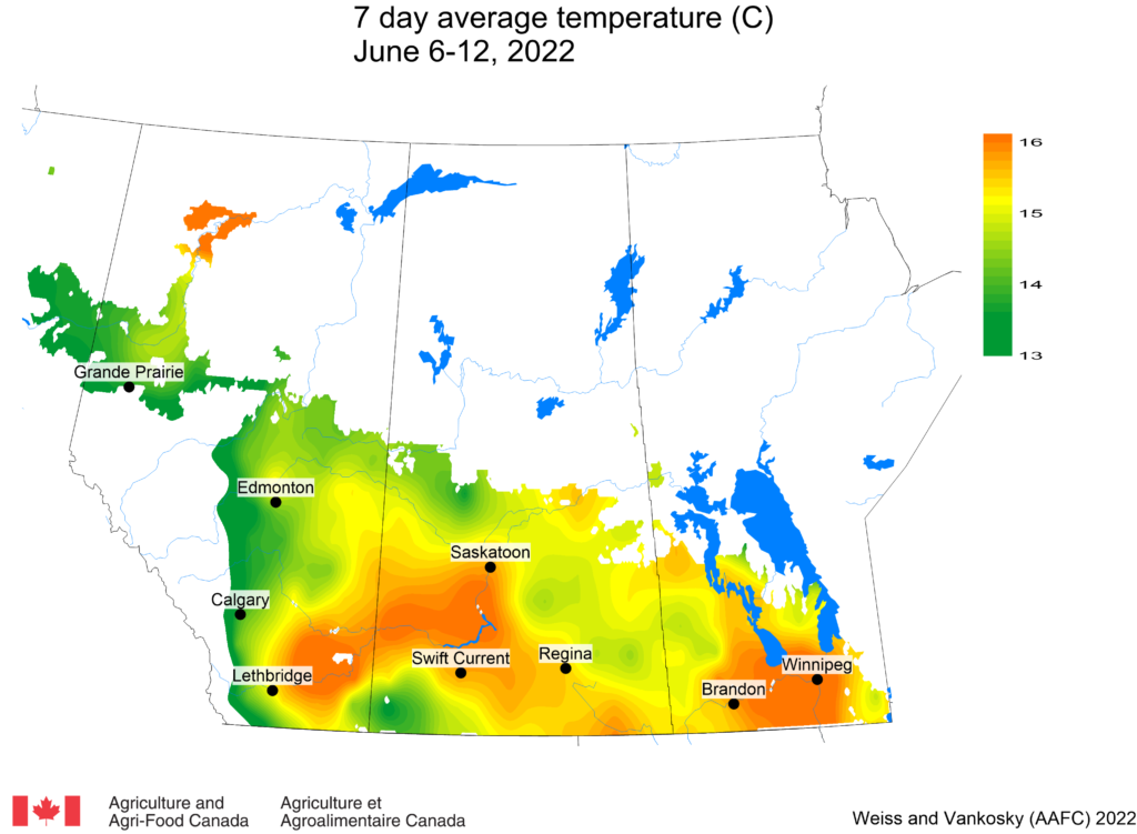
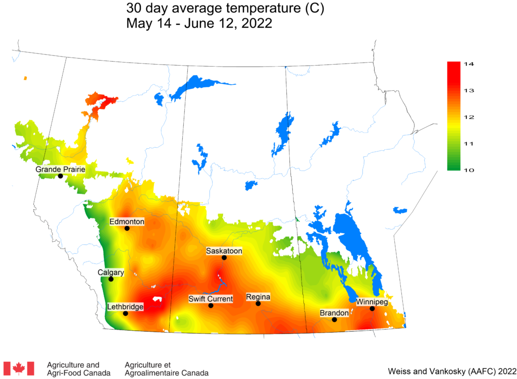
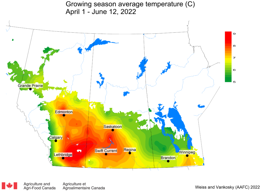
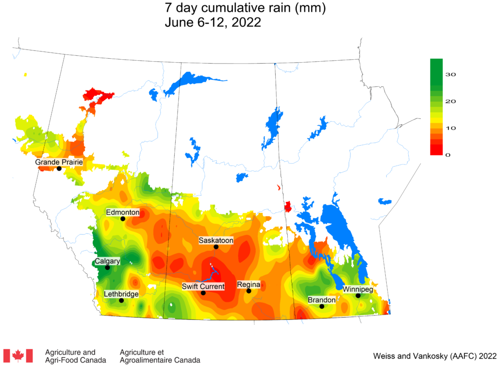
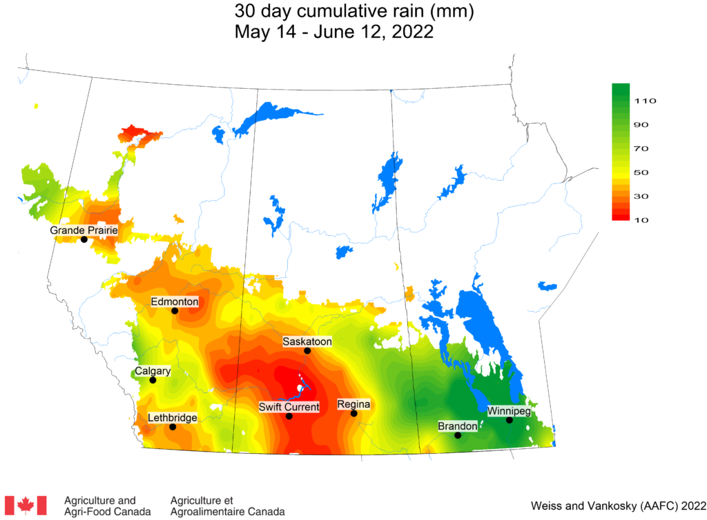
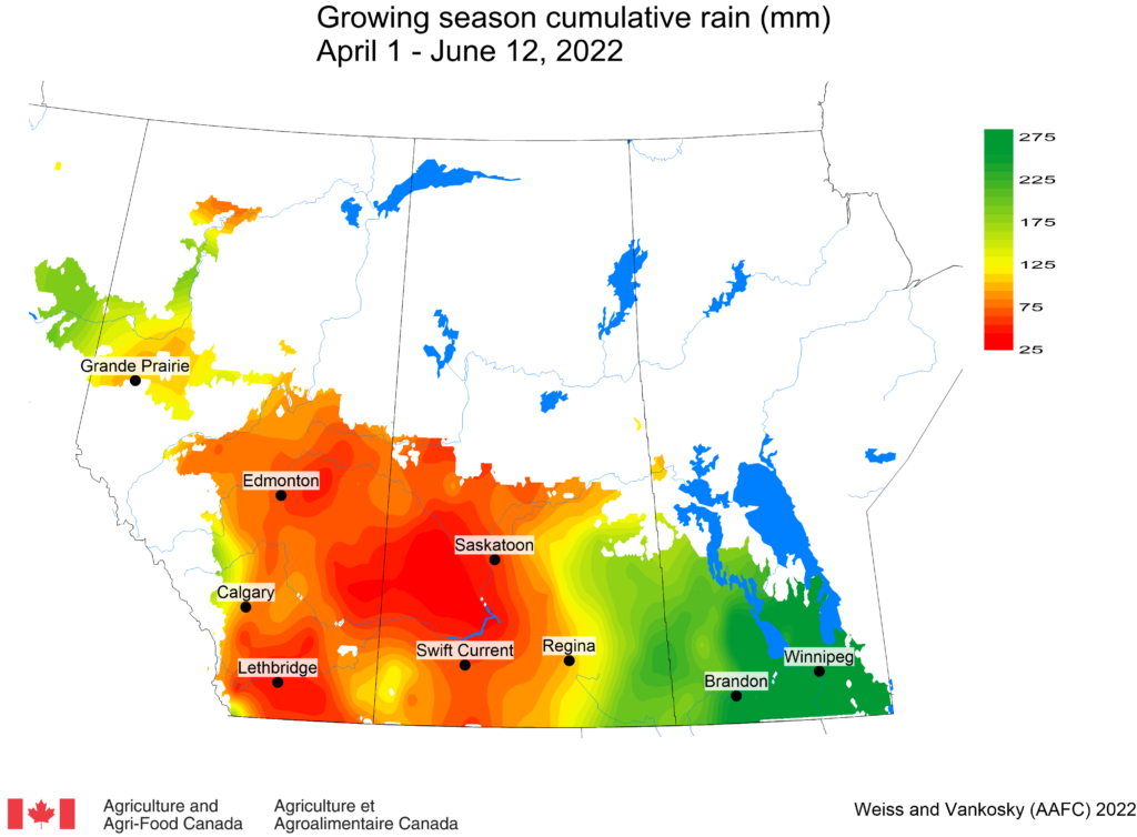
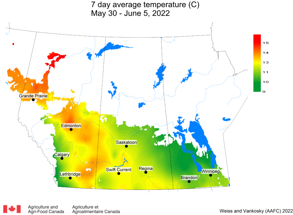
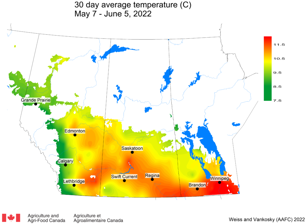
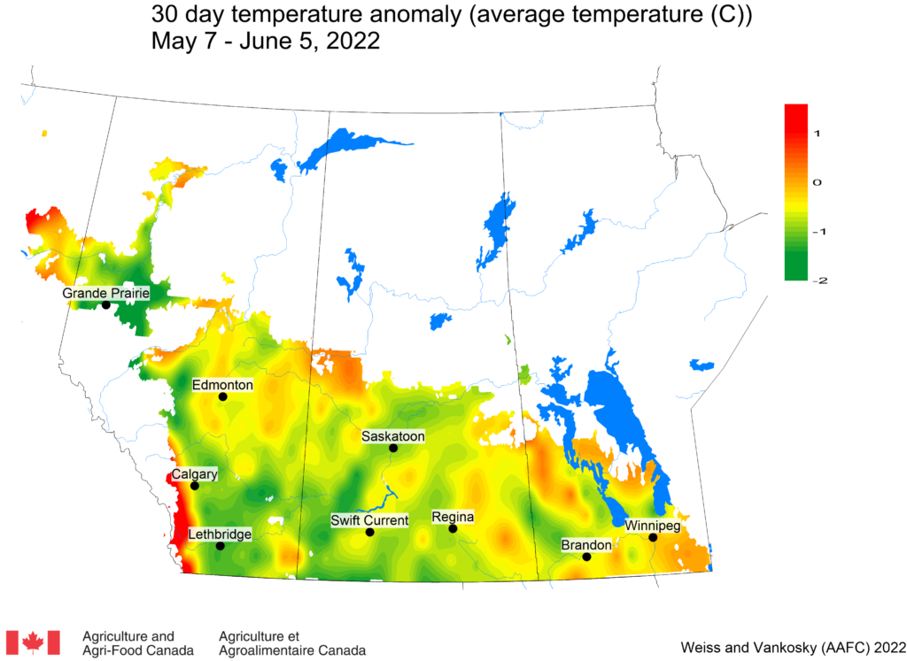
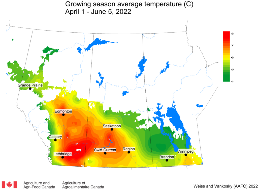
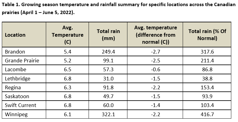
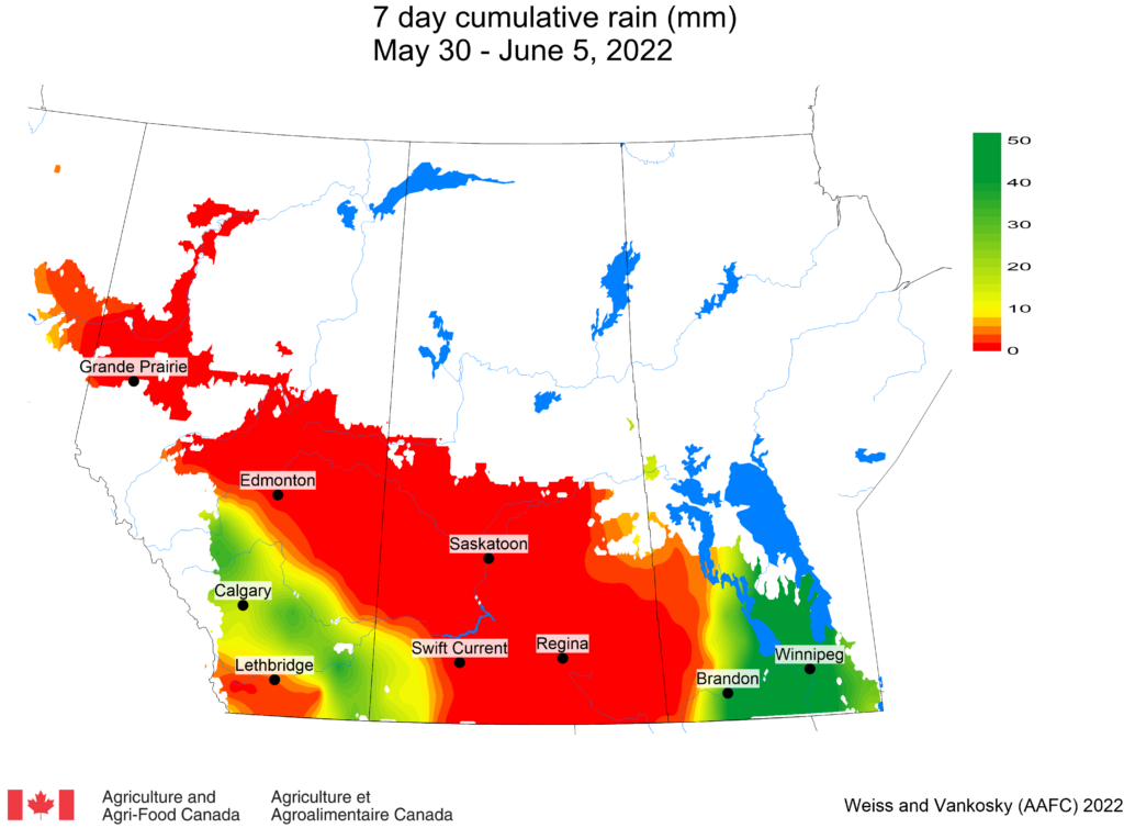
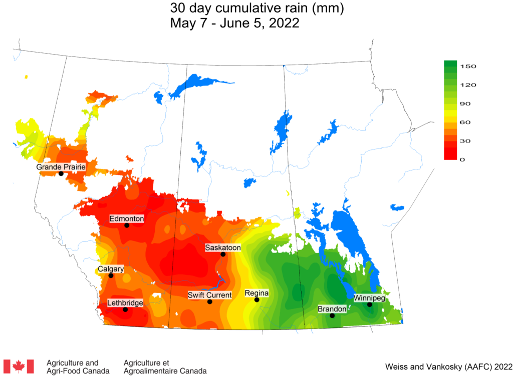
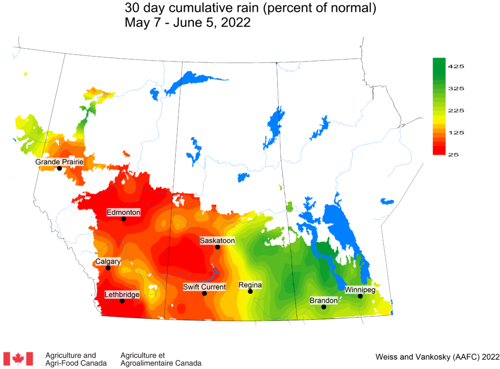

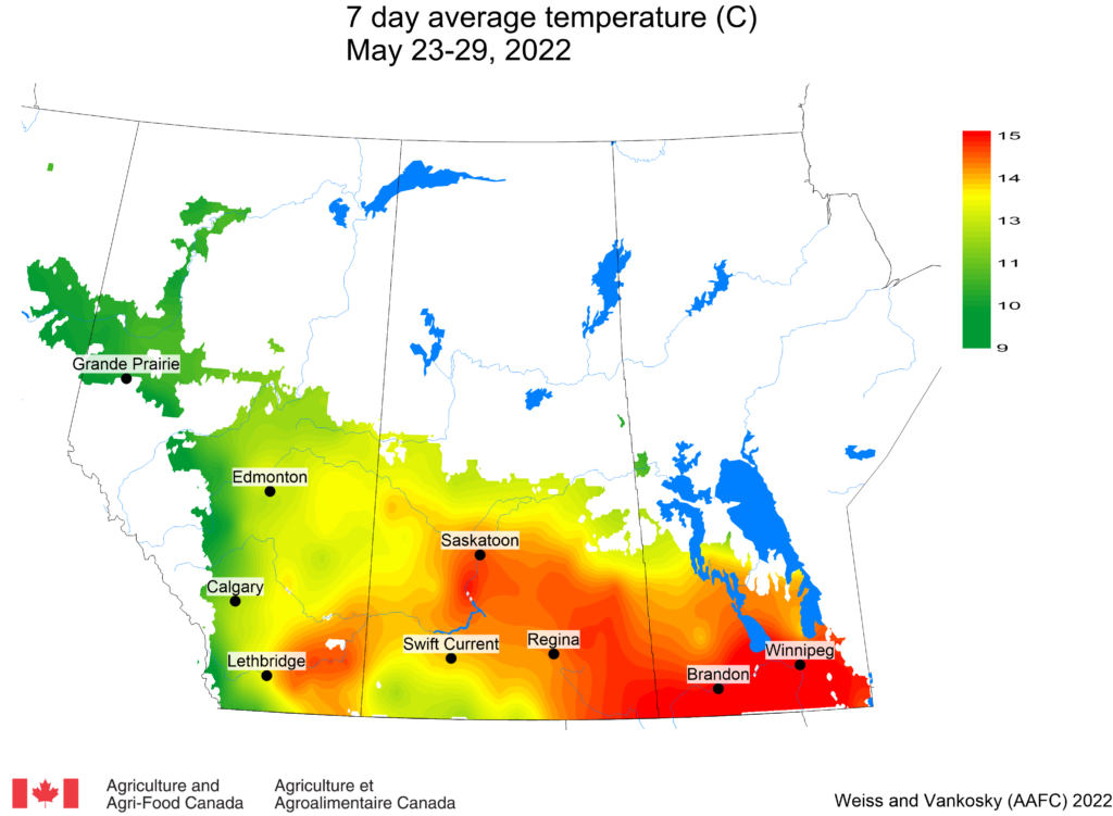
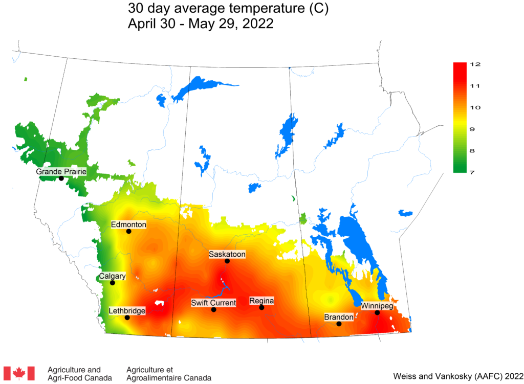
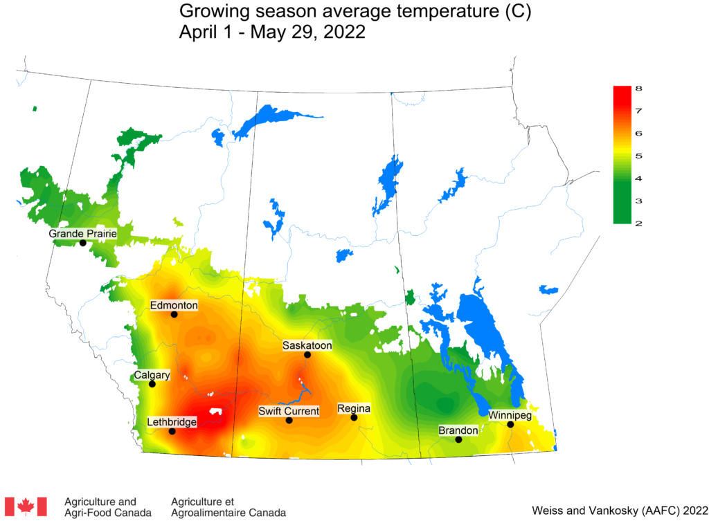
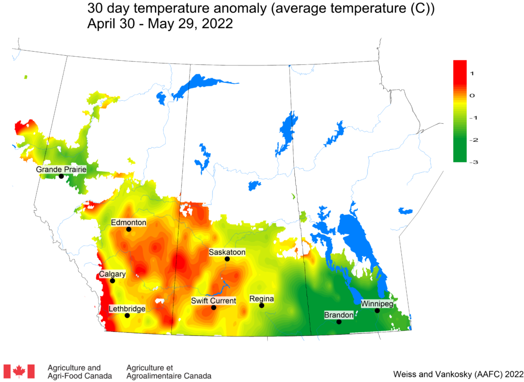
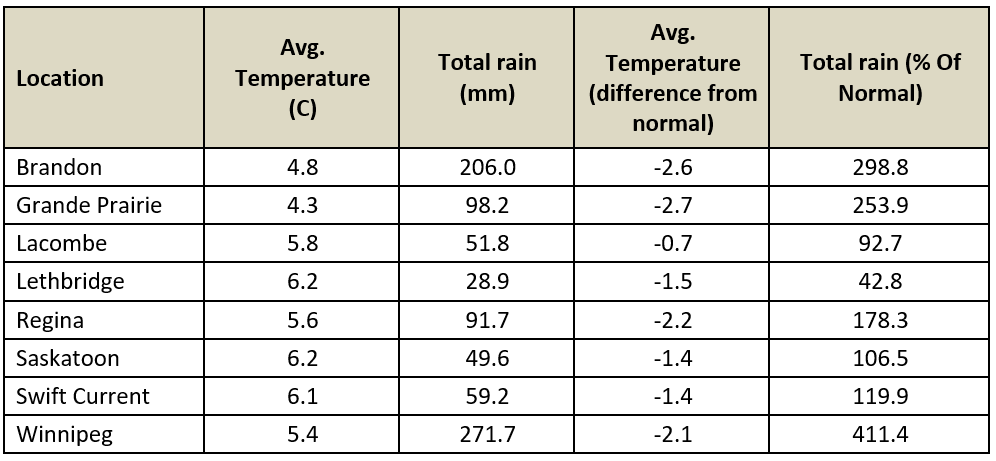

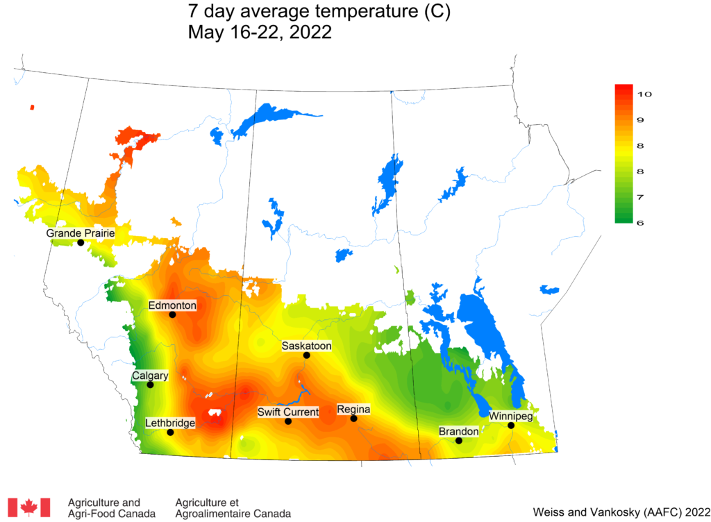
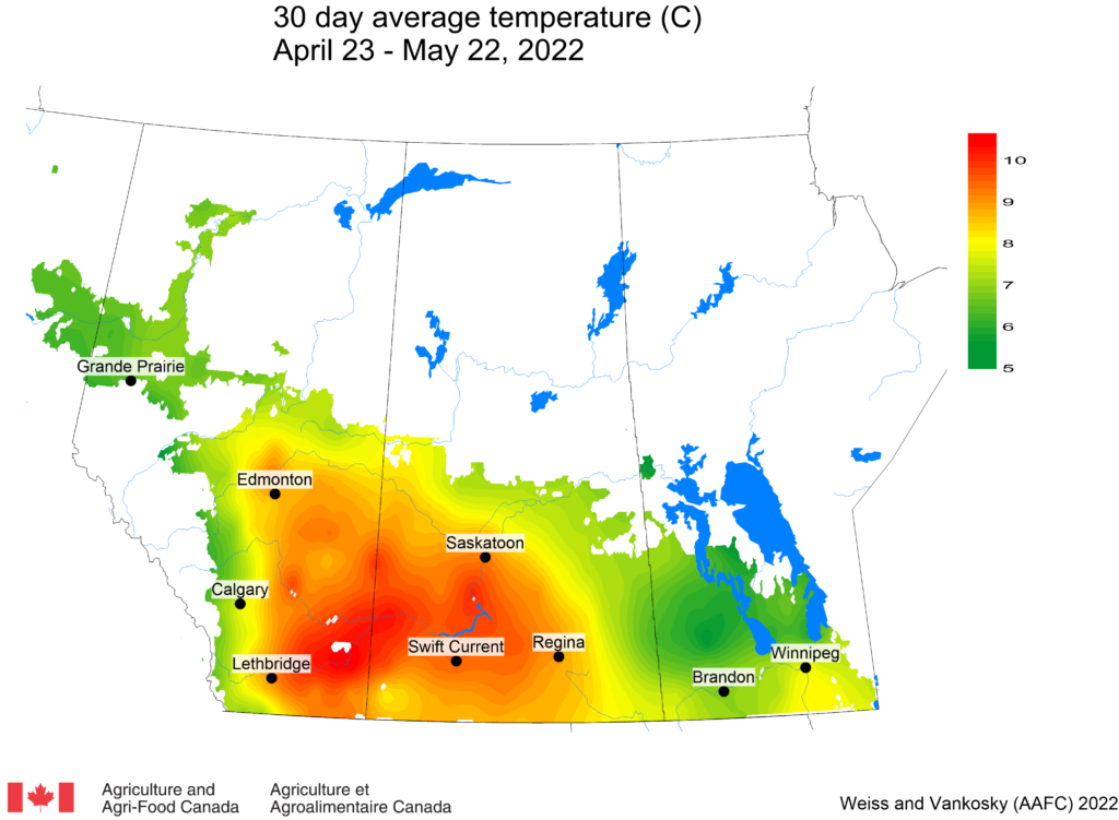
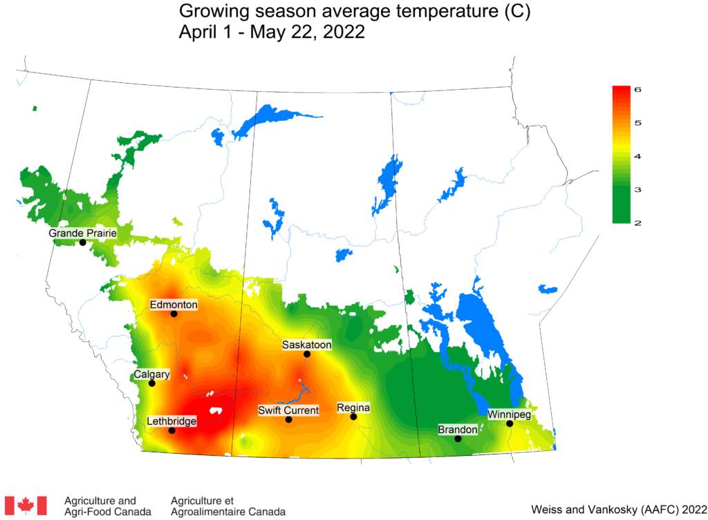
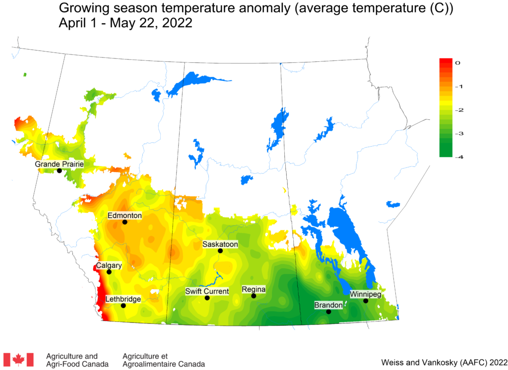
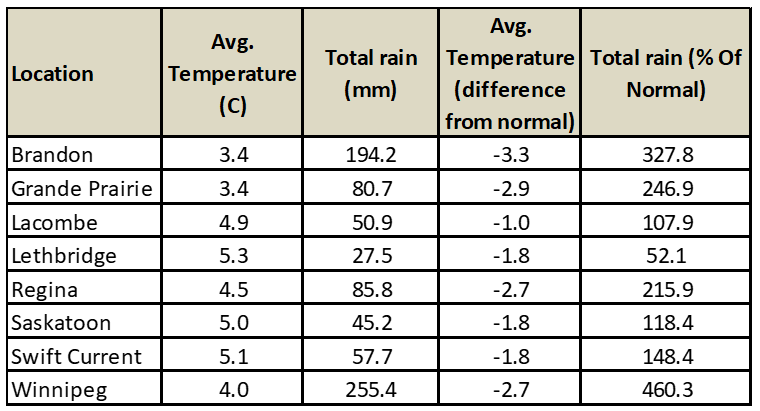
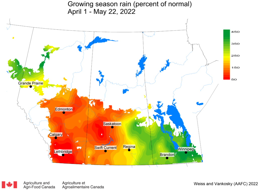
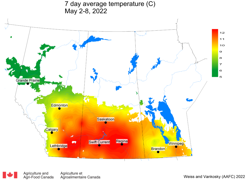
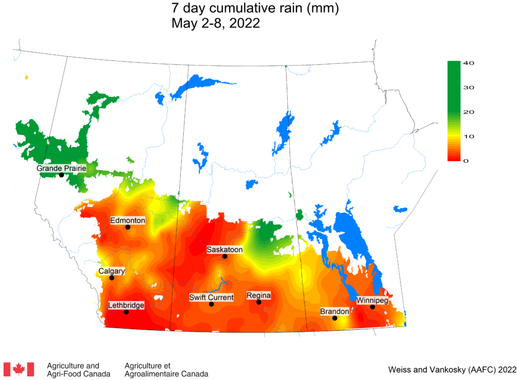
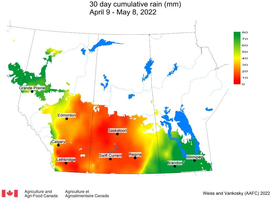
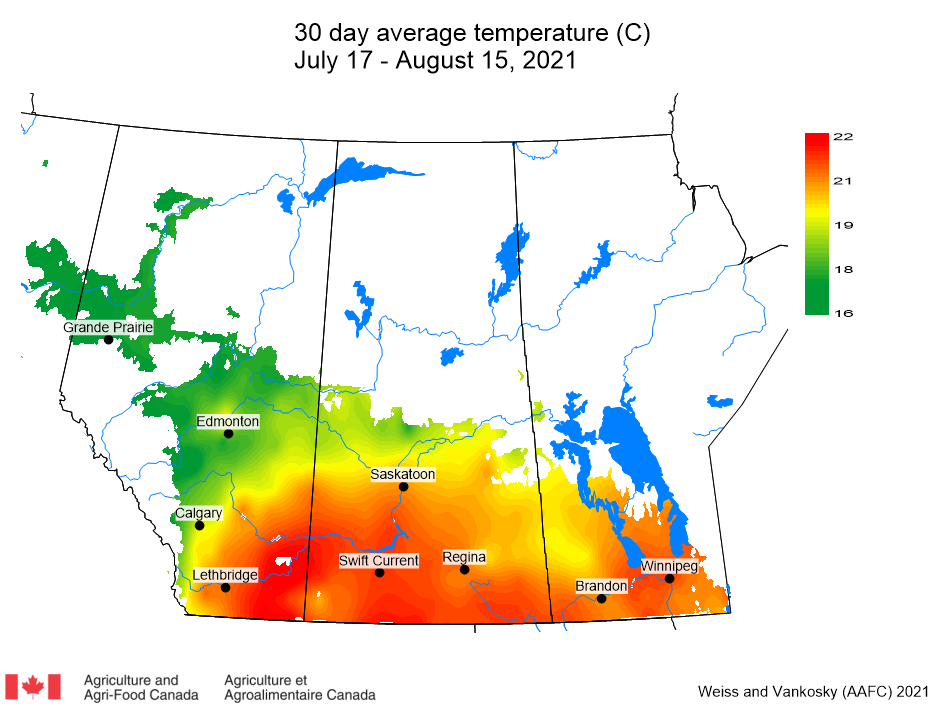
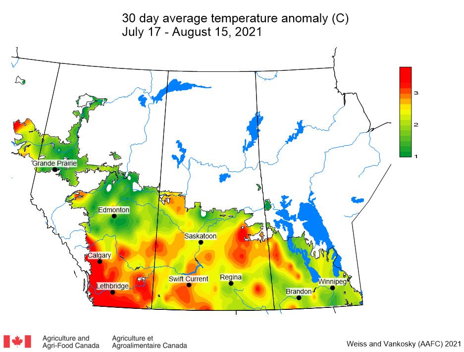
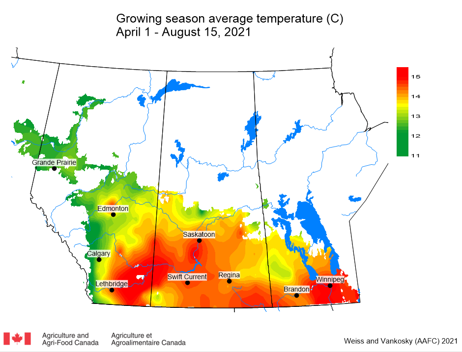
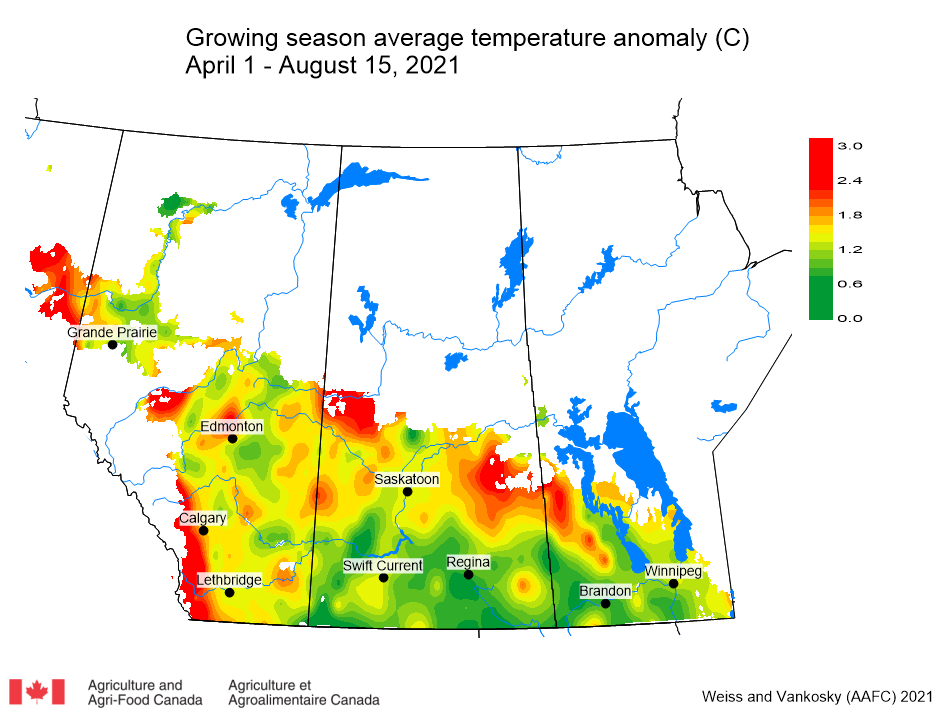
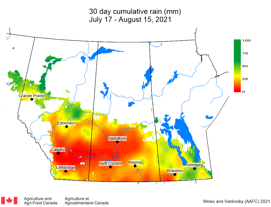
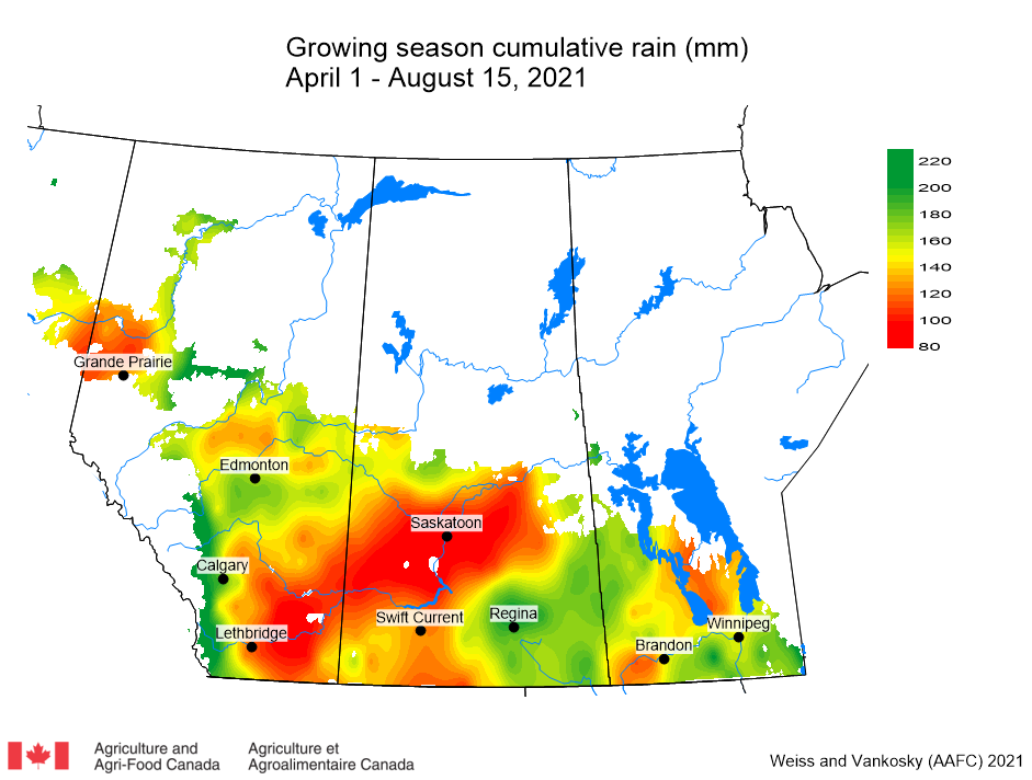
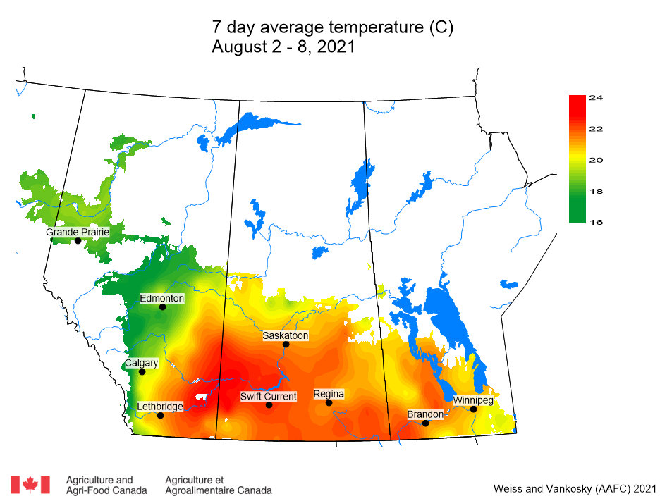
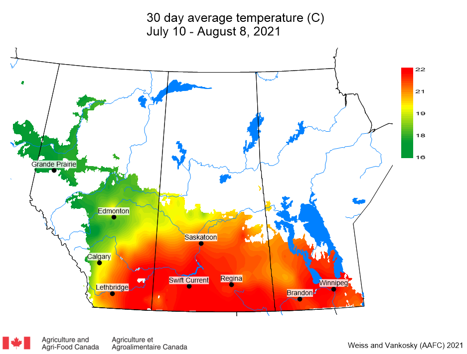
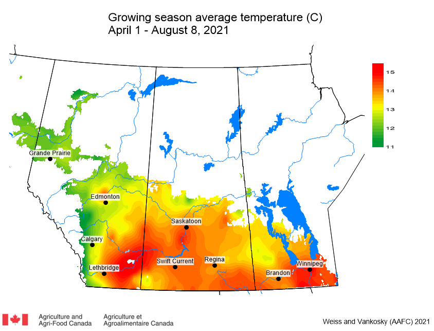
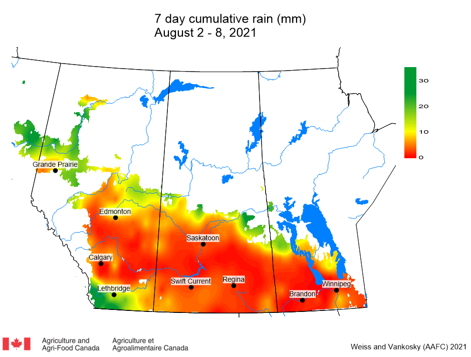
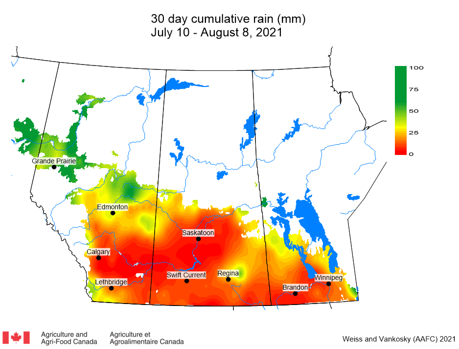
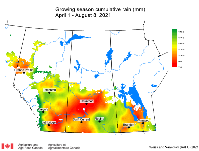
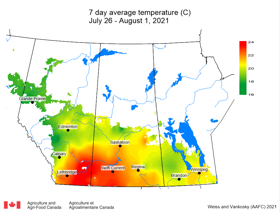
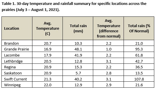
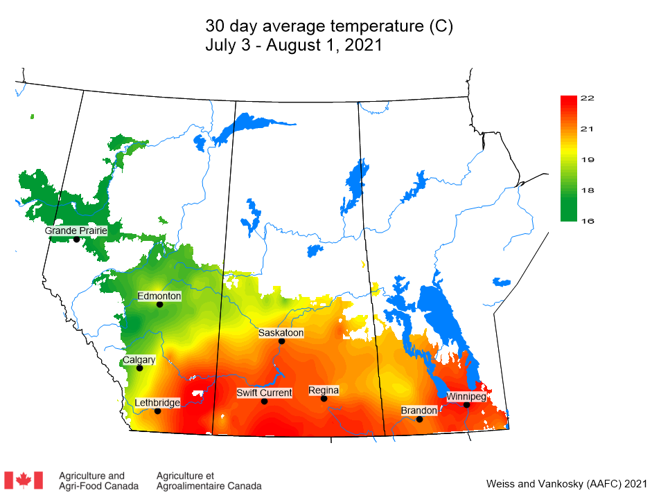
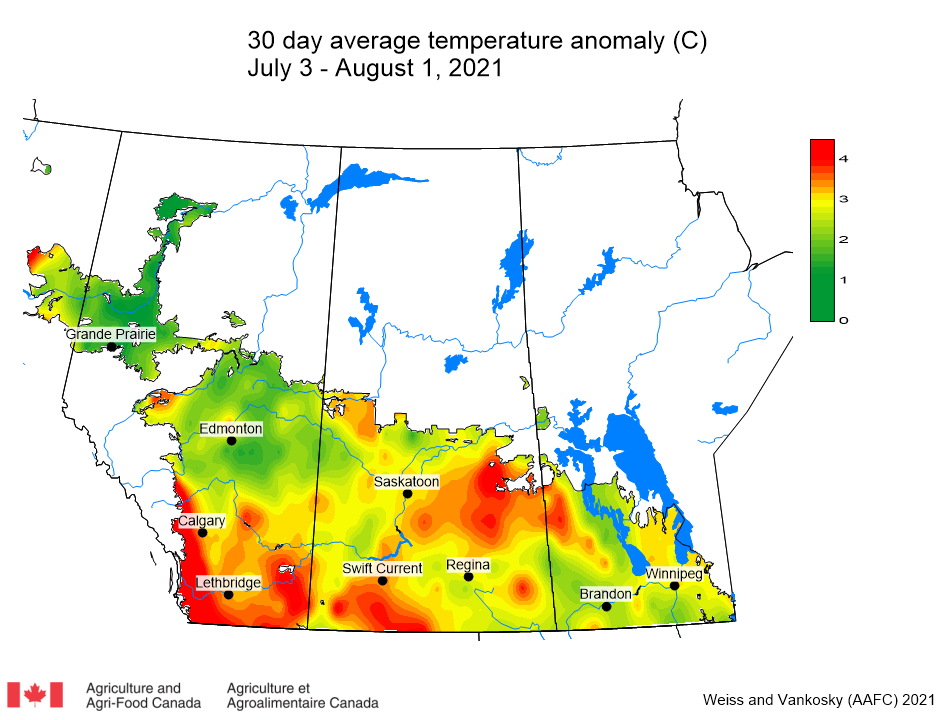
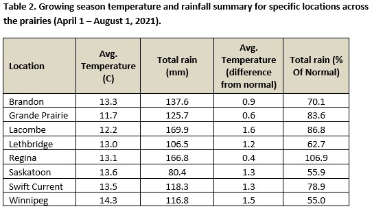
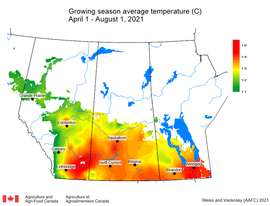
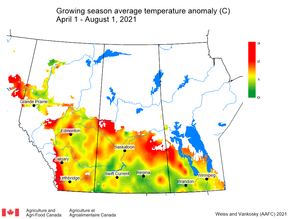
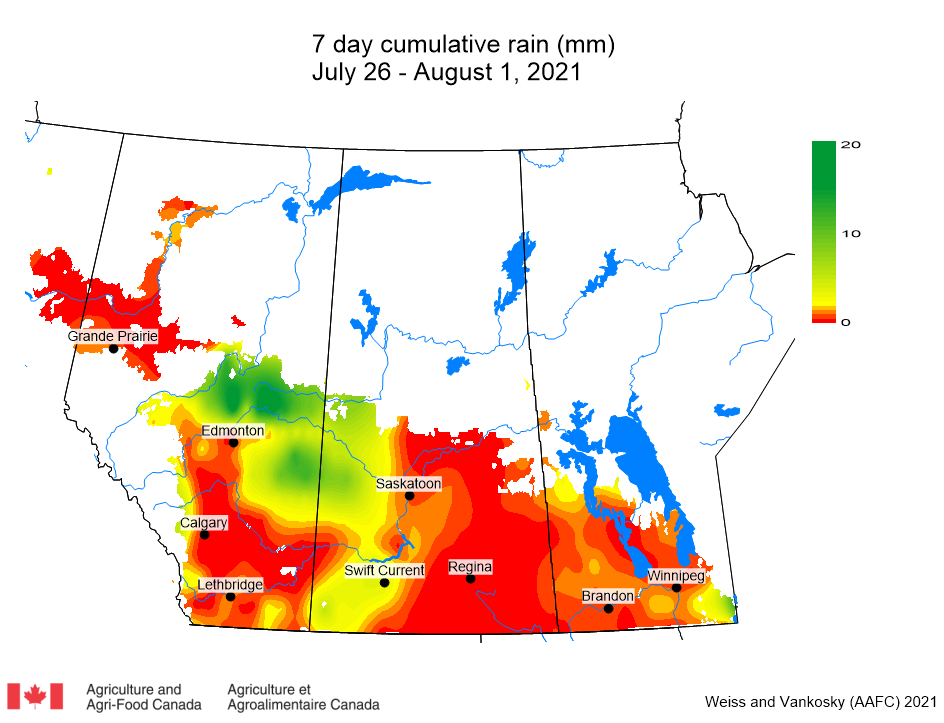
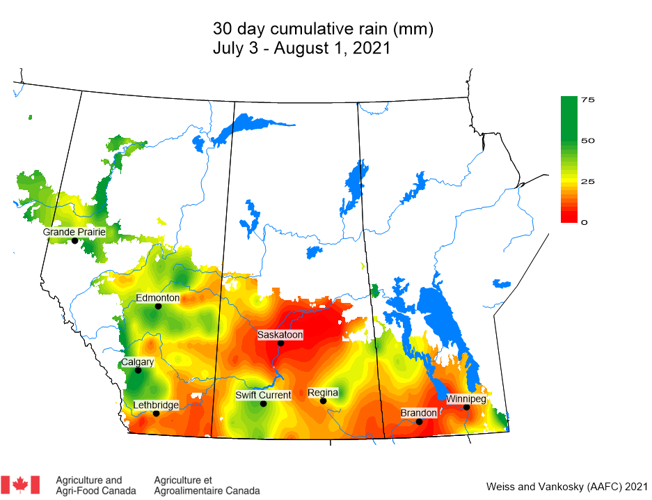
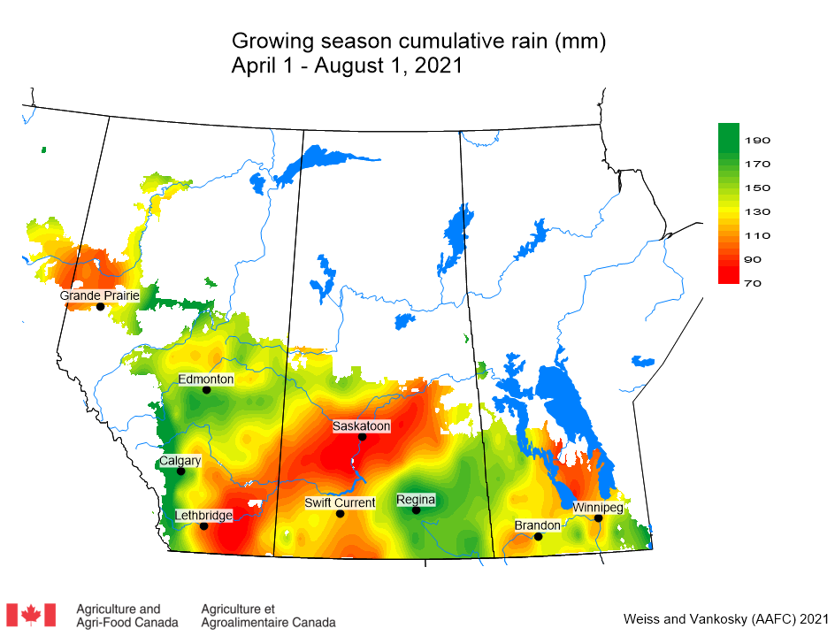
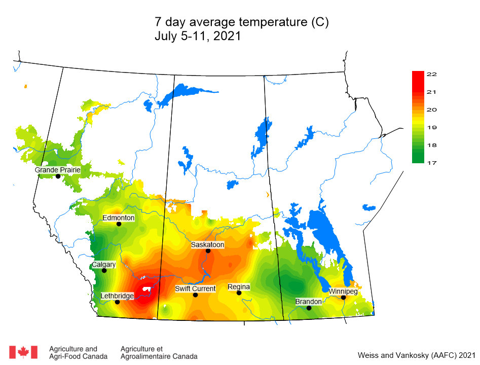
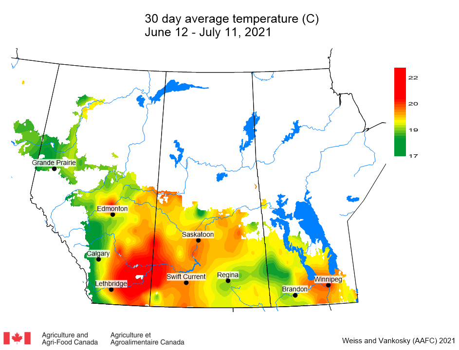
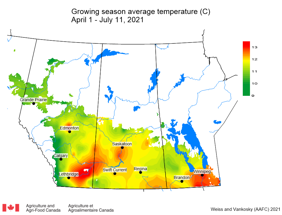
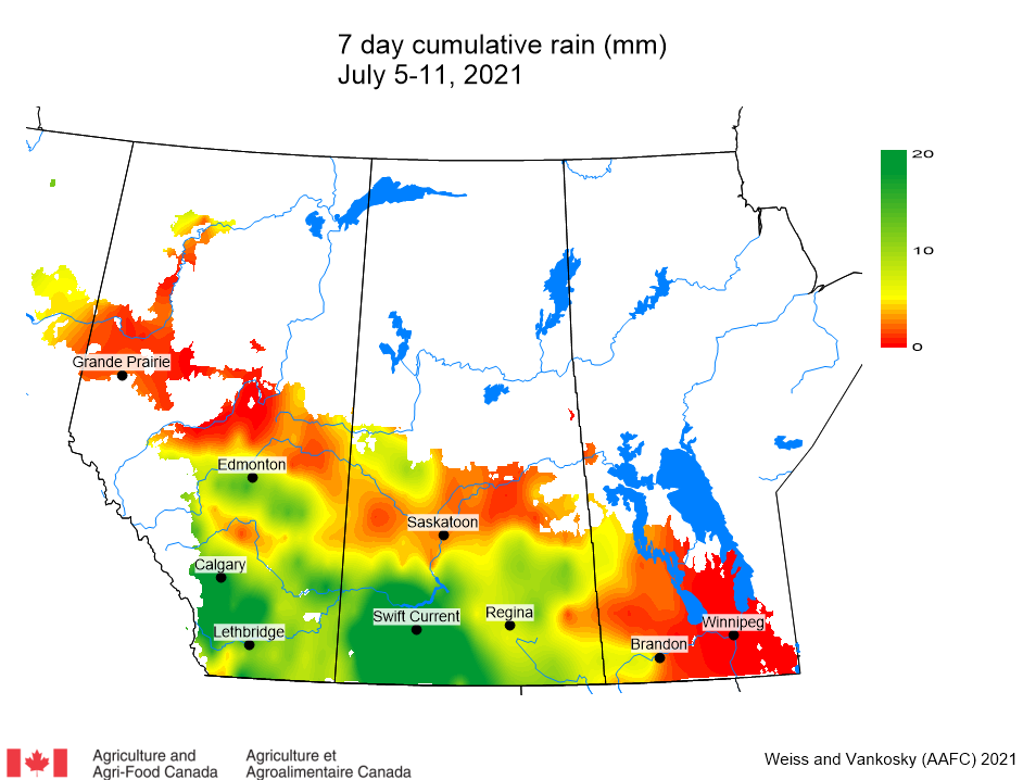

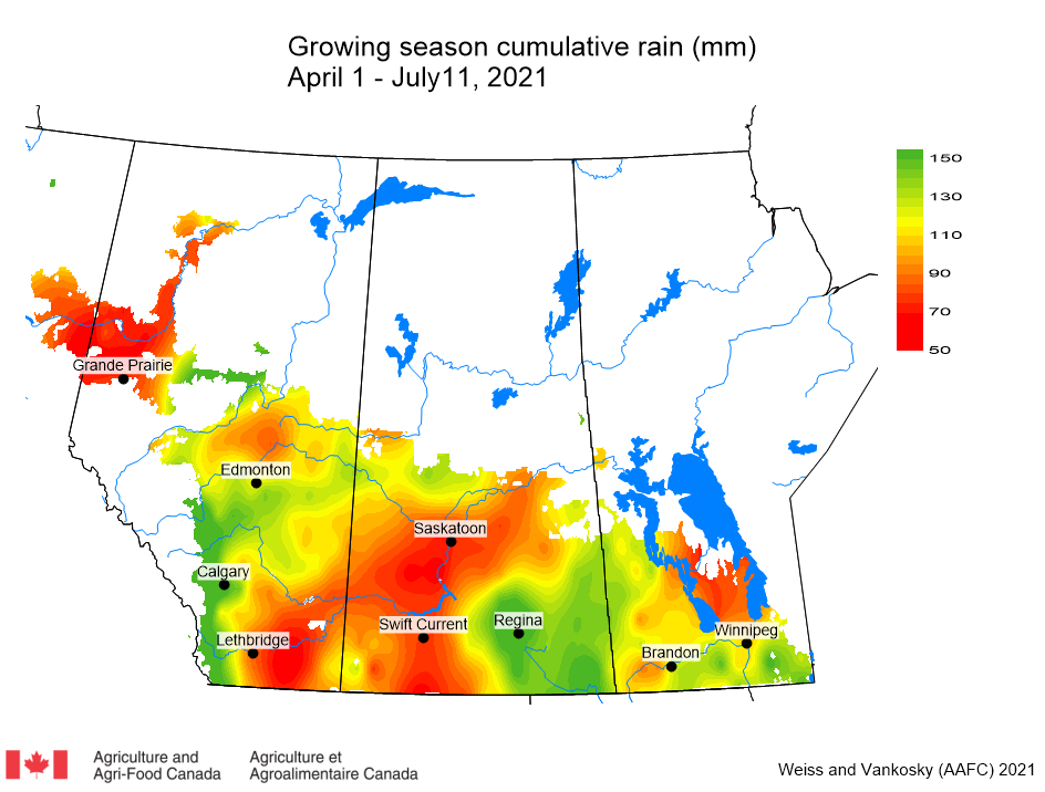
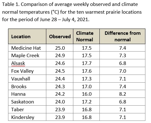
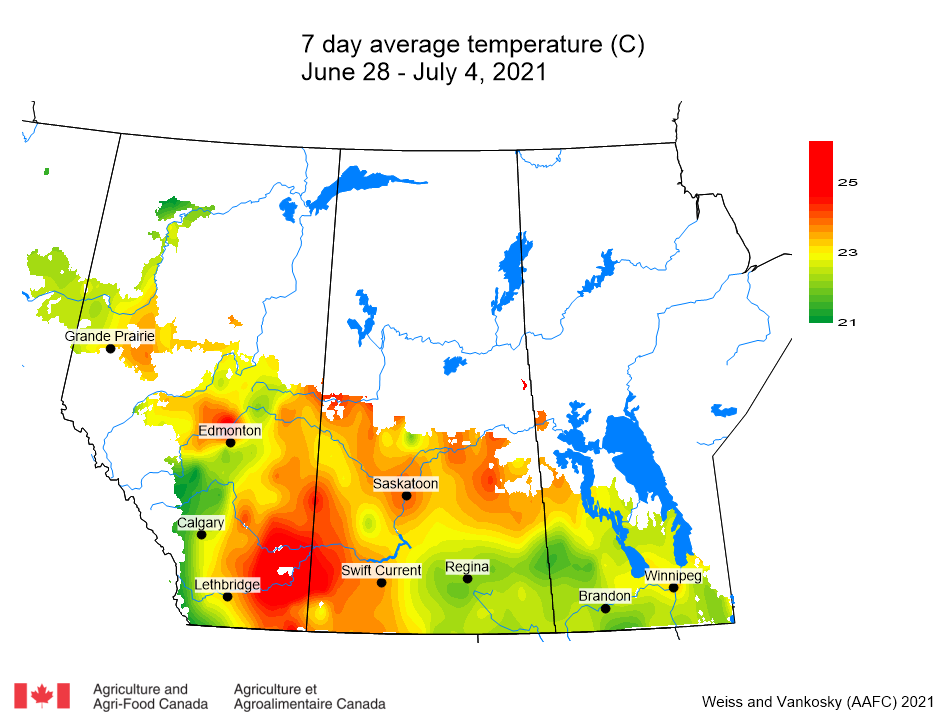
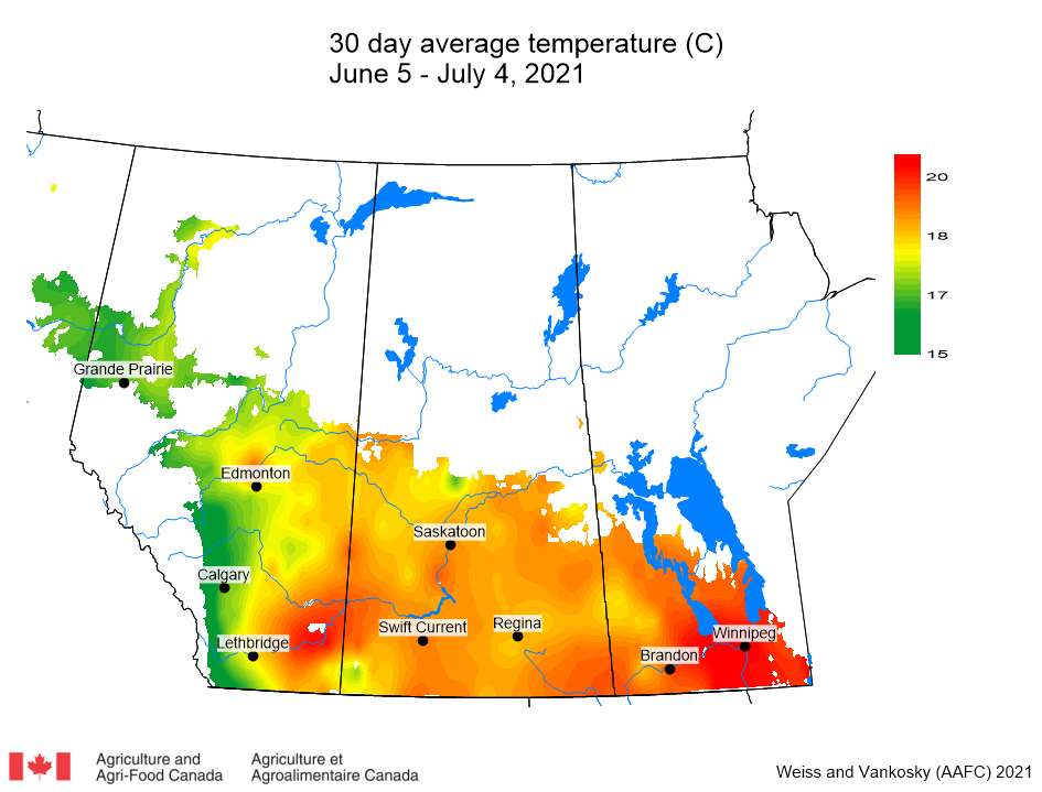
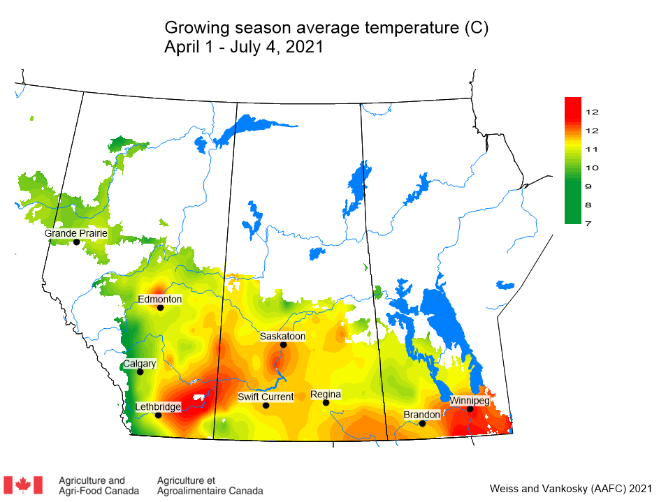
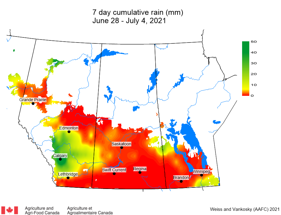
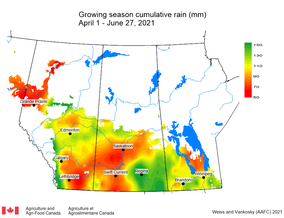

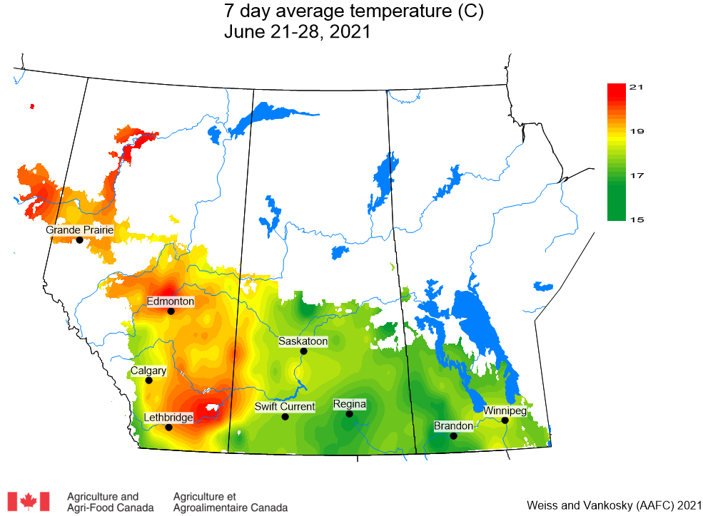
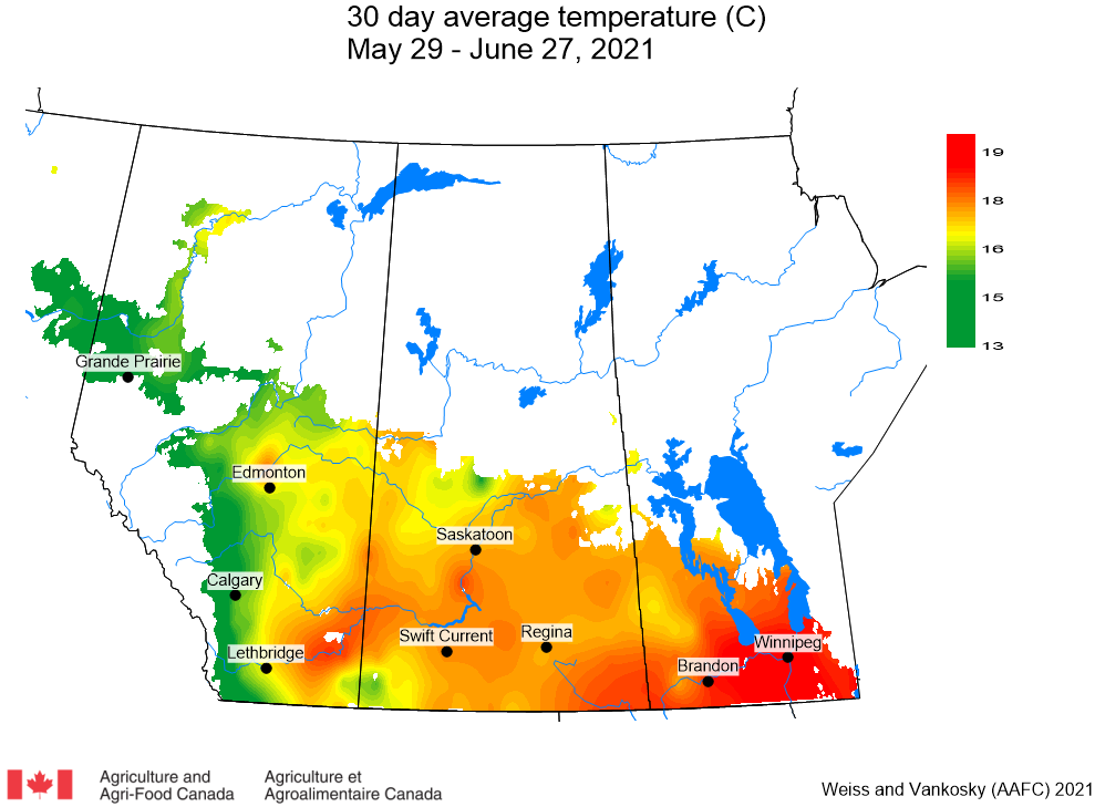
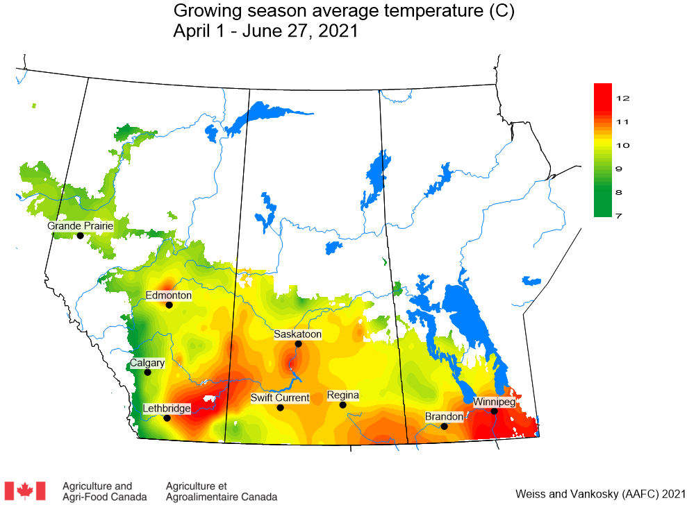
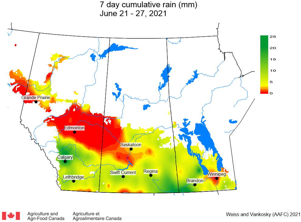
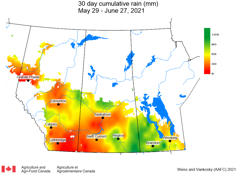
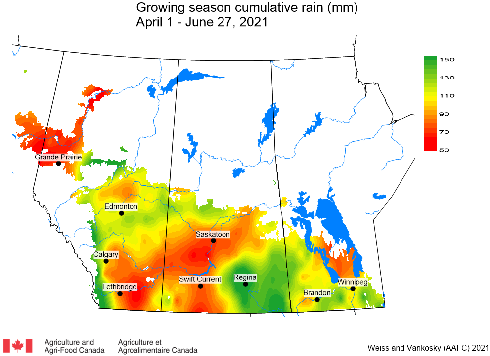
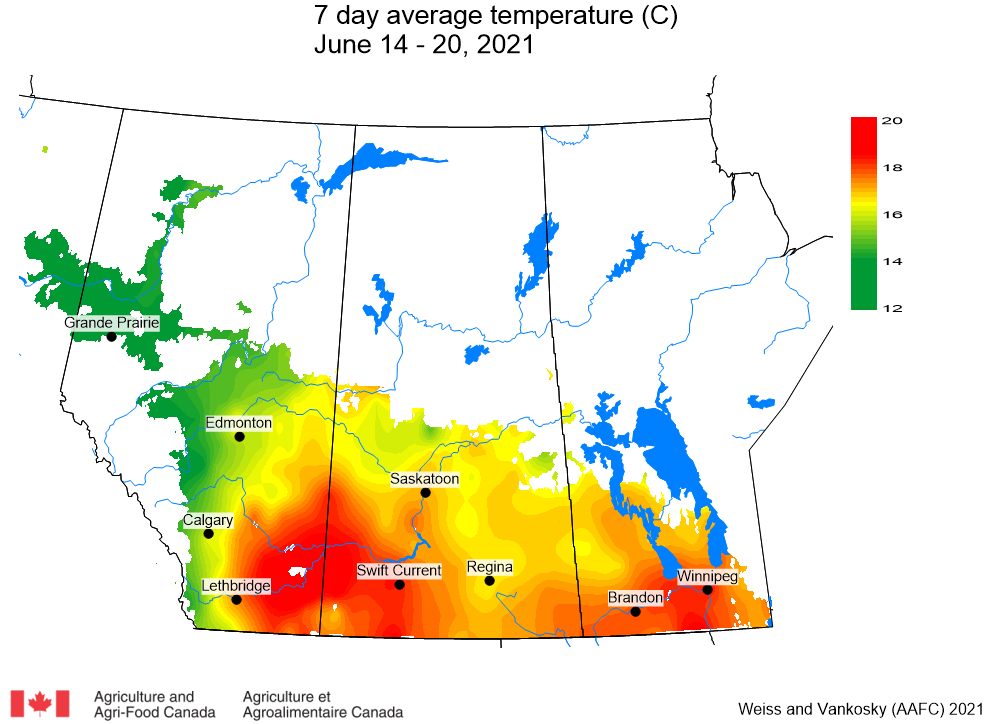
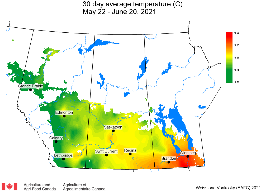
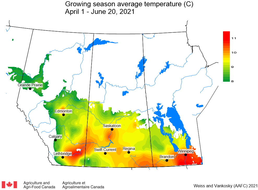
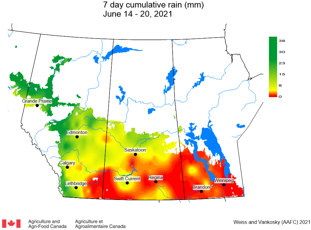
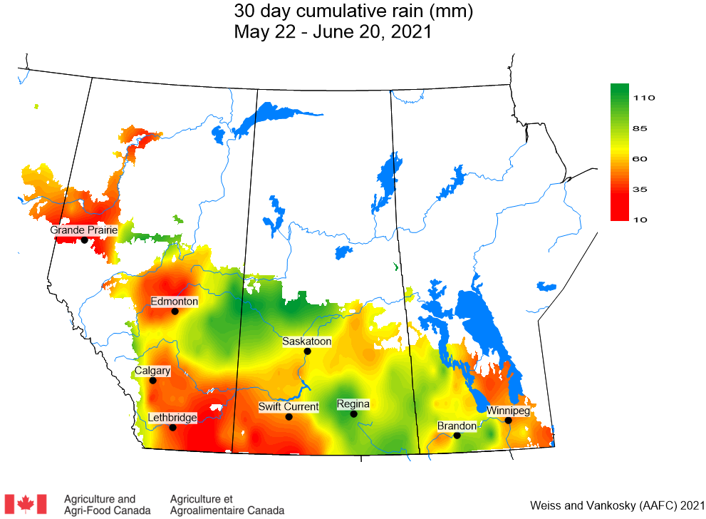
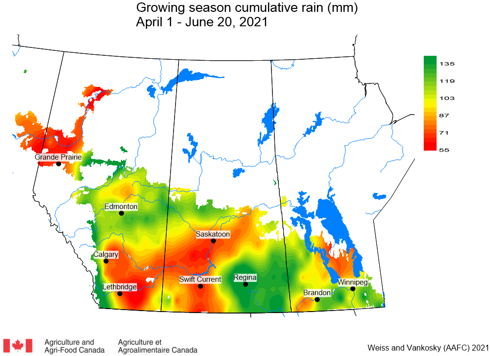
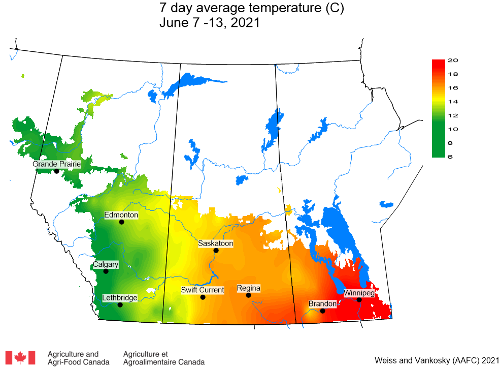
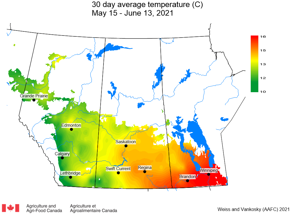
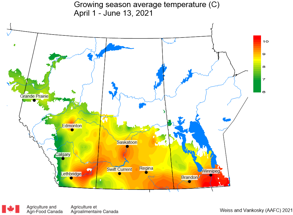
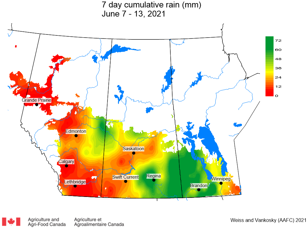
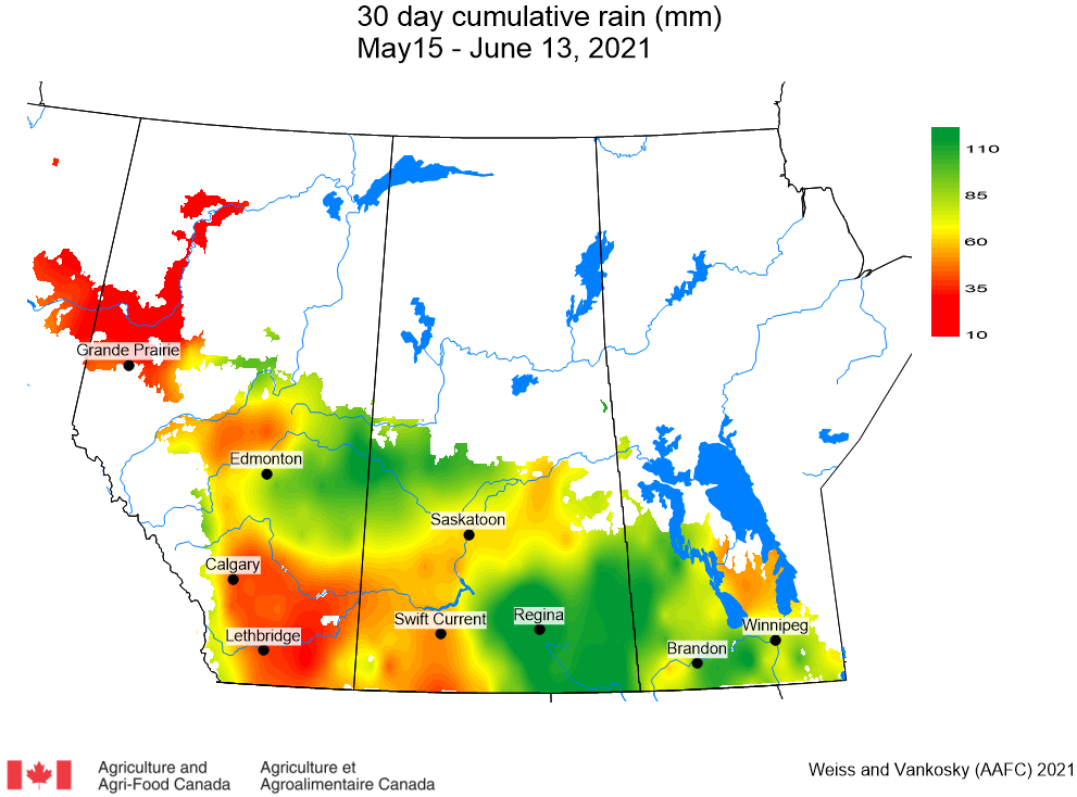
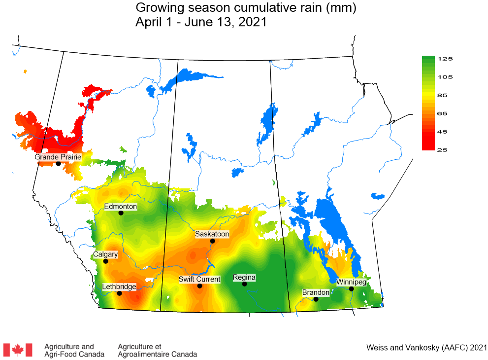
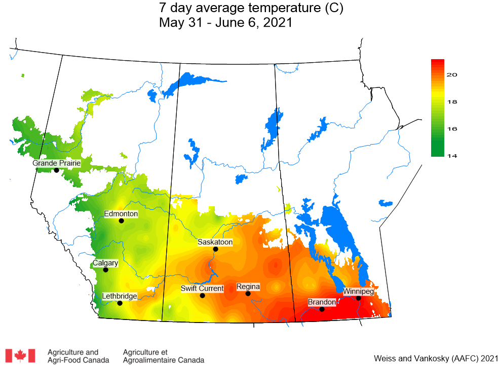
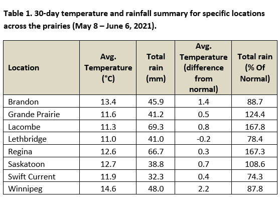
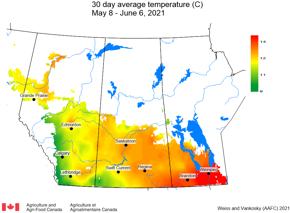
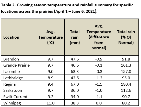
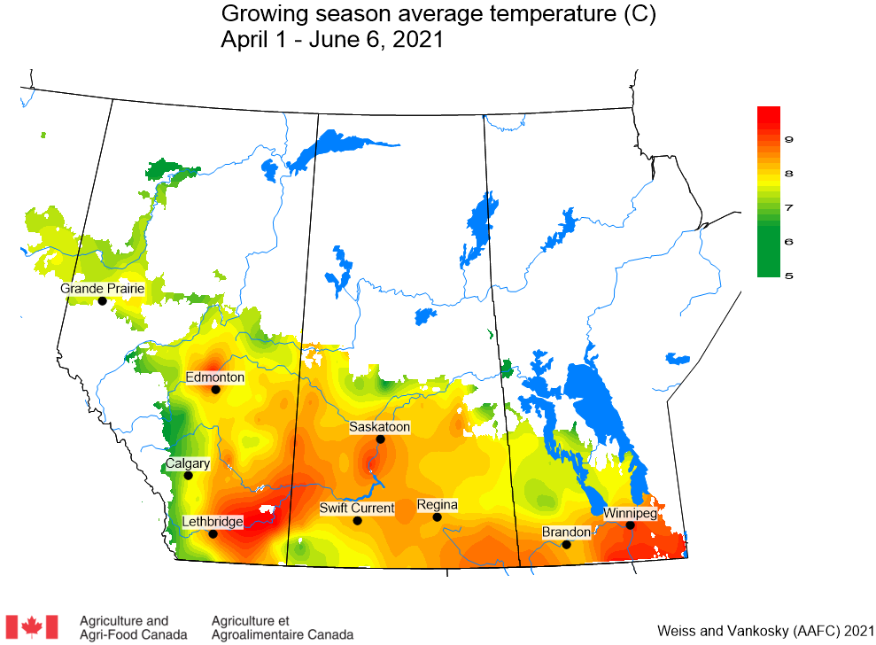
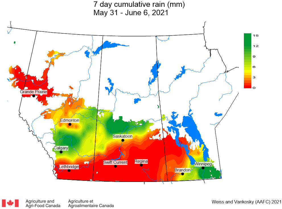
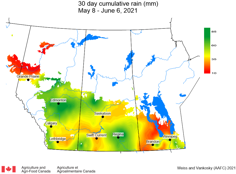
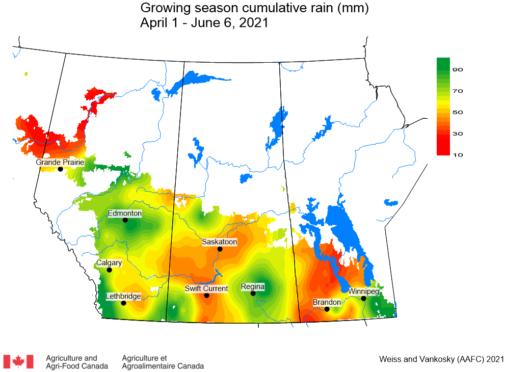
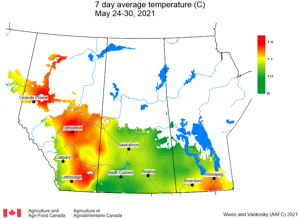
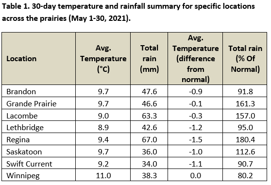
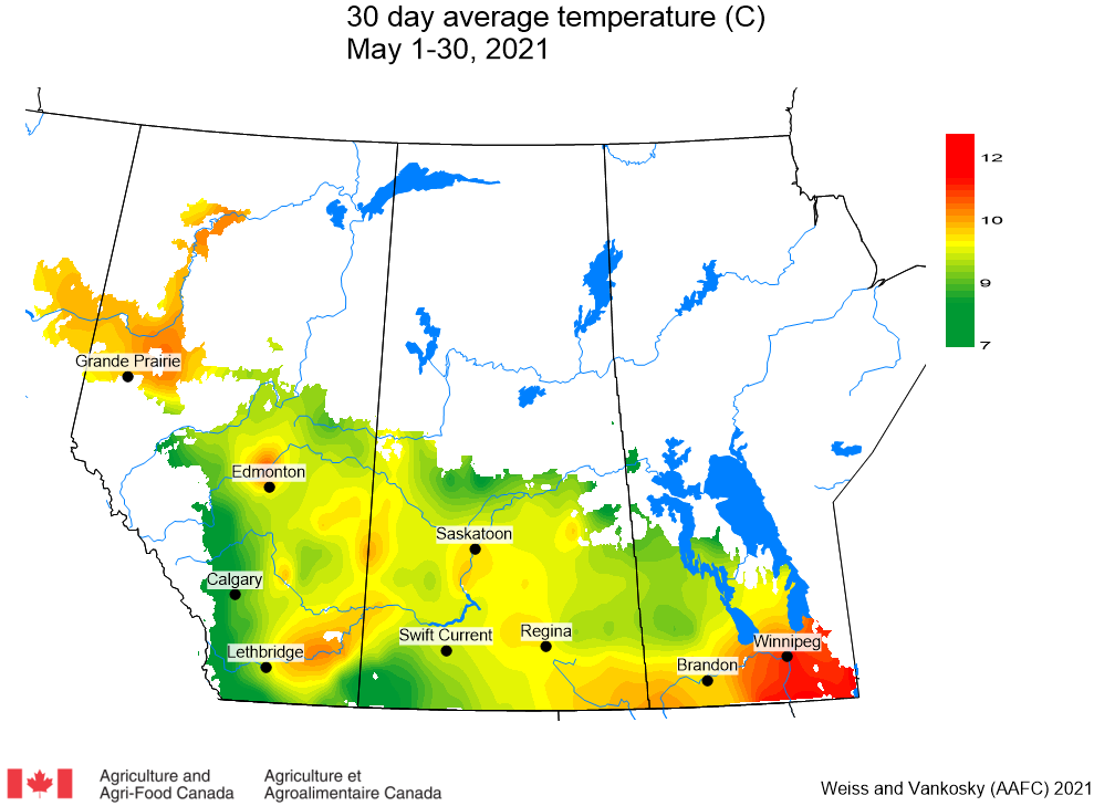
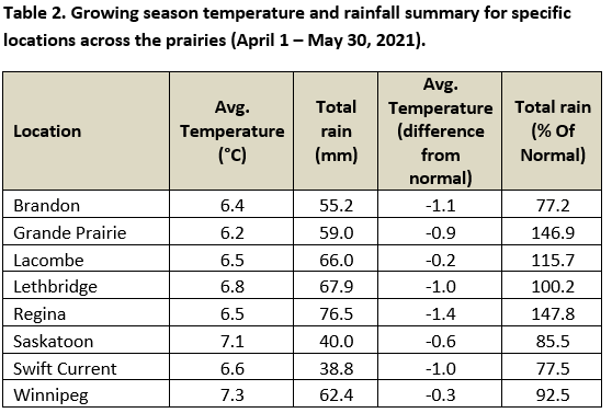
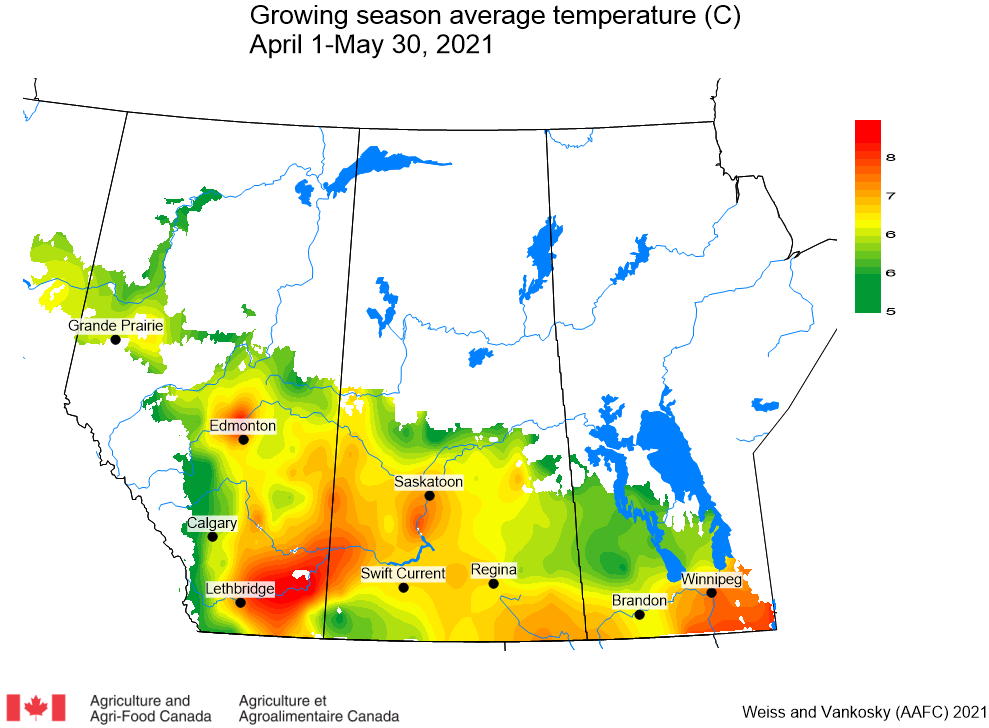
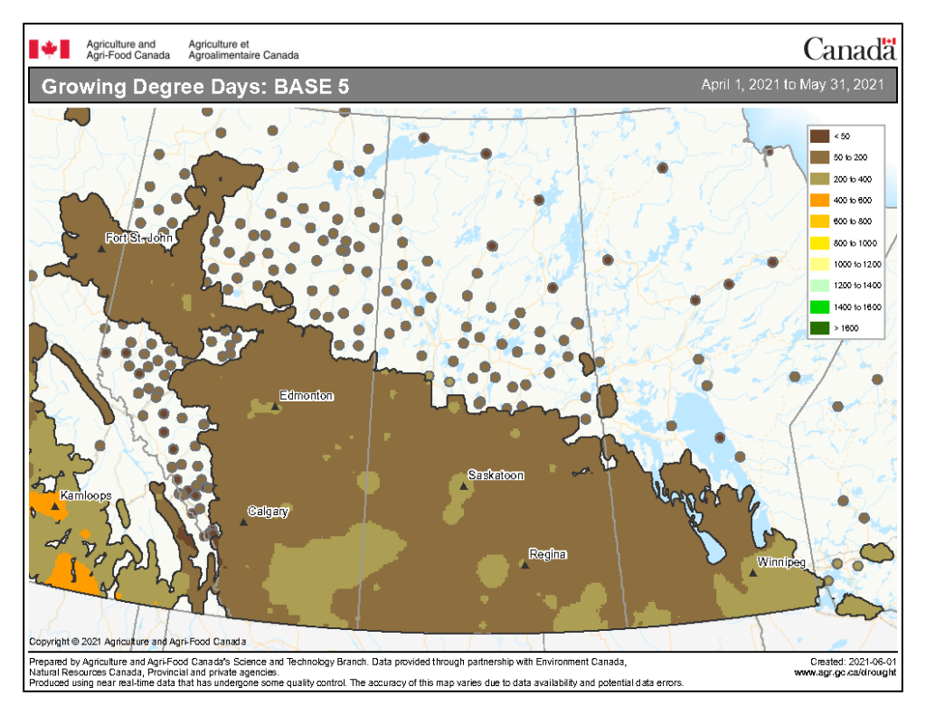
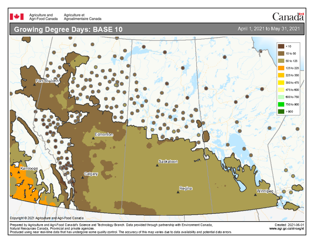
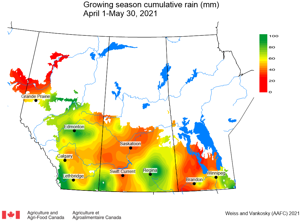
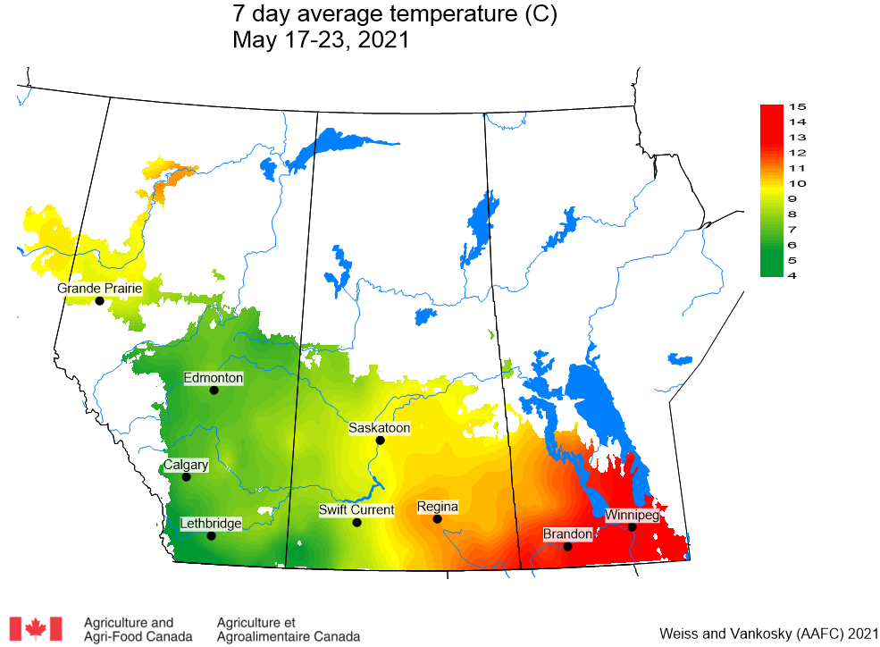
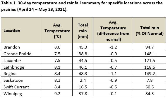
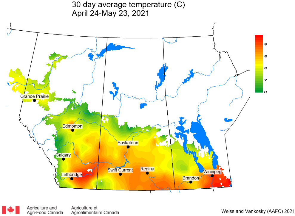
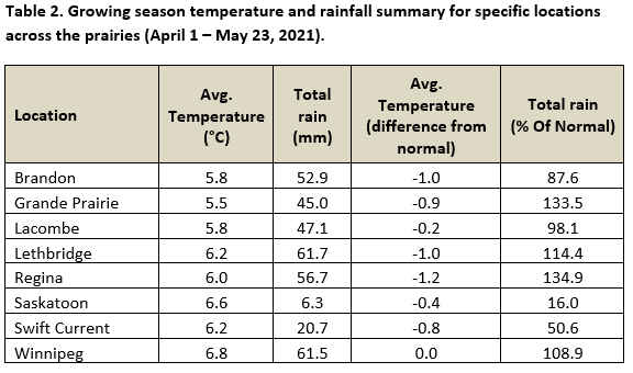
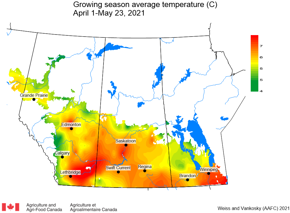
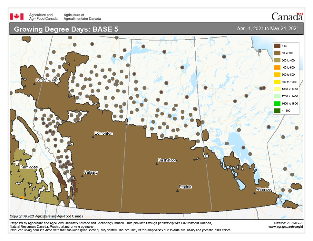
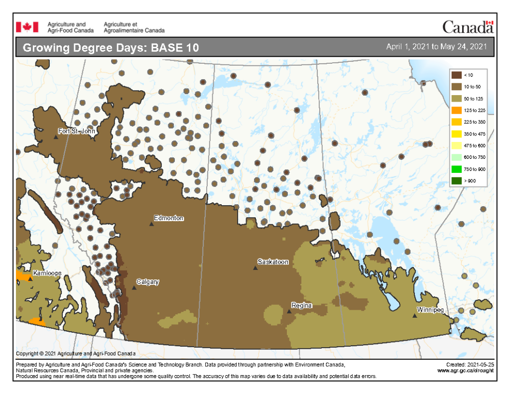
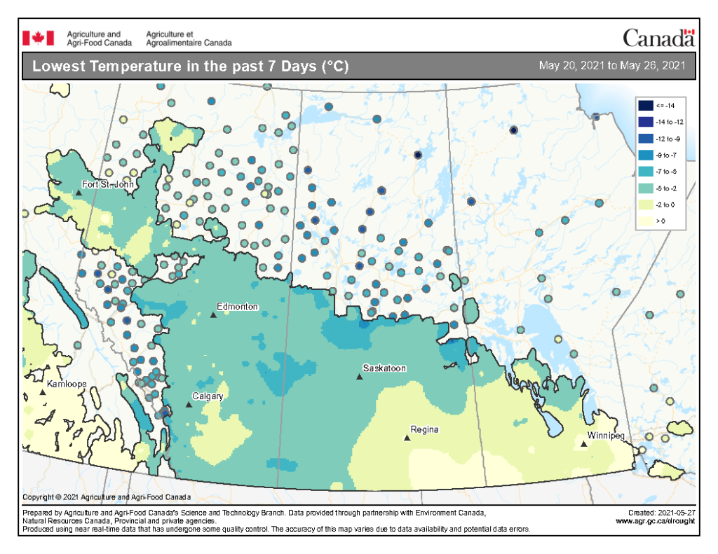
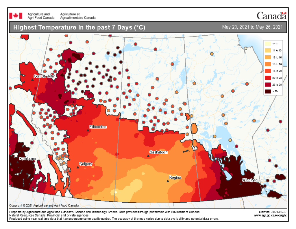
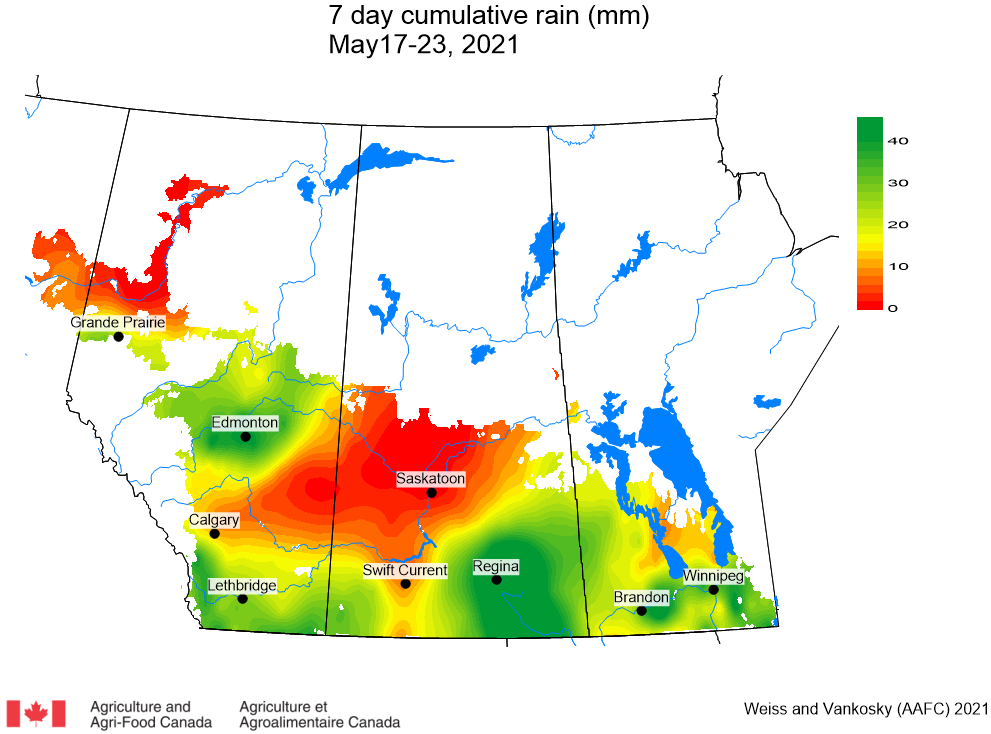
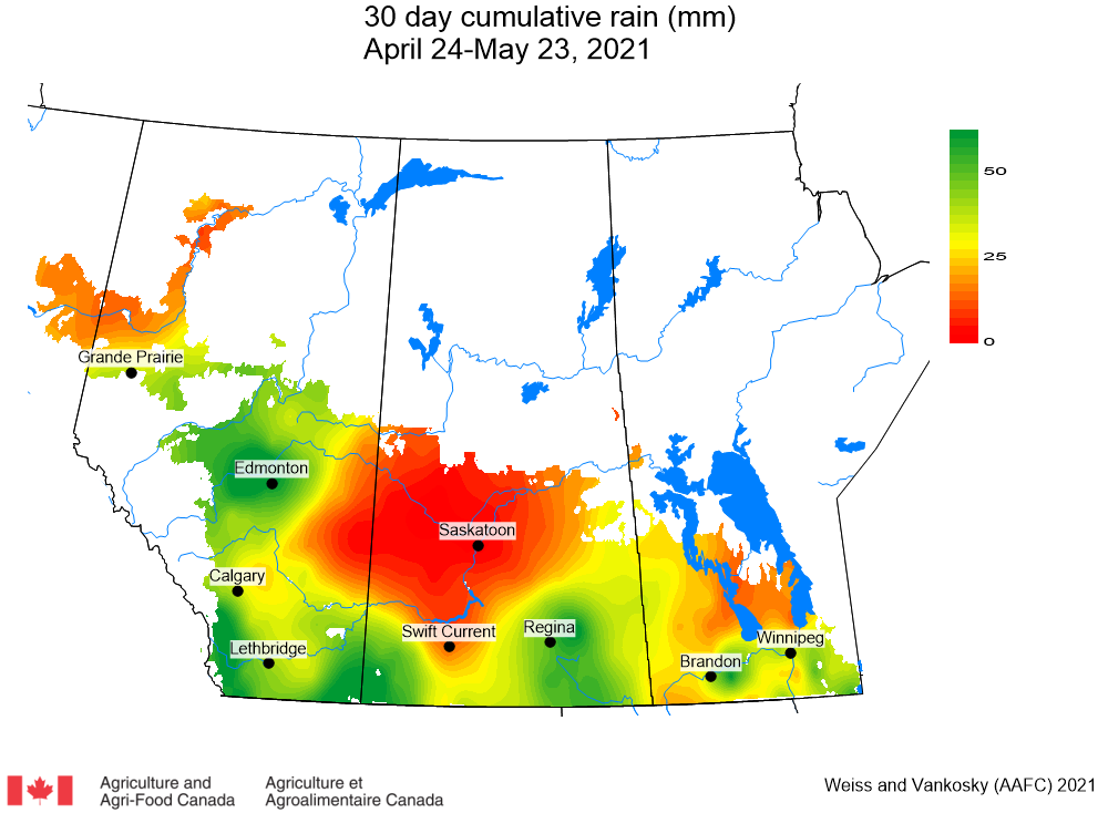
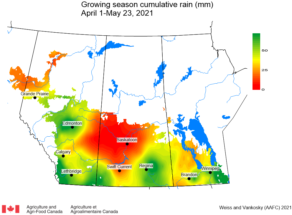
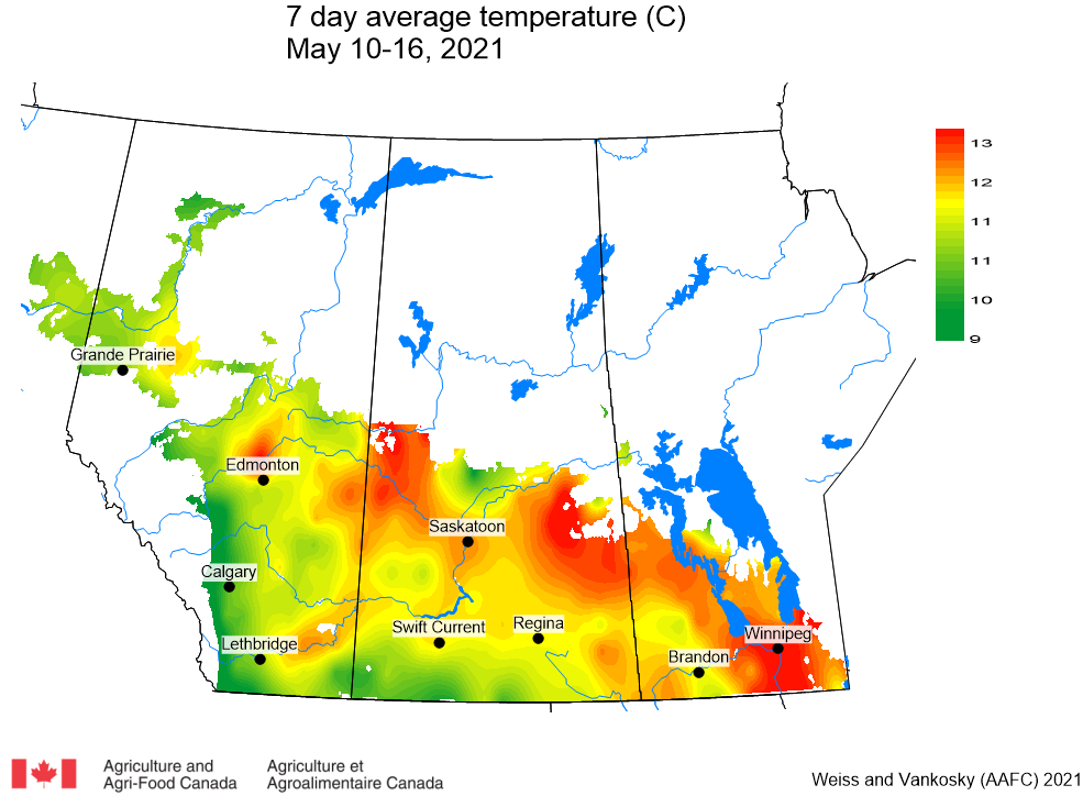
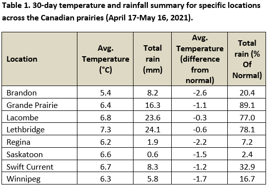
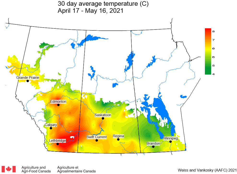
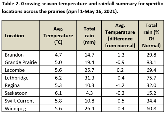

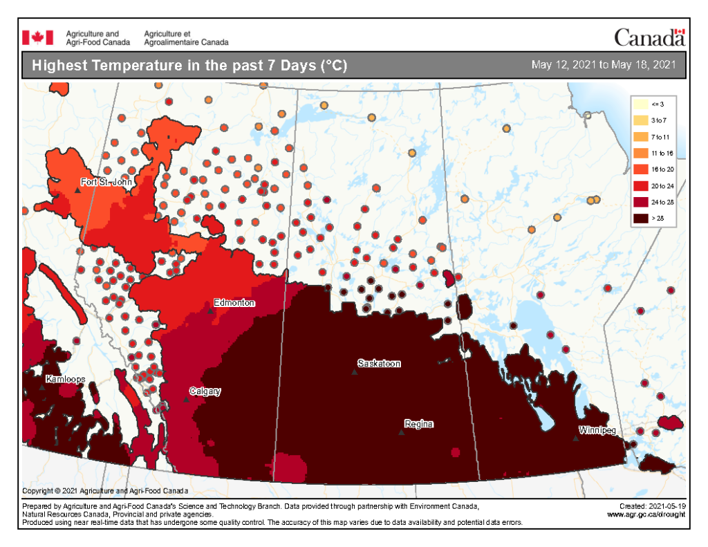
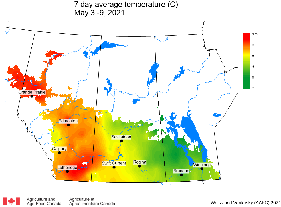
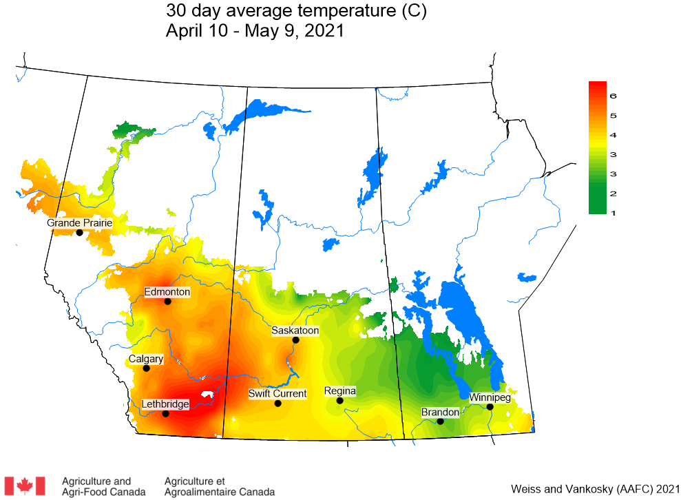
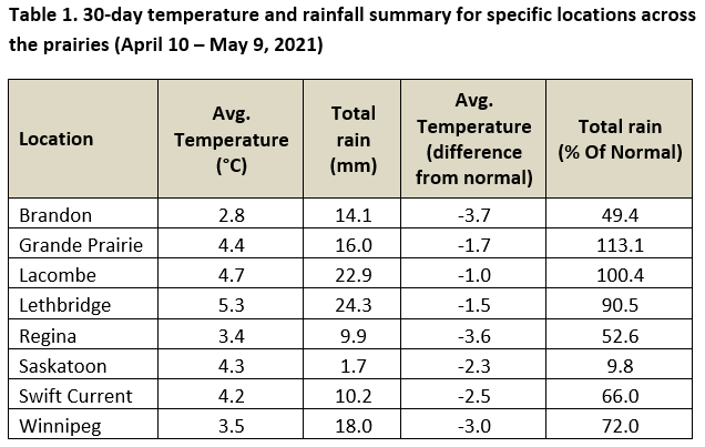
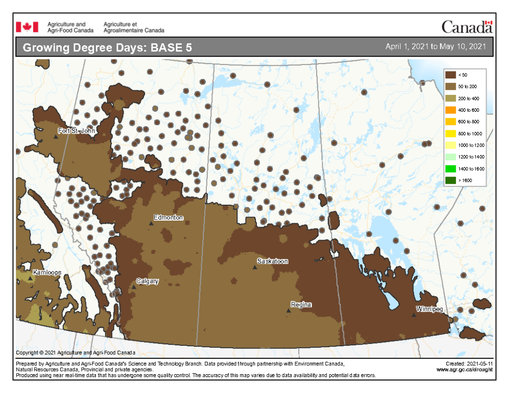

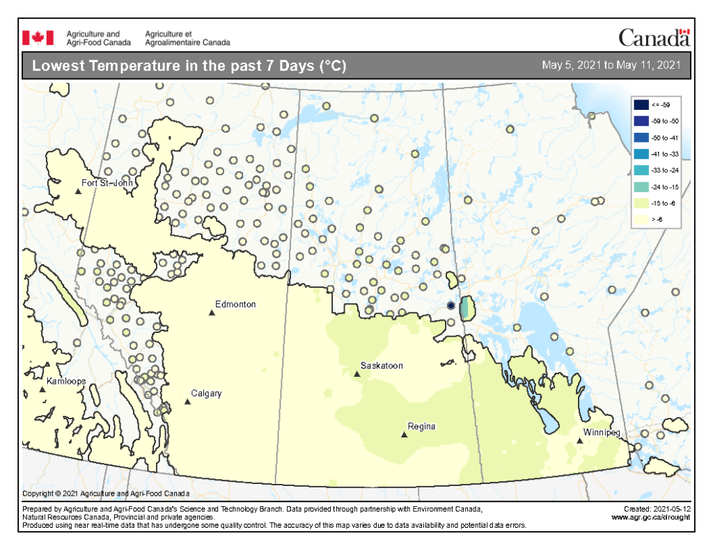
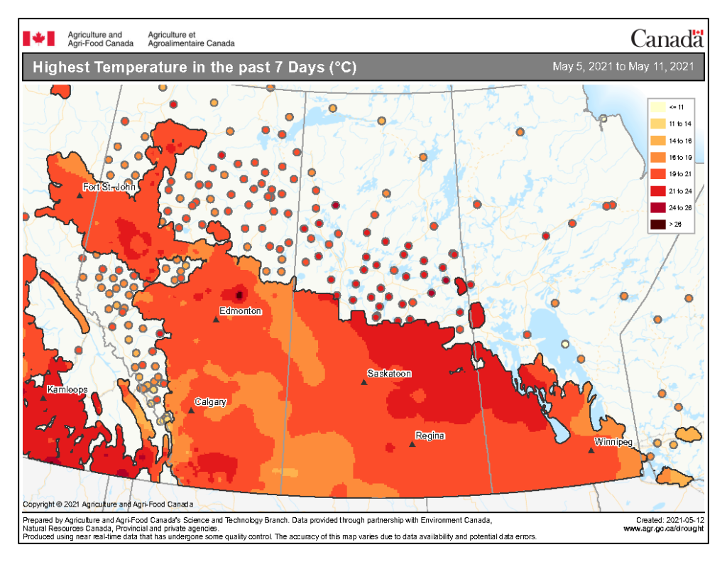
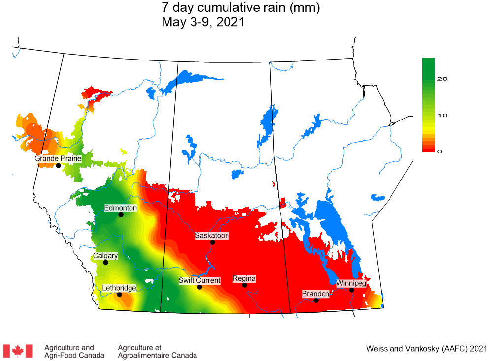
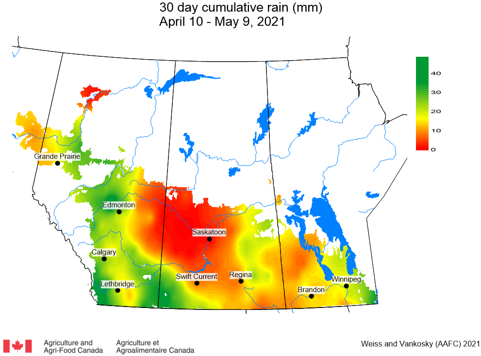
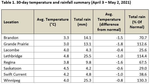
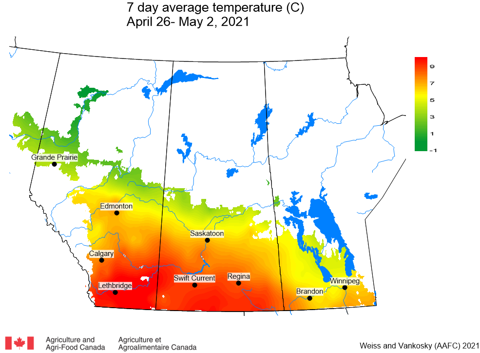
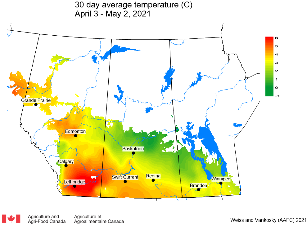

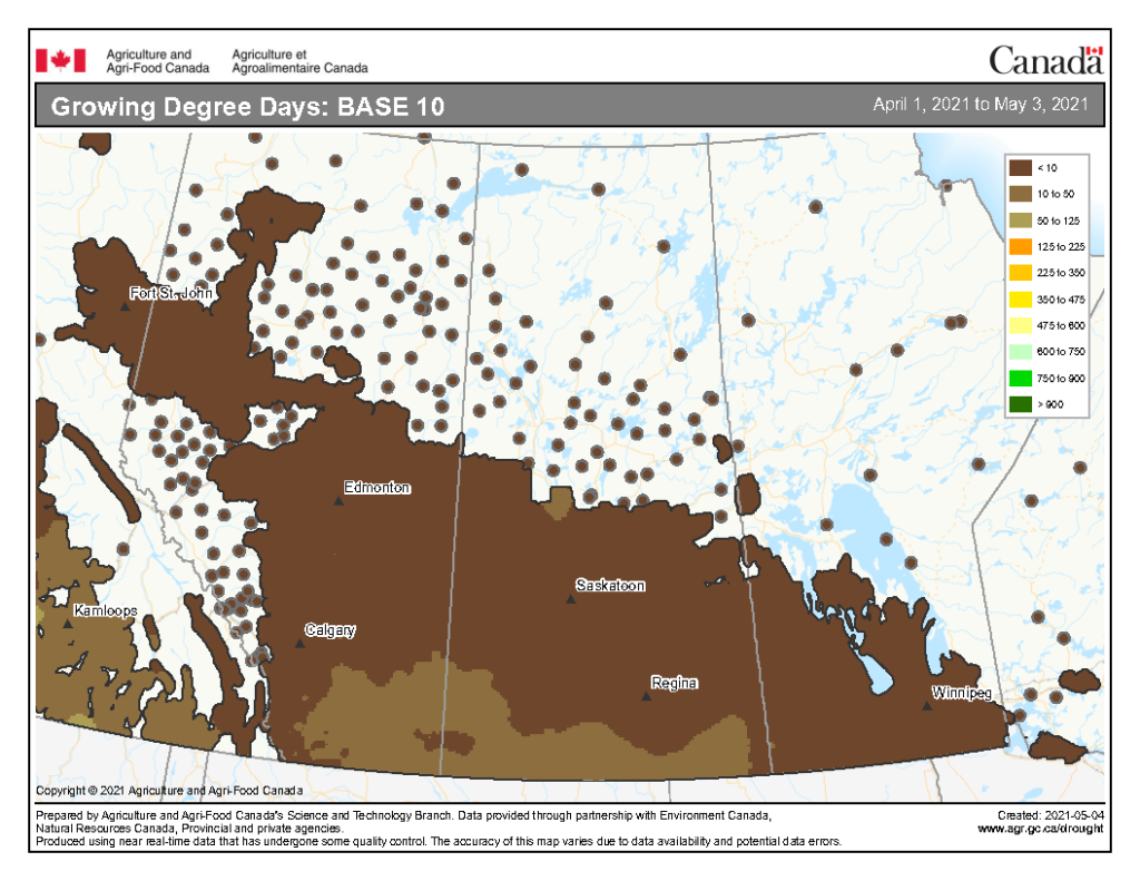
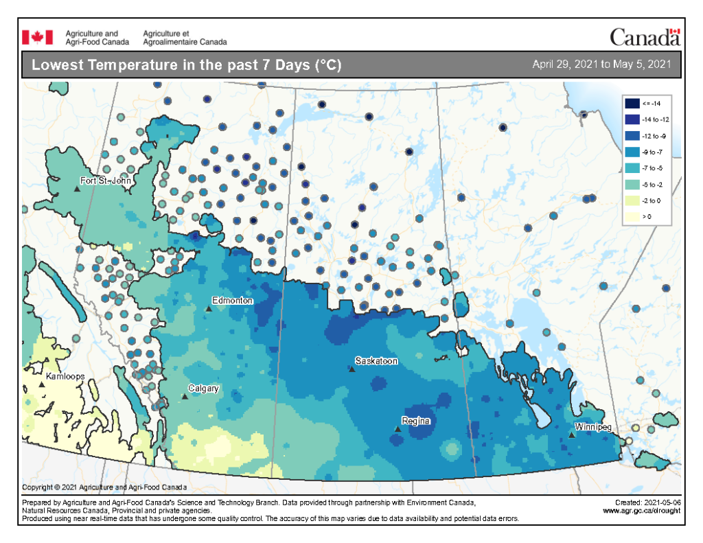
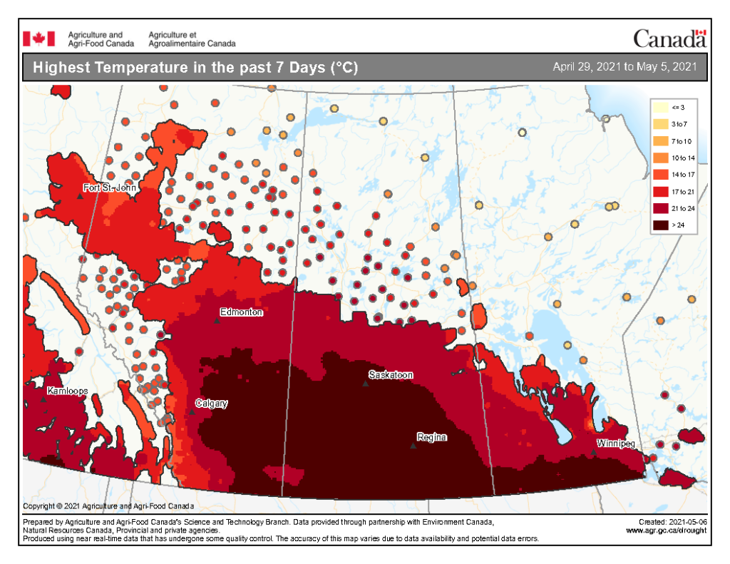
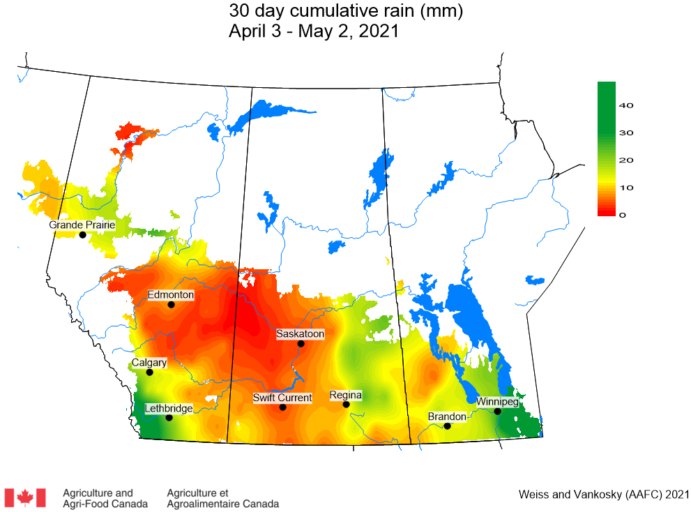
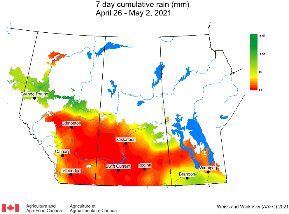
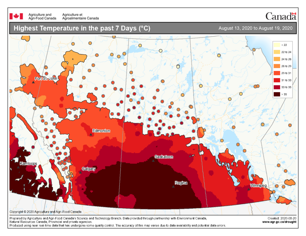
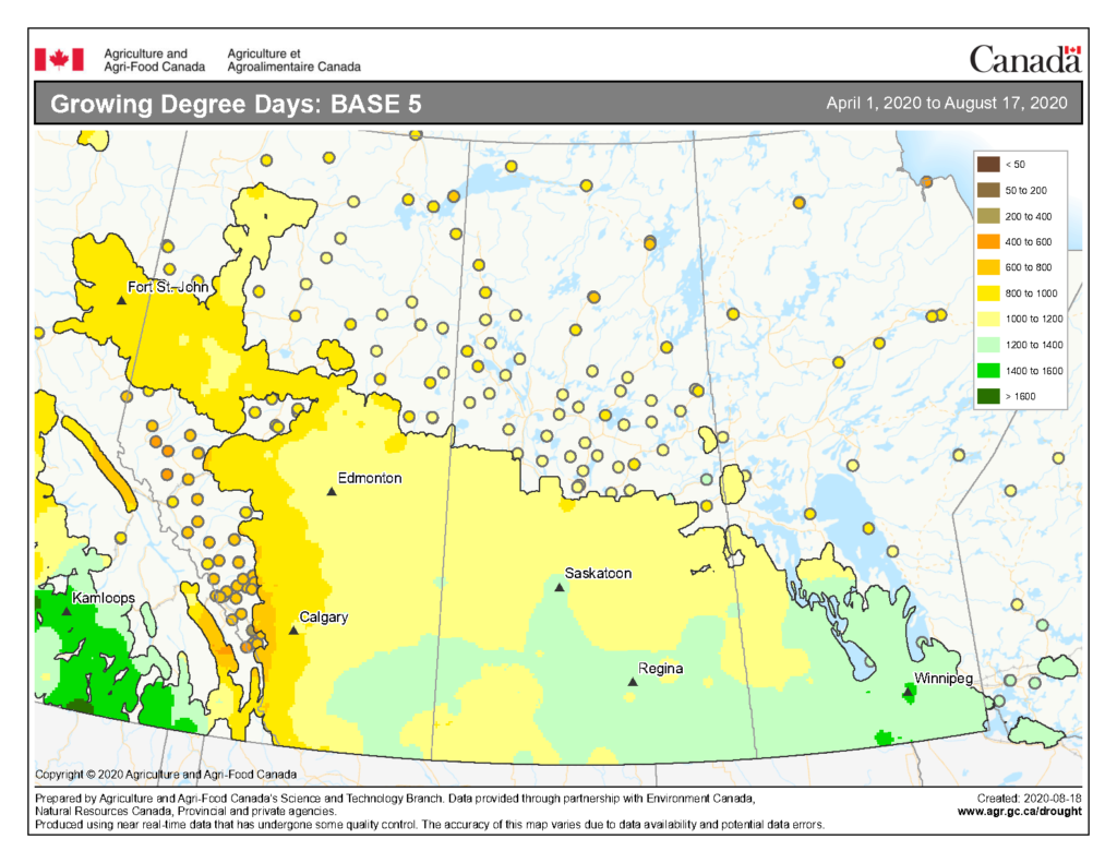
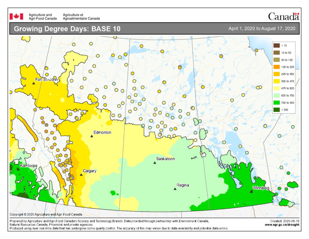
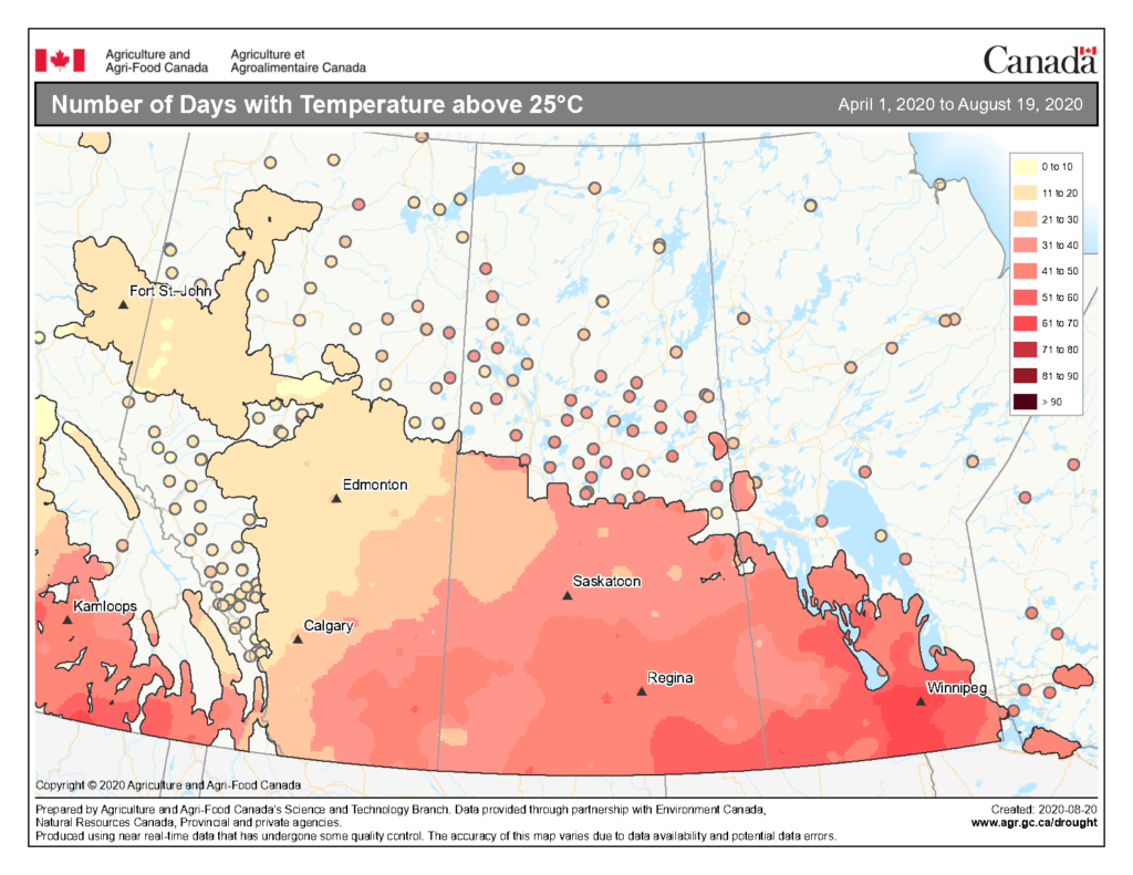
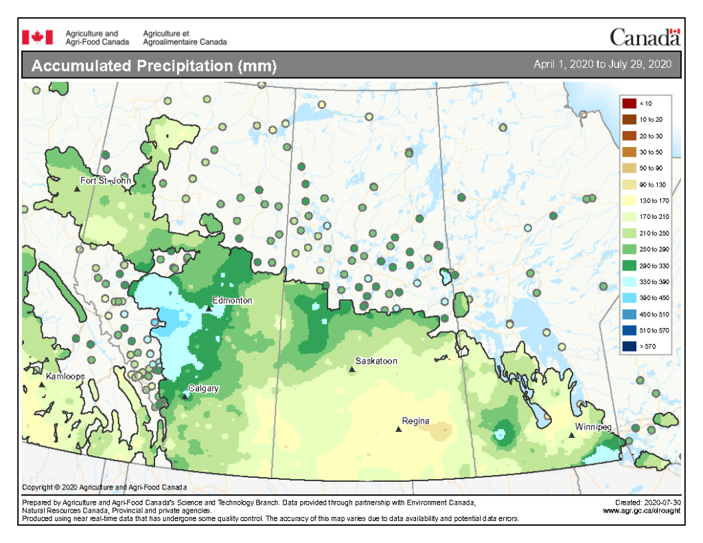
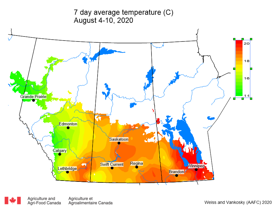
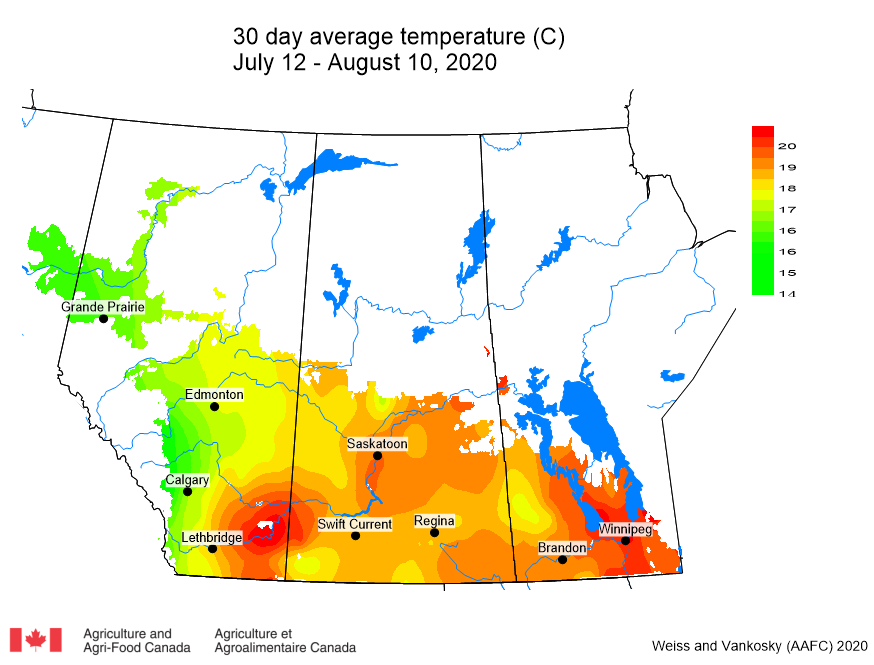
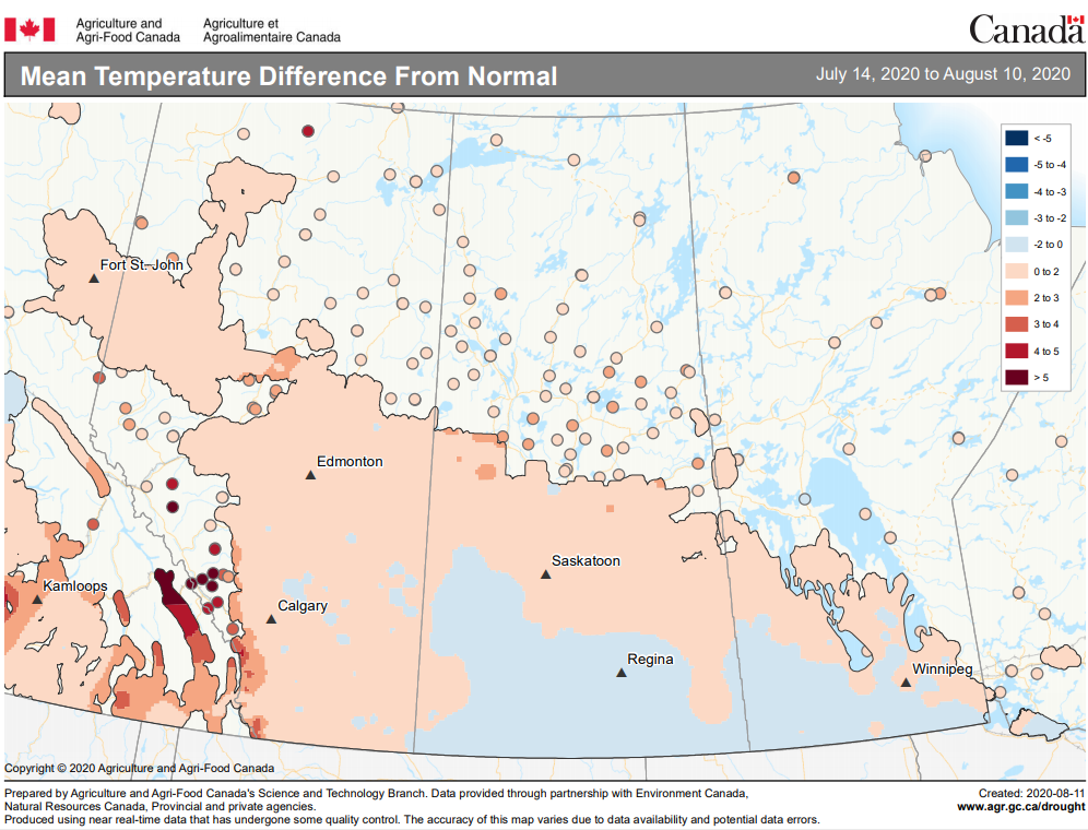
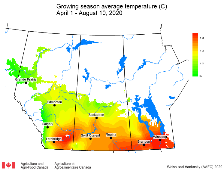
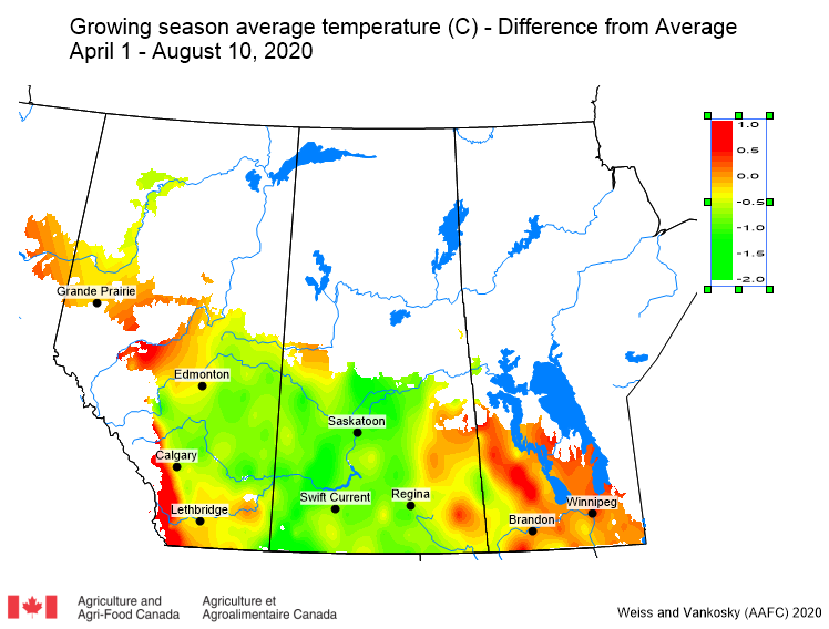
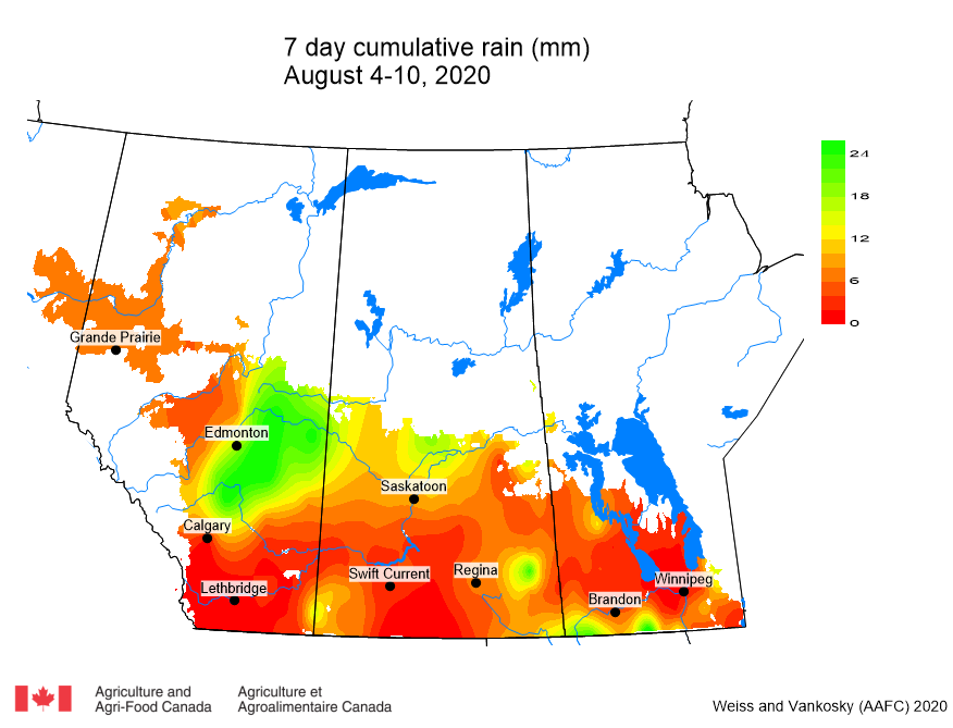
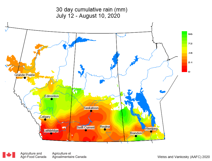
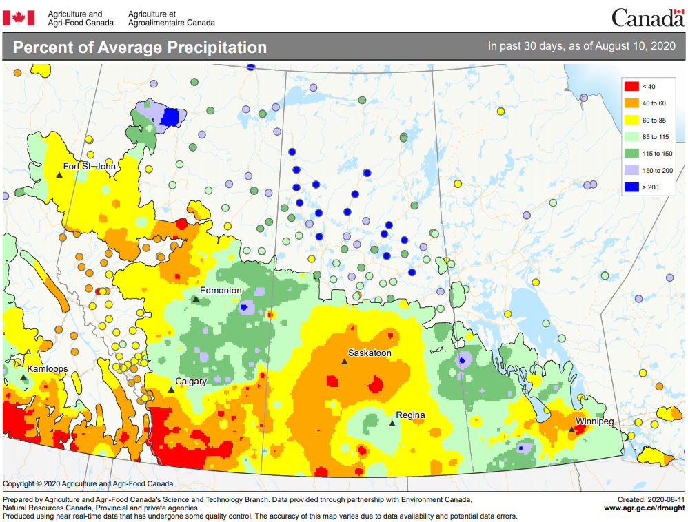
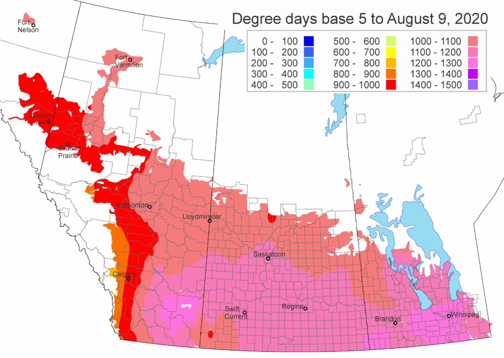
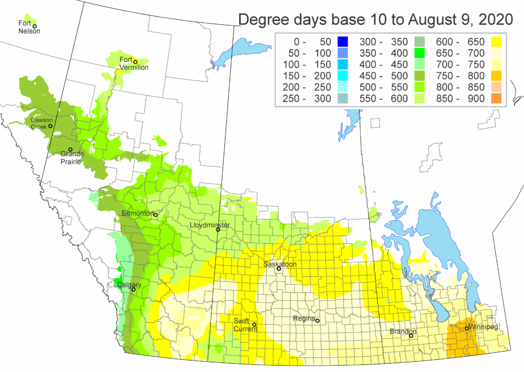
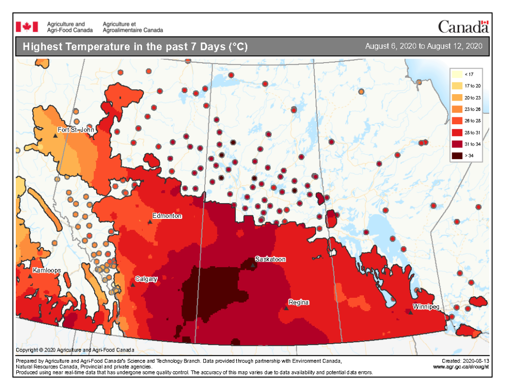
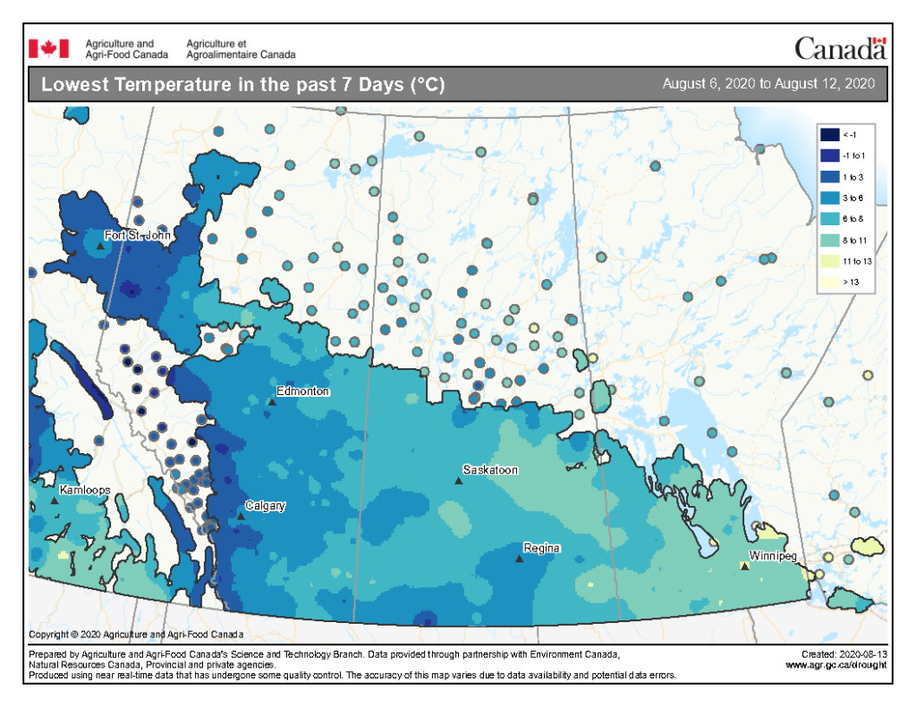
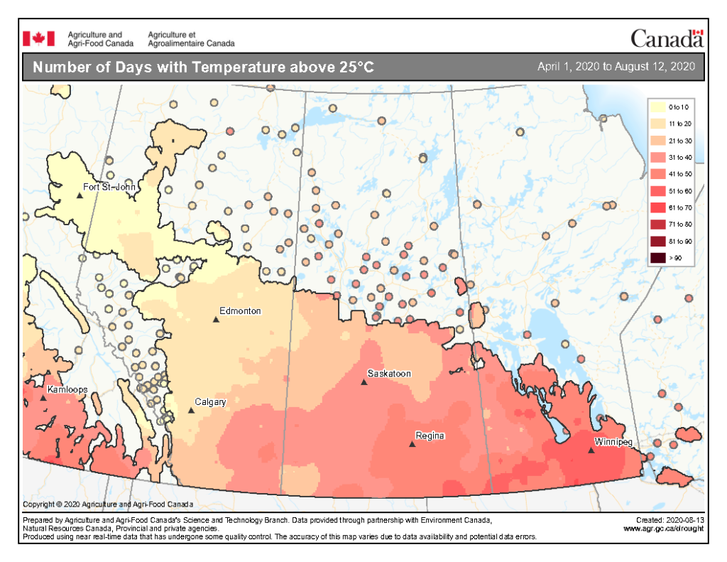
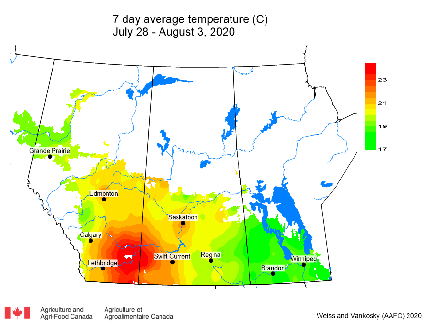
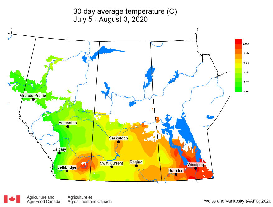
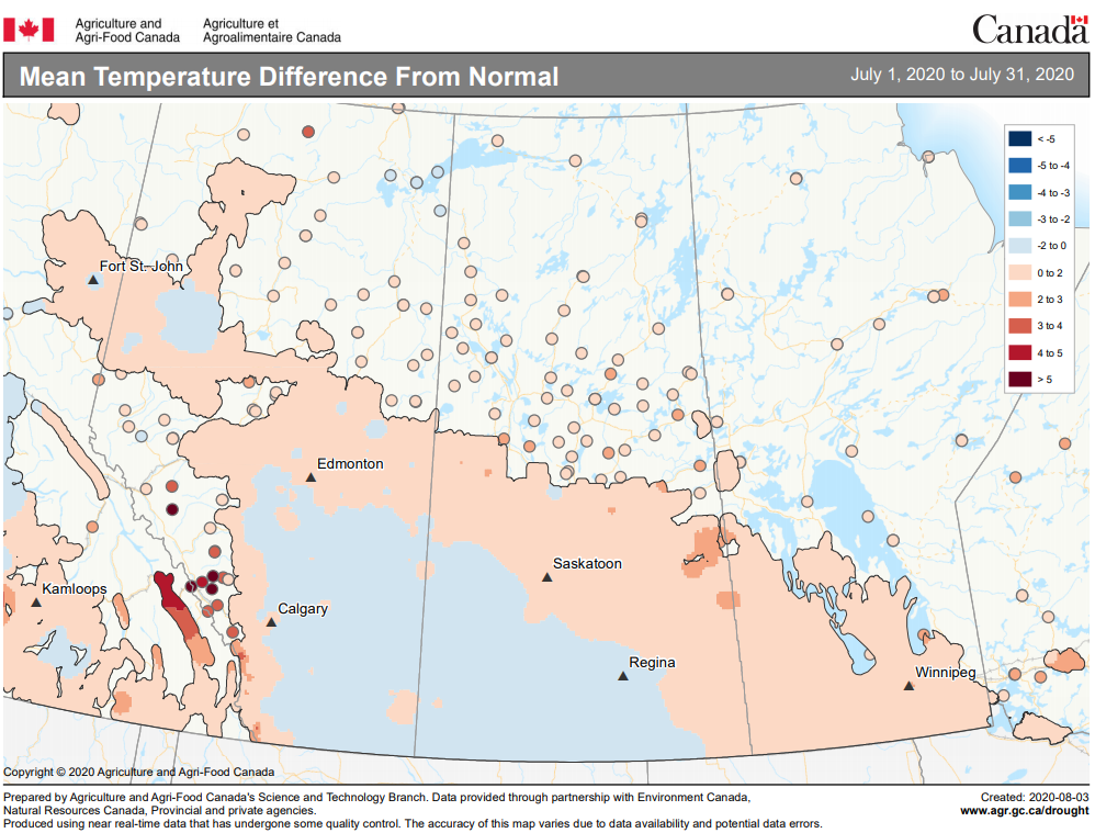
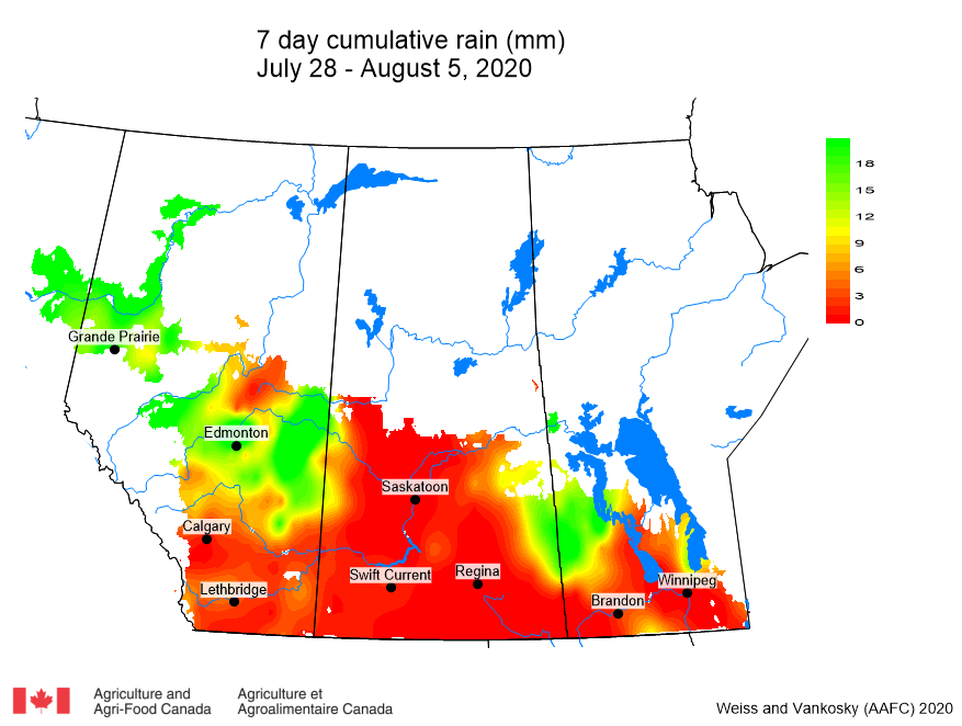
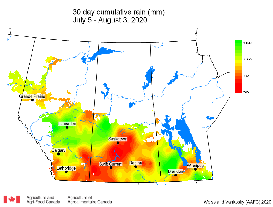
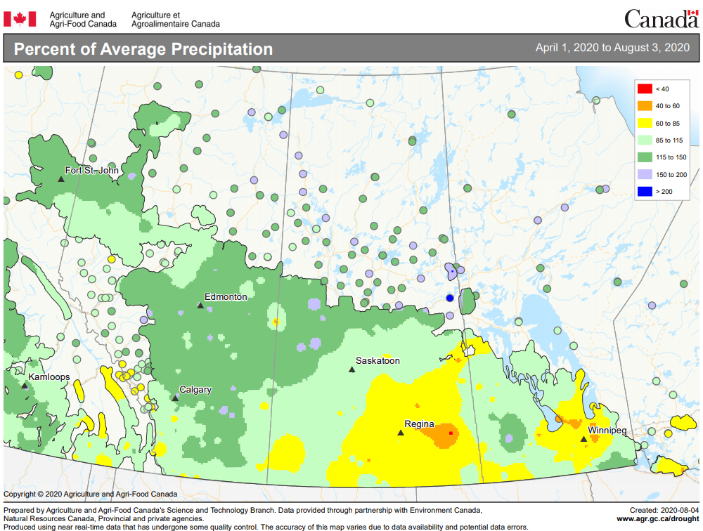
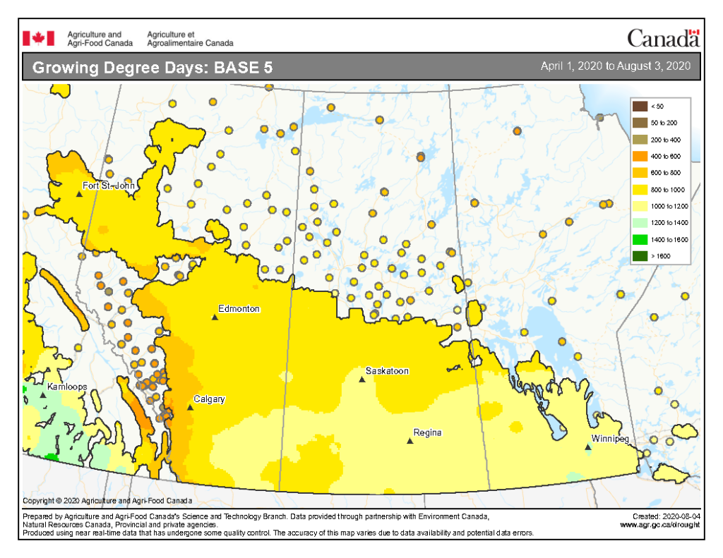
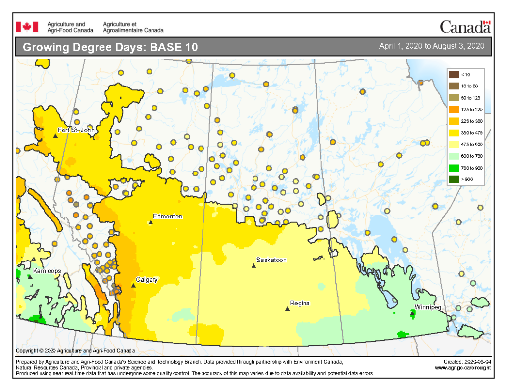
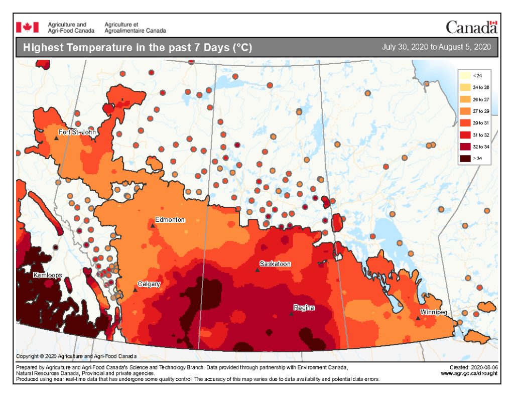
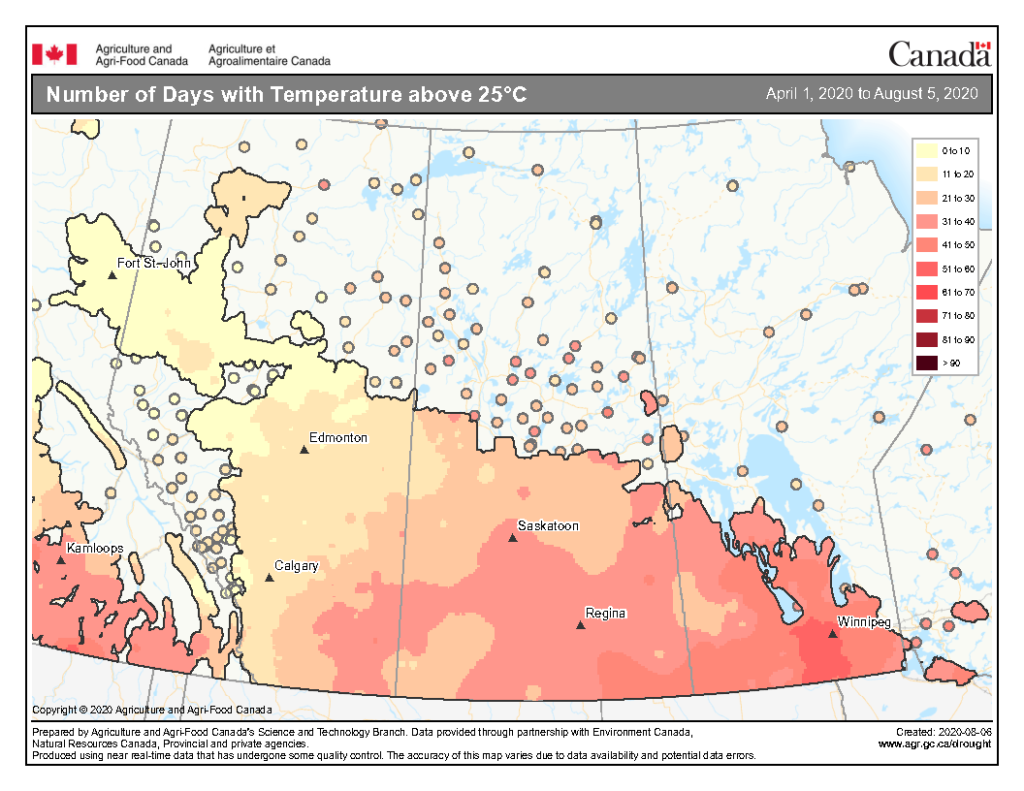
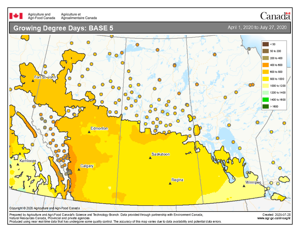
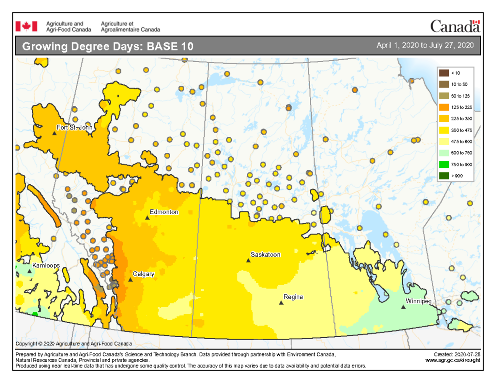
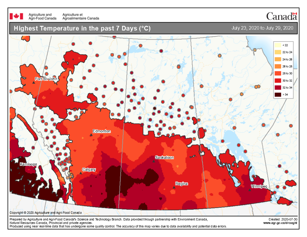
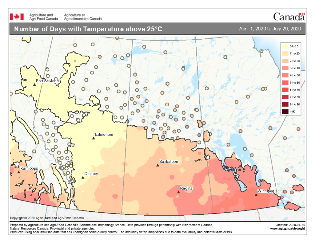
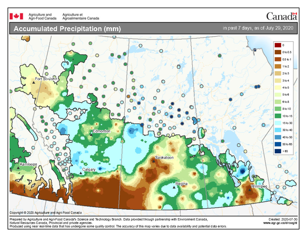
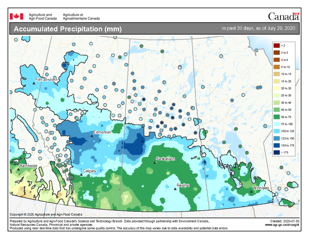
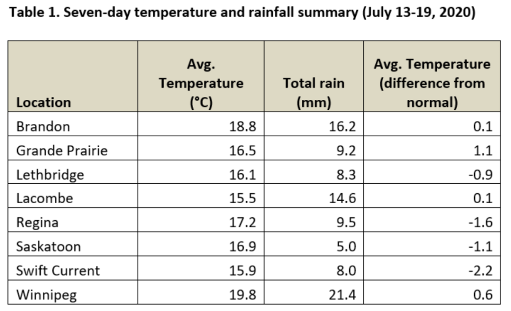
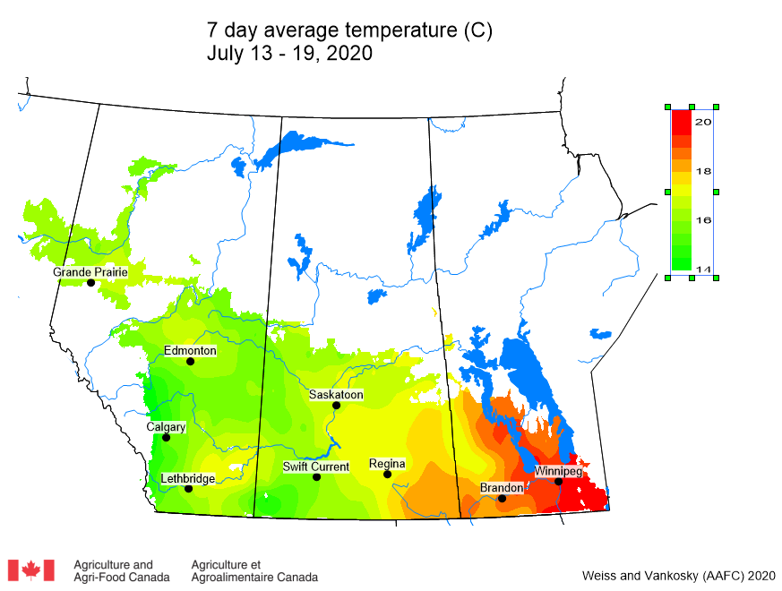
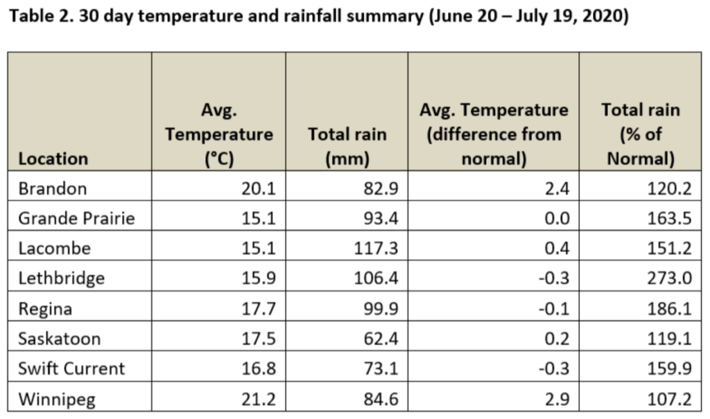
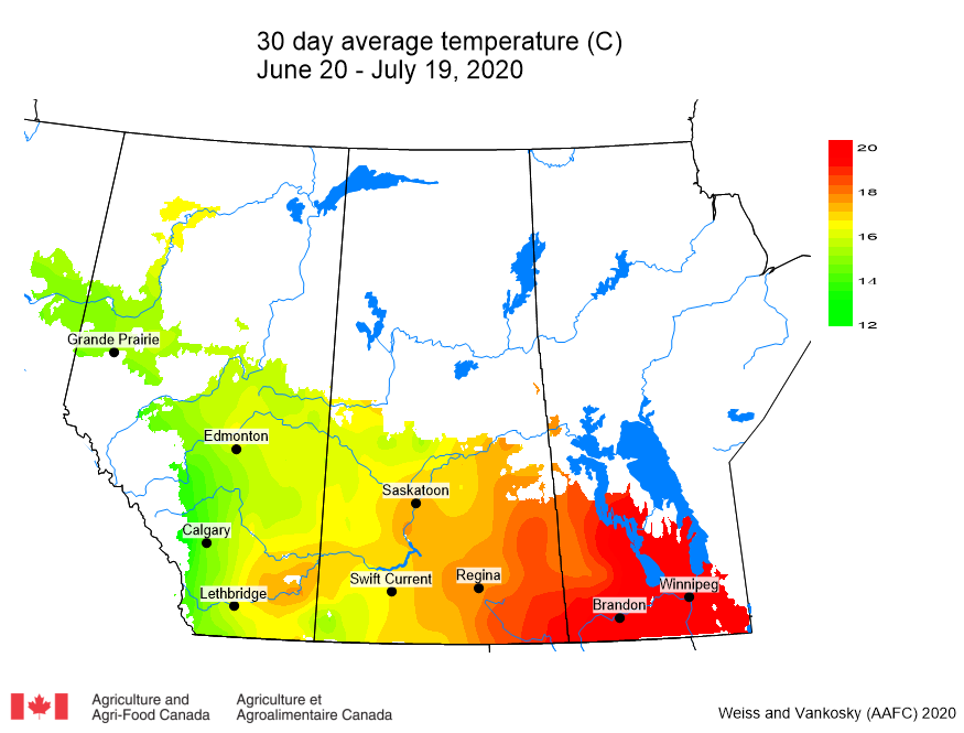
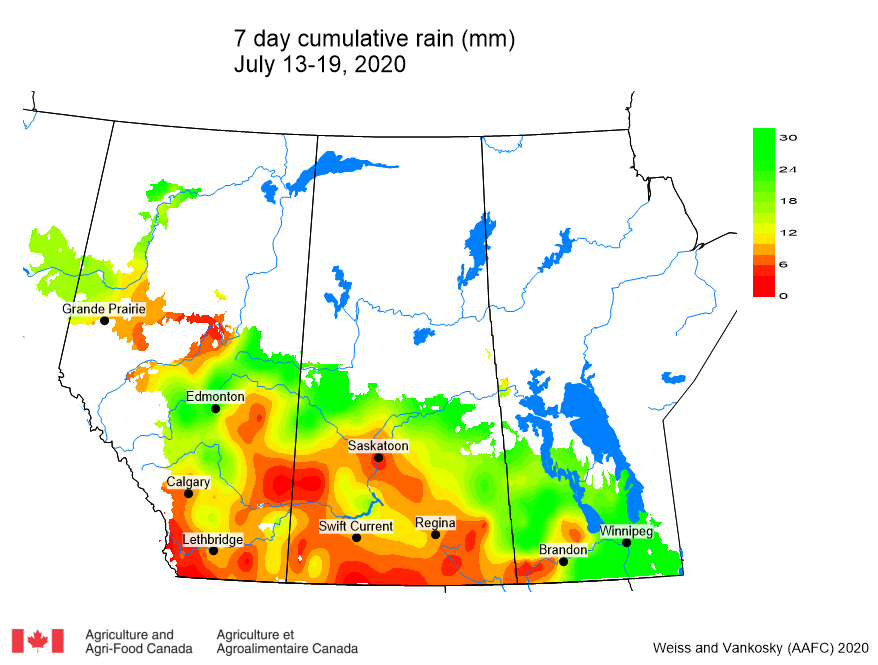
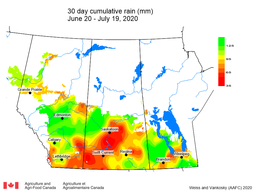
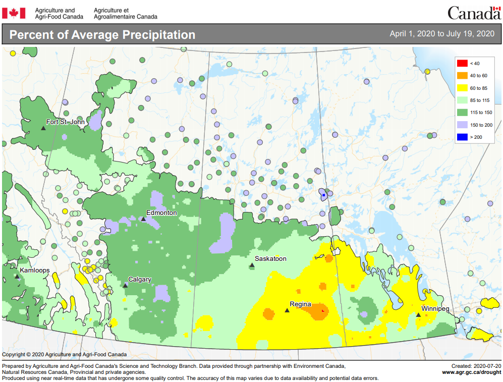
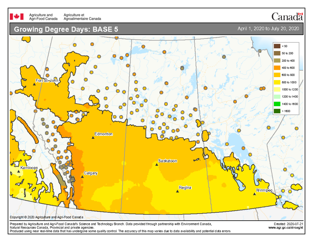
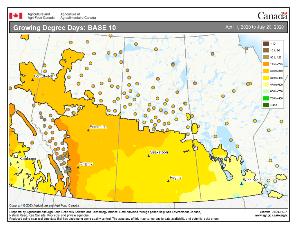
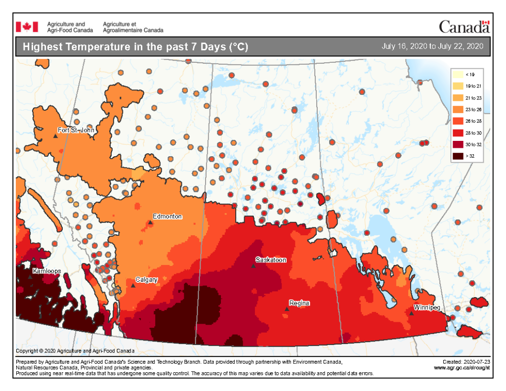
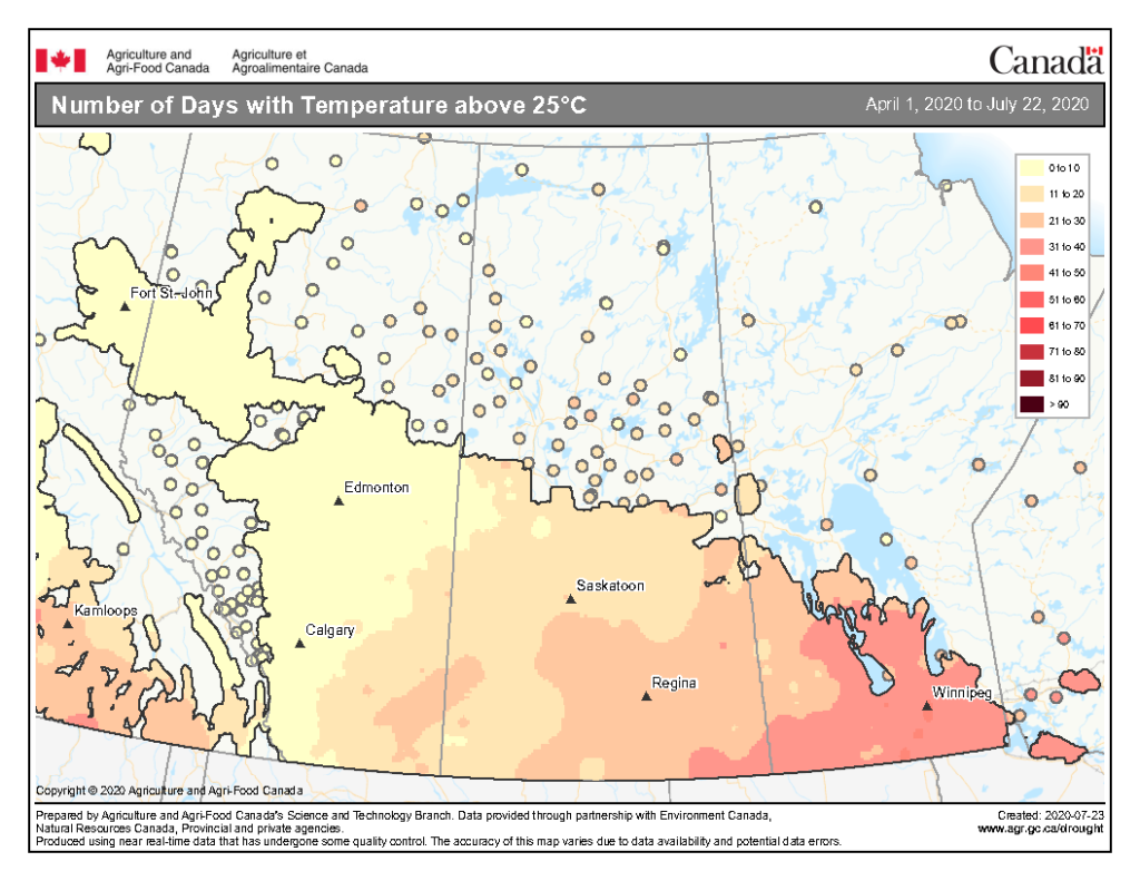
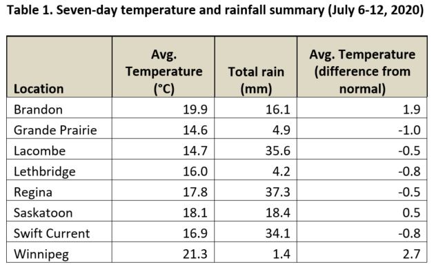
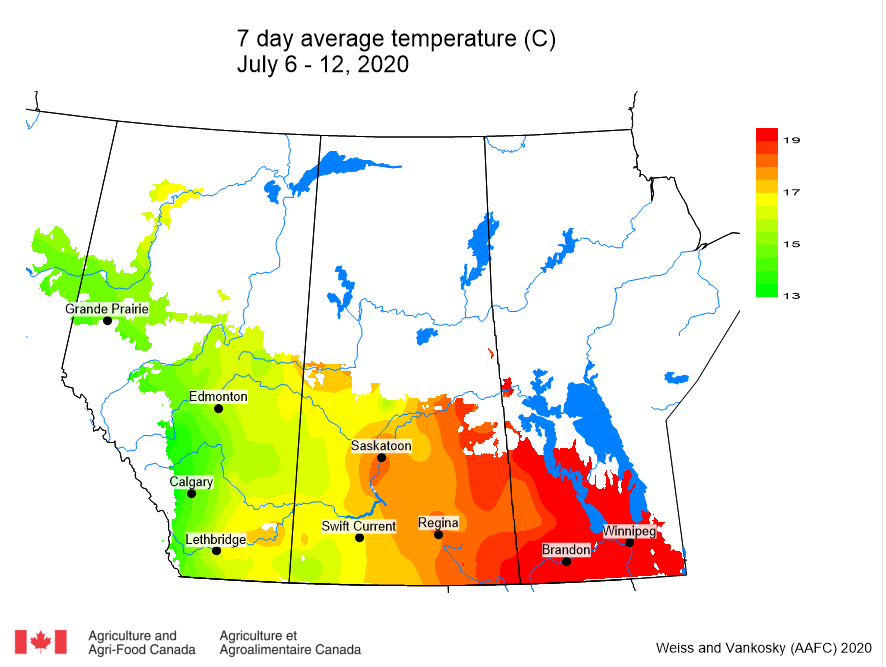
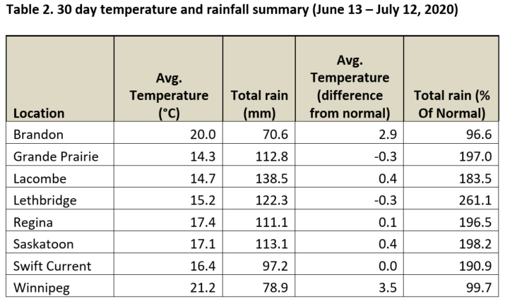
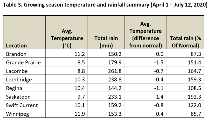
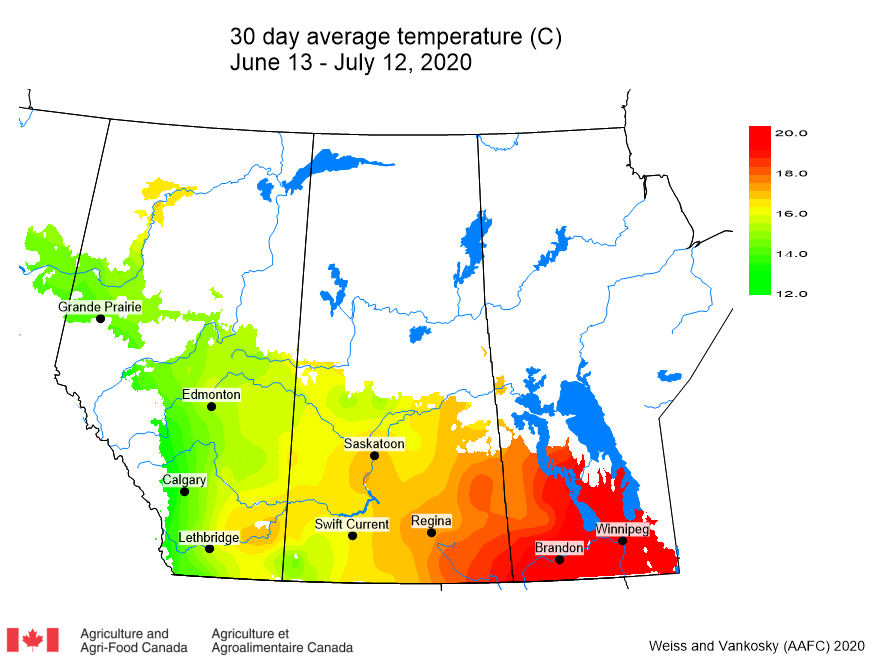
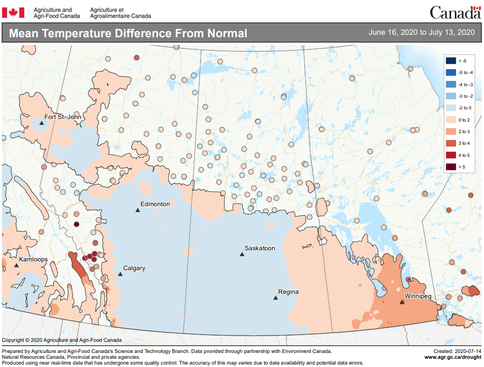
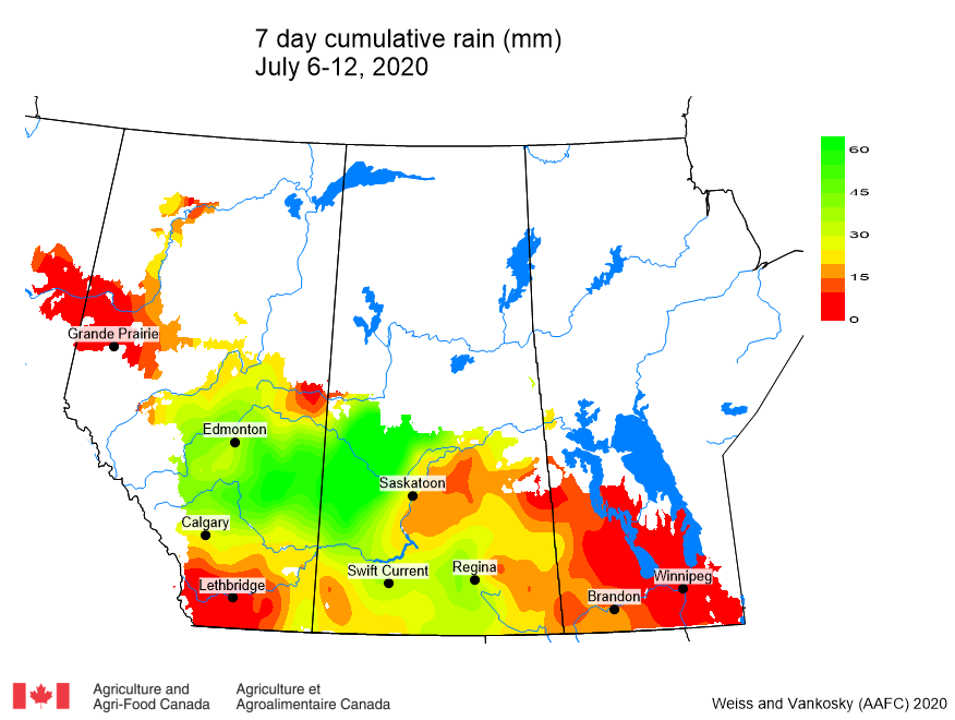
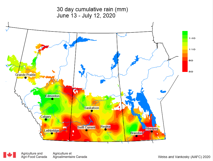
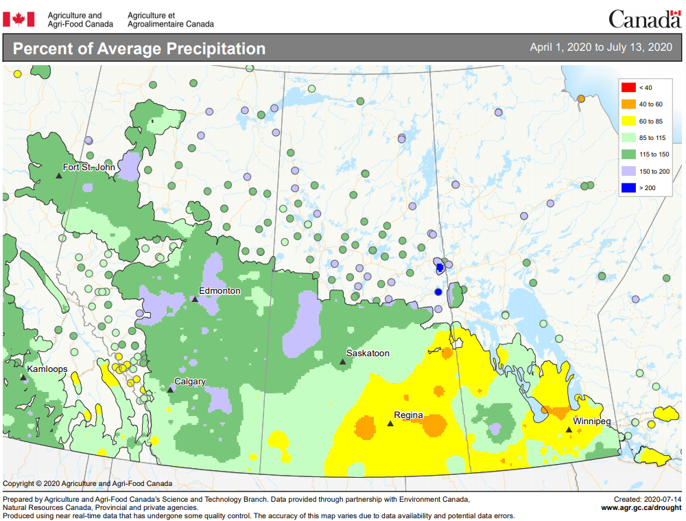
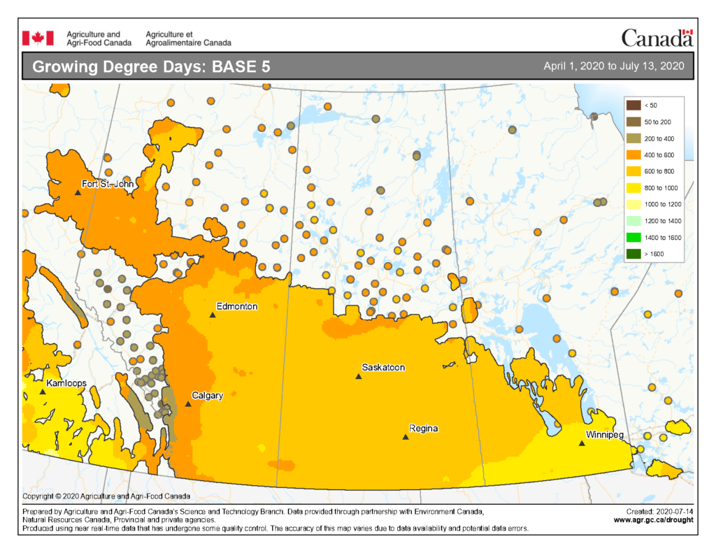
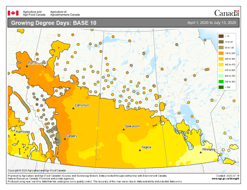
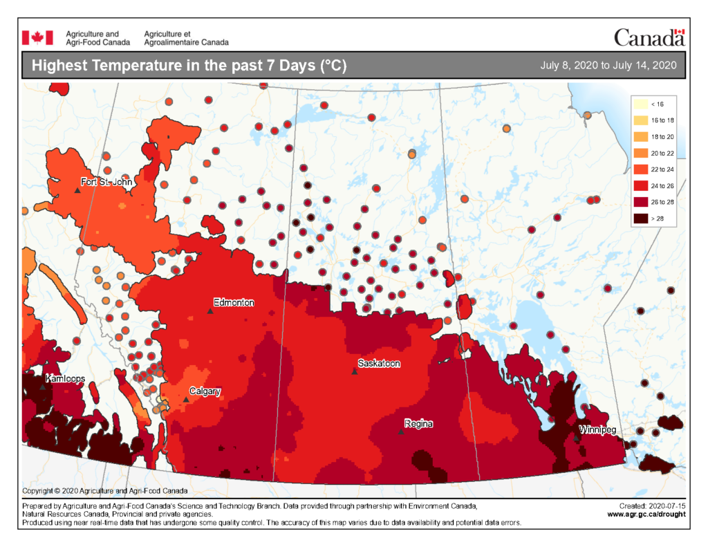
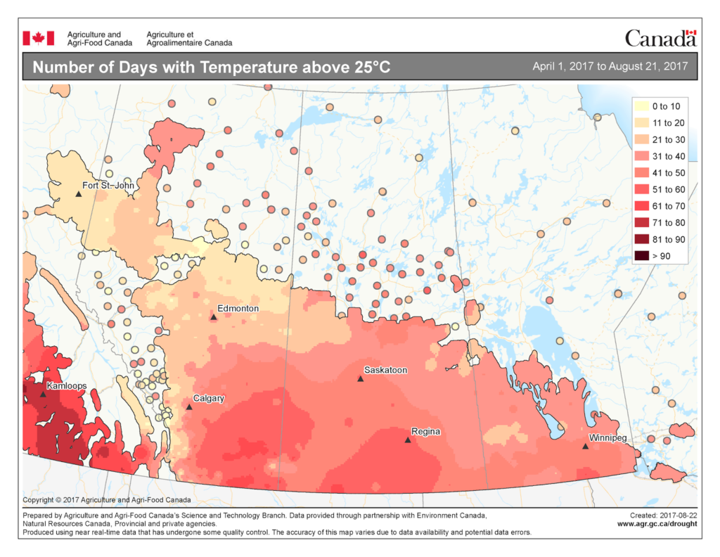
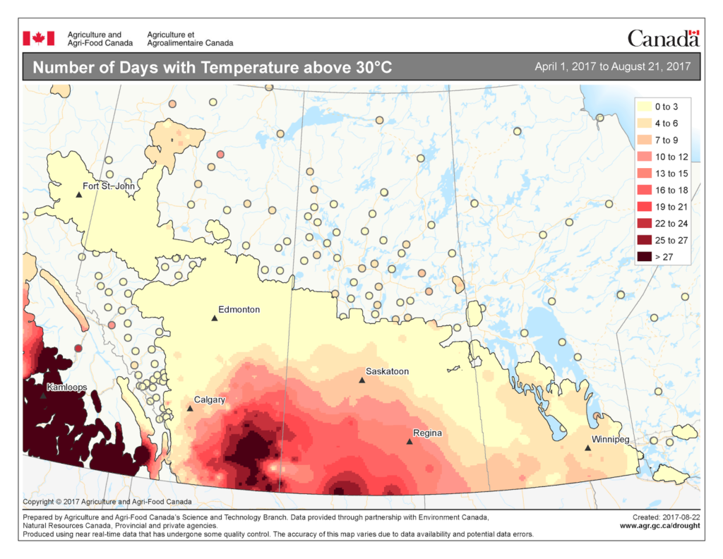
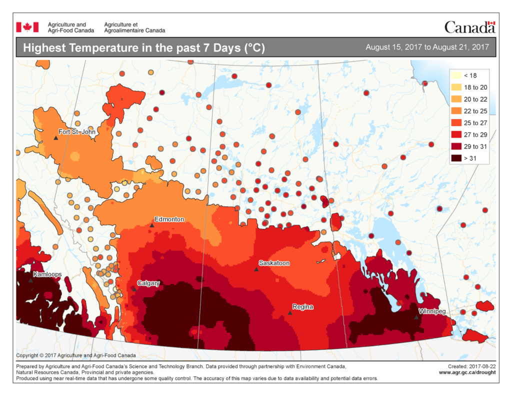
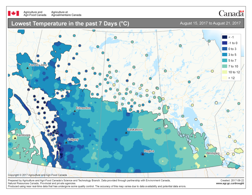
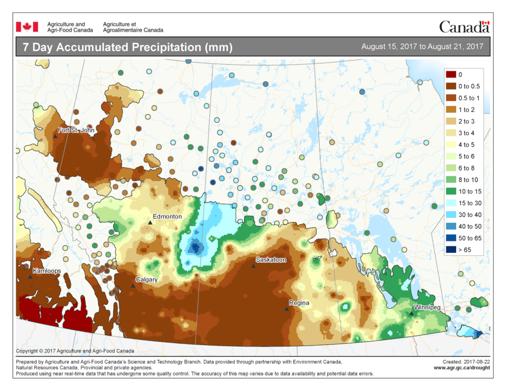
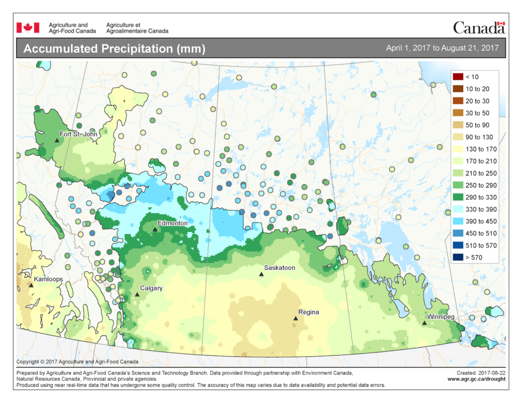
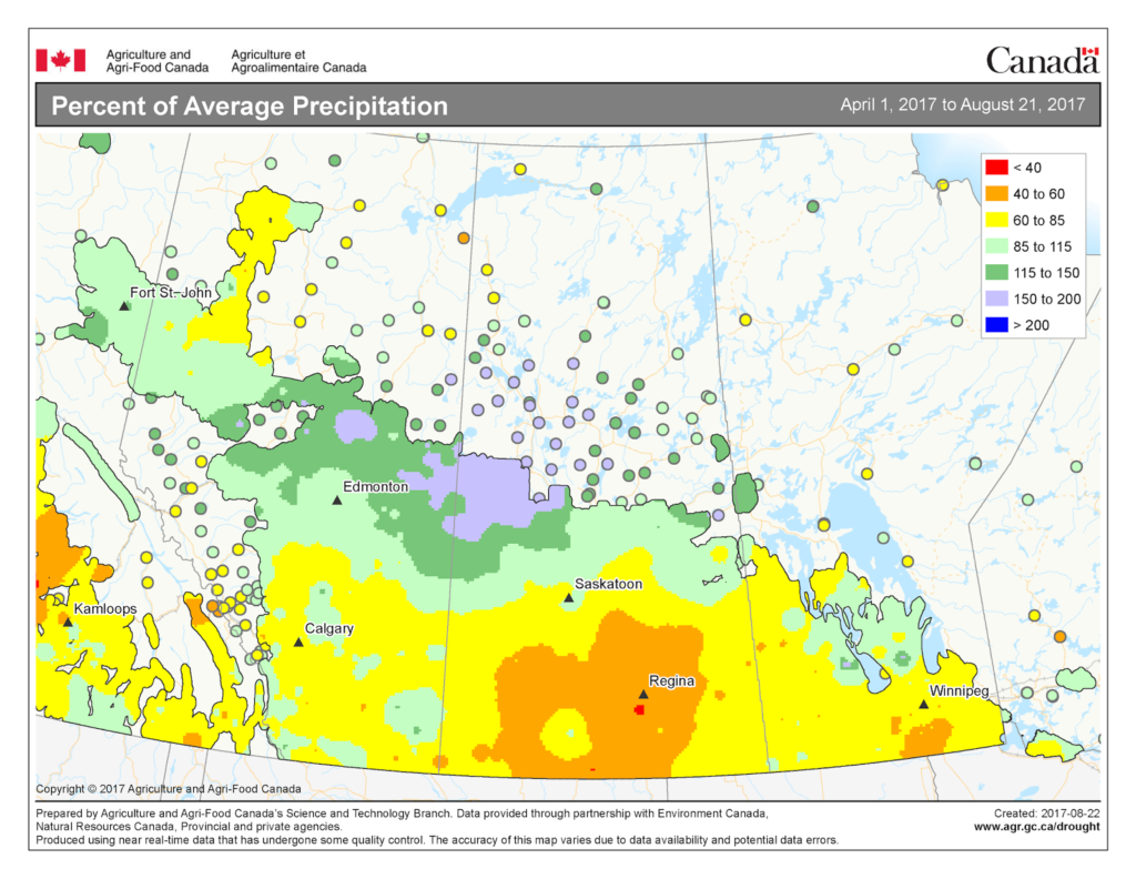
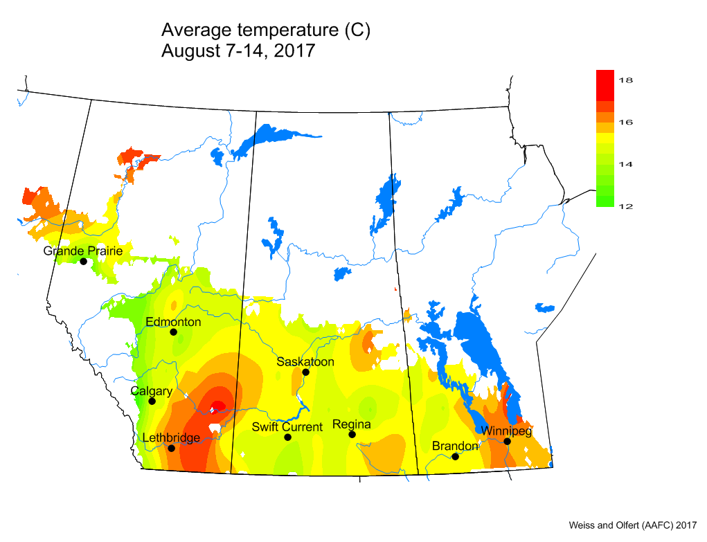
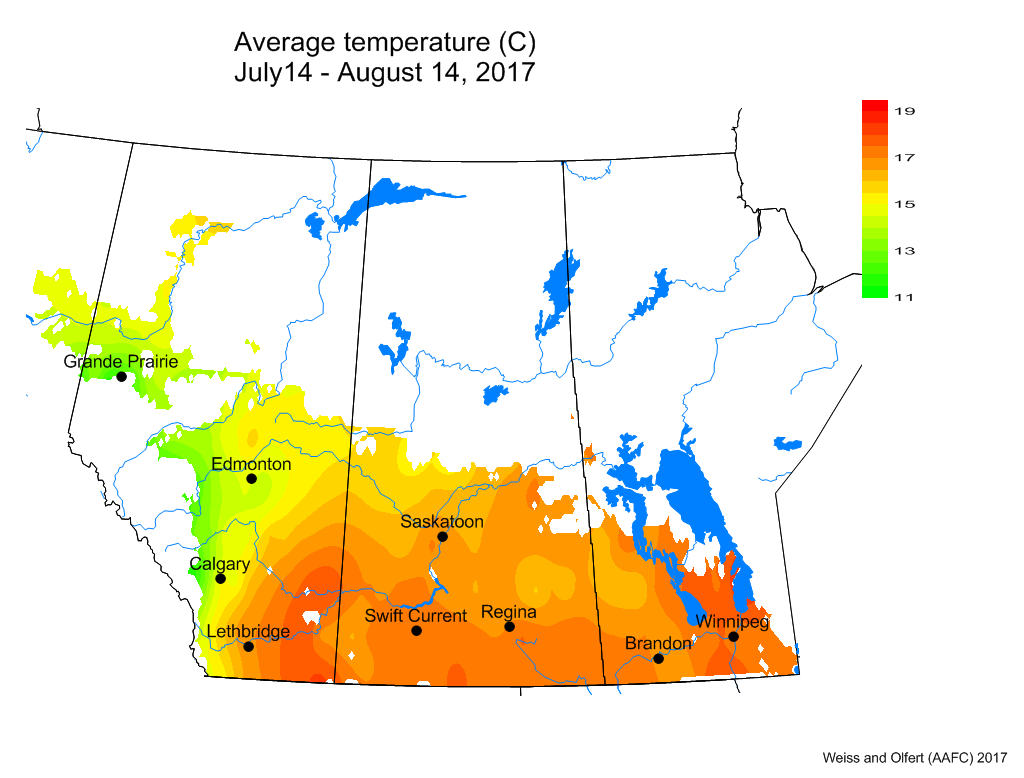
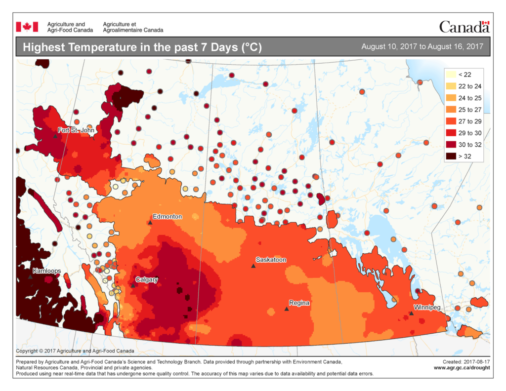
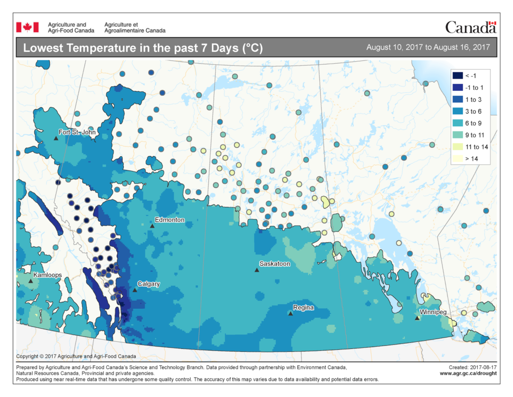
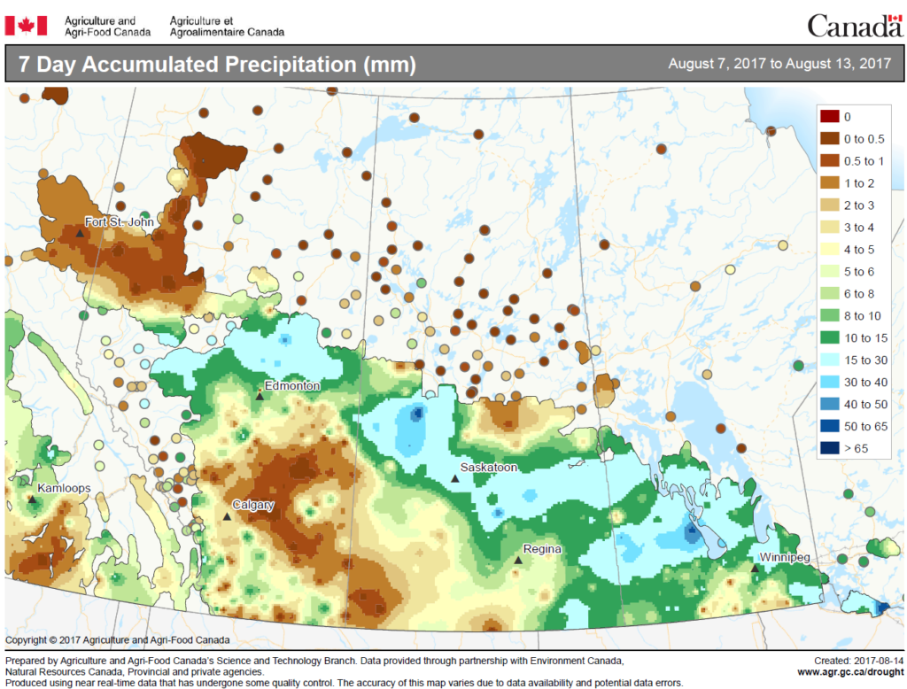
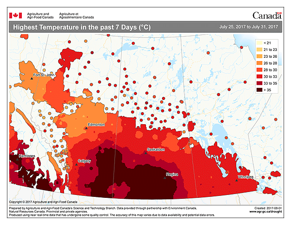
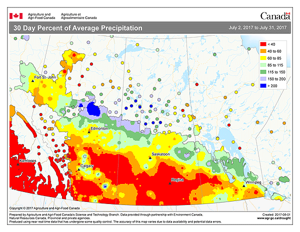
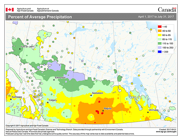
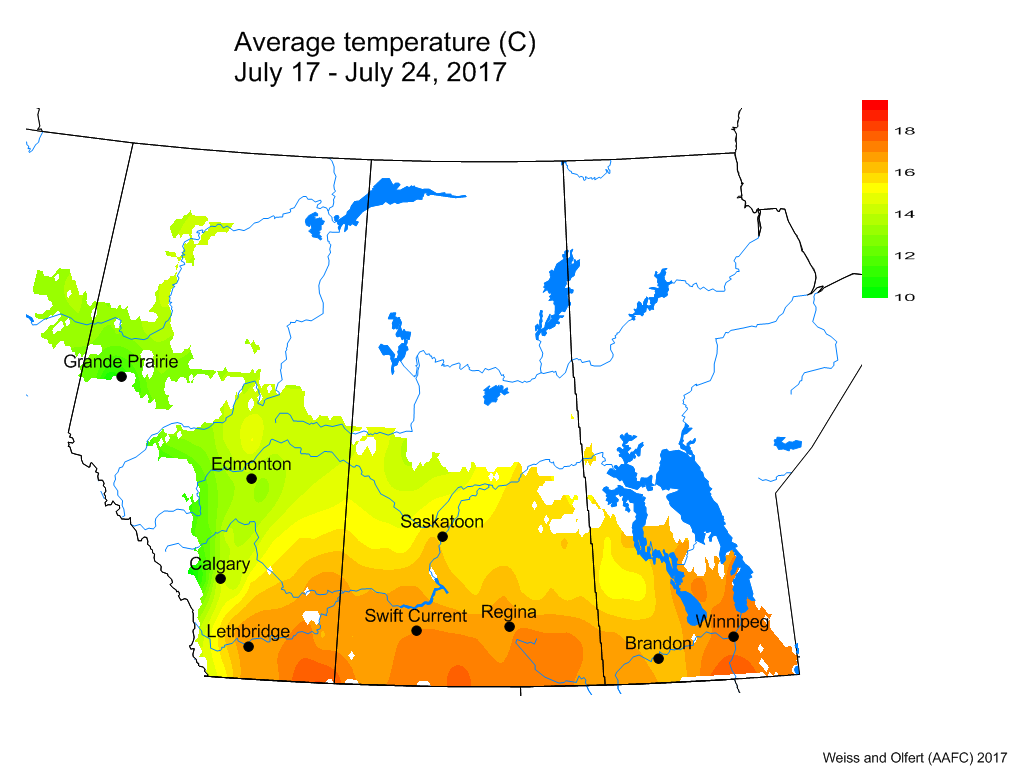
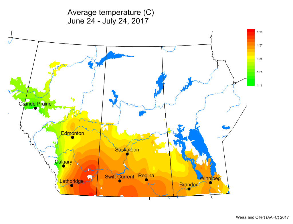
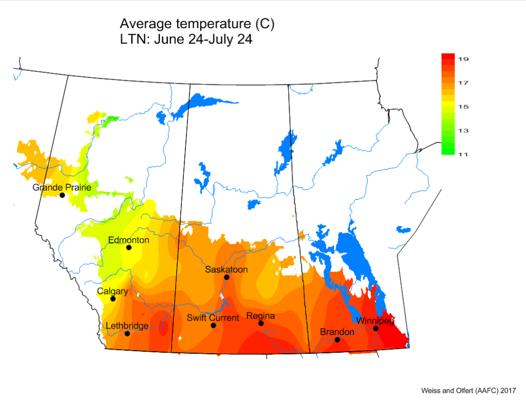

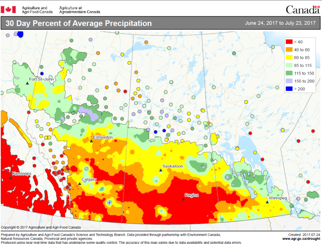
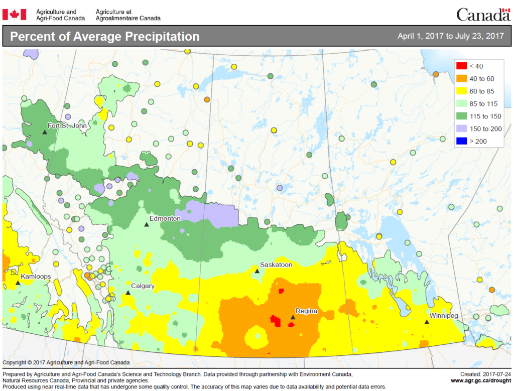
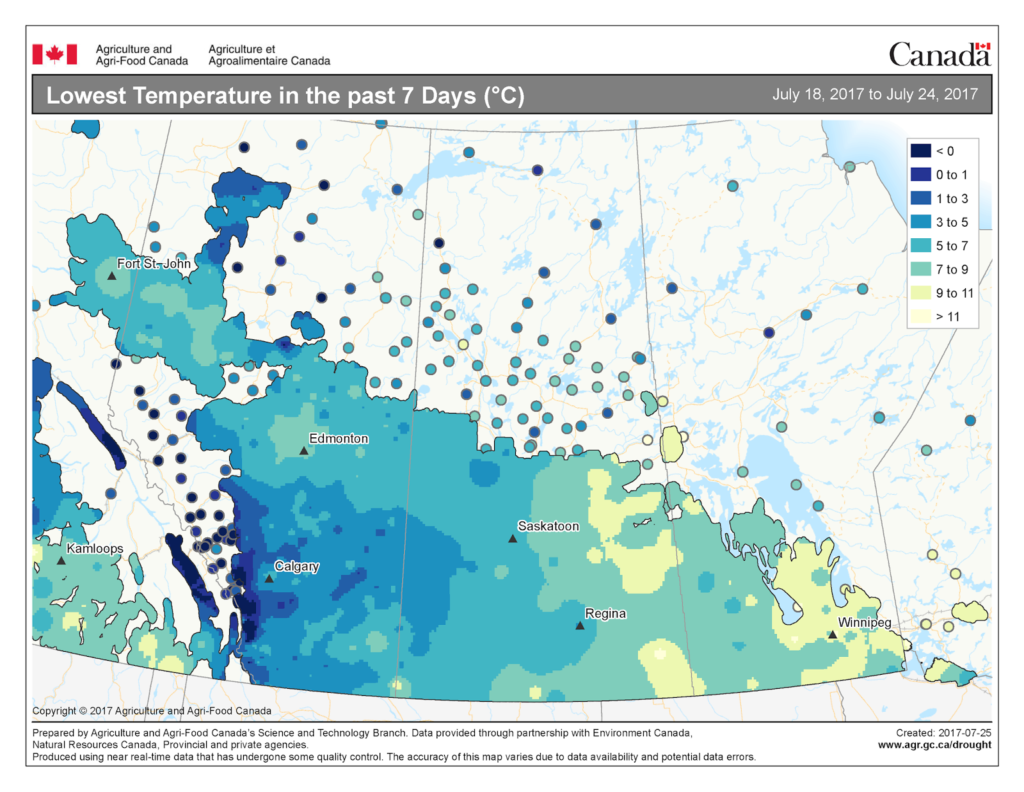
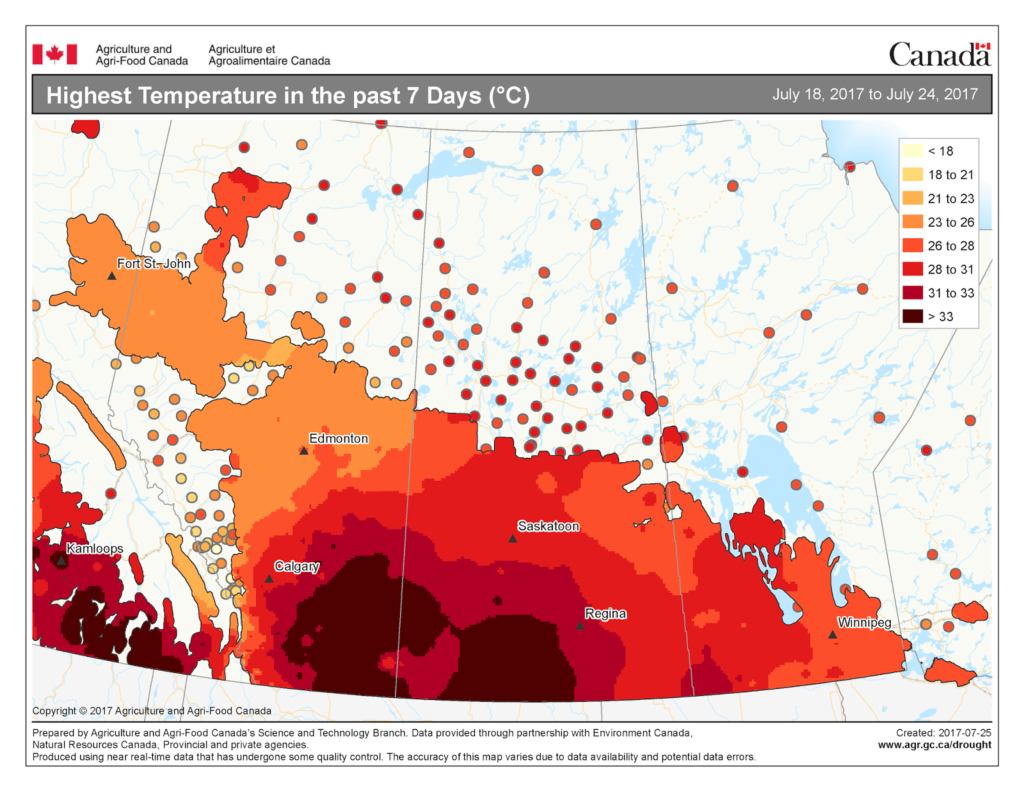

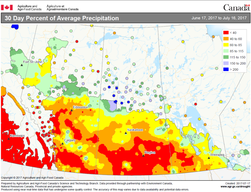
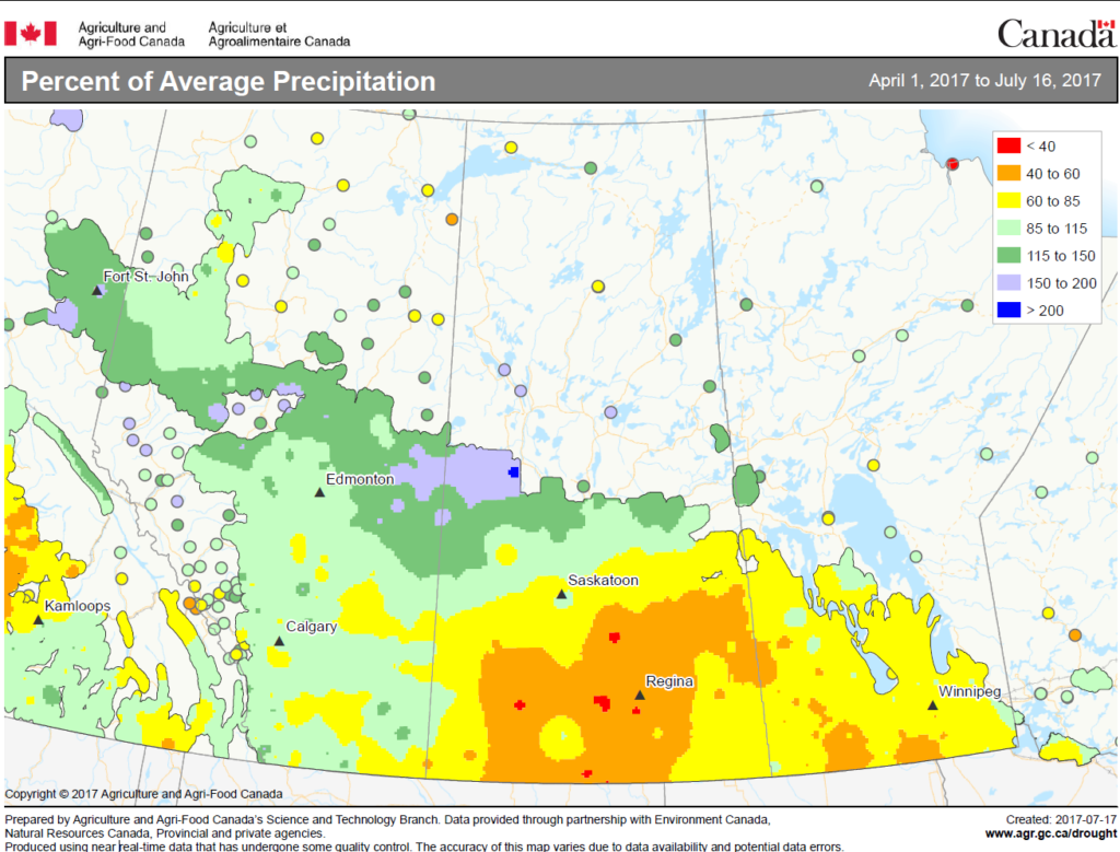


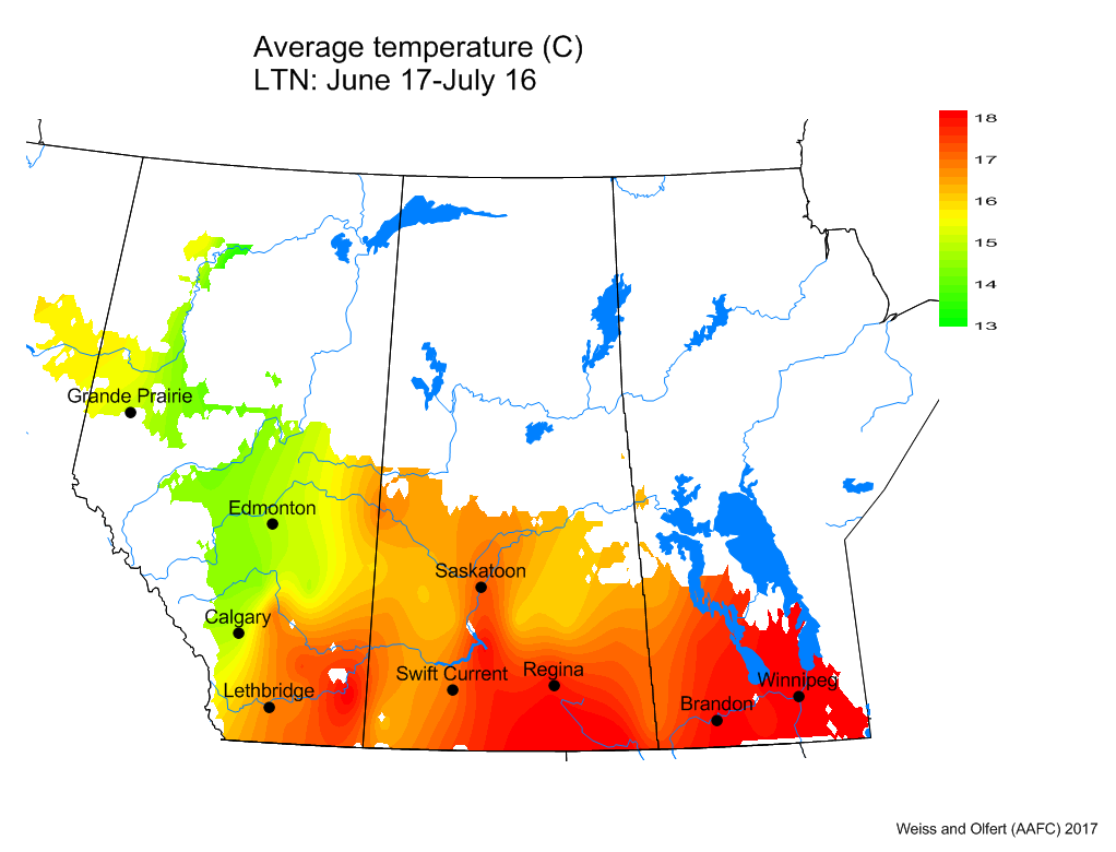


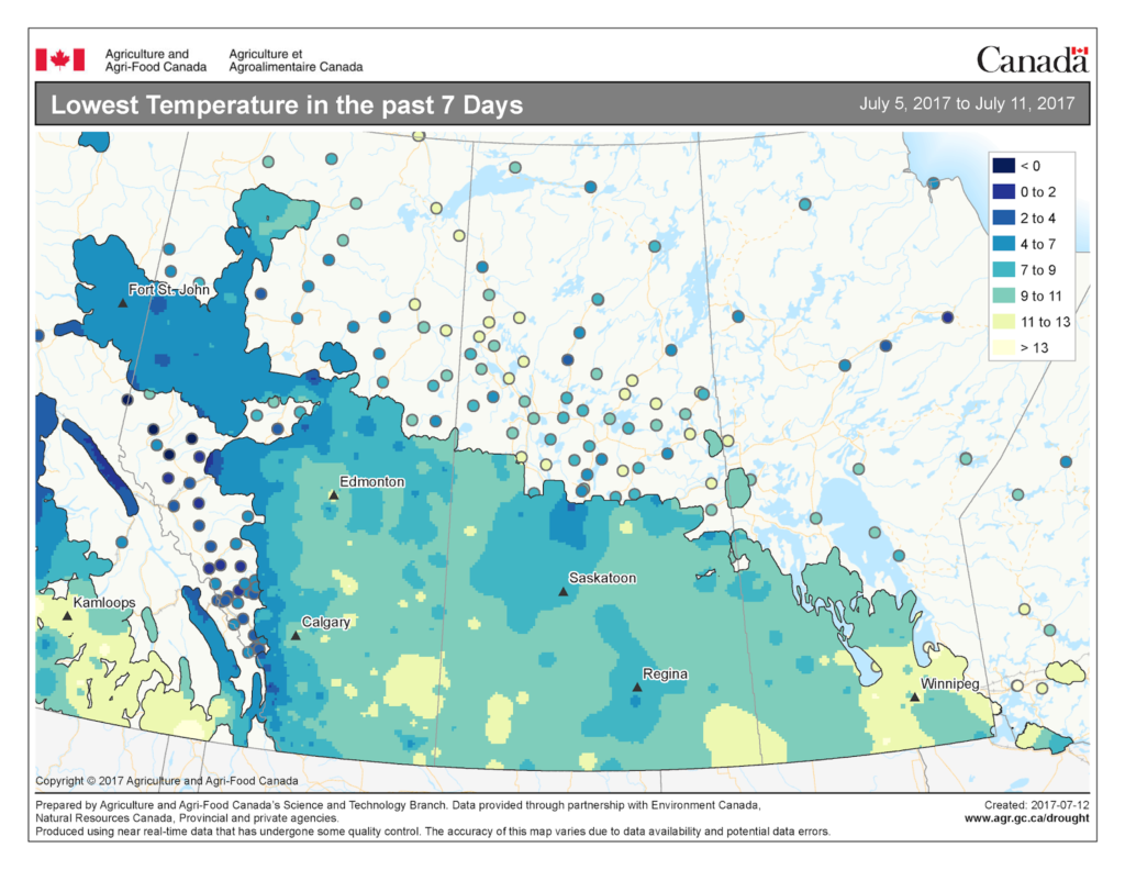
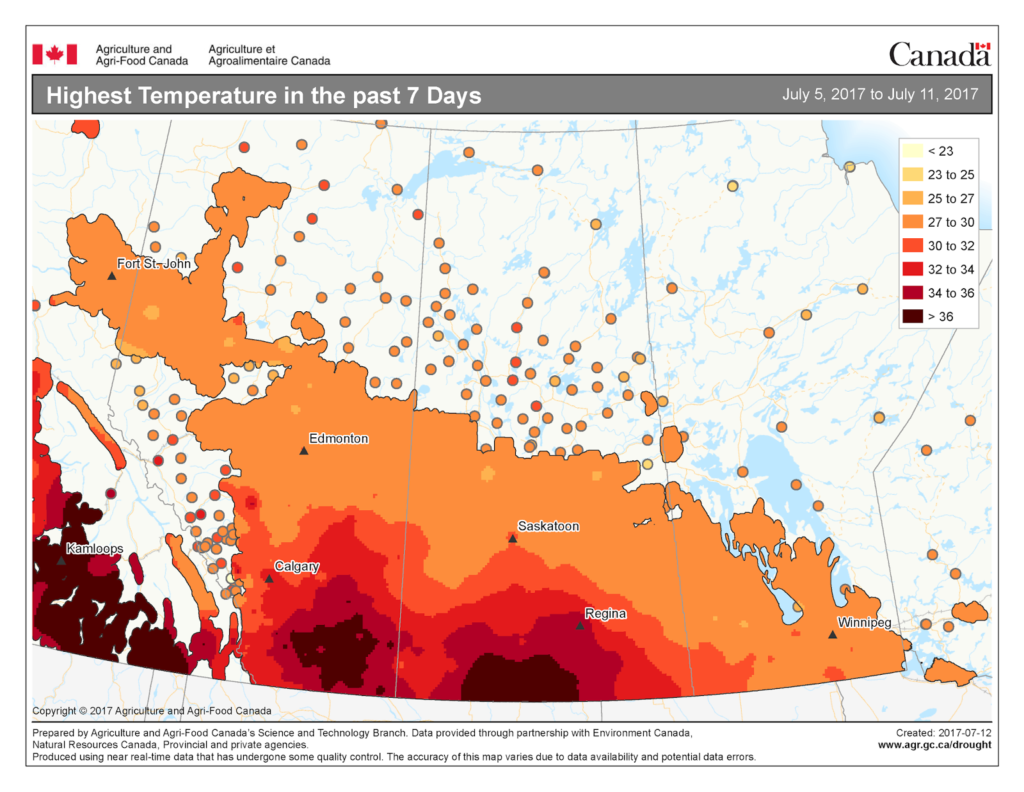
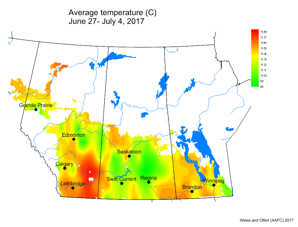
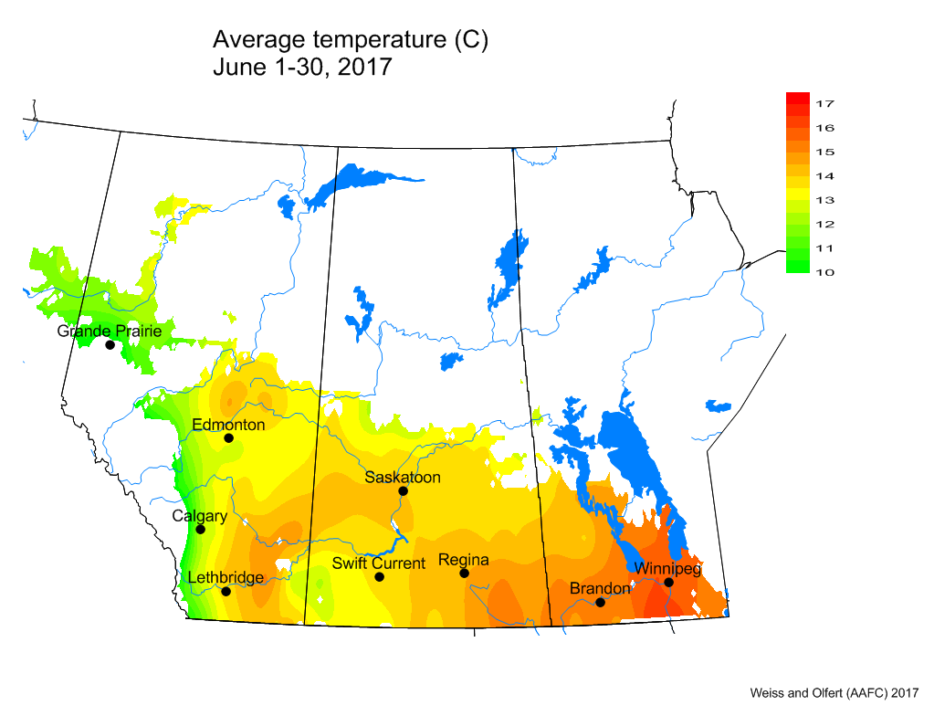
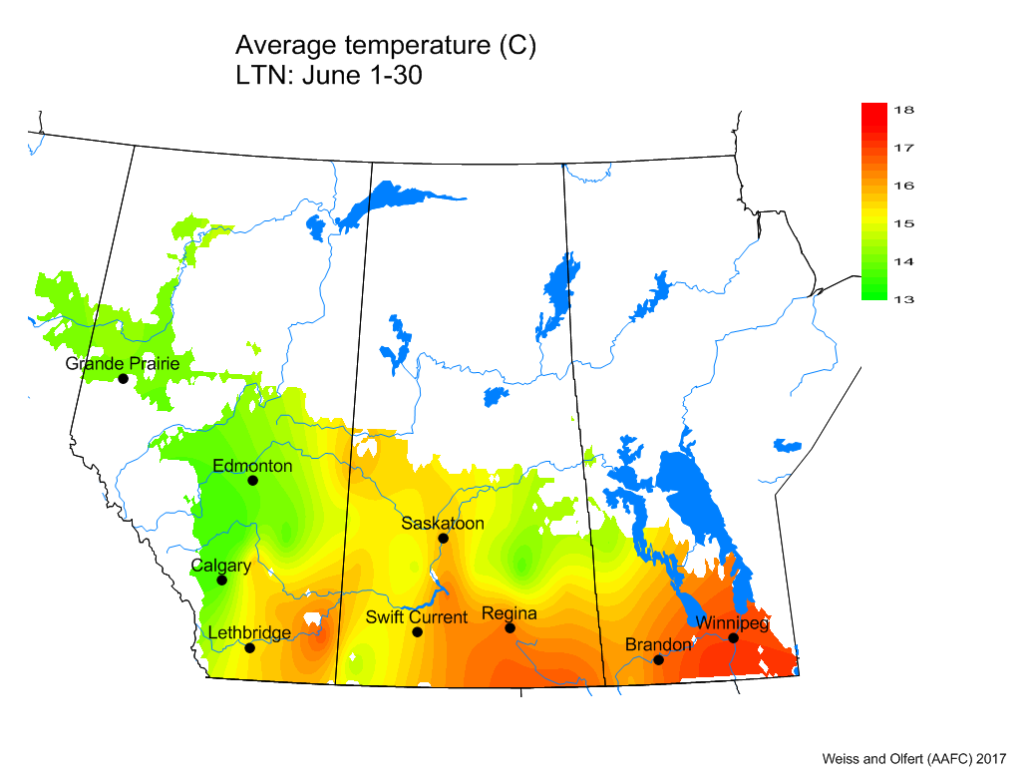
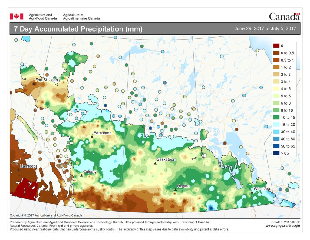
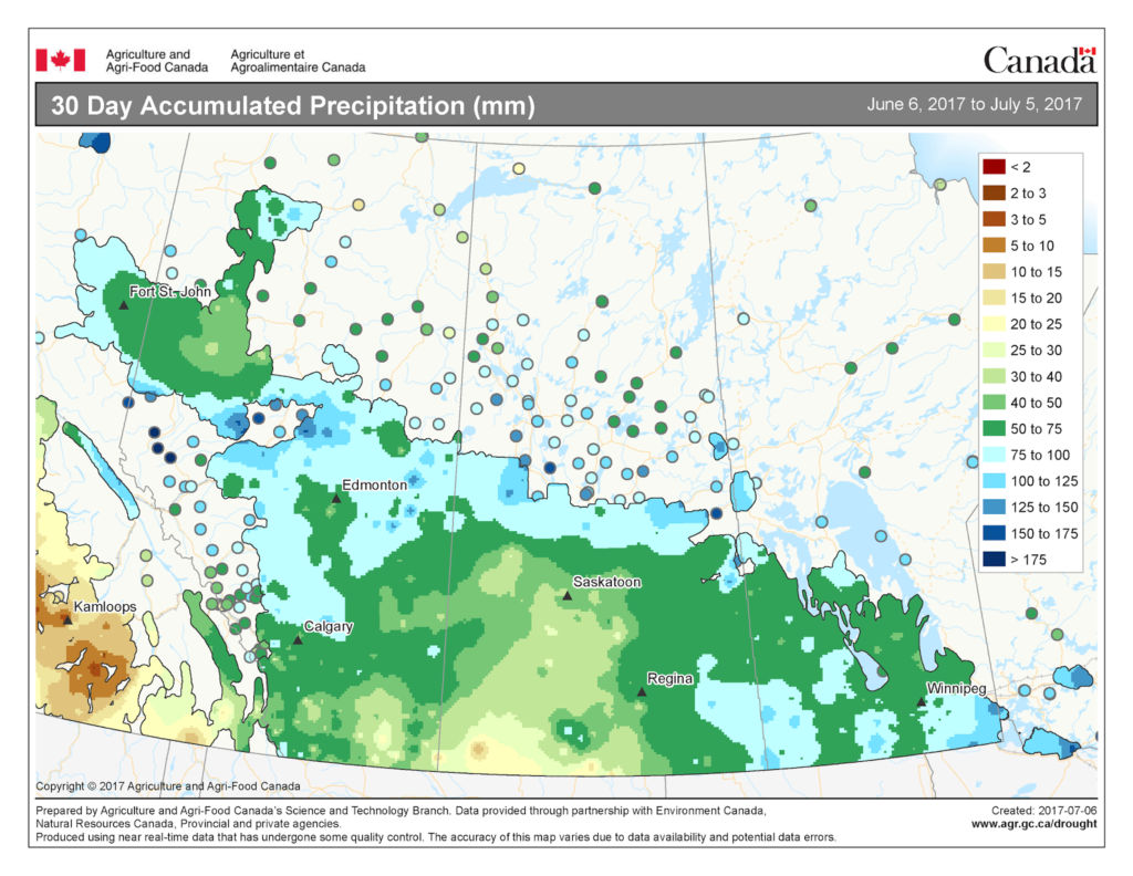
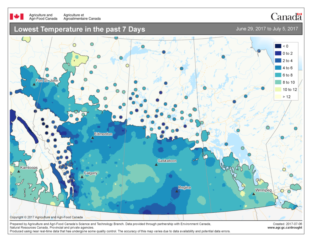
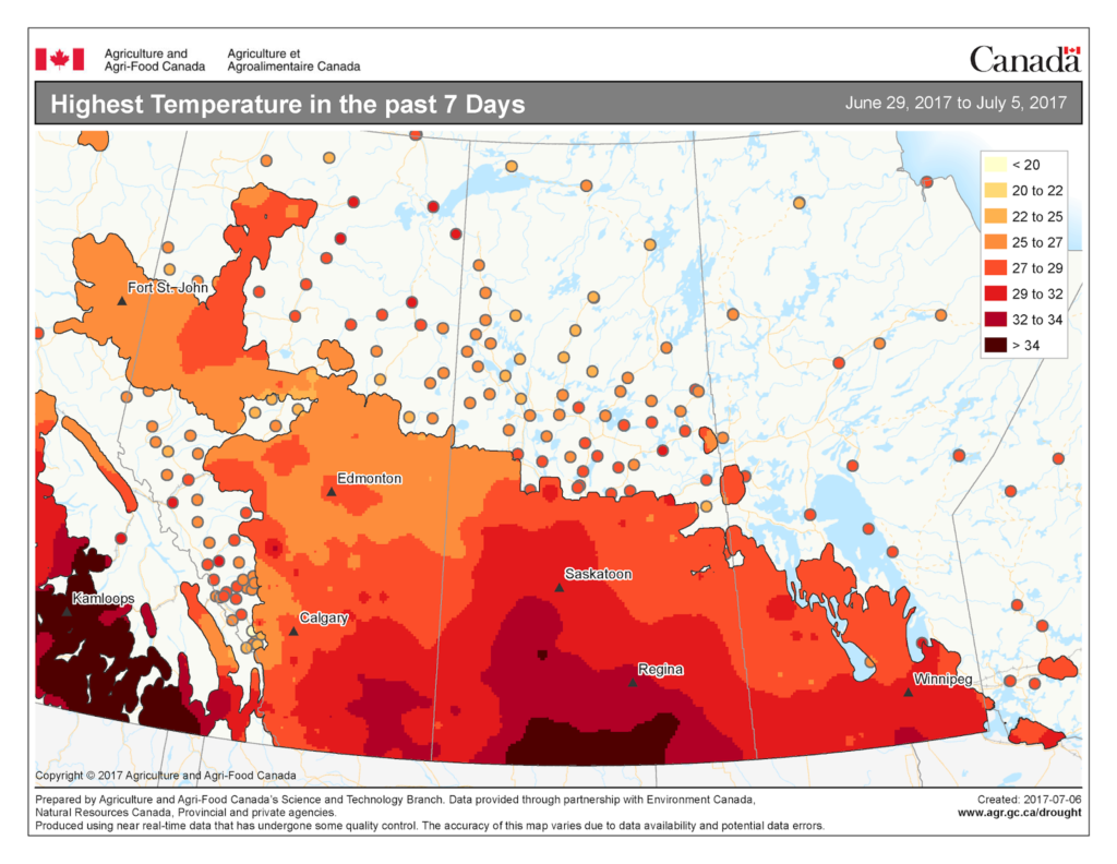
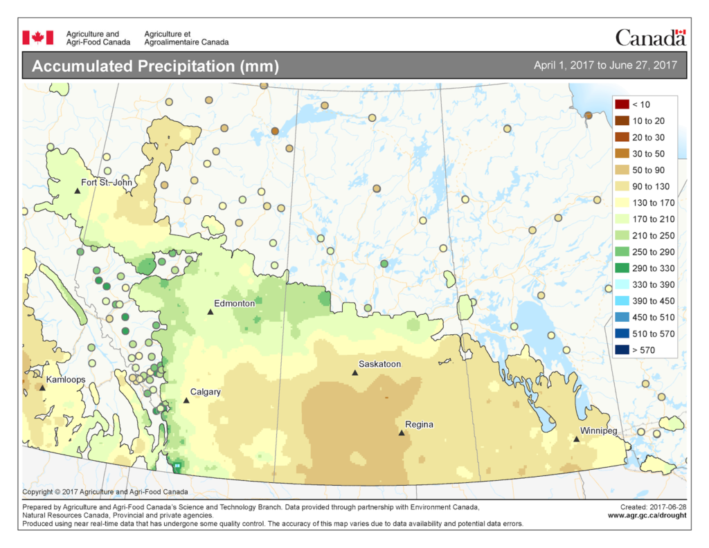
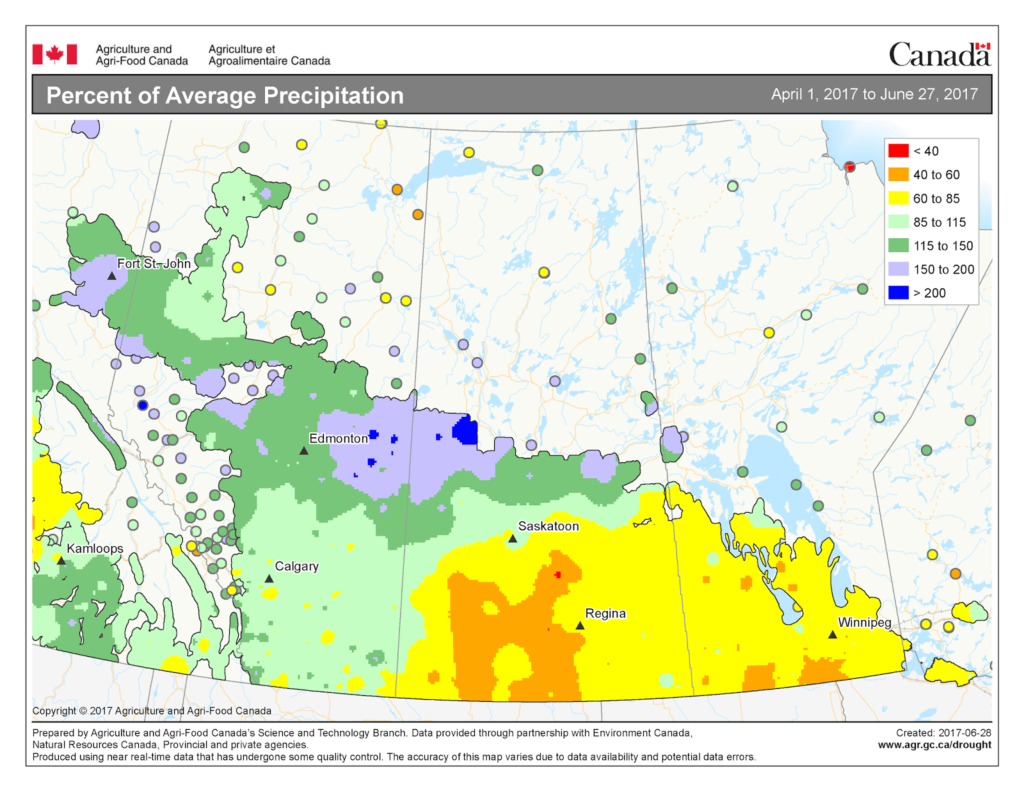
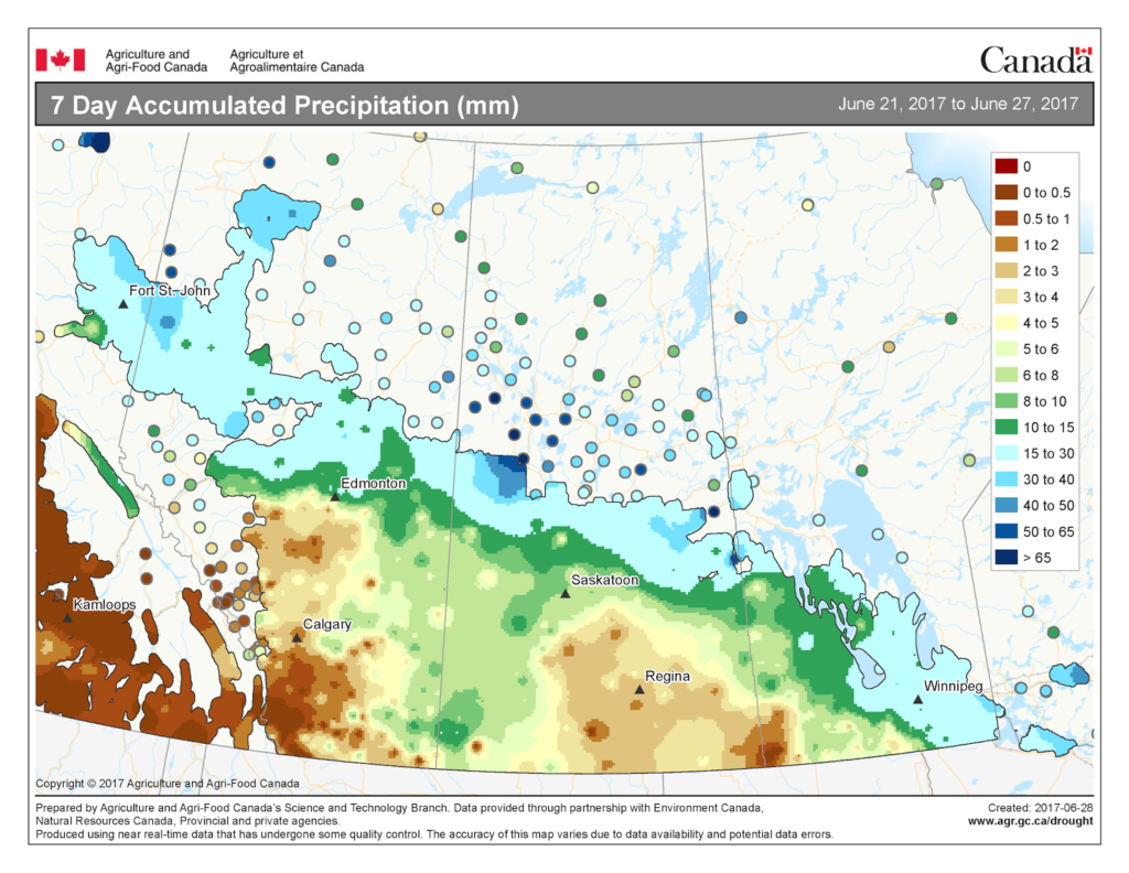
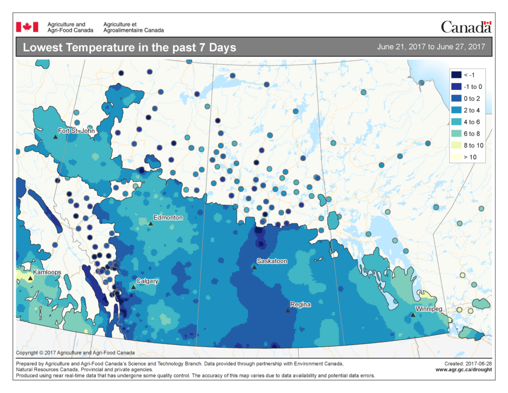
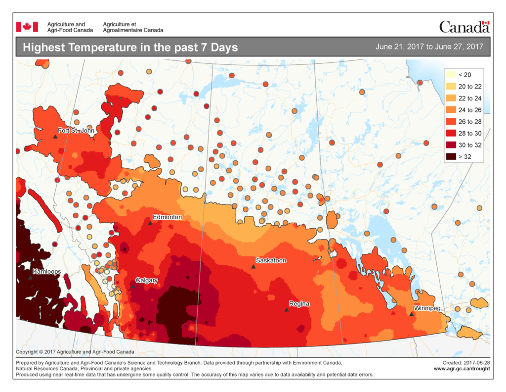
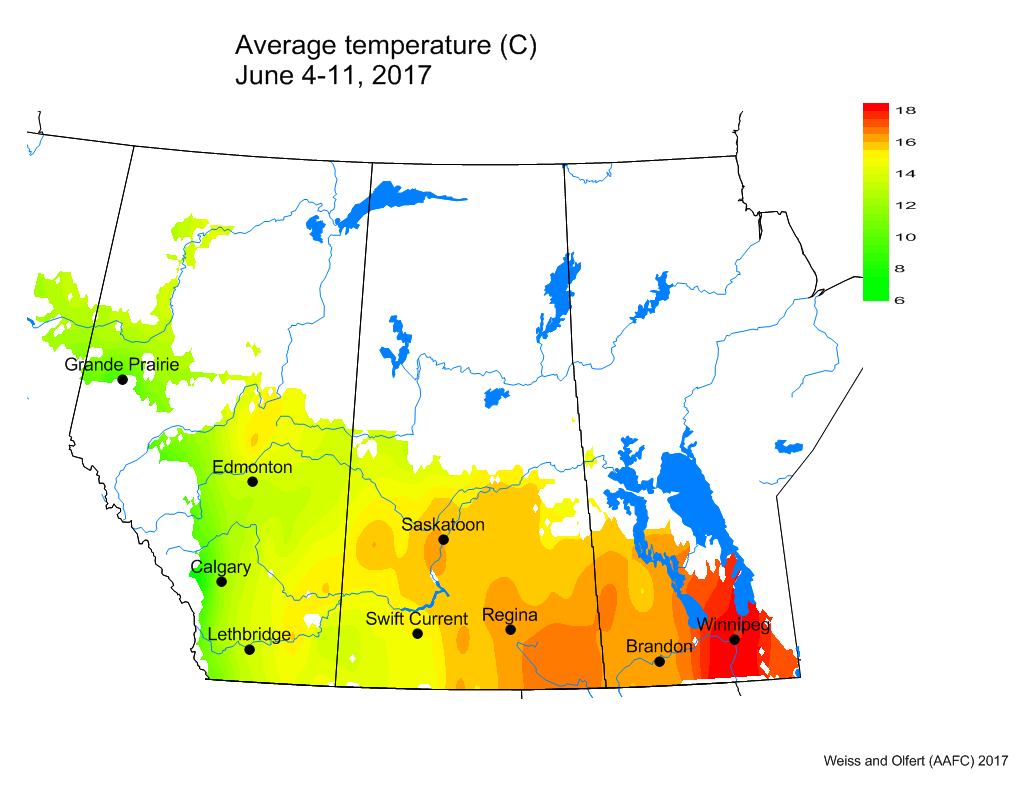
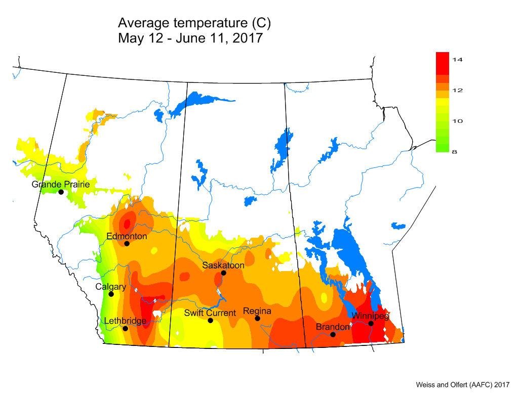
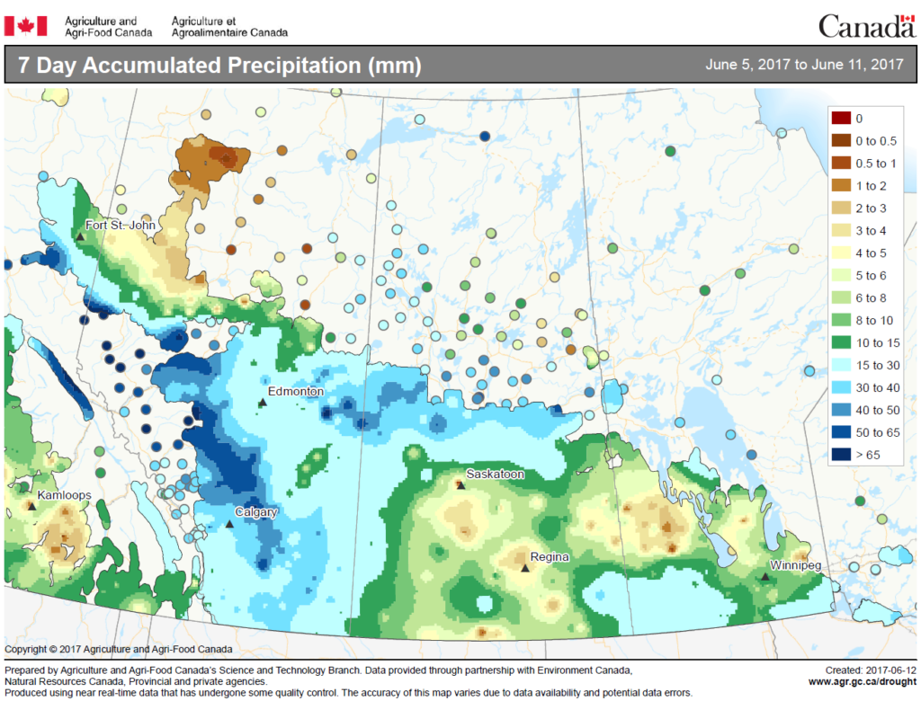
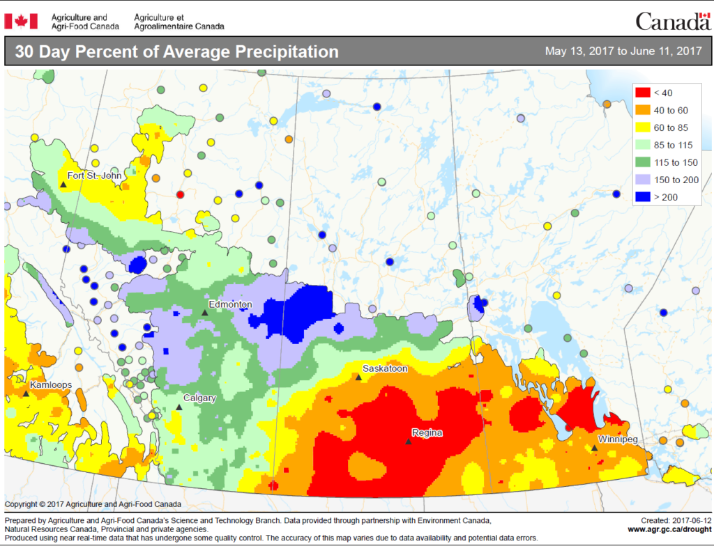

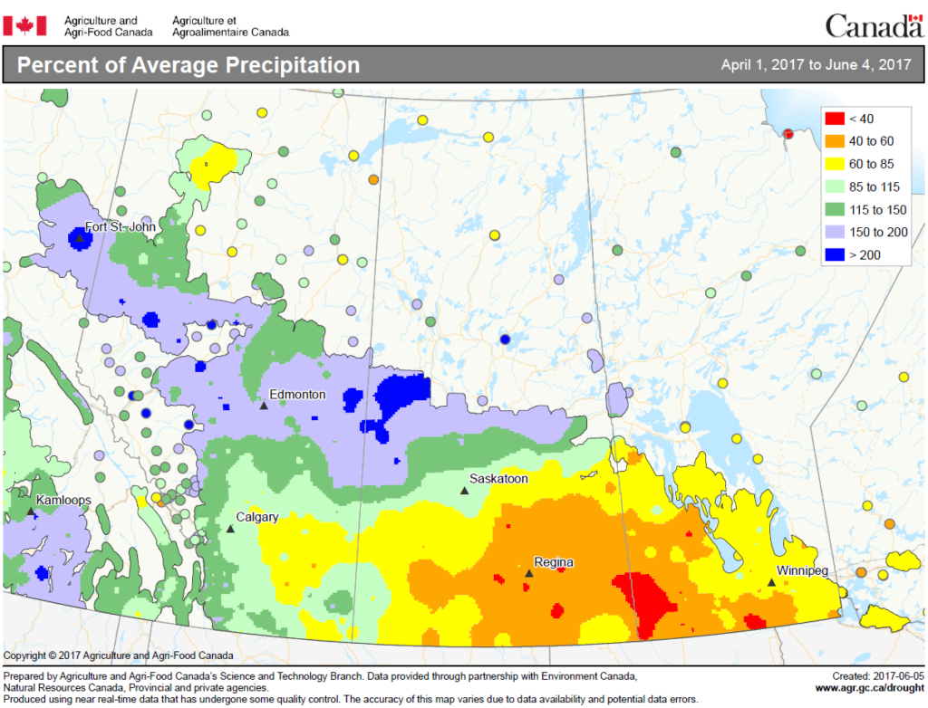
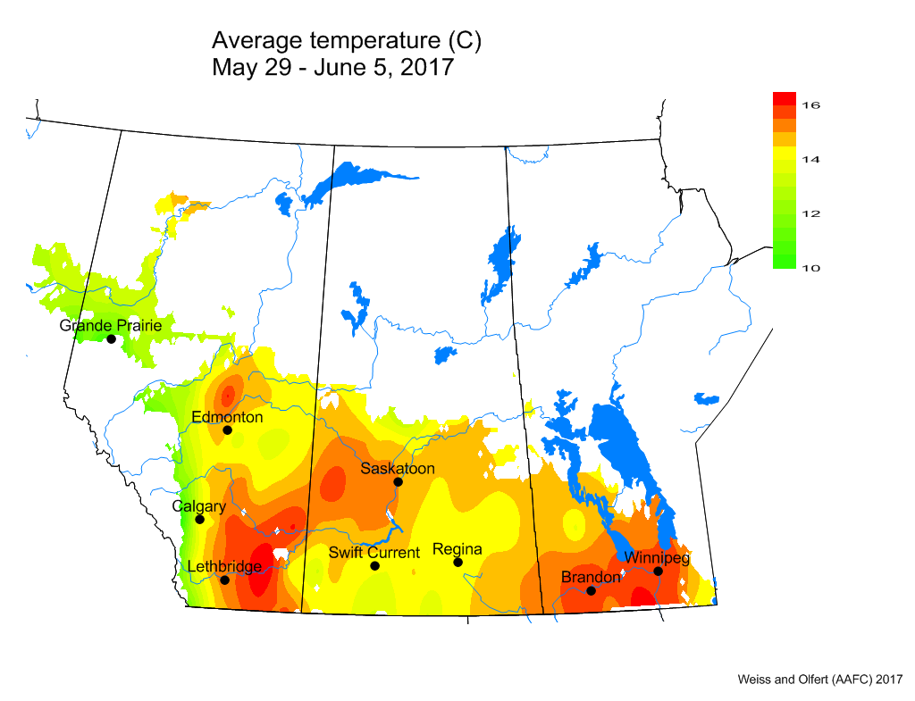
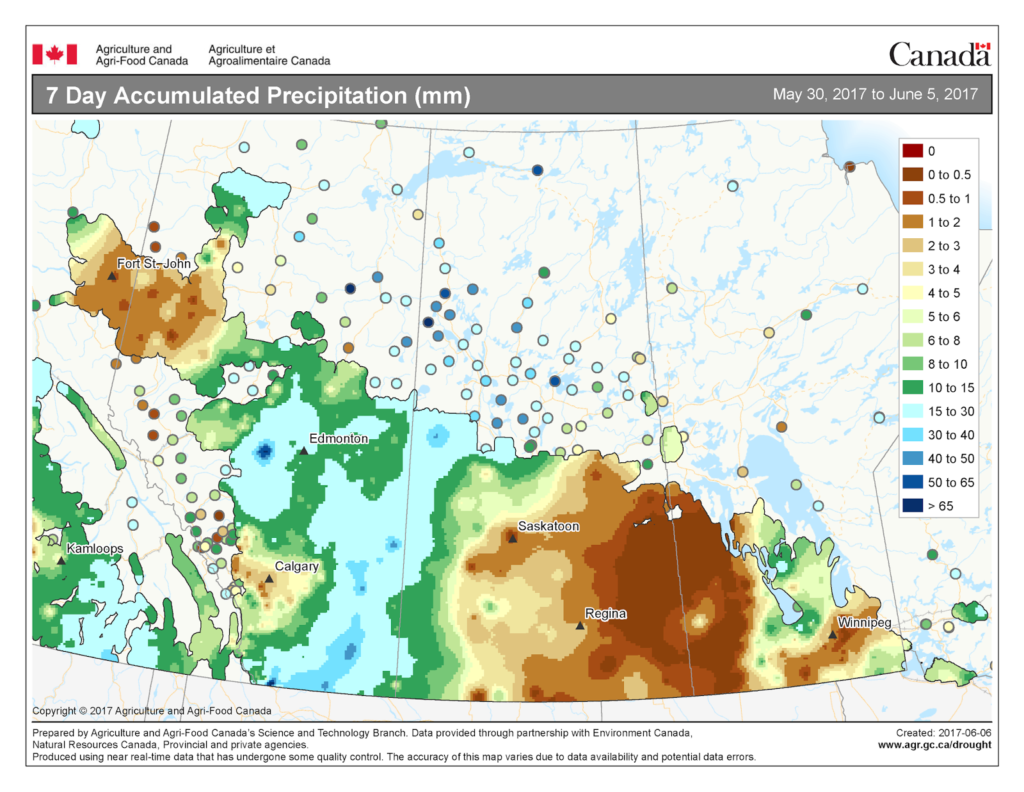
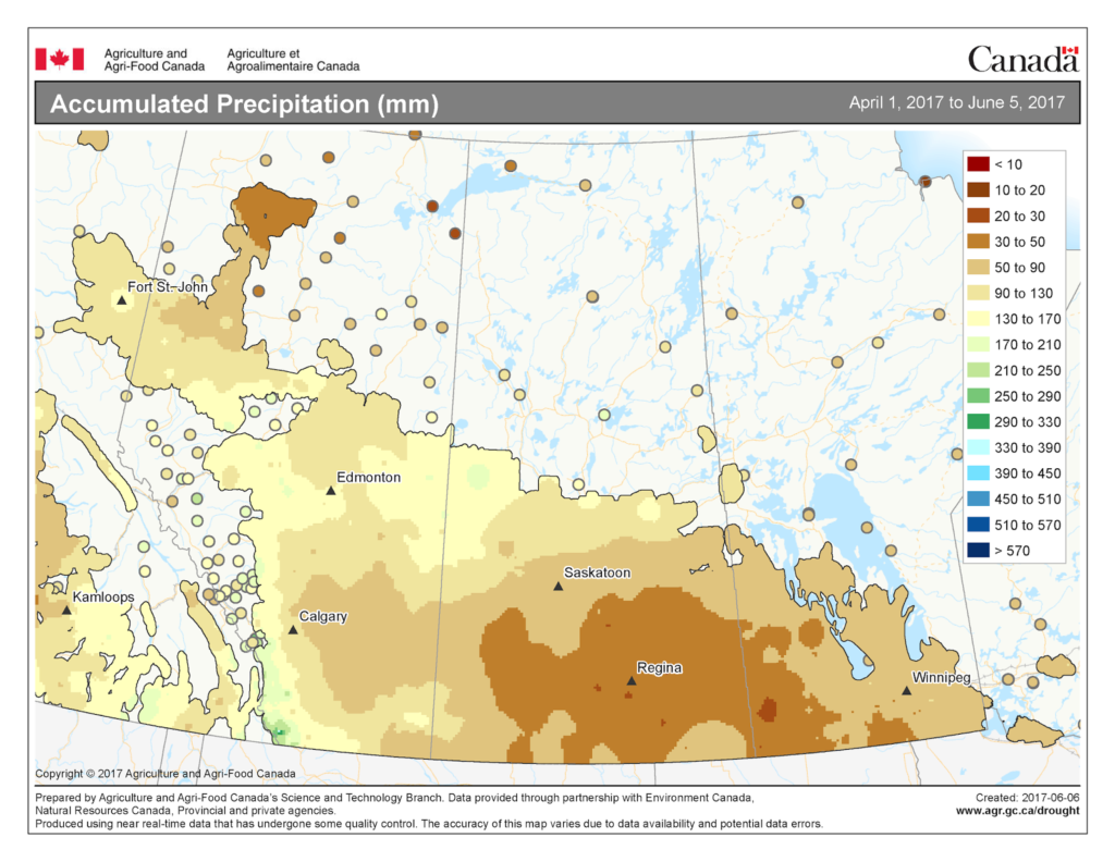
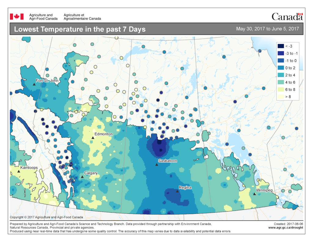
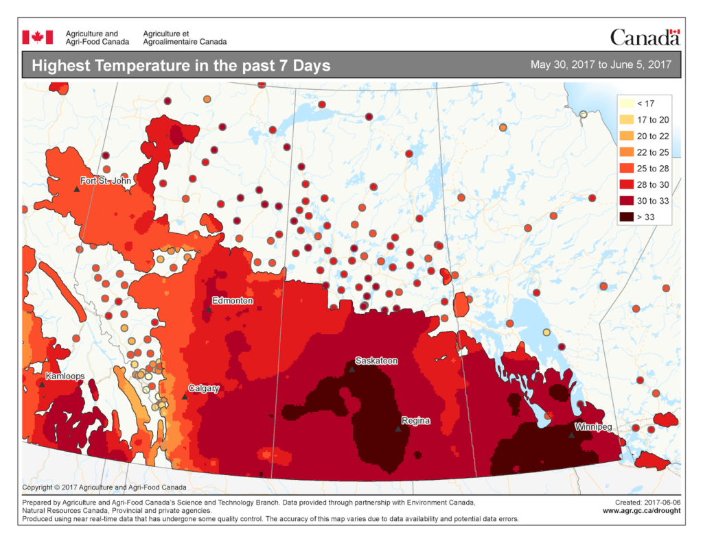

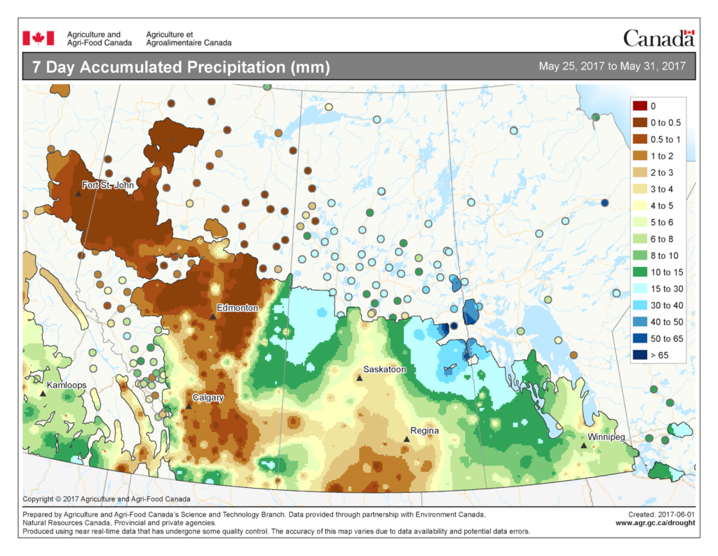
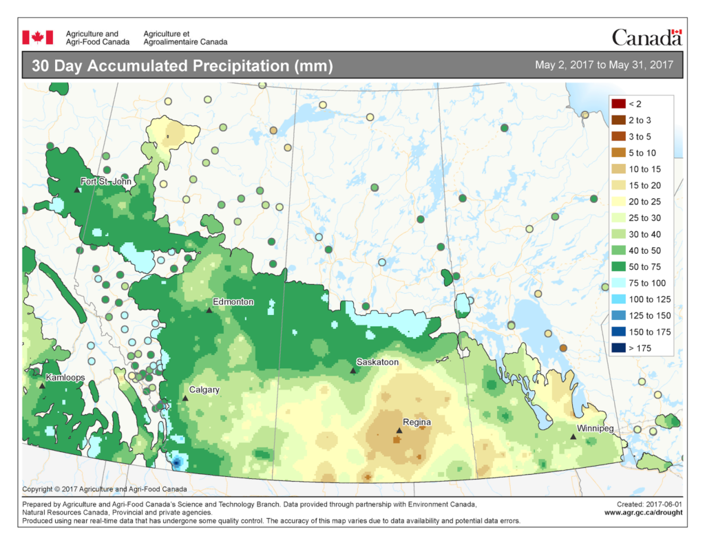
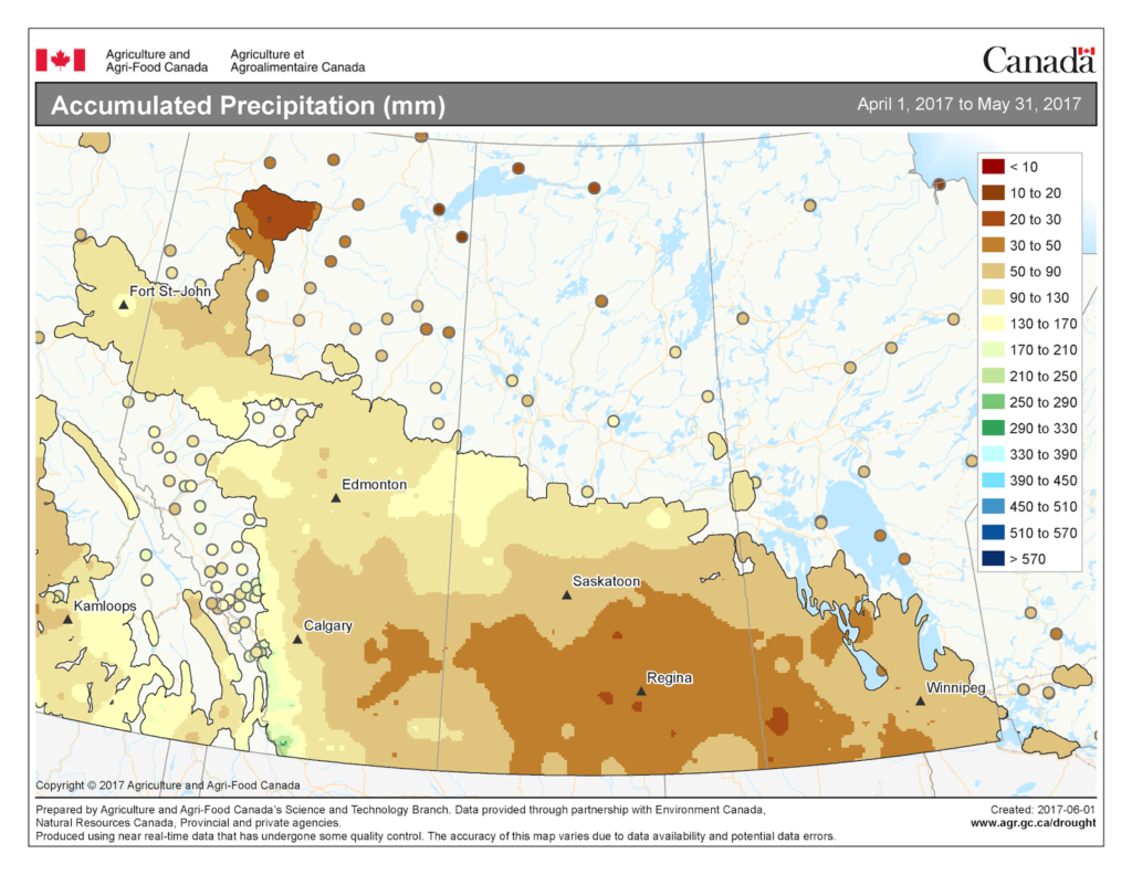
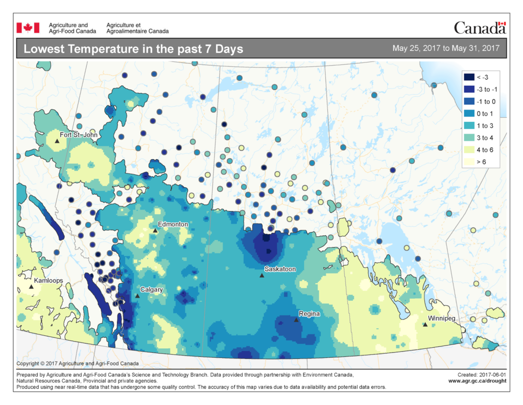
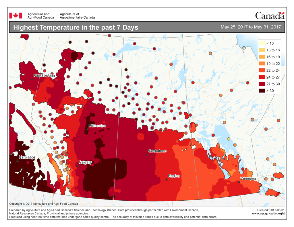


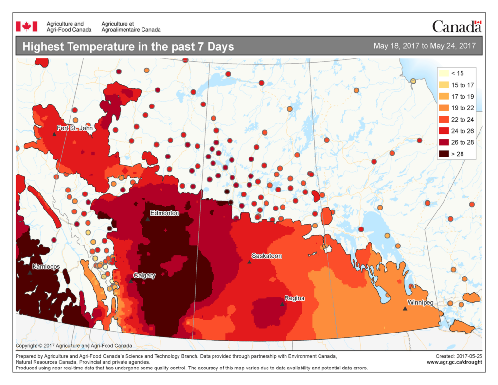
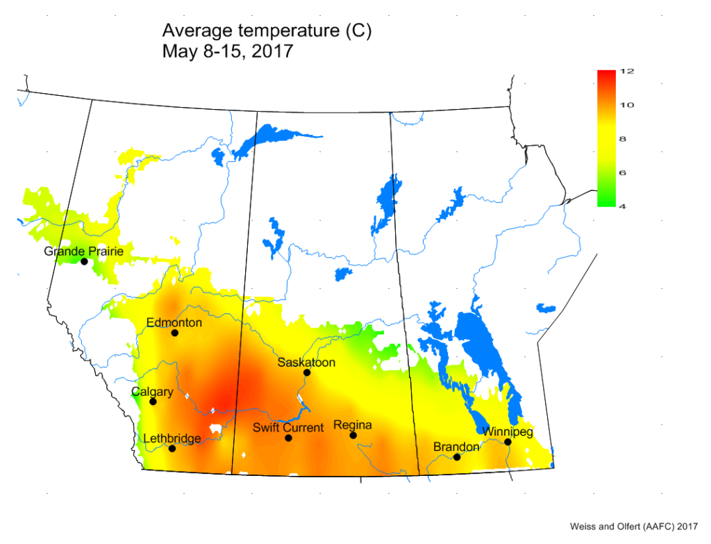
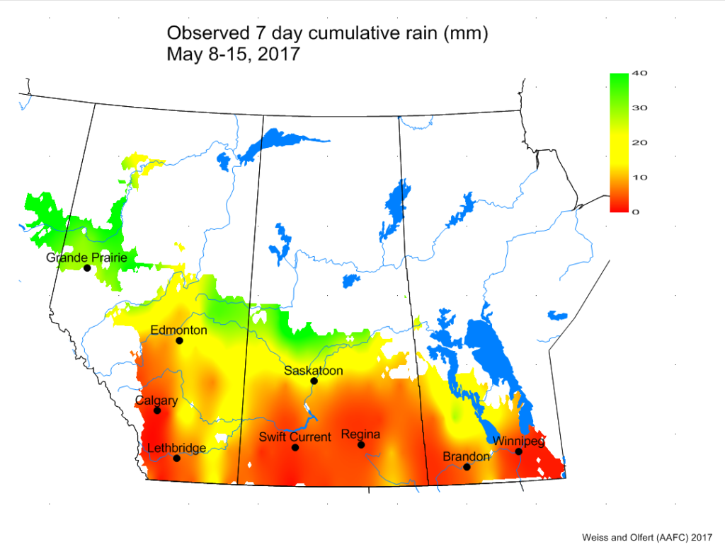

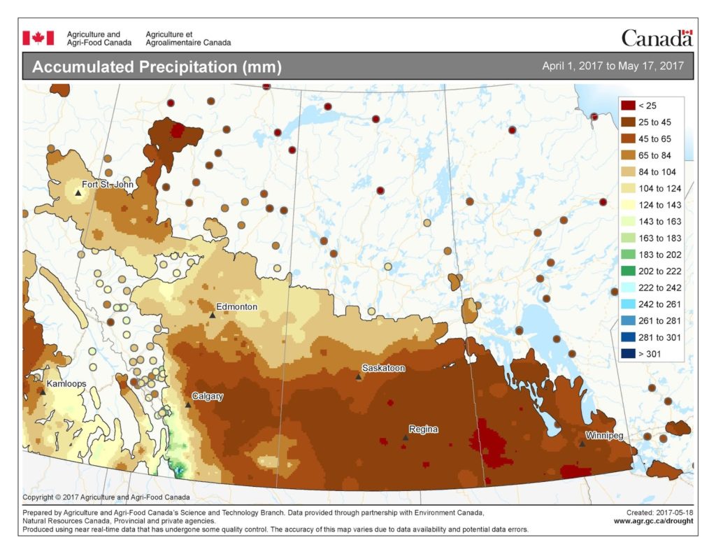

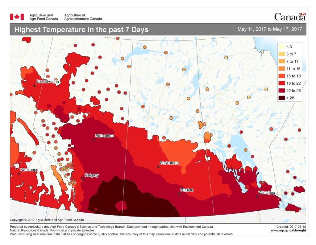
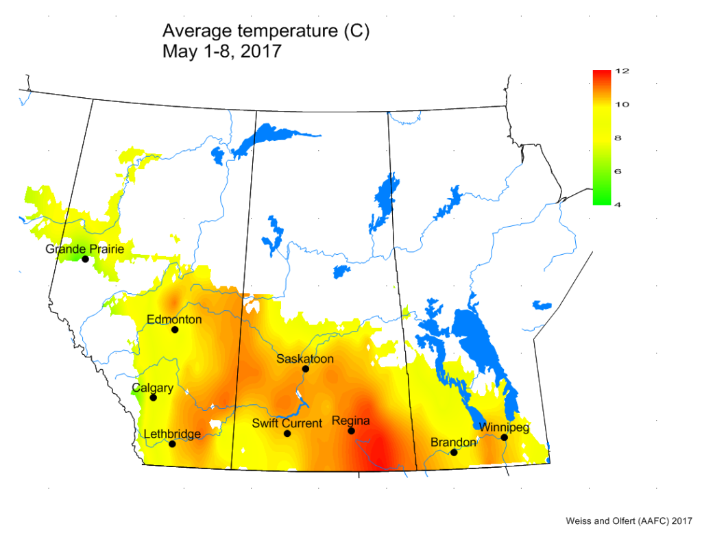
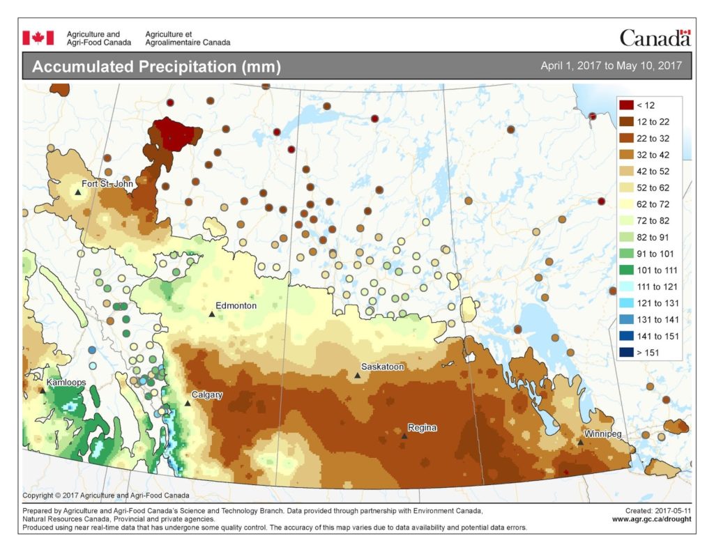
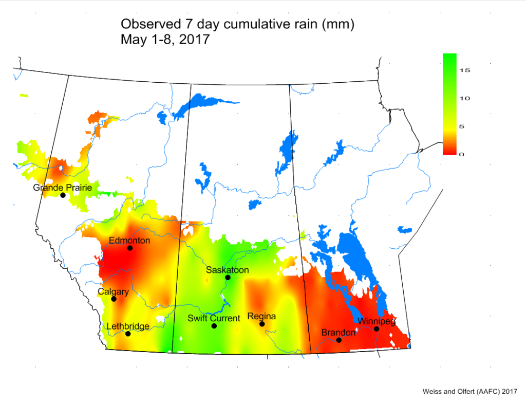

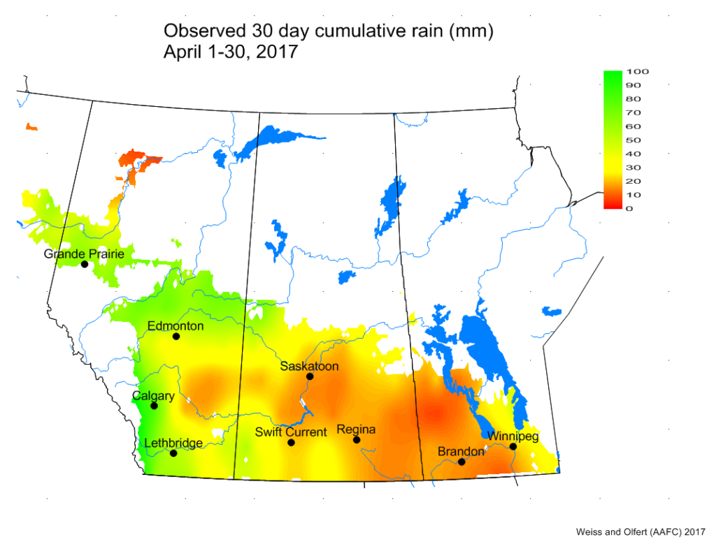
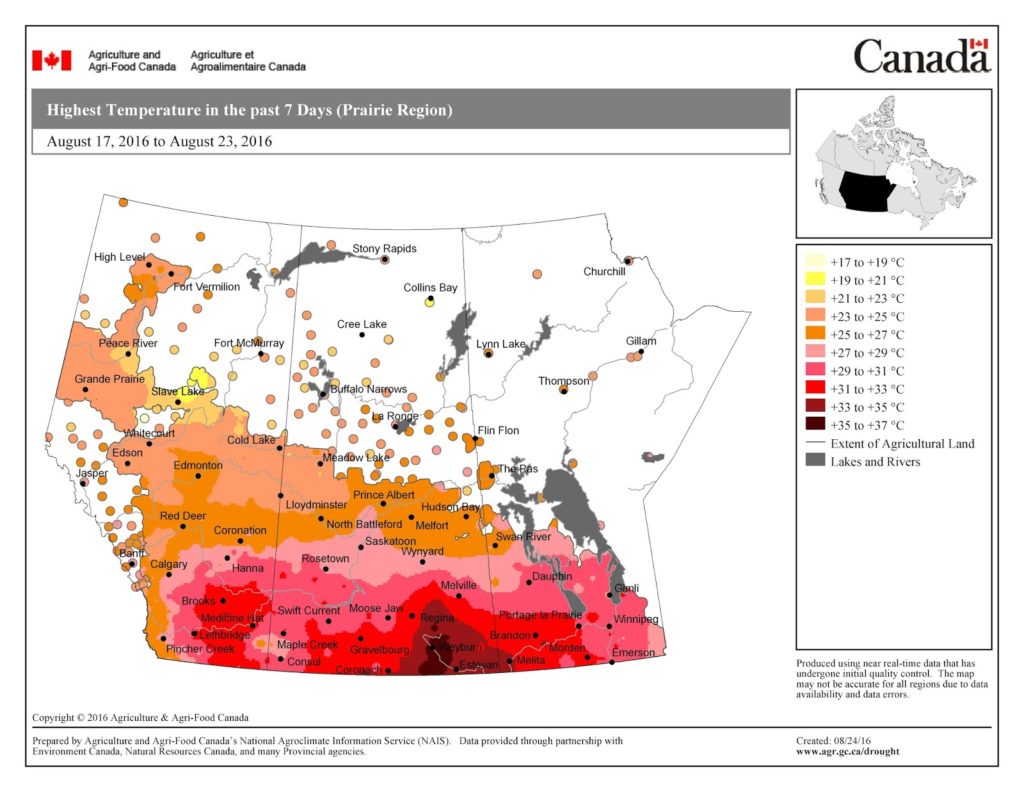


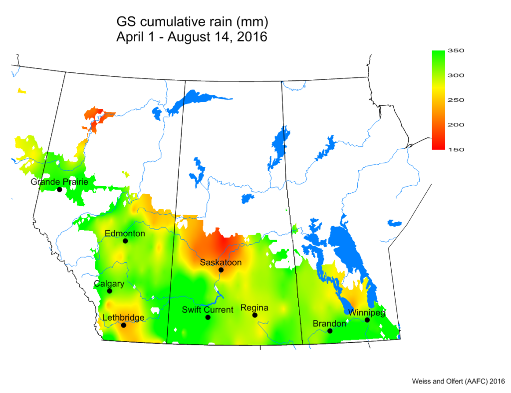
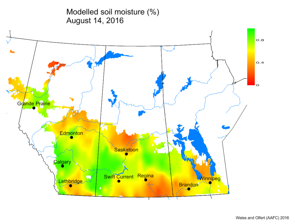

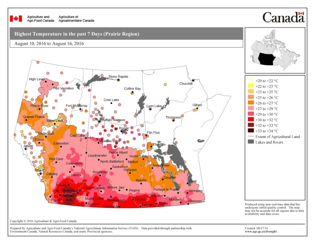


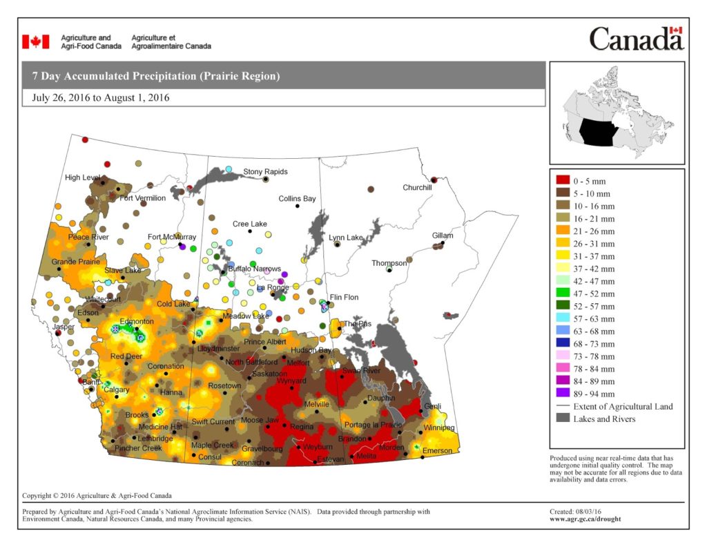

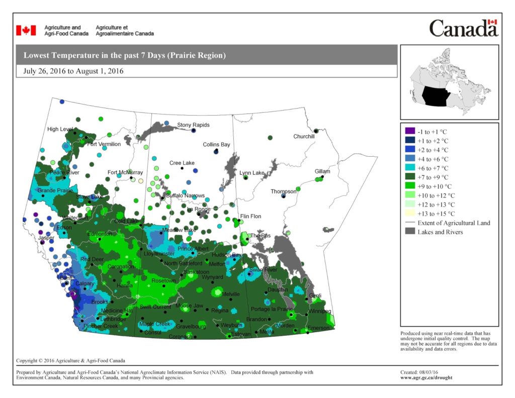
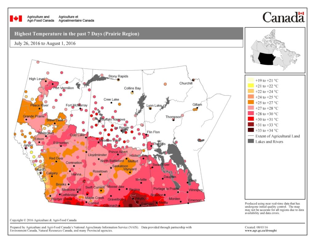
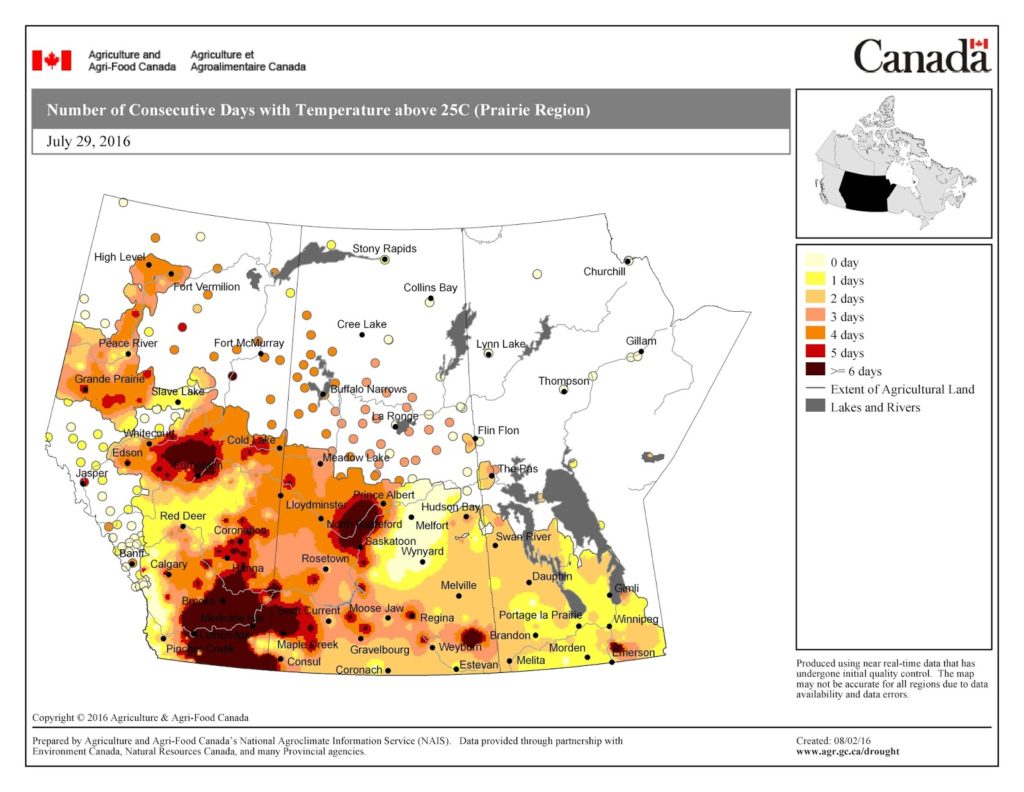
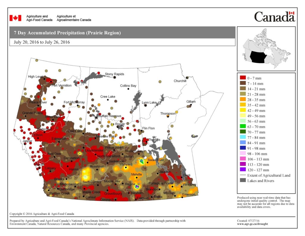
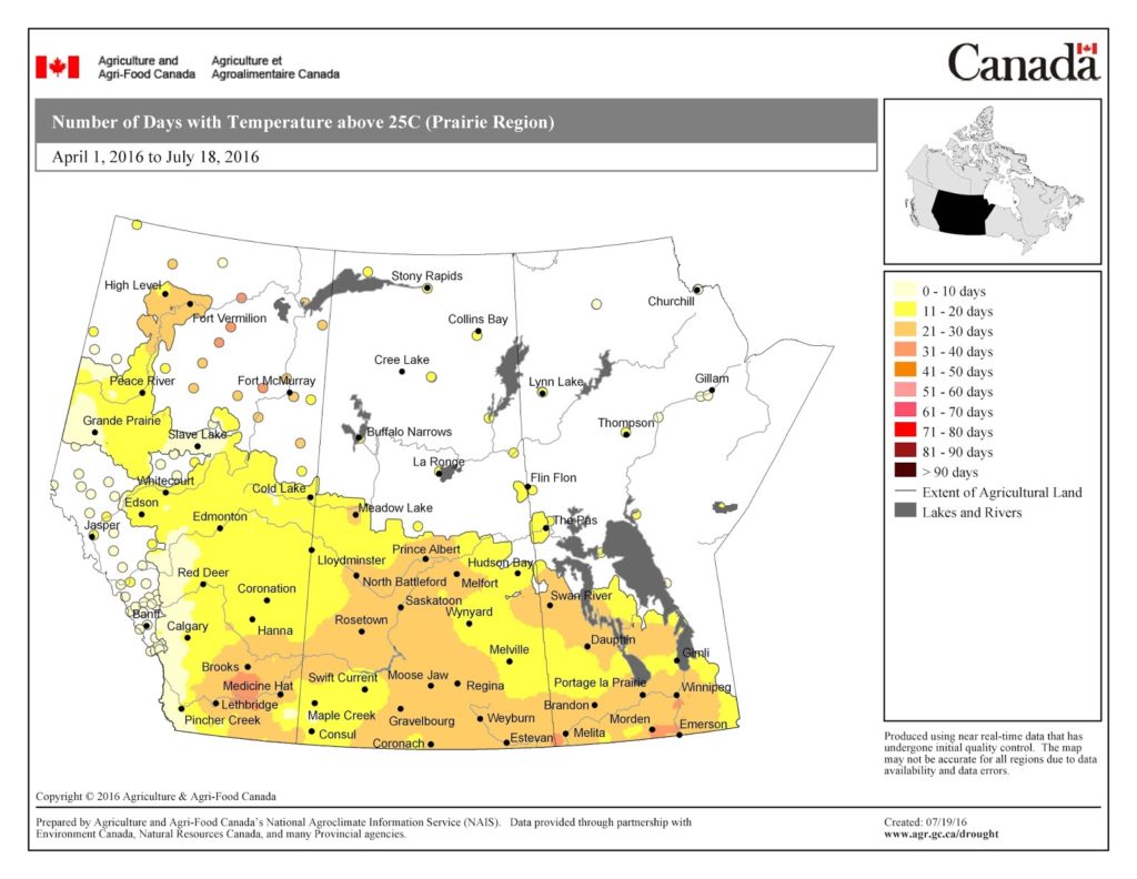
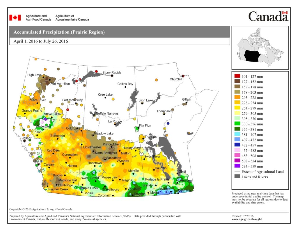
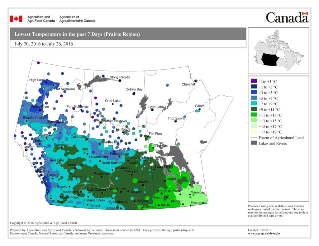
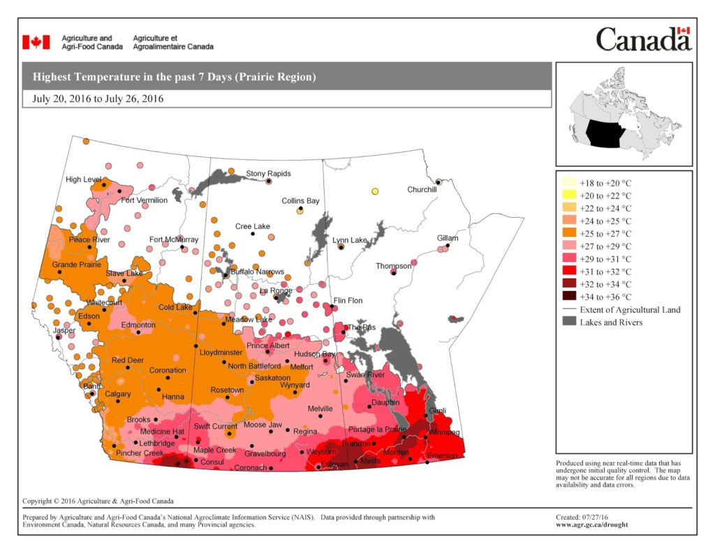
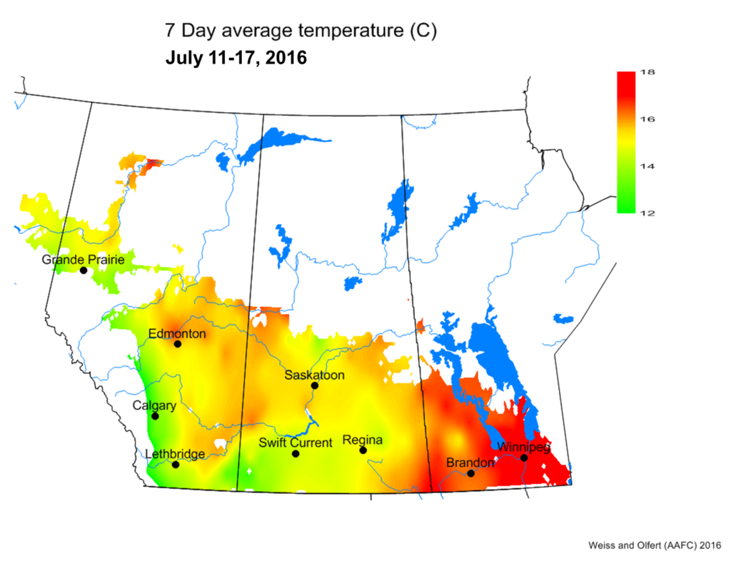
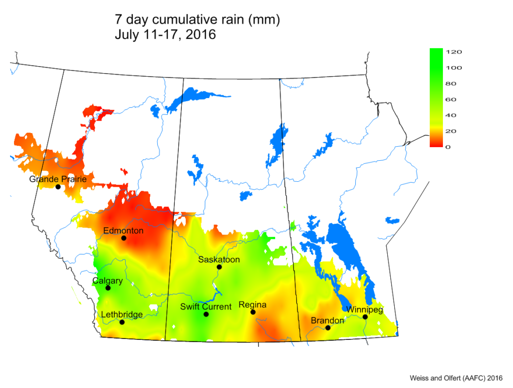
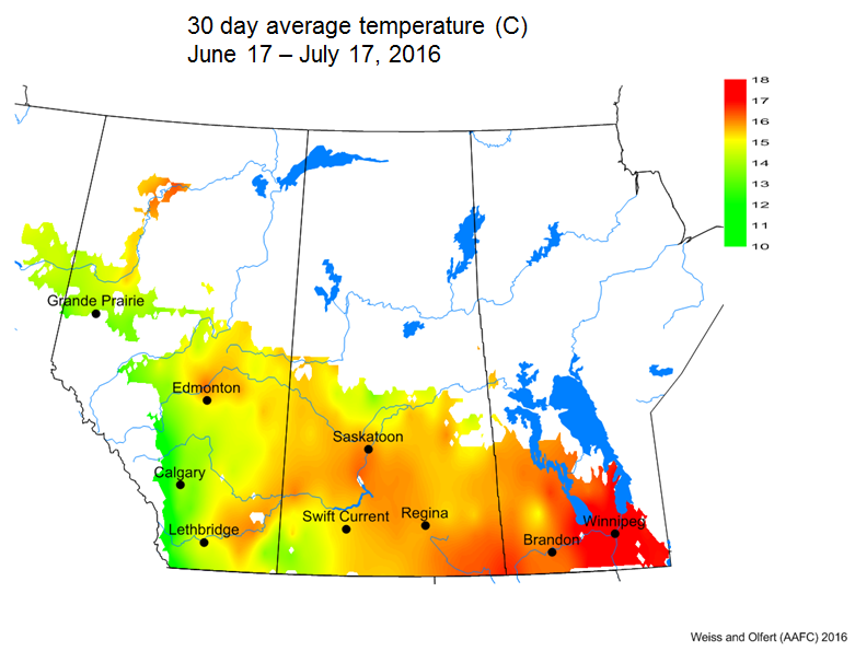
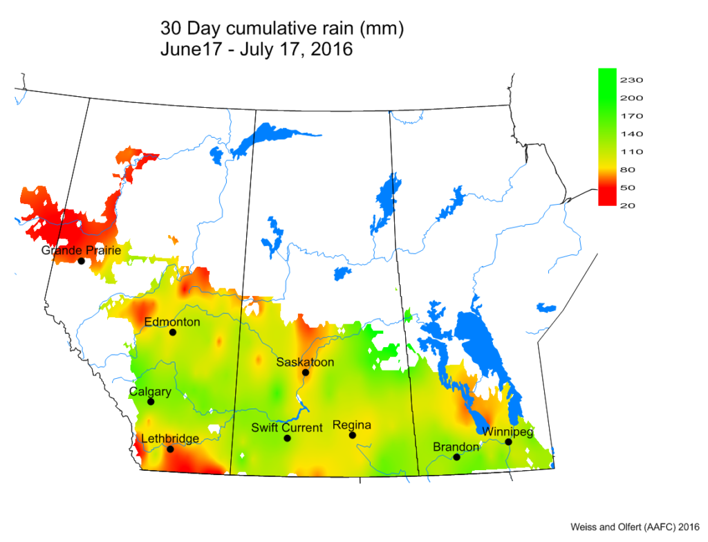
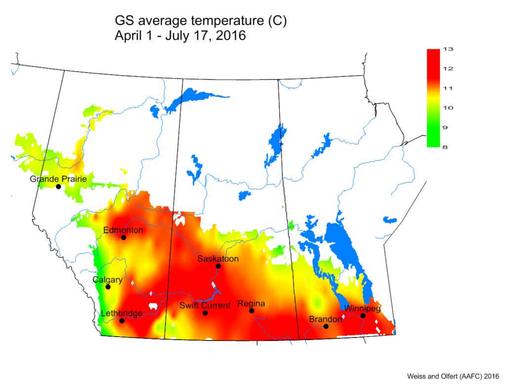

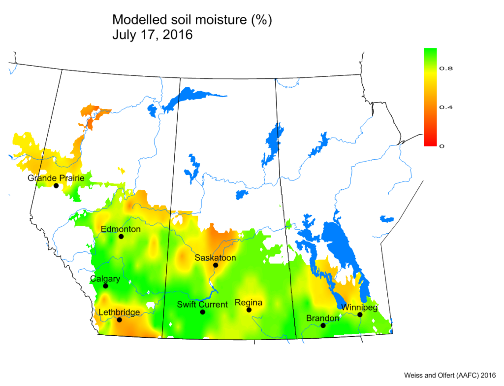


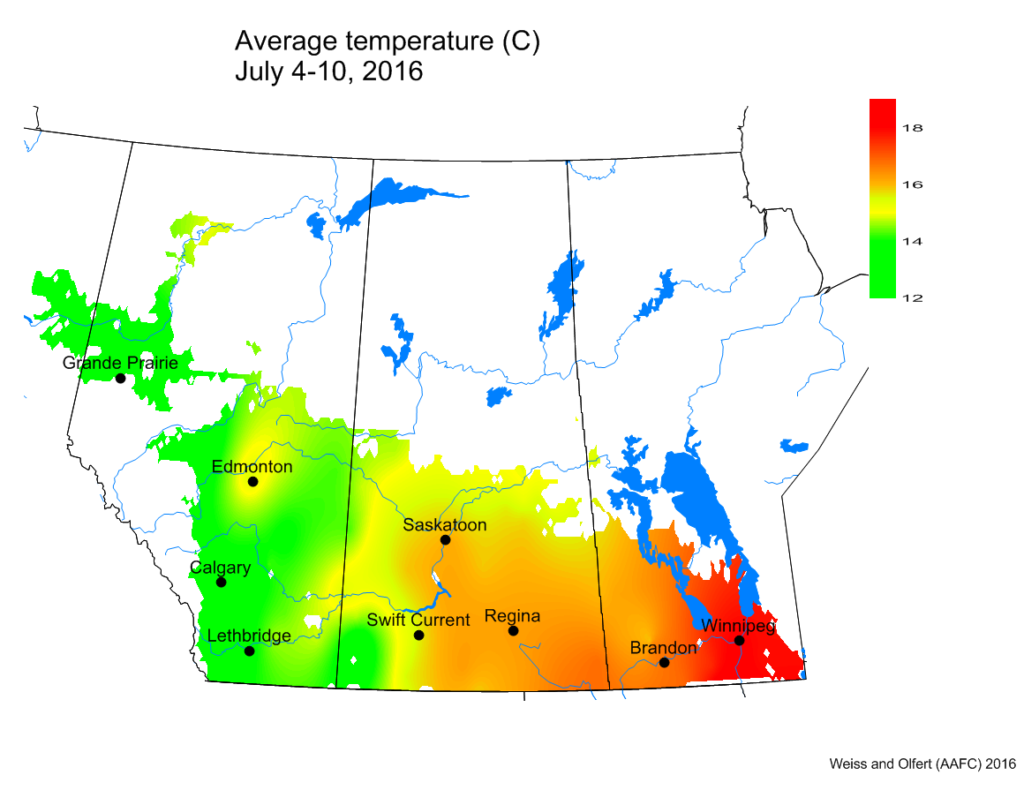
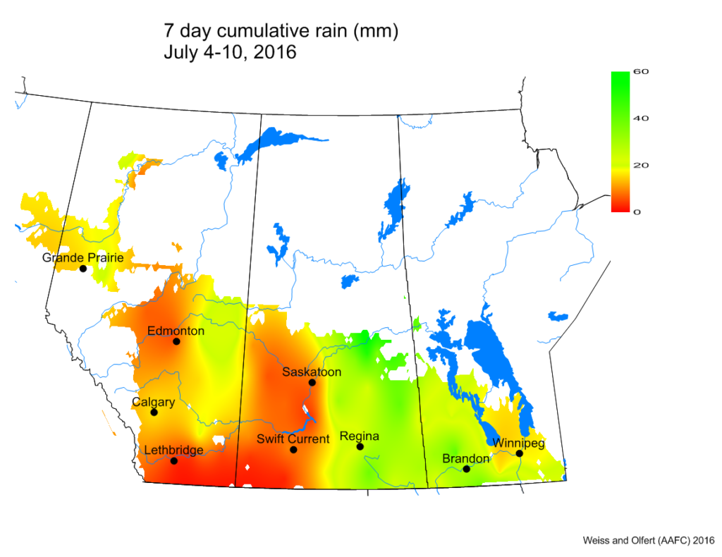
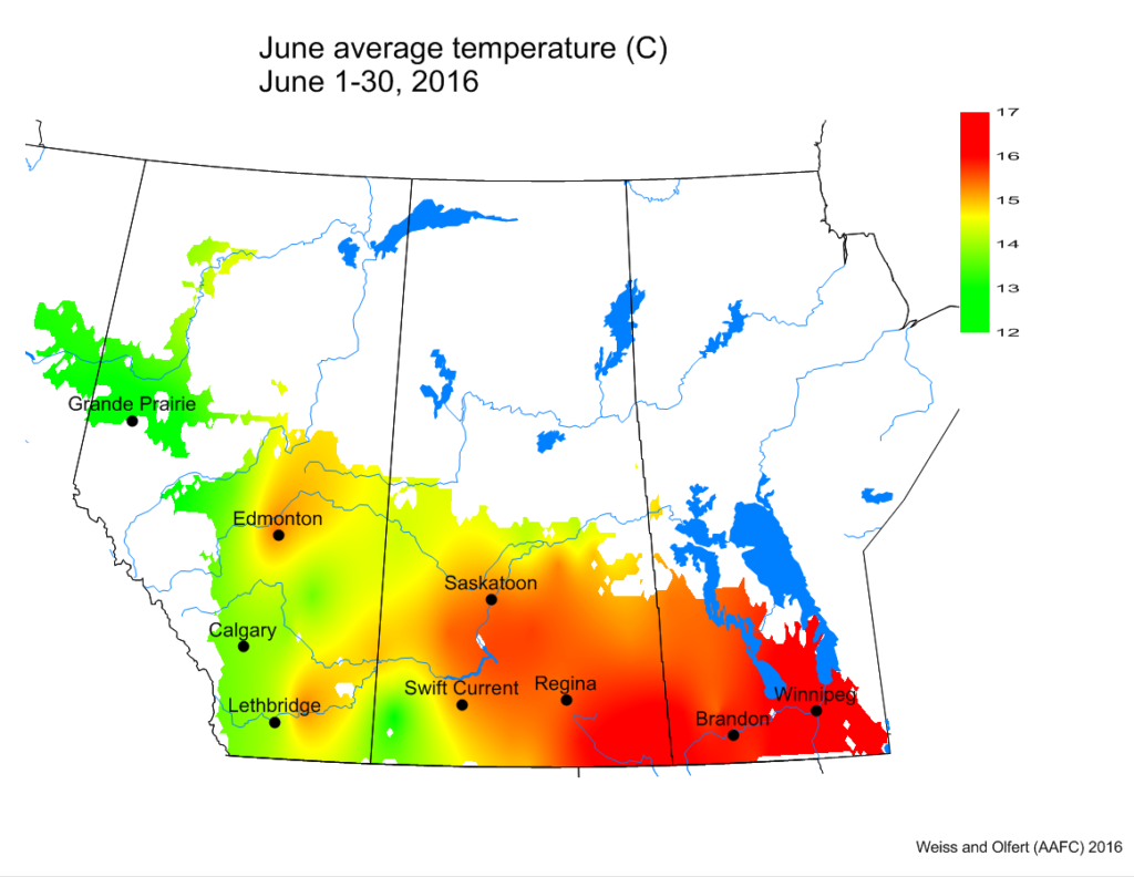
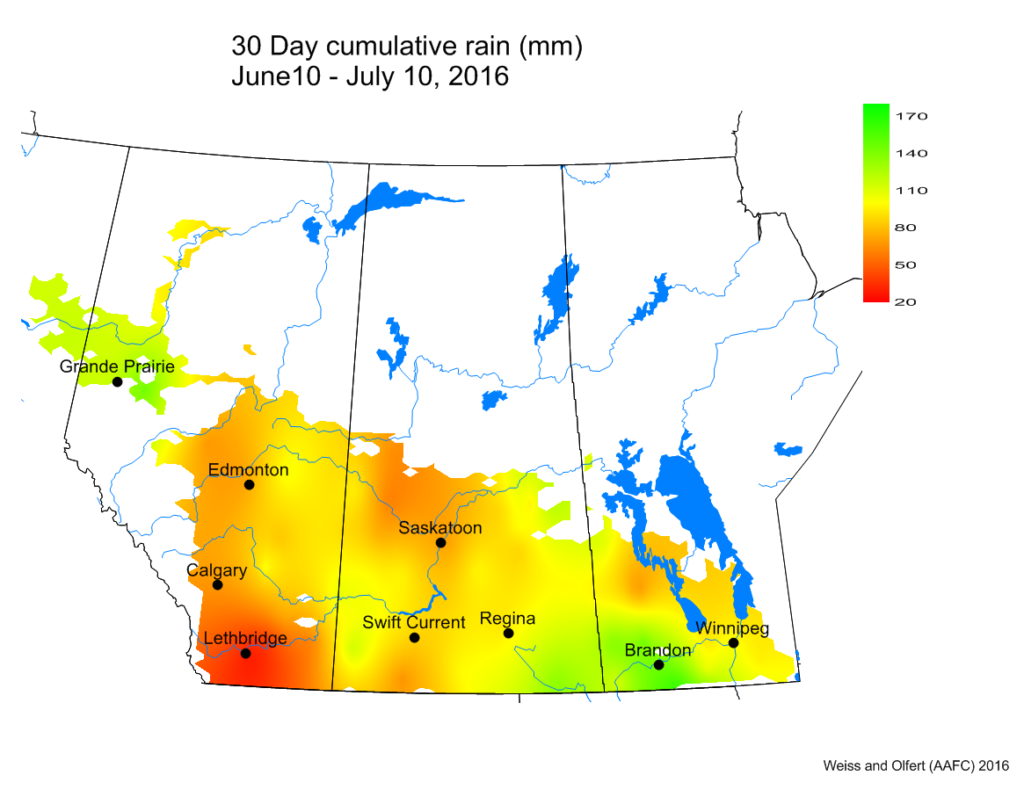
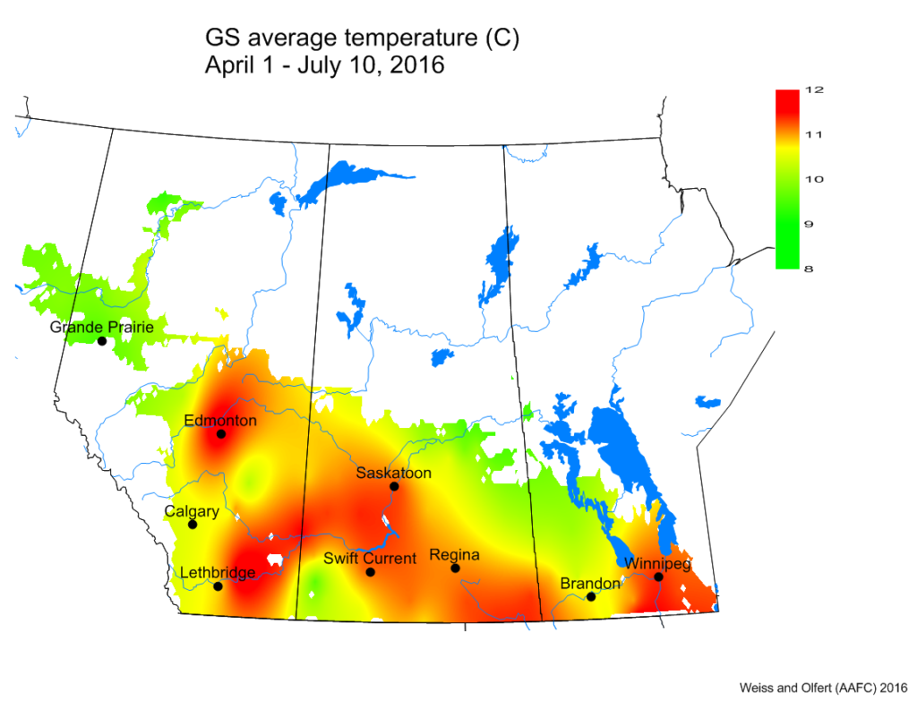
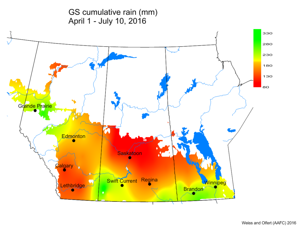
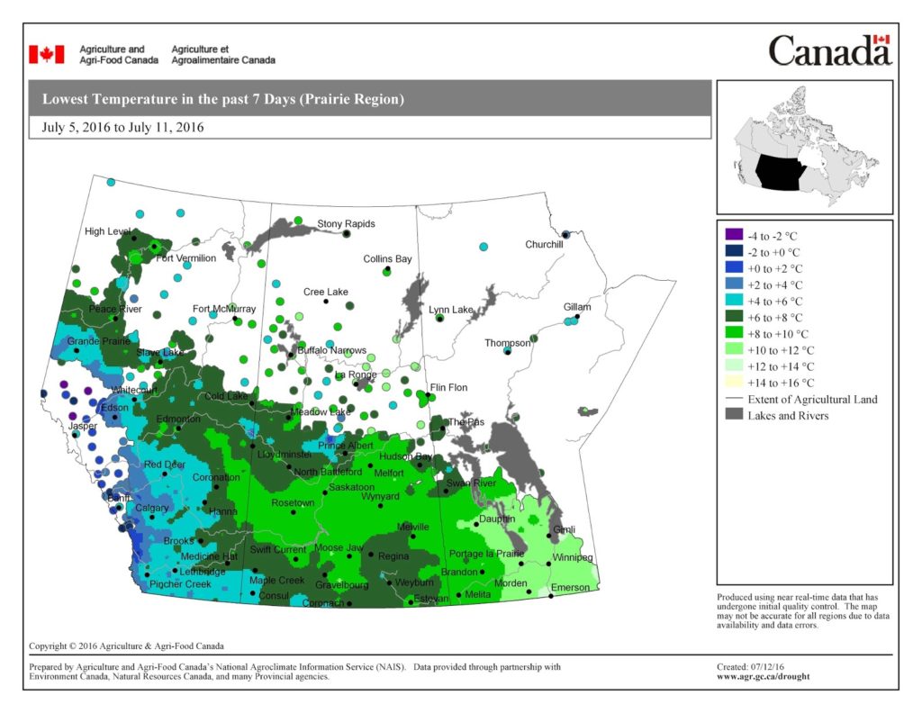

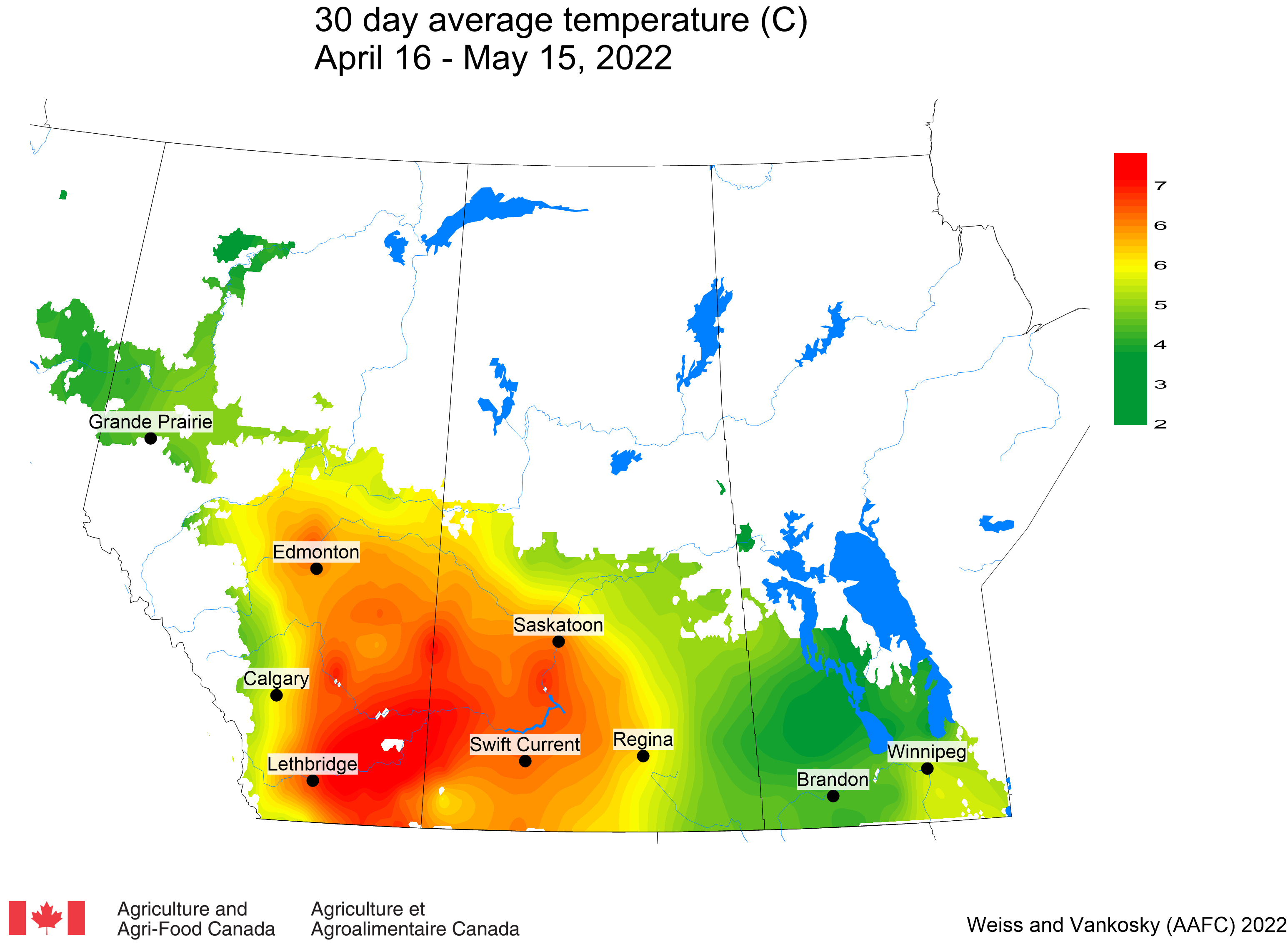
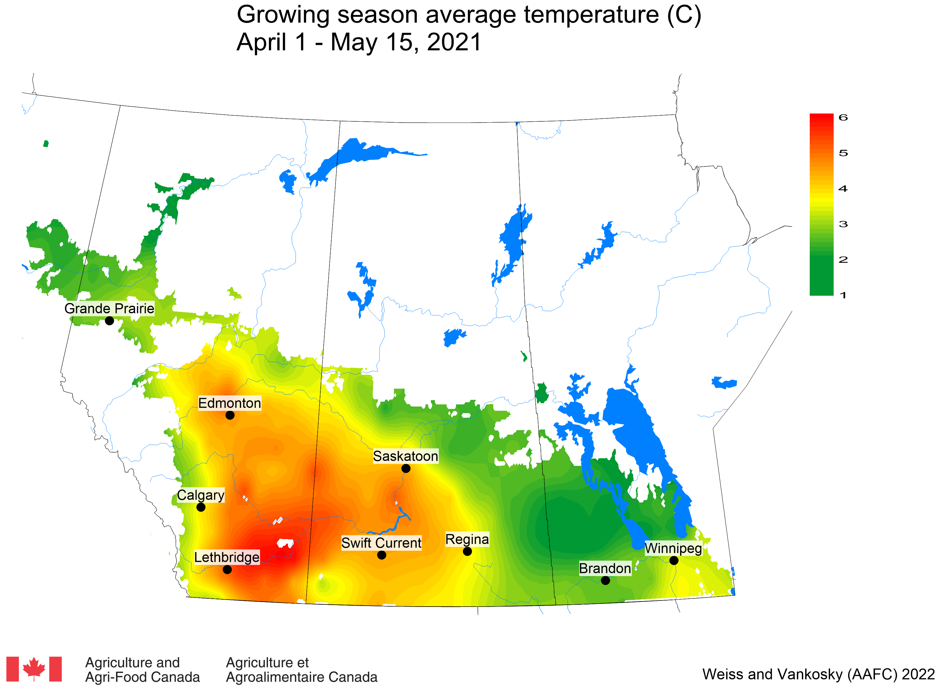
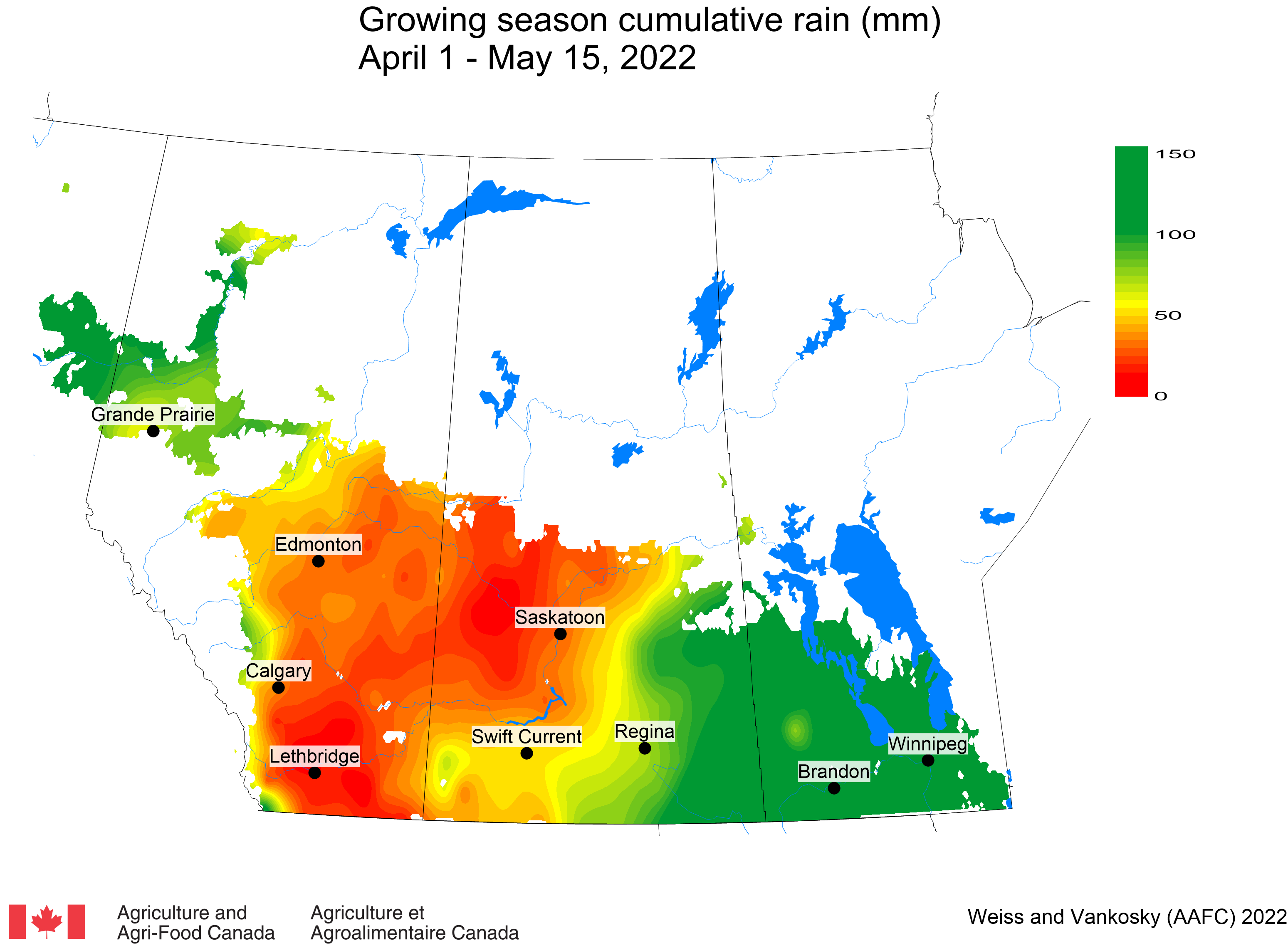