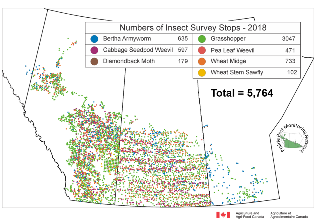
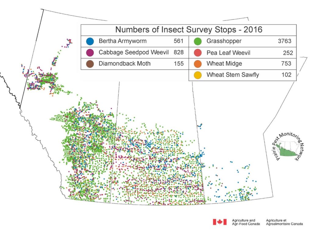
The Prairie Pest Monitoring Network is a collaborative effort. In-field monitoring data is collected at regional, provincial, and prairie-wide levels. Using Geographic Information Software (GIS), surface area maps are generated from survey data to create prairie-wide maps. Techniques are used to smooth transitions between zones and can affect the values in localized areas and, as such, these maps should be interpreted on a regional level only.
TIP: To prepare for the 2025 field scouting season, review the 2024 Prairie-wide Maps. Take a moment to note which geographic regions for each corresponding insect pest are highlighted in yellow, orange, or red as these are areas and insect pests to prioritize in 2025’s field scouting efforts.
Annual insect distribution maps are posted by the PPMN and can be reviewed on this webpage.