This week’s weather summary was kindly provided by the Prairie Crop Disease Monitoring Network (PCDMN).
Last week (Jun 24-30, 2024), a number of locations had 7 day rainfall amounts that exceeded 50 mm. Most of the rain was observed across the central prairies extending from Oyen to Brandon. Beaverlodge and Grande Prairie had rain amounts that exceeded 45 mm. Growing season temperatures have been similar to climate normal values while rainfall amounts continue to be well above average. Manitoba continues to have warm temperatures and above normal precipitation.
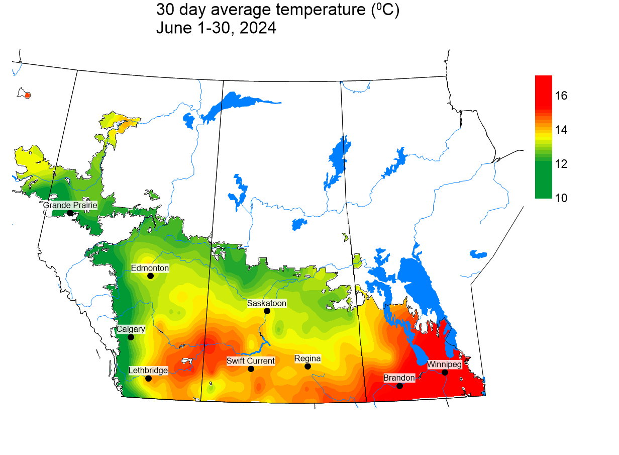
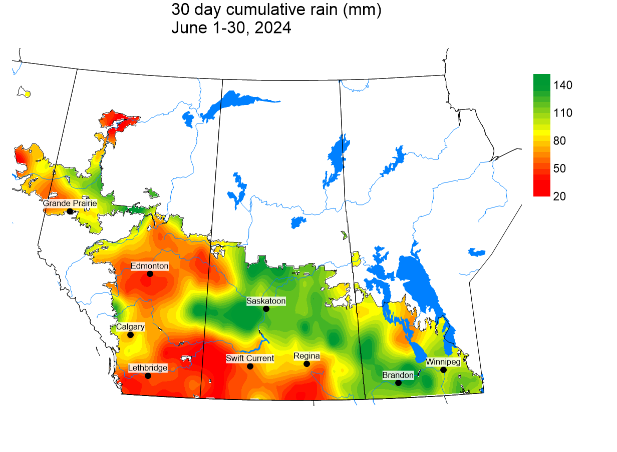
The average 30 day temperature (June 1 – 30, 2024) was 13.9 °C and was almost 1 °C cooler than long term average temperatures. Warmest temperatures were observed across Manitoba and the southern prairies (Figure 1). Most of the prairies have reported 30 day rainfall amounts were normal to above normal. Average cumulative rainfall (mm) over the past 30 days was 86 mm (71 mm last week) and was 150 % of climate normal values. Rainfall amounts have been greatest for Manitoba as well as central and Parkland regions of Saskatchewan (Figure 2). Rain amounts for the area extending from Saskatoon to Kindersley has been 250 % of normal for the past 30 days while cumulative 30 day rain totals for southwestern Saskatchewan and southern Alberta have been less than 65 % of normal.
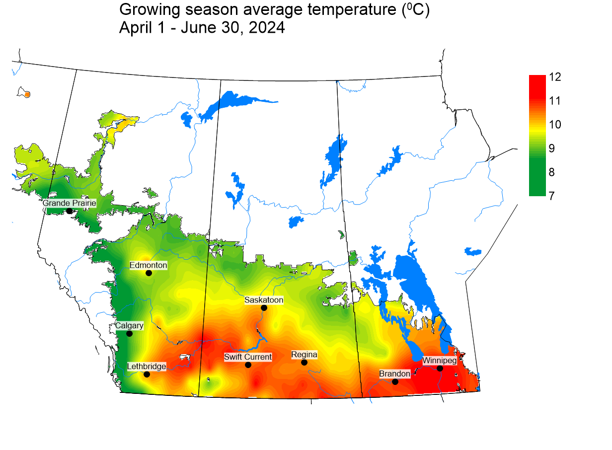
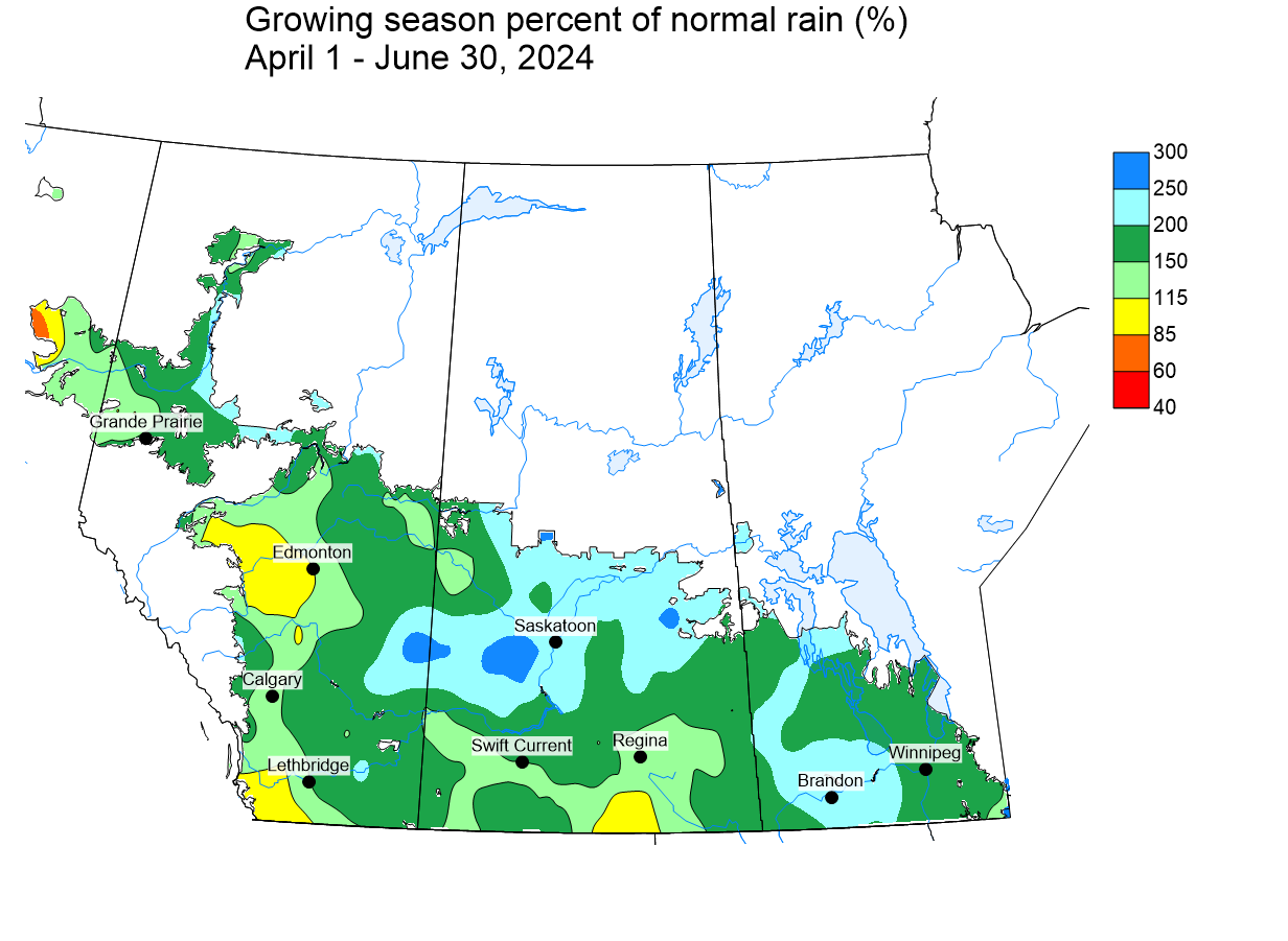
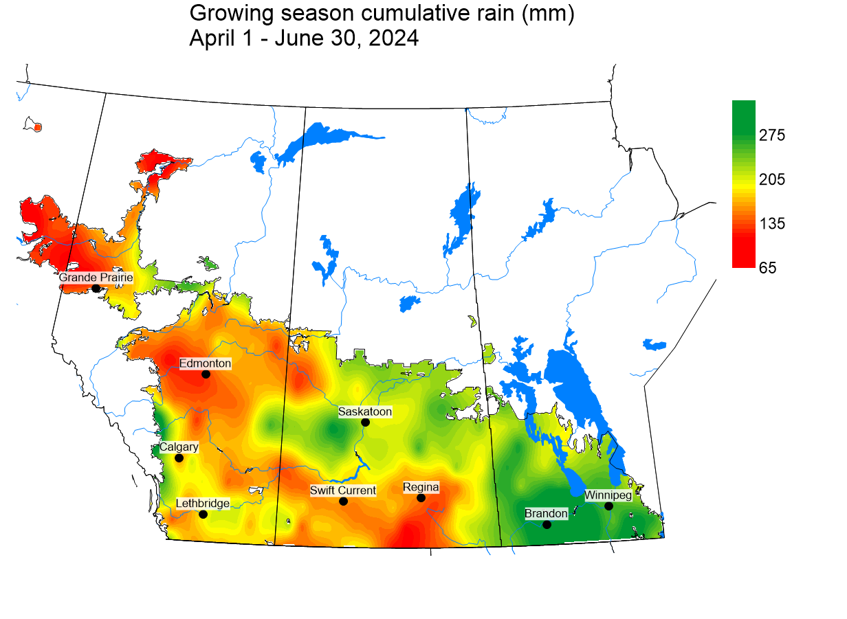
Since April 1, the 2024 growing season average temperature (10 °C) has been marginally greater than climate normal values. Warmest average temperatures were observed across a region extending from Winnipeg to Saskatoon and southwest to Lethbridge (Figure 3). Growing season rainfall (prairie wide average) was 194 mm and has been above normal across most of the prairies (Figure 4). Regions around Brandon and Saskatoon have been particularly wet. Near normal precipitation amounts occurred across southern Saskatchewan, western Alberta and western areas of the Peace River region. Current rain amounts have been 175 % of climate normals. Cumulative rainfall has been lowest for a large region than is west of a line that extends from Regina to Grande Prairie (Figure 5).
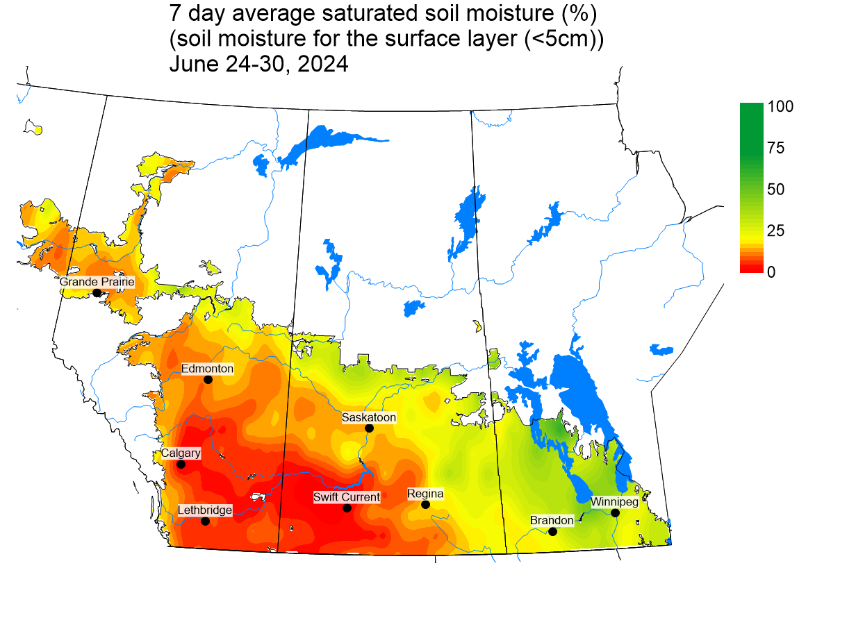
Soil moisture conditions (top 5 cm) continue to be driest for western regions of Saskatchewan and eastern regions of Alberta (Figure 6) and is similar to the 30 day cumulative rainfall map (Figure 4). Soil moisture values were greatest for Manitoba and the Parkland region of Saskatchewan. Lowest values occurred across southern and central regions of Alberta as well as southwestern Alberta.
Growing degree day (GDD) maps for the Canadian prairies for Base 5 ºC and Base 10 ºC (April 1-July 1, 2024) can be viewed by clicking the hyperlinks. Over the past 7 days (to July 3, 2024), the lowest temperatures recorded across the Canadian prairies ranged from -22 to 7 °C while the highest temperatures observed ranged from 4 to 28 °C. In terms of precipitation across the Canadian prairies, review the growing season accumulated precipitation (April 1-July 3, 2024), the growing season percent of average precipitation (April 1-July 3, 2024), and the past 7 days (as of July 3, 2024). Access these maps and more using the AAFC Maps of Historic Agroclimate Conditions interface.
Growers can bookmark the AAFC Maps of Current Agroclimate Conditions for the growing season. Historical weather data can be accessed at the AAFC Drought Watch Historical website, Environment and Climate Change Canada’s Historical Data website, or your provincial weather network. The AAFC Canadian Drought Monitor also provides geospatial maps updated monthly.