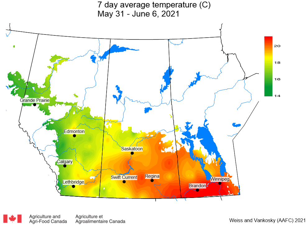
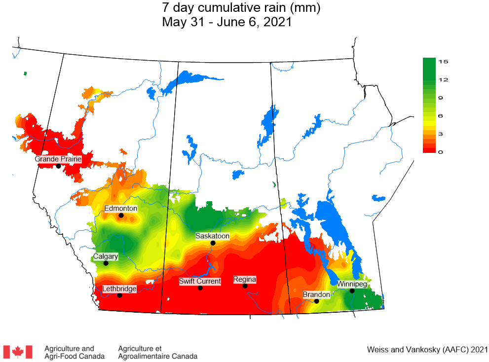
TEMPERATURE: This past week (May 31 – June 6, 2021) extremely warm conditions resulted in weekly average temperatures that were well above normal (Fig. 1). The warmest temperatures were observed across Manitoba and eastern Saskatchewan (Fig. 1).
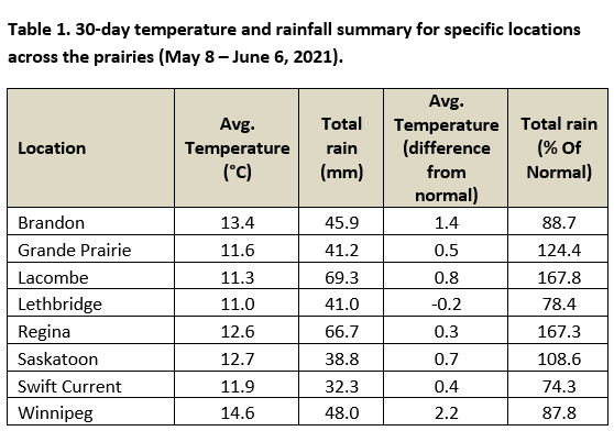
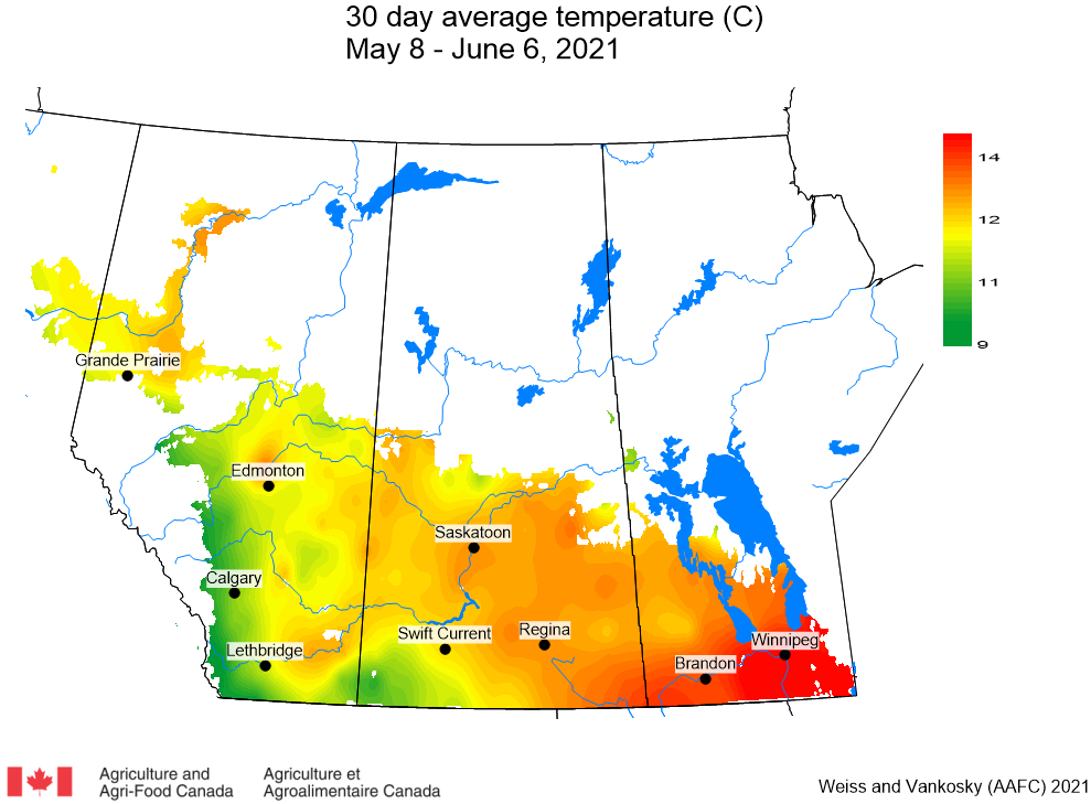
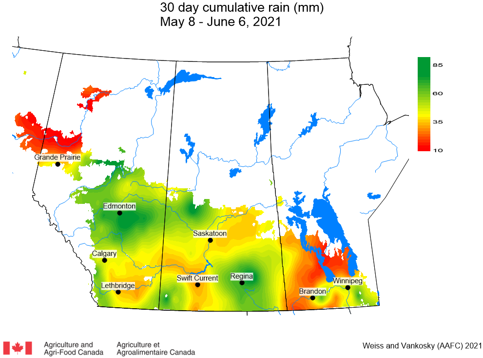
Across the prairies, the average 30-day (May 8 – June 6) temperature was almost 2.5 °C warmer than the previous week and 1.3 °C greater than climate normal values. Warmest temperatures were observed across southern Manitoba (Table 1; Fig. 2).
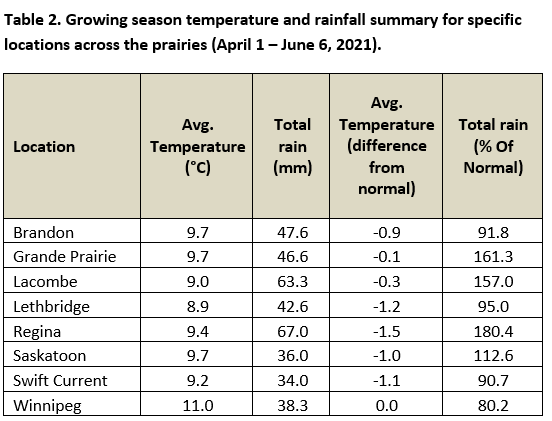
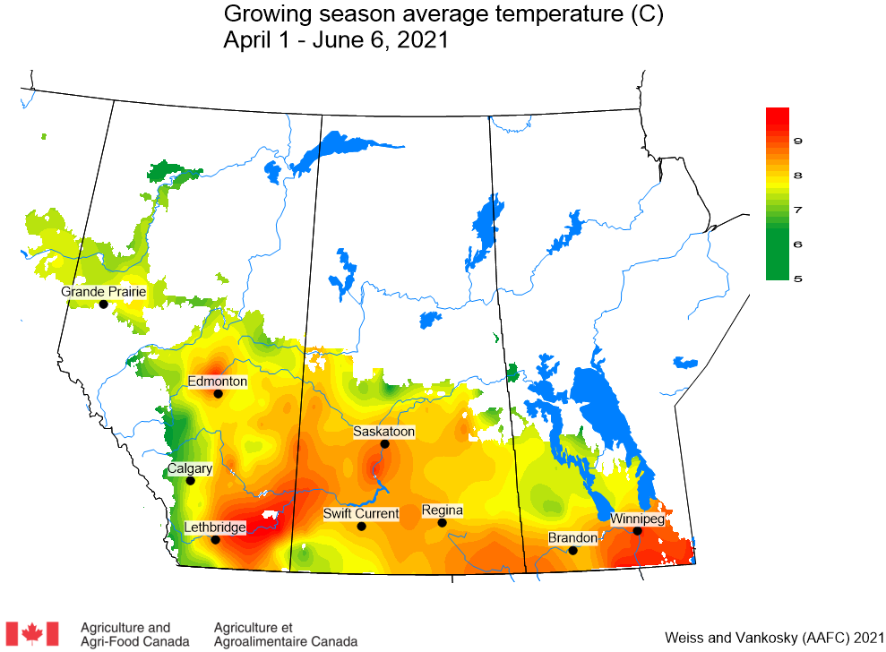
The 2021 growing season (April 1 – June 6) has been characterized by near-normal temperatures. Temperatures have been warmest for southern Manitoba and southern Alberta (Table 2; Fig. 3).
Follow the hyperlinks to access AAFC Drought Watch maps reflecting the growing degree day (GDD) for Base 5 ºC, (April 1-June 7, 2021) and for Base 10 ºC (April 1-June 7, 2021). Over the past 7 days (June 3-9, 2021), the lowest temperatures recorded ranged from <0 to >12 °C while the highest temperatures observed across the Canadian prairies ranged from <10 to >36 °C.
PRECIPITATION: This week, the highest rainfall amounts were reported across northwest Saskatchewan and central Alberta while weekly rainfall amounts less than 2 mm was reported across a large area that extended from western Manitoba, across most of Saskatchewan, to southern Alberta. Extreme dry conditions were reported across the Peace River region (Fig. 4).
Rainfall amounts for the period of May 8 to June 6 (30-day accumulation) were above normal (110 % of long-term average values). Rainfall amounts have been near normal to above normal for large areas of Alberta as well as northwest and southeast Saskatchewan. Well-above-normal rain was reported for Edmonton and Regina. Below normal rainfall amounts were reported for central and northern areas of the Peace River region and across Manitoba (Table 1; Fig. 5).
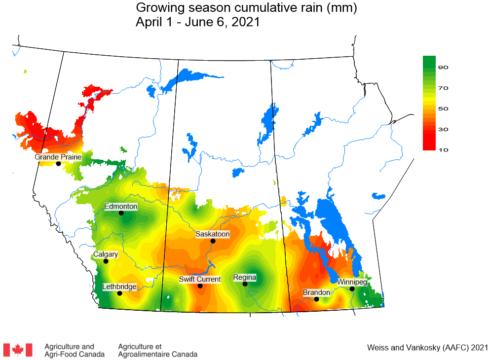
Average growing season (April 1 – June 6) precipitation was 94 % of normal with the greatest precipitation occurring near Edmonton and across eastern Saskatchewan, including Regina. Most of Manitoba and the Peace River region have had 60 % or less than normal precipitation during the 2021 growing season (Table 2; Fig. 6).
The maps above are all produced by Agriculture and Agri-Food Canada. Growers can bookmark the AAFC Current Conditions Maps for the growing season. Historical weather data can be access at the AAFC Drought Watch Historical website, Environment Canada’s Historical Data website, or your provincial weather network.
Access ALL the PPMN’s Wind Trajectory reports (Weekly and Daily).
Access Environment and Climate Change Canada’s weather radar mapping interface. Options to access preceeding precipitation events include clicking off either an 1 or 3 hours time interval, using an 8-colour or 14-colour index. or changing the base map.